Updated 01.15.23 @ 8:44a
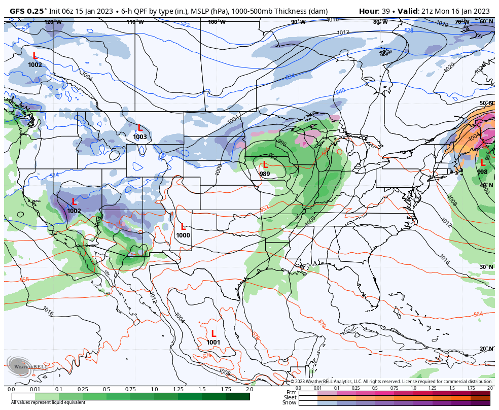
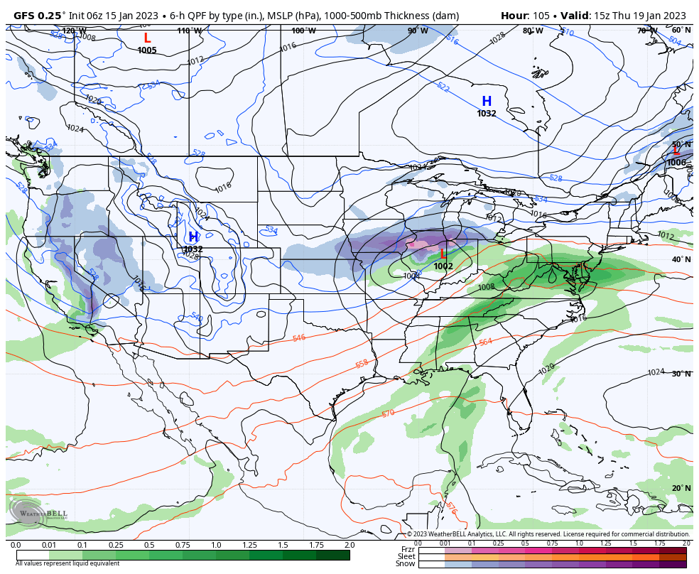
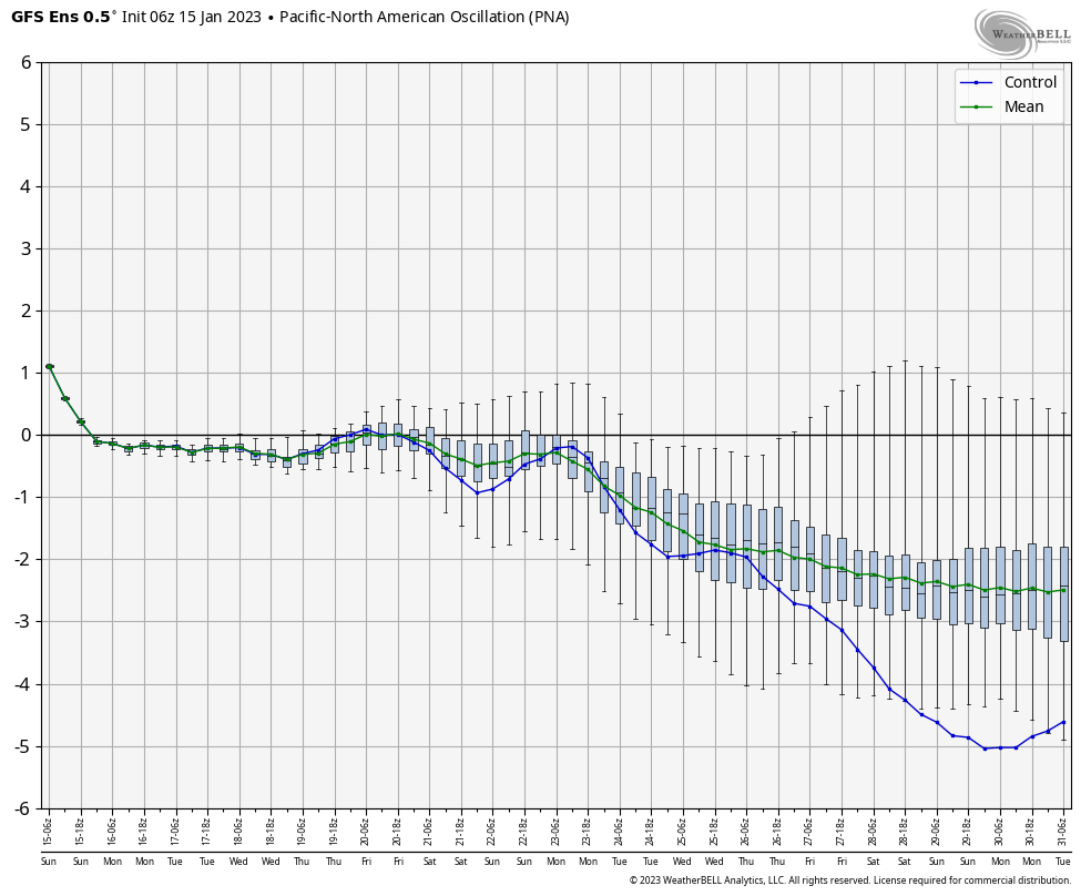
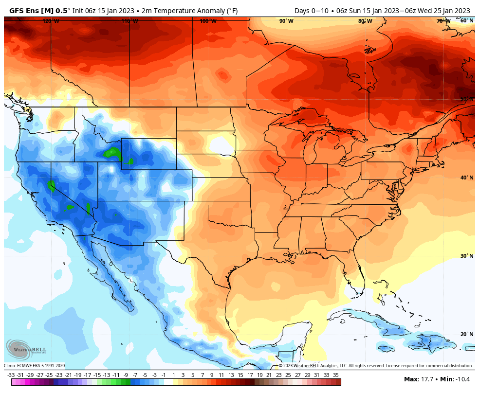
The upcoming 10-day period will feature multiple storms of significance. With a neutral to negative PNA, the storm track should predominantly be on the warm side as the eastern ridge continues to flex its muscle.
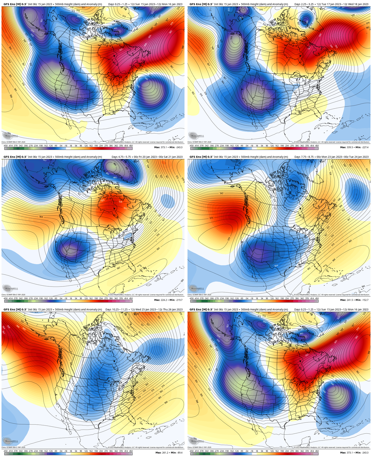
“Transitional” cold will follow behind storm systems, but any sort of sustained cold will be mighty hard to come by over the aforementioned period.
A widespread chunk of the country can expect above normal precipitation in this fast paced, overall warm pattern.

Storm dates of interest include 1/16, 1/19, and 1/22-1/23.
