Updated 06.14.22 @ 7:50a
You must be logged in to view this content. Click Here to become a member of IndyWX.com for full access. Already a member of IndyWx.com All-Access? Log-in here.

Jun 14
Updated 06.14.22 @ 7:50a
You must be logged in to view this content. Click Here to become a member of IndyWX.com for full access. Already a member of IndyWx.com All-Access? Log-in here.
Permanent link to this article: https://indywx.com/2022/06/14/video-heat-and-humidity-dominates-before-cooling-late-week-relief-gorgeous-fathers-day-weekend-dialed-up/
Jun 14
Updated 06.14.22 @ 7:33a

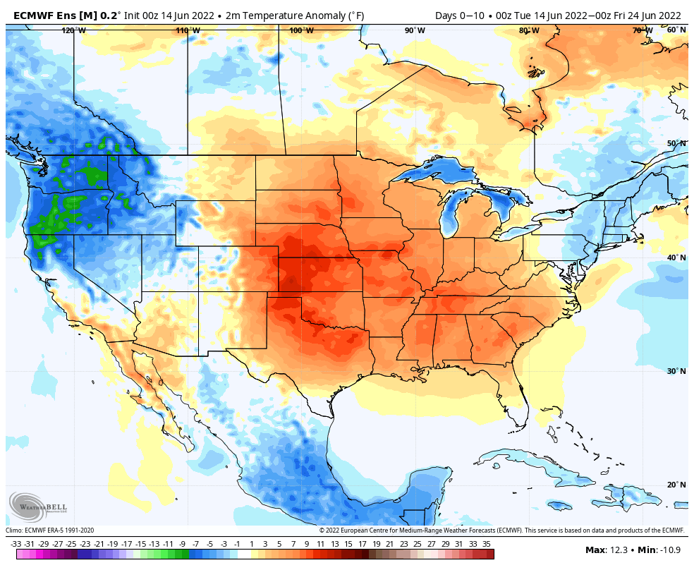
Forecast Period: 06.14.22 through 06.24.22
A cold front will slide through the area Thursday with the potential of a widely scattered shower or storm. The bigger story will be a significant reduction of heat and humidity as we close out the work week and head through the weekend. After dealing with heat indices in the 105º+ range today and Wednesday, lows that drop back into the 50s this weekend sure will feel nice. After Thursday, dry conditions should dominate through the weekend.
The upper ridge will then expand northeast once again as we head into the new work week. You know what this means, oppressive heat and humidity will return next week. Like this week, the most oppressive conditions come in the Tuesday-Thursday time frame before another cold front returns us to cooler, more seasonal temperatures next weekend. Get the idea that we’re locked into a “transitional” pattern for the foreseeable future?
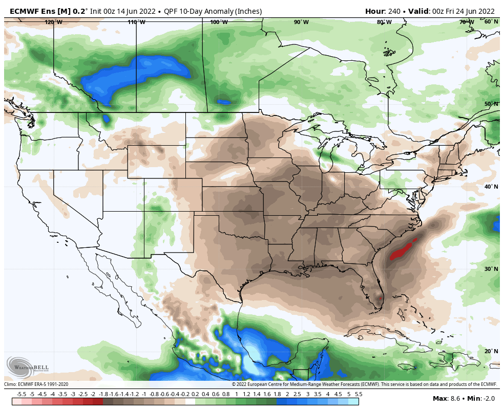
From a rainfall perspective, we’re in that time of year where it’s all but impossible to predict rainfall amounts down to a specific backyard (case in point yesterday where many north and eastern Indianapolis ‘burbs clocked in a quick 2″+, while others on the south and west side didn’t see a drop of rain). From an overall perspective, rainfall amounts will run well below normal over the next 7-10 days. We will keep an eye on storm clusters that may round the periphery of the upper ridge early next week, and these could influence our weather Monday into Tuesday (similar to what we dealt with yesterday).
As we look beyond the 10 day period, the ‘mean’ upper pattern should feature the ridge pulling back west and placing our immediate region into a northwesterly flow aloft to close the month of June. This should translate to relatively wetter, cooler times.
10-Day Rainfall Forecast: 0.50″ to 1.00″
Permanent link to this article: https://indywx.com/2022/06/14/weekly-severe-and-agwx-outlook-2/