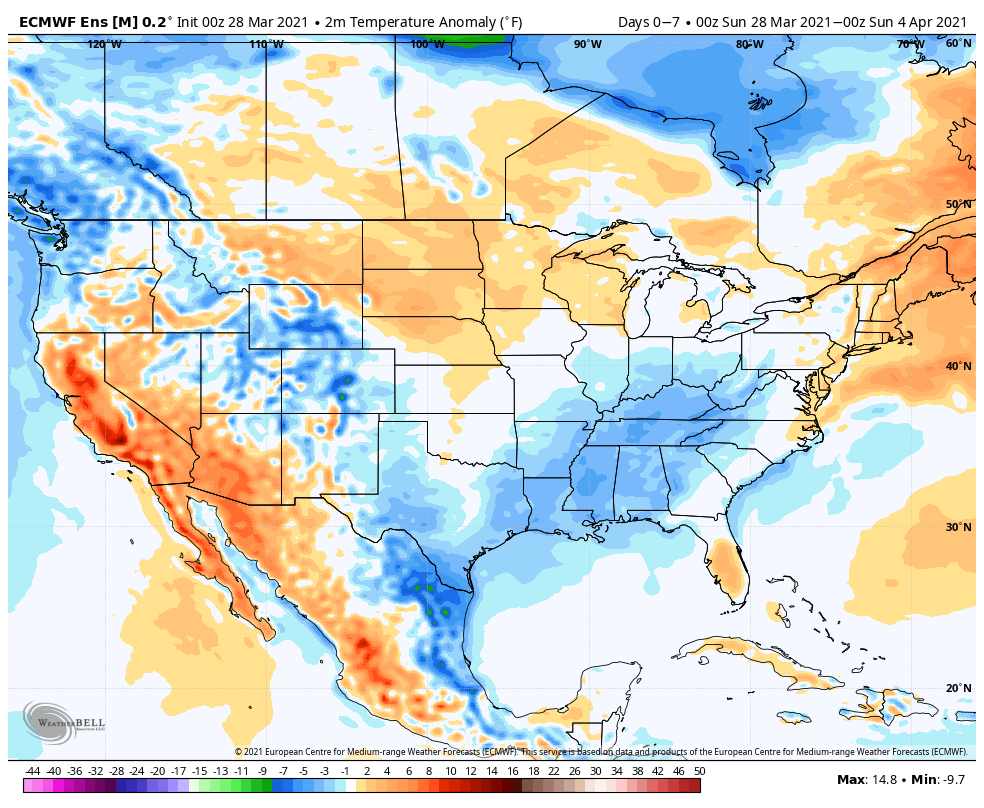
Temperatures will run below normal through the upcoming period from the Ohio Valley into the Southeast. Meanwhile, resurgent warmth will build across the northern Plains.
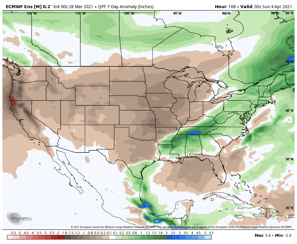
After an active stretch of weather, an overall drier pattern will build in through the upcoming period across the Plains and into the Ohio Valley. Meanwhile, the eastern seaboard will remain wetter than normal.
We forecast central Indiana to receive a half inch or less of rain over the upcoming 7-day period (most of that comes this morning and again with a frontal passage Tuesday night).
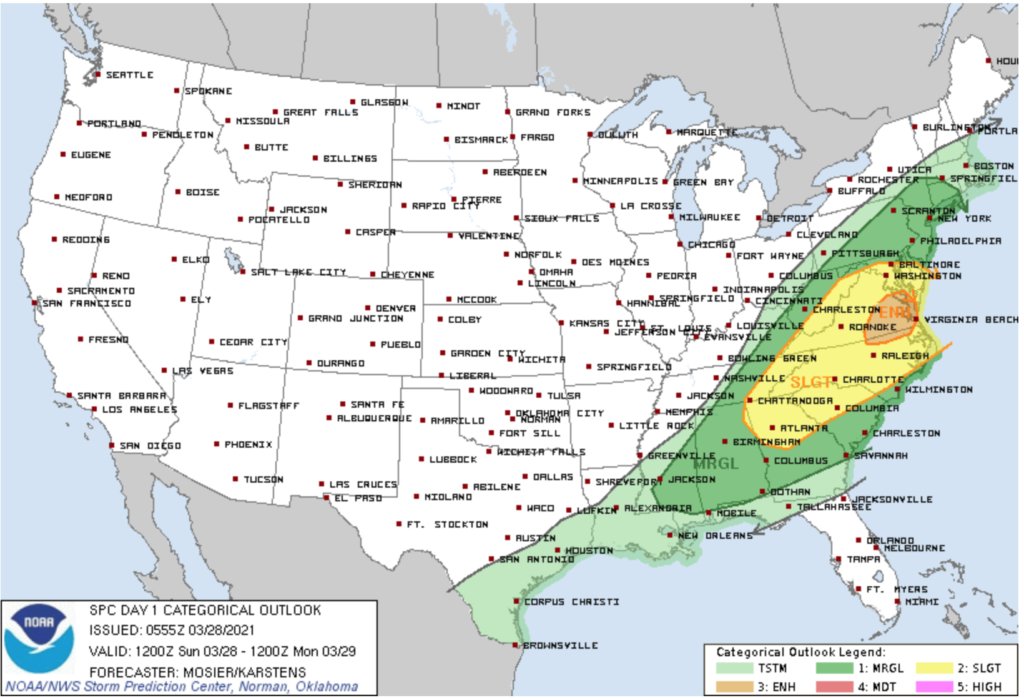
The most active severe weather day of the 7 upcoming will be today- primarily east of the mountains and into the Mid Atlantic region into the Southeast.
Forecast period: 03.28.21 through 04.04.21
You don’t need us to remind y’all just how active and busy things have been over the past couple of weeks. For those weather weary, an extended period of overall quieter weather will build in for the upcoming week. The only exception to that will be some early showers today and again with a frontal passage Tuesday night-predawn Wednesday. The bigger story will be the pop of unseasonably cold air that will arrive on the heels of the passage of the midweek cold front. We’re talking about some neighborhoods falling into the 10s by late week for morning lows. Brrrrr. Thankfully, the cold won’t last more than a couple of days and we’ll be back to moderating conditions as Easter Sunday arrives.