September 2, 2019 archive

More On Our September Outlook…

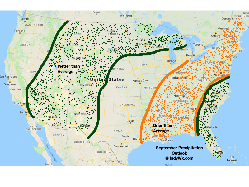
For those that didn’t have a chance to catch Sunday’s video update, we wanted to take the time this evening to review our September Outlook.

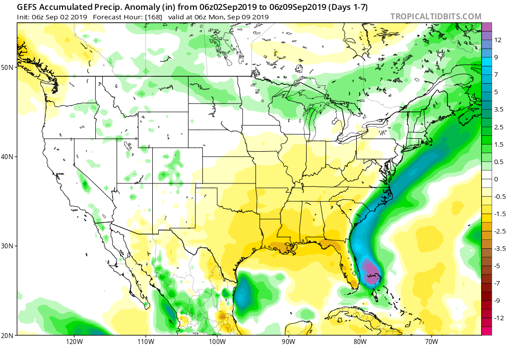
Specific to Indiana, we’re expecting an overall warmer than normal and drier than average 1st month of meteorological fall:

The orange hues represent areas of 1-2 (F) above normal while the blue paints a story of 1-2 (F) below normal when all is said and done 9/30.

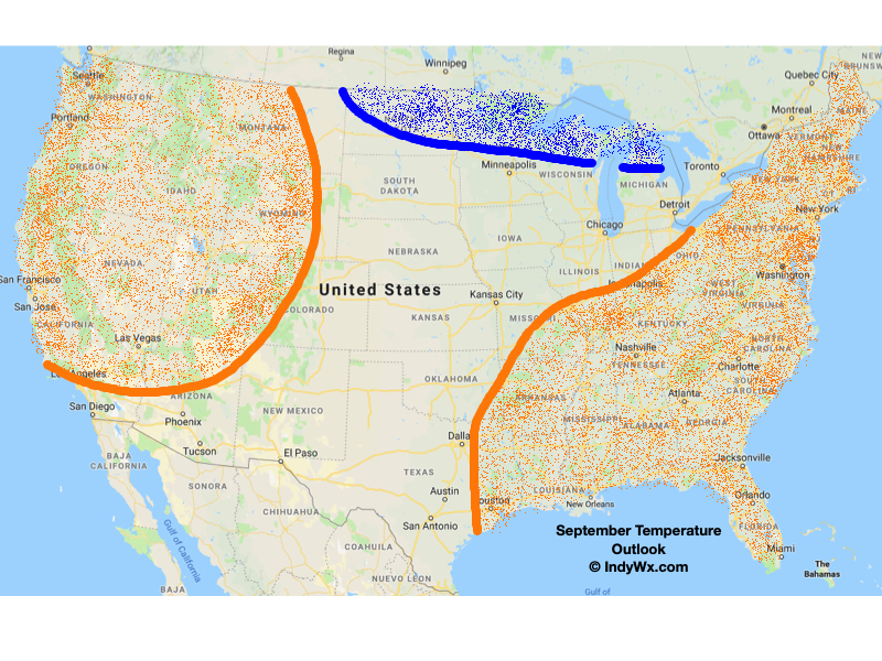
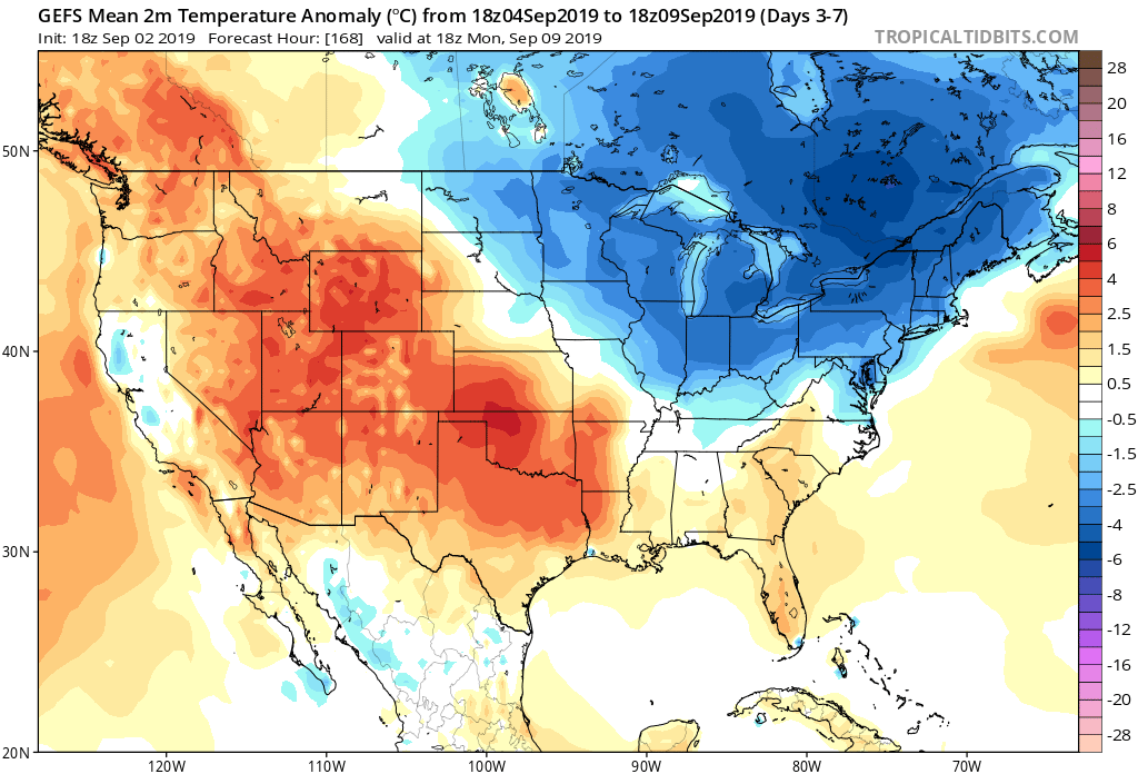
That’s not without an early cool snap to start the month. Typically, we’d expect lows around 60 and highs in the lower 80s through the first 1/3 of the month, but that won’t be the case this year. Instead, look for a rather lengthy period of lows in the lower-middle 50s (even a few nights in the upper 40s) and highs in the lower-middle 70s. This is all thanks to the negative EPO that’s currently in place.


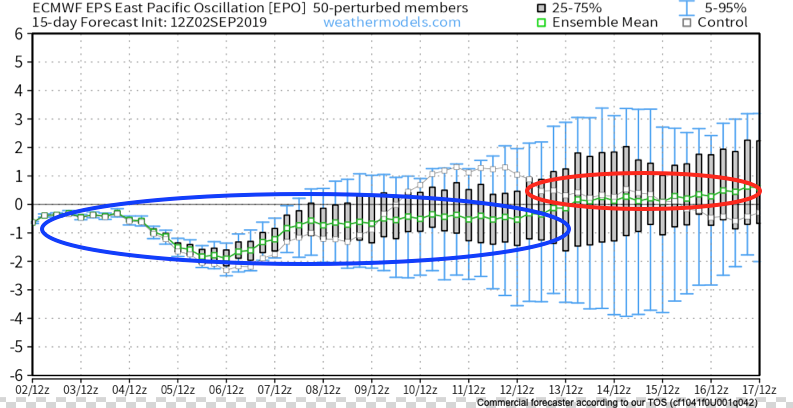
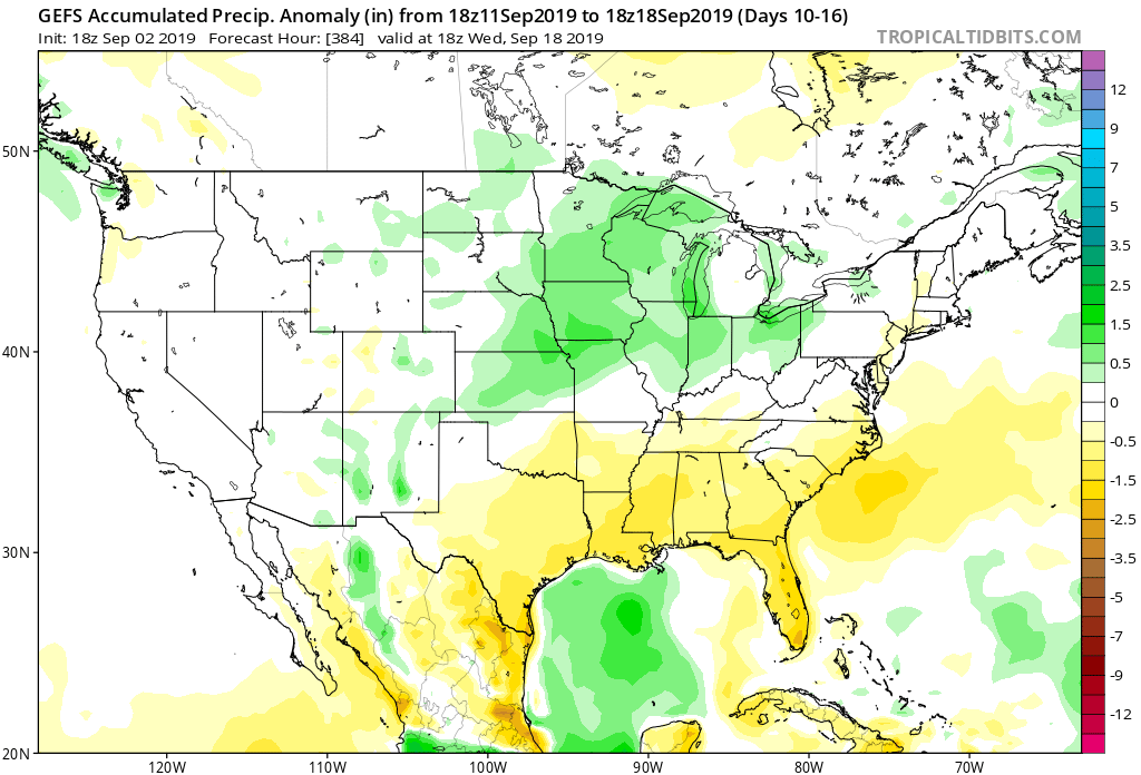
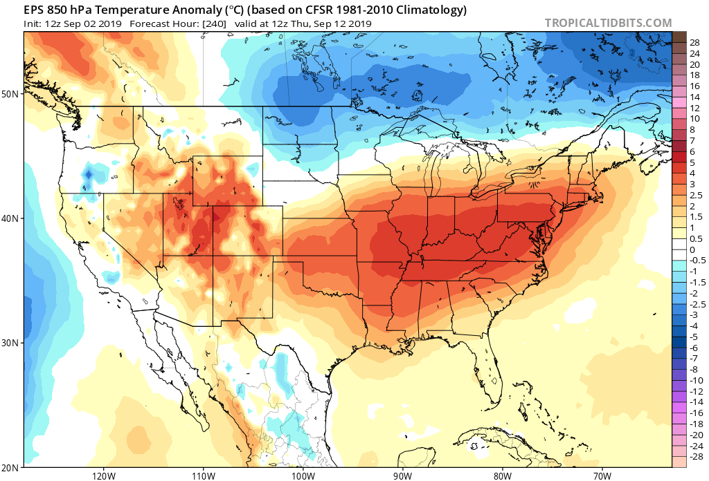
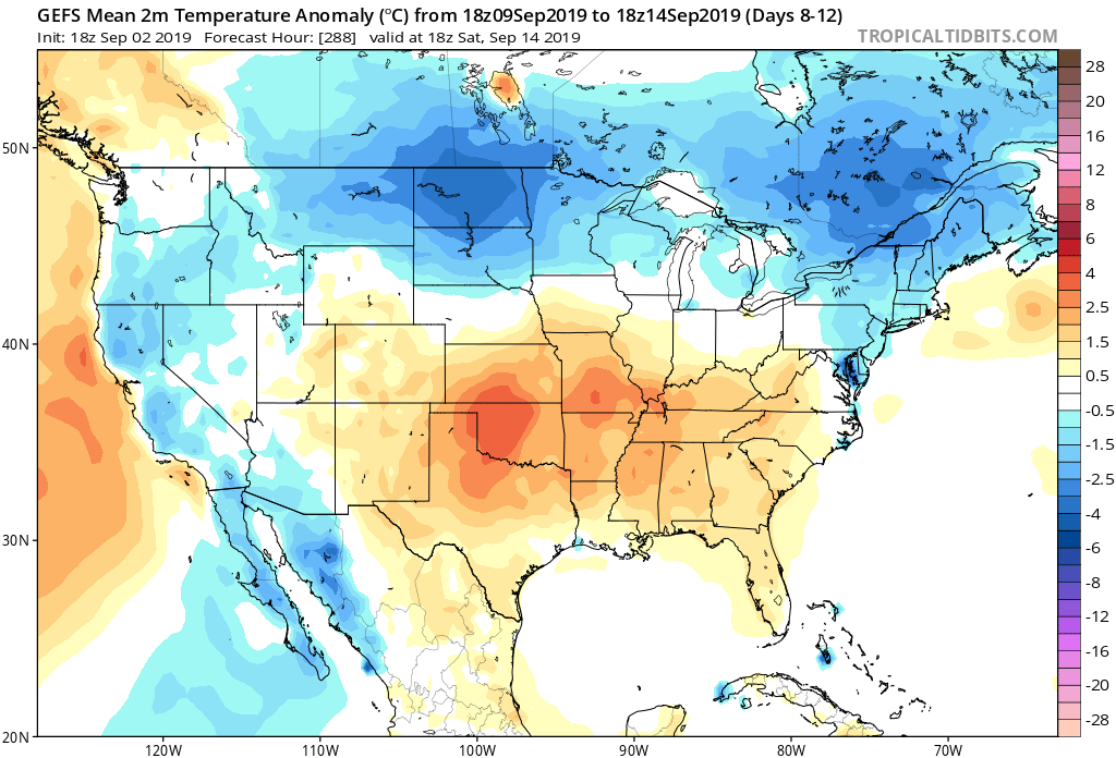
Notice though how the EPO trends positive towards mid-month. This would suggest warmer times are on the horizon after the unseasonably cool open to September. Sure enough, latest ensemble data is in agreement with this look.

With the period of moderation, we’re likely also going to head back into a wetter pattern- at least compared to how we open the month of September.

Permanent link to this article: https://indywx.com/2019/09/02/more-on-our-september-outlook/

Weekly AG And Severe Weather Update…

Forecast period: 09.02.19 through 09.09.19

7-Day Precipitation: Precipitation is expected to run well below normal through the forecast period.

7-Day Temperatures: Temperatures are expected to run below average through the forecast period overall.

Severe Weather Outlook: In what will be a quiet period, overall, we’ll keep an eye to our north Tuesday evening. The reason? A cold front will push south and a line of strong to severe thunderstorms is expected to develop across northern Indiana tomorrow evening. Damaging wind is the greatest concern with storms across northern parts of the state. As the front continues to settle south, thunderstorms will weaken as they push into central Indiana between 8p and midnight. Otherwise, severe weather isn’t expected through the period.

Summary: The upcoming 7-days will be dominated by an overall cooler and drier than normal theme than we’d come to normally expect for early September. A couple of cold fronts will sweep through the state this week: Tuesday night and again Saturday. While there isn’t a lot of fanfare expected with these fronts from a precipitation perspective, they will serve to offer up a true fall-like feel mid week into the weekend. We’ll keep an eye on thunderstorms across northern IN Tuesday PM, but still expect these to be in a weakening state as they arrive into central parts of the state tomorrow night.

Permanent link to this article: https://indywx.com/2019/09/02/weekly-ag-and-severe-weather-update-5/

IndyWx.com