
You must be logged in to view this content. Click Here to become a member of IndyWX.com for full access. Already a member of IndyWx.com All-Access? Log-in here.
July 2019 archive
Permanent link to this article: https://indywx.com/video-big-changes-on-deck-looking-into-august/
Jul 20
Weekly #AGwx And Severe Weather Outlook…
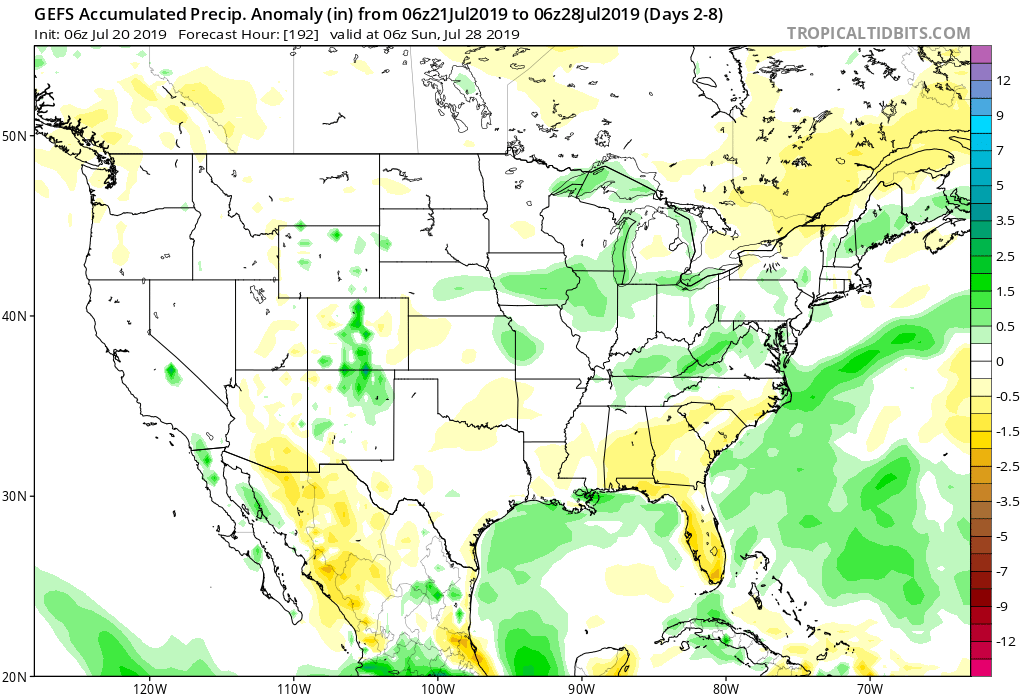
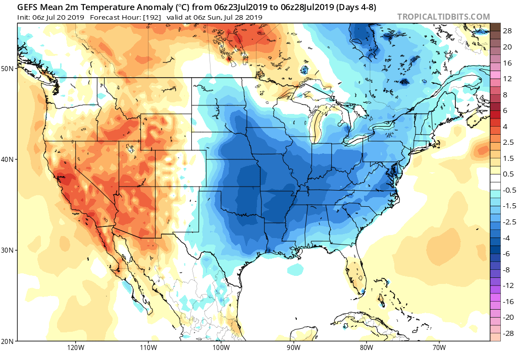
Forecast period: 07.21.19 through 07.28.19
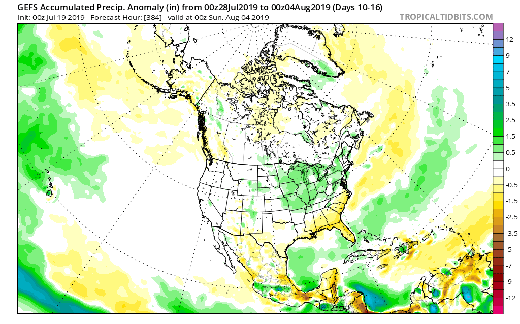
7-Day Precipitation: Rainfall is expected to run near average through the period.
7-Day Temperature Outlook: Temperatures are expected to run below average through the forecast period.
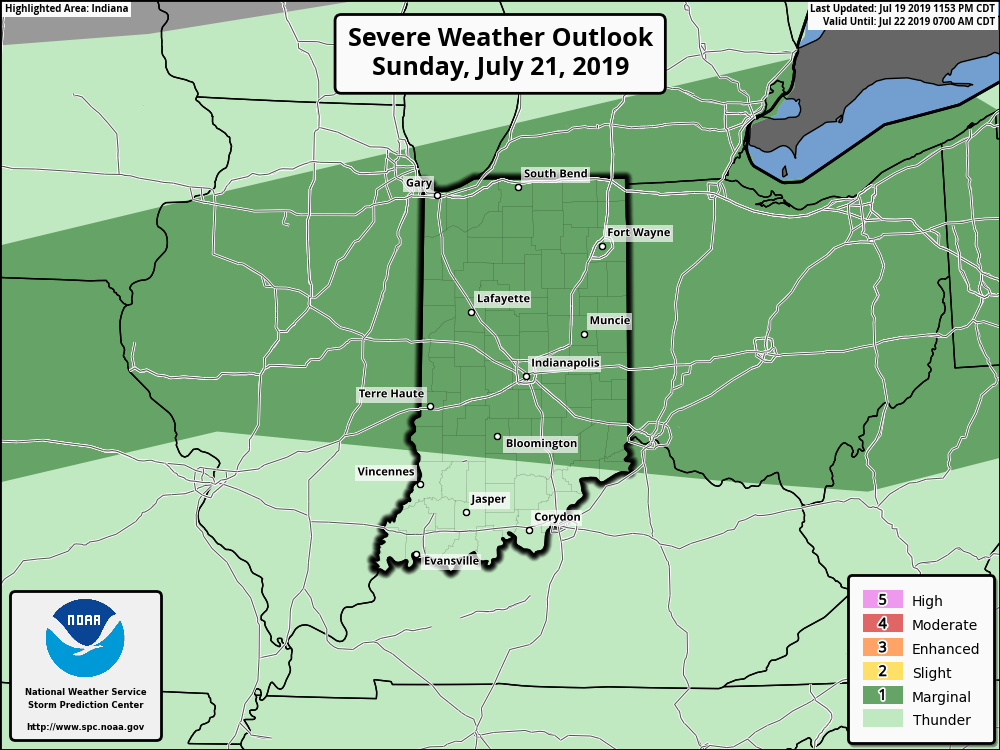
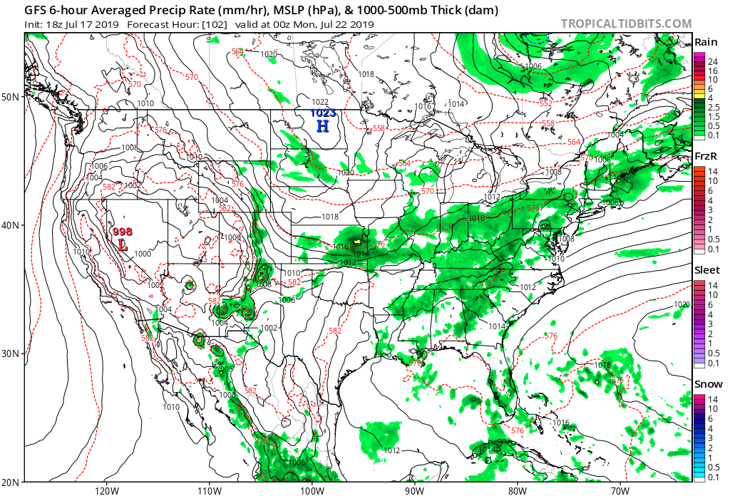
Severe Outlook: A strong cold front will slice into the unusually hot and humid air tomorrow afternoon and likely spark an increase in overall thunderstorm coverage. A few storms may become severe with large hail and damaging winds. Otherwise, after Sunday, severe weather isn’t expected through the remainder of the forecast period.
Summary: Hang in there, friends. Today will be the last ridiculously hot and humid day before we start to note relief. Sunday will still be hot and plenty humid, but will be the start of a cooler regime that will take hold in earnest by early parts of the work week. Before that, a cold front will spark scattered to numerous thunderstorms Sunday afternoon and evening and a few of these could become strong to severe. Linger upper level energy will keep shower chances in our forecast Tuesday with the much cooler temperatures. As we look forward, the next organized chance of rain and thunderstorms will come next weekend as another cold front sweeps through the Ohio Valley along with reinforcing pleasantly cool air behind the boundary.
Permanent link to this article: https://indywx.com/weekly-agwx-and-severe-weather-outlook-7/
Jul 19
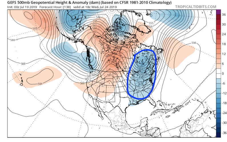
Dangerously Hot Now, But We’re Talking About An Entirely Different Weather Pattern To Close July And Open August…
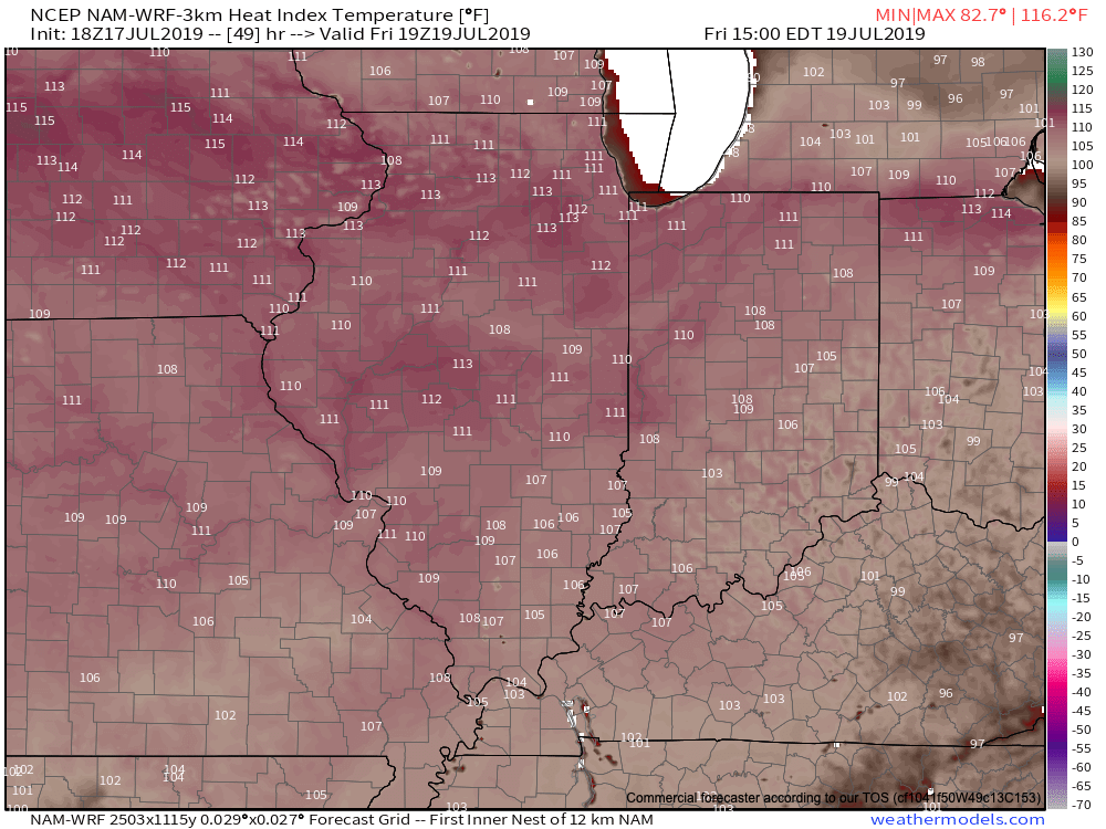
Over the weekend we’ll bake in some of the hottest and most humid air we’ve dealt with around these parts since 2012, however big relief is on the horizon.
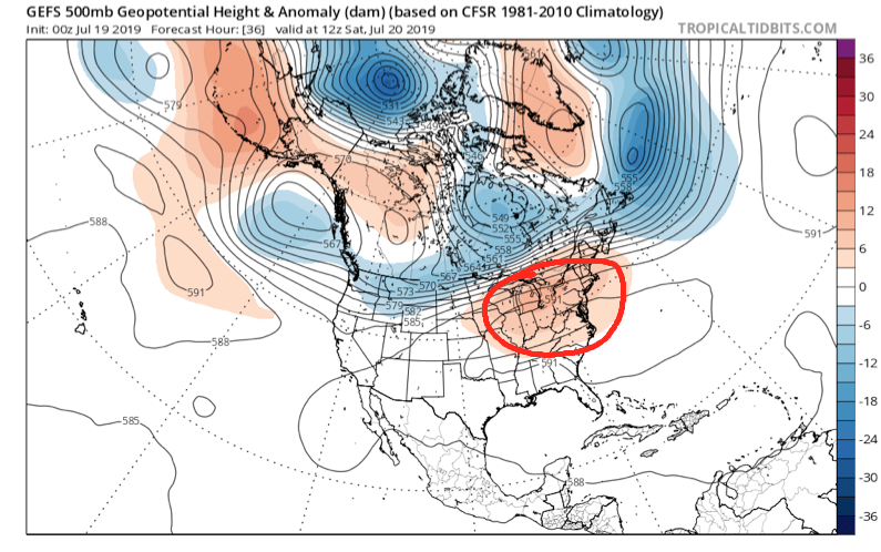
We’ll get rid of the expansive upper level ridge responsible for the heat this weekend and replace it with a significant trough (at least by late summer standards).
A strong cold front will sweep through the Ohio Valley Sunday and Monday with increasing coverage of showers and thunderstorms (a few may be strong). It’s this front that will help usher in the refreshing changes for next week. We’ll go from heat indices between 104-108 this weekend to overnight lows in the upper 50s to lower 60s at times next week. Ahhhhhh….
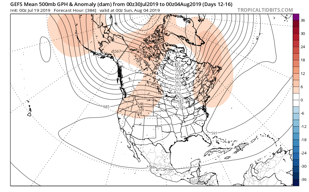
As we look ahead to early August, there’s certain to be additional warm-hot days, however, the mean pattern doesn’t look to promote any sort of sustained significant heat through the early portion of the month. Perhaps the most interesting item showing up on the longer range guidance (EPS and GEFS) is a return of a northwesterly flow aloft and the potential of a wetter regime building in as we traverse the early August period.
Hang in there, the reward on the other side of the weekend will be worth it with cool, Canadian air flowing south.
Permanent link to this article: https://indywx.com/dangerously-hot-now-but-were-talking-about-an-entirely-different-weather-pattern-to-close-july-and-open-august/
Jul 18
VIDEO: Keeping An Eye On Storms To Our Northwest This Morning; Pattern Change On Deck Next Week…
You must be logged in to view this content. Click Here to become a member of IndyWX.com for full access. Already a member of IndyWx.com All-Access? Log-in here.
Permanent link to this article: https://indywx.com/video-keeping-an-eye-on-storms-to-our-northwest-this-morning-pattern-change-on-deck-next-week/
Jul 17
“Sneaky” Storms Precede Dangerous Heat…
As we prepare for the hottest air of the summer, we’ll have to remain on guard for the potential of thunderstorms impacting at least a part of the state Thursday morning.
Upper level energy will track southeast into the state late tonight and early Thursday and combine with just enough energy to allow thunderstorms that should develop during the overnight (across southern WI and northern IL) to track into western Indiana during the predawn hours. (It should be pointed out this is separate from the convection that is currently resulting in warnings across MO and IL- as of 6:20p eastern time). Thereafter, these storms are expected to rumble into central Indiana in a weakening format around the morning rush Thursday.
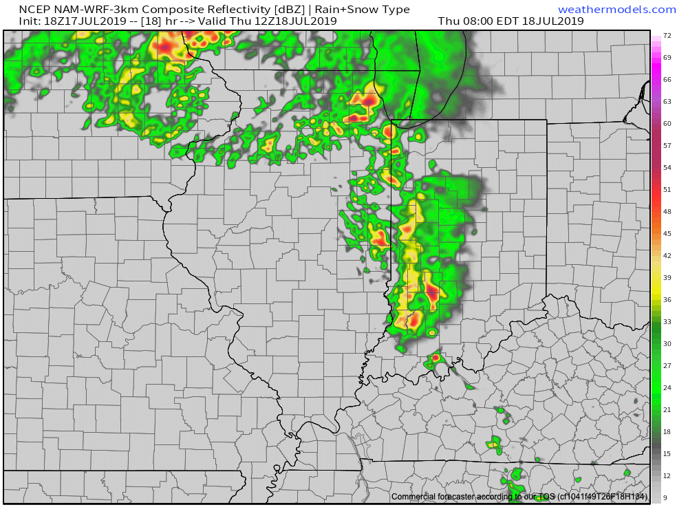
Thereafter, the big story will be the high heat and humidity that will lead to truly dangerous conditions across central Indiana beginning tomorrow afternoon into Sunday. Heat indices will top out between 100-105 each afternoon and in some cases a few degrees higher. It’ll be important to build in frequent breaks inside and drink plenty of water. Most, if not all, neighborhoods can expect to remain rain-free through the first half of the weekend (after we deal with our Thursday morning storms).
Thankfully, we still are forecasting a “game changer” of a cold front to plow through the region late Sunday and early Monday with storms (a few could be severe) followed by a much cooler and more refreshing air mass next week.
This is likely the first of a couple of cold fronts that will pass through the region between now and the end of the month, ensuring we wrap up July seasonal to cooler than average.
Permanent link to this article: https://indywx.com/sneaky-storms-precede-dangerous-heat/