
 Highlights:
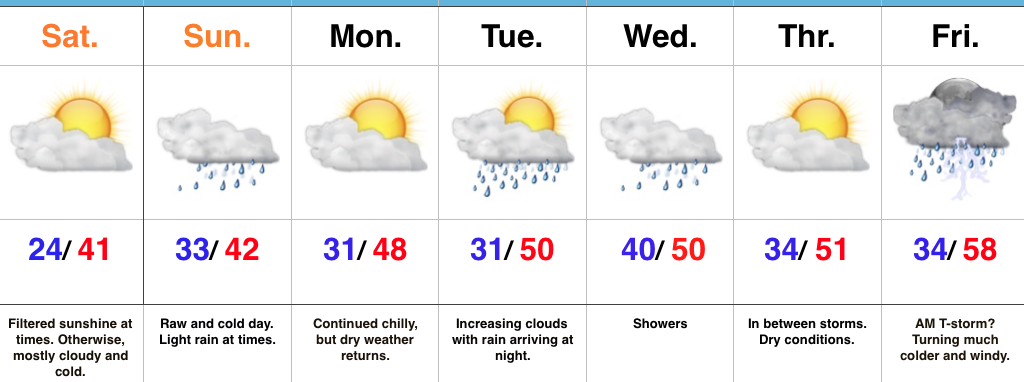
- Filtered sunshine today
- Raw and messy Sunday
- Fast-moving weather pattern next week
Bundle Up…Wake up temperatures are more like we’d expect in late December as opposed to early November, including lower to middle 20s across central Indiana. Filtered sunshine will eventually give way to a thickening cloud deck late. Those clouds will be a harbinger of things to come as moisture overspreads the region Sunday morning. Look for a cold, raw close to the weekend with periods of light rain (sleet may mix in with the rain during the onset early Sunday, but this won’t be a big deal).
We’ll open up the work week with dry and chilly conditions before a couple of fast-moving systems impact our mid and late week weather. Clouds will increase Tuesday and showers will arrive at night, continuing into Wednesday. Our next (stronger) storm will arrive to wrap up the work week. A southwesterly air flow will inject briefly milder air Friday morning and may be sufficient enough to create a couple of thunderstorms. We’ll then transition to a much colder, windy regime to wrap up Friday with falling temperatures.
Upcoming 7-Day Precipitation Forecast:
- Snowfall: 0.00″
- Rainfall: 1.00″ – 1.50″

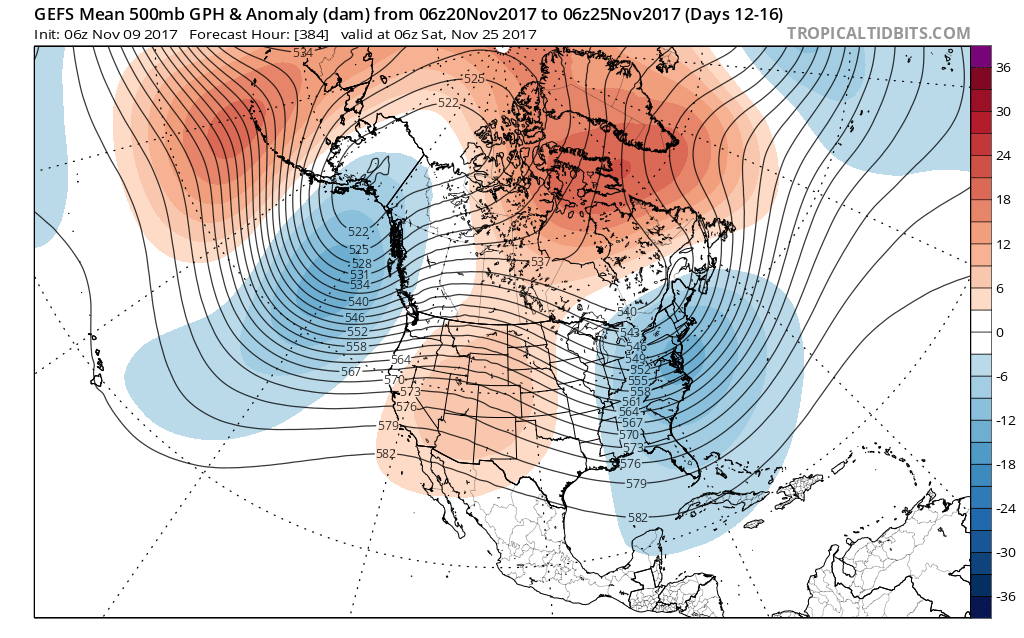 Such a pattern illustrated above, per the European ensemble (image 1) and the GFS ensemble (image 2), would help drill a tongue of unseasonably cold air through the northern Plains, into the Mid West, and across the East.
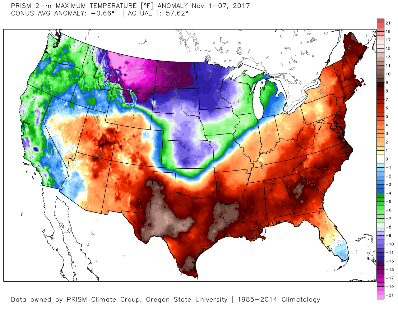
 We’ve been discussing early snow cover across Canada and the northern tier for weeks and how models would have to “correct” colder as they realize the air masses traveling over the snowpack won’t be able to modify as they normally would without that snowpack. The differences between this November and last are startling and show how the early snowpack is beginning to “feedback” on itself leading to early-season cold air.
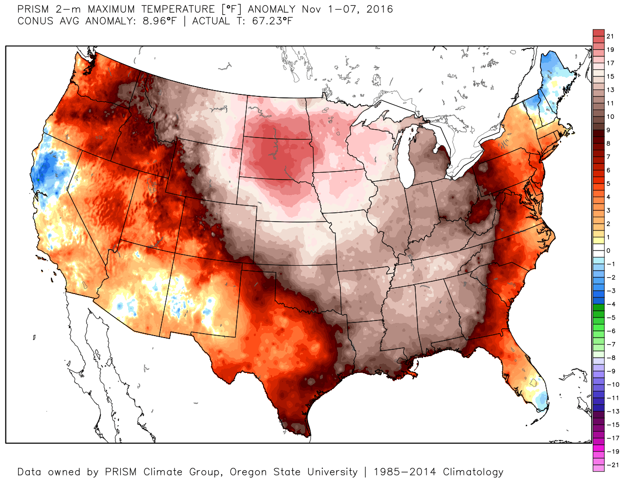 2017 snowpack and temperatures anomalies through the first week of November:
 Given the overall look to the pattern downstream, I anticipate the cold will continue to “press” and eventually overwhelm the pattern east as we progress through the second half of the month.
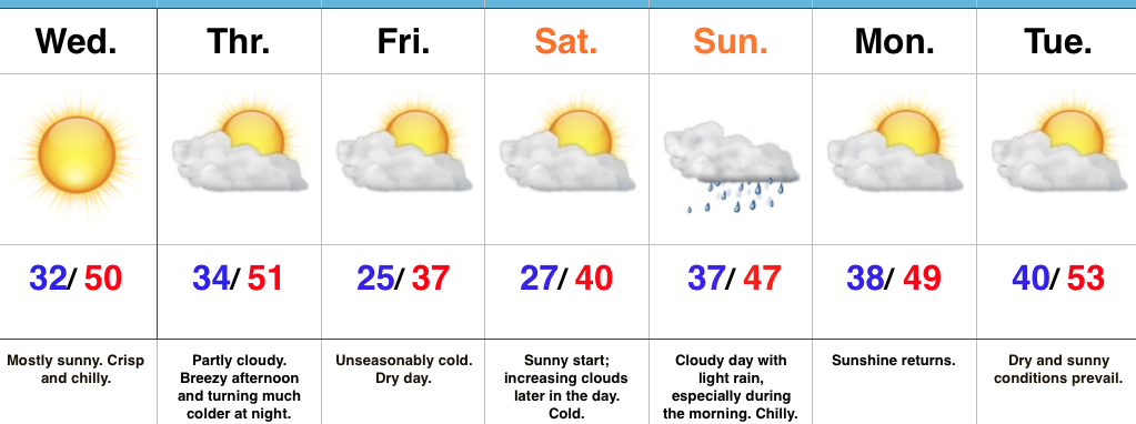 Highlights: