
 Highlights:
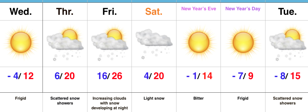
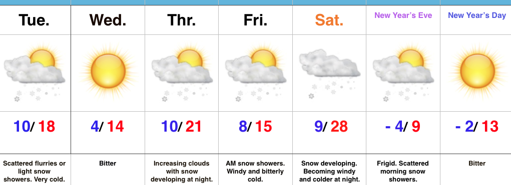
- Frigid times
- Snow chances return
- Bitter open to 2018
Serious Cold…Arctic high pressure has settled over the region and combined with our snow cover to produce the coldest morning around these parts in a couple of years. Some across central Indiana are awaking to double digit below zero readings. Even the slightest breeze coupled with these bitterly cold readings creates dangerous conditions to spend time outdoors.
Cold is here to stay. In fact, we’ll only grow more bitter next week. If we can put snow down between now and then, there’s a good chance we’re not even cold enough early next week with forecast temperatures. Speaking of snow, we’ll have to keep close tabs on impulses of upper level energy late tonight into Thursday for the potential of overachieving in the snowfall department (similar to what the I-70 corridor experienced Tuesday). With arctic air in place, it doesn’t take much to get snow going.
We’re still expecting a more widespread snow event over the weekend. We’re targeting Friday night into Saturday for light snow to overspread the region and this will setup a frigid close to the year and open to 2018.
Upcoming 7-Day Precipitation Forecast:
- Snowfall: 1″ to 3″
- Rainfall: 0.00″
 Highlights:
 Snow will begin to overspread the state, especially north of the I-70 corridor during the mid-to-late morning hours and we expect a steady snow to fall across the northern half of the state throughout the majority of the day. A period of moderate to heavy snow should develop during the mid-to-late afternoon, continuing into the evening hours across central Indiana. Road conditions will begin to really deteriorate during this time frame as surface temperatures fall into the 20s.
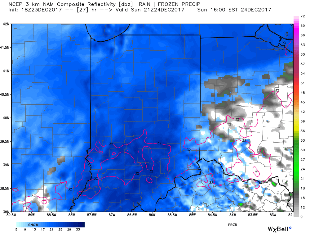 Eventually, snow will end from west (around 8p) to east (around midnight) tomorrow night, but not before depositing a widespread swath of 3″-5″ for areas generally north of I-70. For the city, itself, we think 2″ to 3″ is a good call, with generally an inch, or less across far southern portions of the state.
 Don’t be surprised if enough Christmas “magic” results in localized heavier totals with potential banding that develops tomorrow afternoon into the evening hours. All in all, this will be a classic, picturesque snow event for Christmas Eve. Hoosiers will wake up Christmas morning with a fresh blanket of white.