
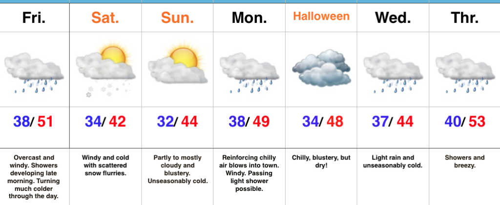
 Highlights:
- Cold pattern
- Showers give way to scattered snow flurries Saturday
- Chilly Halloween ahead
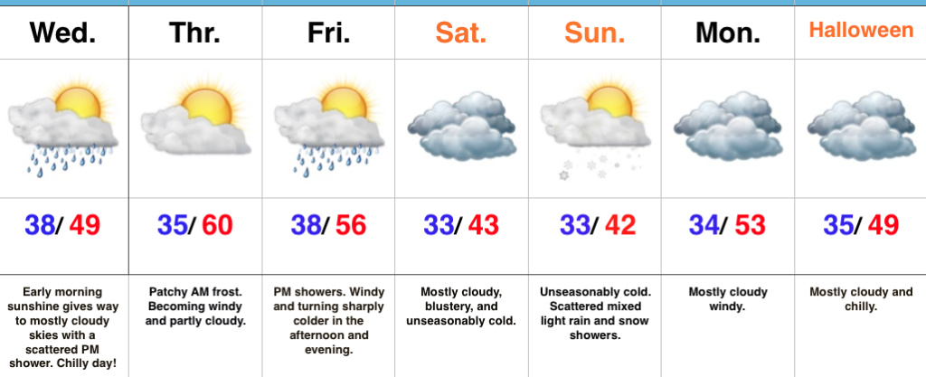
Into The Tank…Thursday was a delightful weather day across the region, including sunshine and seasonable temperatures after the cold and frosty start. Unfortunately, weather won’t be nearly that nice through the duration of our current 7-day forecast period.
A cold front is marching east and will pass through the state from this morning to early afternoon (west to east). A band of showers will accompany the frontal passage along with strong and gusty winds shifting to the north, and falling temperatures through the day. Heavier coats will be required by this afternoon.
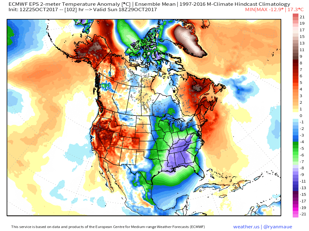
The air will grow cold enough for lingering moisture to fall as scattered snow flurries Saturday into early Sunday. – Novelty event only, but the first flakes of the season are always fun to see. Otherwise, look for a cold and blustery weekend. Wind chills will fall into the 20s this weekend.
Flipping the page to next week, a reinforcing chilly air mass will settle into the region in time for Halloween. While considerable cloudiness will be with us, trick-or-treat hours should be cold and dry.
Our next storm system builds in the middle of next week with a chilly light rain overspreading the region by Wednesday.
The 2017-2018 IndyWx.com Winter Outlook is now available!
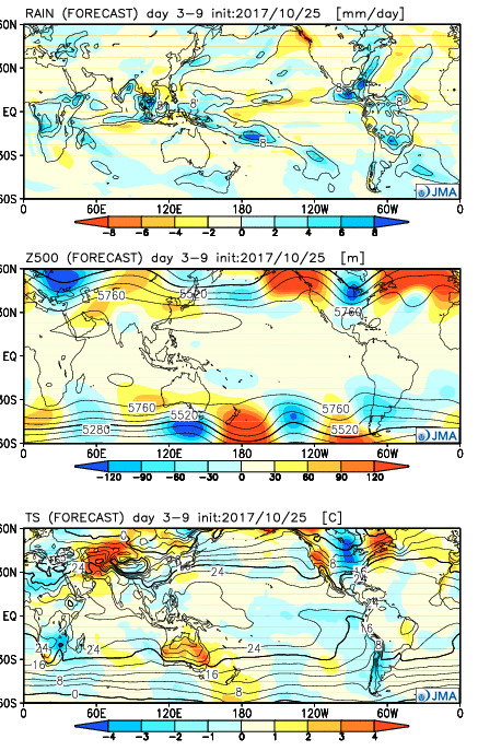
Upcoming 7-Day Precipitation Forecast:
- Snowfall: Trace
- Rainfall: 0.50″ – 0.75″
 Week 2:
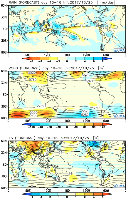 Weeks 3-4:
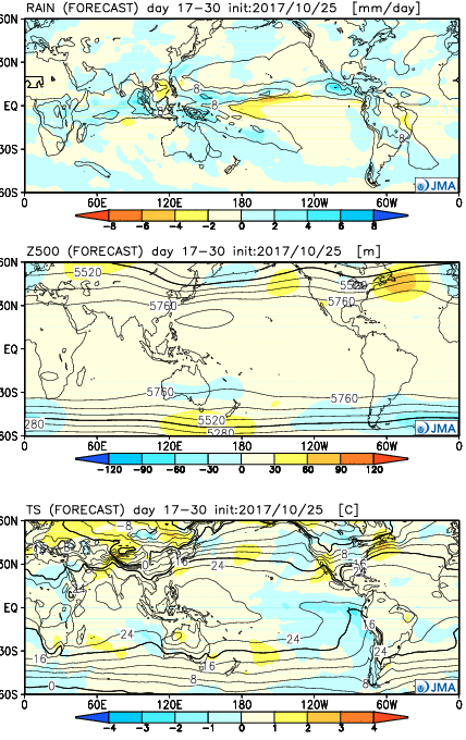 28 Day Mean:
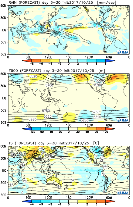 After the cold start to the month, the JMA Weeklies suggest ridges will “bookend” the country as November evolves, especially the Northeast region. This fits our research, as well, and fits the pattern, overall. If you haven’t had an opportunity to read our
 II. Gusty Thursday: After a cold, calm start to our Thursday, southerly winds will become gusty late in the afternoon. This is a result of an approaching cold front that will impact the region Friday.
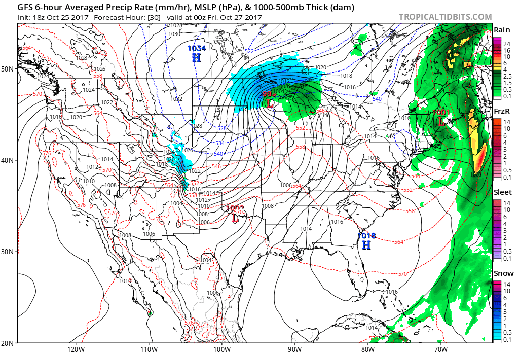 III. Unseasonably Cold Weekend: A cold front will pass Friday afternoon and a band of showers will accompany the frontal passage. Winds will shift to the northwest late in the day and drive in a sharply colder close to the work week. Air will grow cold enough to potentially support snow to mix in with the rain as precipitation comes to an end. Additionally, upper level energy and the colder air mass this weekend (the air will have a bite to it) could support mixed rain and snow showers Sunday. – Novelty stuff only, but those first flakes are always special to see. Nonetheless, temperatures will run well below normal. In fact, highs will be closer to our average low temperature this weekend.
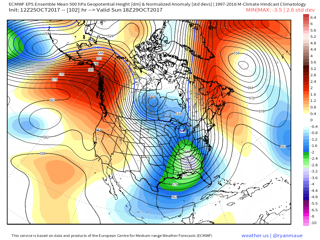
 IV: Reinforcing Halloween Chill: We still stand firm on the idea of warm costumes being required this Halloween as chilly reinforcements blow into town Monday night. This will result in Halloween featuring a high in the mid to upper 40s with lows Tuesday night/ Wednesday morning dipping to around freezing (upper 20s in outlying areas away from the metro). Most of Trick-or-treat hours should feature temperatures in the upper 30s and lower 40s.
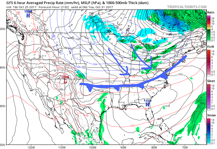
 Highlights: