
Thanksgiving is only a week away (where on earth does time go?!) and more and more folks are asking what we think winter will hold for central Indiana. In case you missed it earlier this fall, here’s our official Winter Outlook.
We’re continuing to dig in and monitor new data that’s streaming into the office, as well as ocean profiles. With that said, we wanted to share some of our findings with you this morning with respect to how various ocean regions can impact our weather this winter.
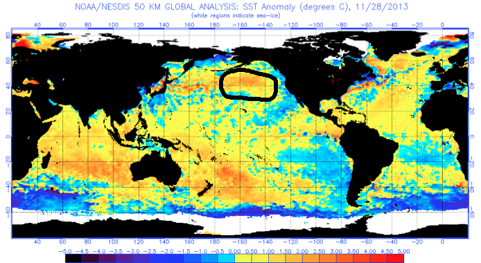
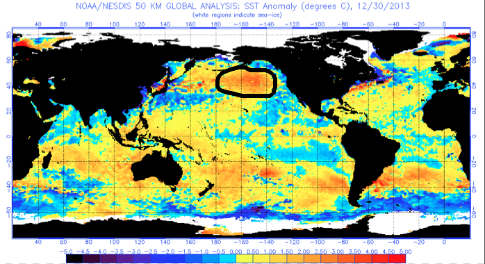
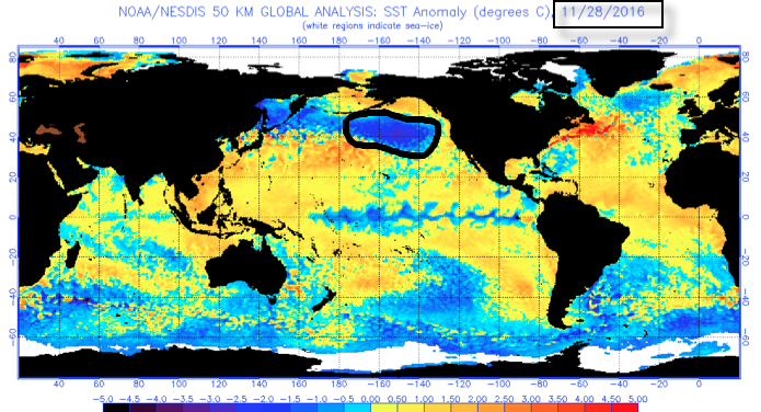
We’re noticing significant changes, particularly in the north Pacific, with the famous “warm blob” emerging (image 1). This is a big factor that aided in persistent cold; wintry weather during the ’13-’14 winter (images 2-3). Notice the difference from last year, too (image 4). This isn’t a full blown cold PDO (Pacific Decadal Oscillation) yet, but trending in that direction and “ups the ante” for cold, wintry conditions, locally this year.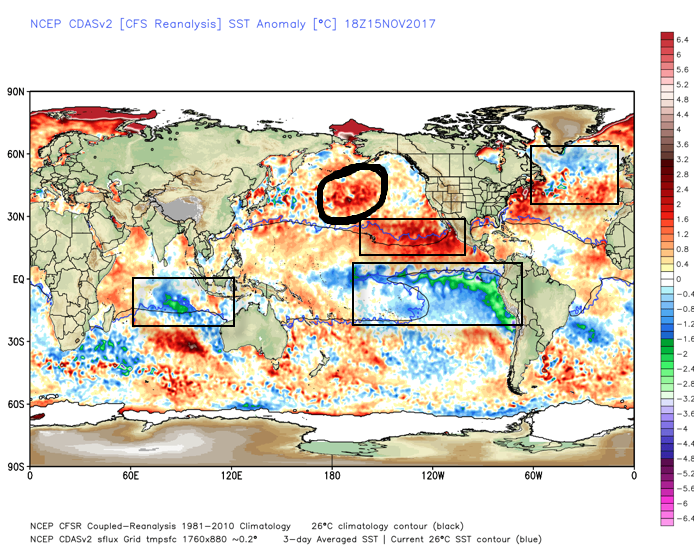
 What makes seasonal forecasting so challenging (and fun :-)) are the multiple features that can impact a forecast. We’ve talked about the importance of ENSO (various types of Nino and Nina events) in past updates, as well as low solar and QBO. All of these moving parts and pieces are coming together in a manner that seems to be favoring more of a cold, wintry regime, locally, this year. Is that us saying another blockbuster 2013-2014 winter awaits? Absolutely not (there are other differences noted above with the SST configuration). However, it is suggesting that this winter will be absolutely nothing like the past couple…
Might want to think about getting the snow blower tuned up!
More later today on the short-term. Make it a great Thursday!
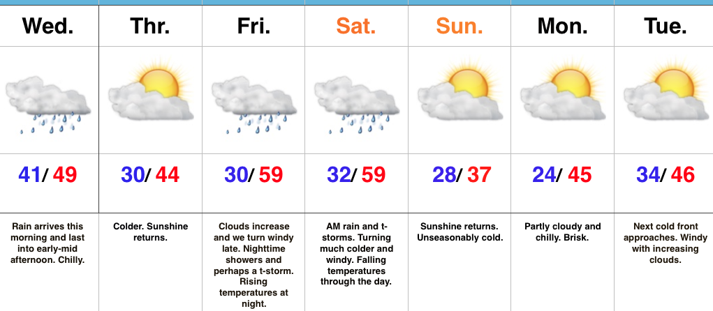 Highlights:
 Despite an active weather week ahead, the open to the new work week will be rather uneventful. Weak high pressure will keep us dry today and Tuesday. Fog and low clouds should give way to an increasingly bright sky by this afternoon (still more clouds than sun today) and partly cloudy skies Tuesday.
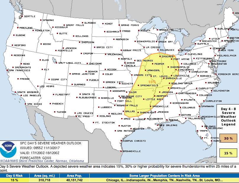
 A stronger storm will impact the region as we close out the work week. Strengthening low pressure will track into the Great Lakes and drag a trailing cold front through our region Friday evening. A briefly milder southwesterly air flow will push temperatures close to 60° Friday afternoon/ evening before the sharply colder push of air blows into town for the weekend. The transition may include strong to severe thunderstorms Friday PM, and the Storm Prediction Center (SPC) has outlined a large portion of the region under a severe risk Friday. It’ll be important to stay tuned to future updates. Even outside of potentially damaging thunderstorm gusts, non-t-storm winds will gust over 40 MPH Friday.
 Once the cold front sweeps through the region, a sharply colder air mass will plunge into the Ohio Valley for the weekend. Overnight data has trended even colder and would suggest falling Saturday temperatures (most of the day will be spent in the 30s) and highs only in the lower to middle 30s Sunday.
 Speaking of cold, Thanksgiving week is looking unseasonably cold, and there’s also the potential of early-season snow (far too early for specifics).
 Highlights: