Can’t Beat This Weekend Weather…
 Highlights:
- Sun-filled weekend
- Sunday turns windy
- Storms arrive Monday evening
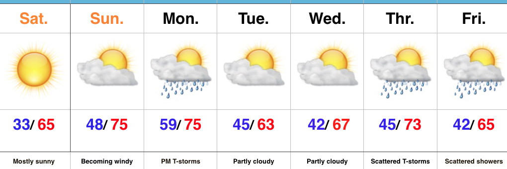
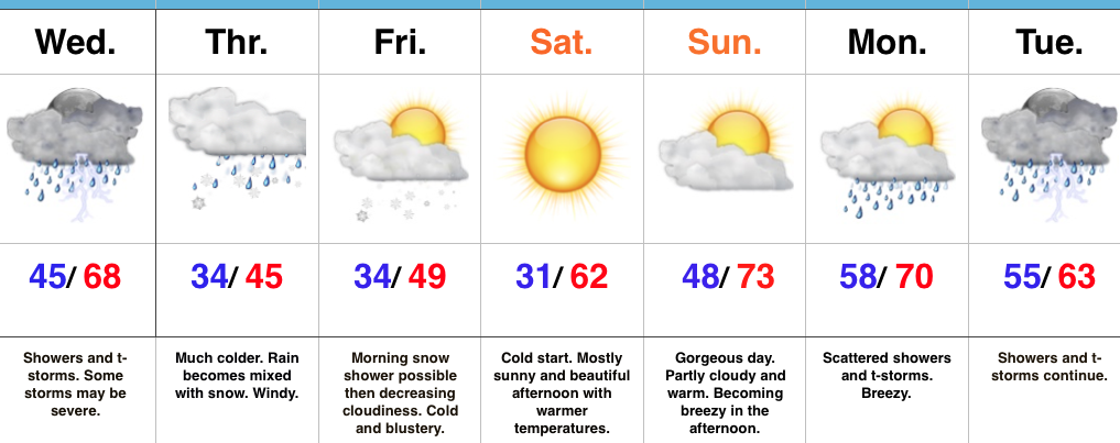
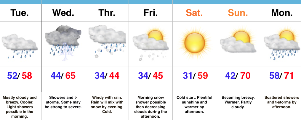
Sunscreen Required This Weekend…It’s not very often around these parts where we can dial-up two beautiful weekends in back-to-back fashion, but that’s exactly what we’ll do. High pressure will supply a gorgeous Saturday and Sunday, complete with plentiful sunshine. We’ll add 10° Sunday, but also throw in 30-40 MPH wind gusts, especially by afternoon. Get outside and enjoy this weather!
A weak frontal boundary will slip into the state Monday afternoon and will likely kick-up some thunderstorms as it pushes southeast Monday afternoon and evening. A strong thunderstorm, or two, can’t be ruled out. We’re back to dry weather midweek before unsettled weather returns to close out the work week. Looking ahead just beyond the current 7-Day would suggest a wet and stormy beginning Easter Sunday before a drier finish. Stay tuned as we still have time for things to change.
Upcoming 7-Day Precipitation Forecast:
- Snowfall: 0.00″
- Rainfall: 0.50″ – 1.00″
 Week 2:
 Weeks 3-4:
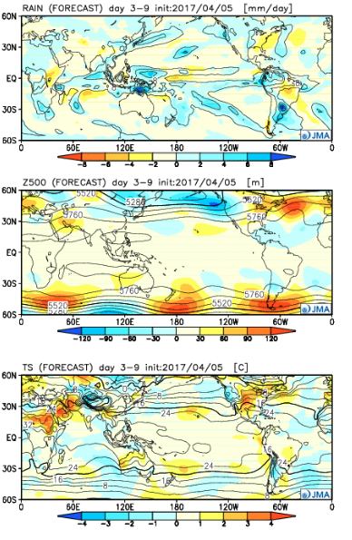
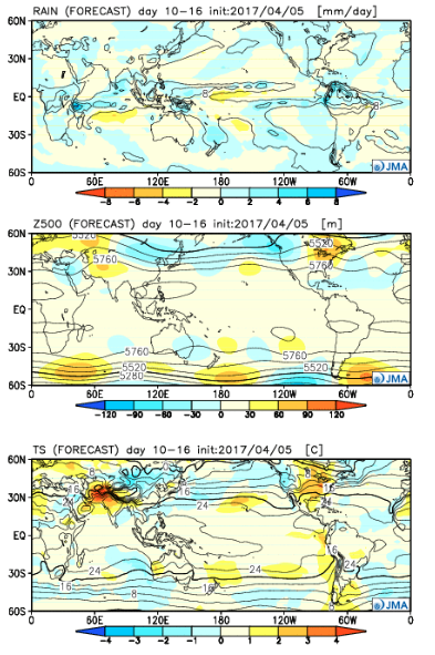
 The big picture is one that shows a drier pattern developing across the East during Week 1, but we caution that this drier regime doesn’t look to “lock” in. Data suggests we get back to an active pattern between Week’s 2-4, biased wetter than normal in the Mid West and Plains. The other screaming message is that a busy severe season should continue through the period. Cold sets up across the Pacific Northwest, associated with the “mean” trough position, while spring-like warmth continues to build across our region in overall terms. We know what that means as storms eject off the Rockies and track east…
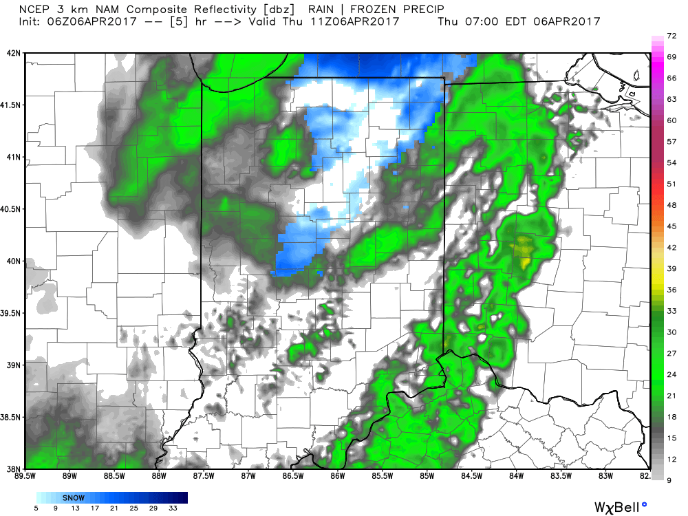 We’ll also add wind into the mix late morning through early evening, including gusts around 50 MPH. Factor in the much colder temperatures with gusty northerly winds and you have the makings for a truly “raw” day across the region. The National Weather Service has issued a Wind Advisory until 8pm.
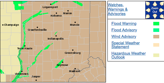 We should finally get rid of the precipitation later tonight and after a chilly Friday, weekend improvements are coming. Lows both Friday and Saturday morning will be around freezing for most central Indiana neighborhoods. After a cloudy start Friday, sunshine should return Friday afternoon as drier air works into the region. With high pressure arriving this weekend, sunny conditions can be expected and with a southwest wind developing by Saturday afternoon, moderating temperatures are on deck as well.
 In fact, after that cold start Saturday, highs should climb into the lower 60s Saturday afternoon and all the way into the lower to middle 70s Sunday afternoon!
 Highlights:
 Highlights: