
As the race weekend and Memorial Day draw ever-closer, data is able to pick up on some of the specifics associated with our weather for the all-important long weekend.
After scrolling through the data this evening, it appears as if we need to bracket late Friday night-Saturday morning and again late Saturday into Sunday morning for the potential of two rounds of gusty storms. Some of these storms could reach strong to severe levels, and the Storm Prediction Center continues to outline central Indiana for a Slight Risk Saturday (large hail and damaging straight line winds are of greatest concern, locally).
 Despite having to dodge a couple rounds of gusty storms this weekend, we want to stress that the majority of the holiday weekend should feature rain-free hours, and certainly isn’t worth cancelling any outdoor plans. In fact, after a beautiful Carb Day, most of the daytime hours both Saturday and Sunday should be rain and storm free. Have a means of getting the latest weather information, but plan to enjoy long stretches of rain-free hours this weekend.
Much more later!
 Highlights:
 While we can’t completely rule out an afternoon shower or storm Sunday, the most widespread activity should occur during the morning hours- before race time. Stay tuned. We’ll turn cooler early next week…
 Thankfully, rain will begin to diminish Thursday morning and we’re back to mostly dry conditions by Thursday afternoon. Before dry weather returns, some neighborhoods can expect to accumulate between 1″-2″ of rain.
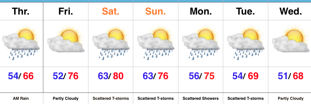
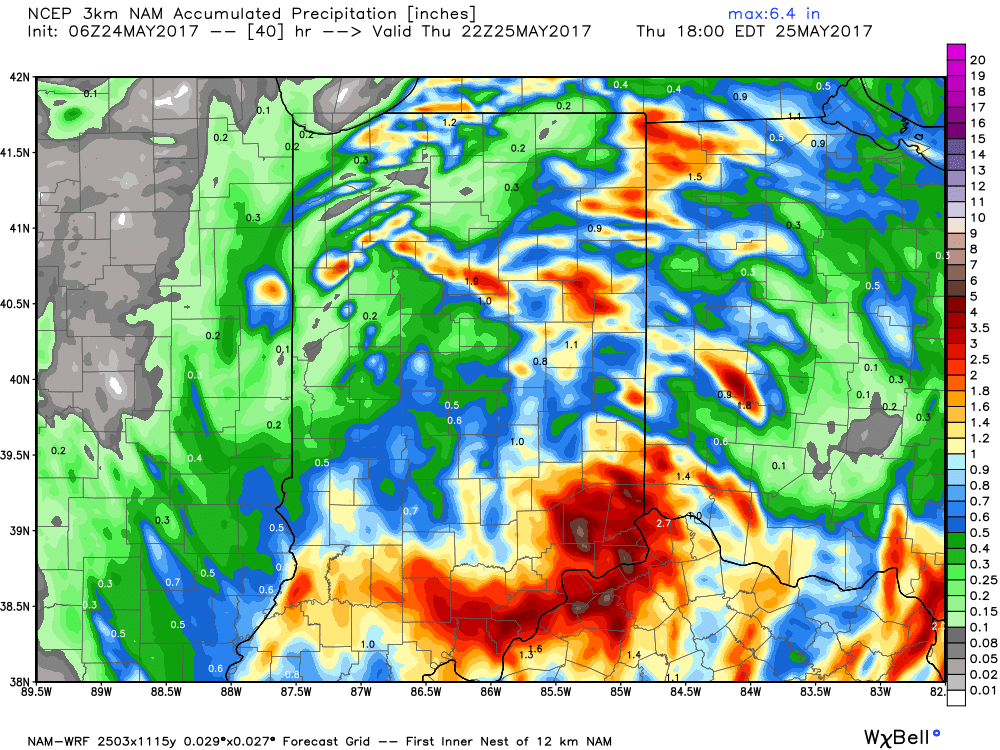 With the clouds and showers around, expect unseasonably cool conditions both today and Thursday. Highs will only reach the mid to upper 60s both days.
 Highlights: