Humidity Increases; Late Week Storms Then Cooler…
 Highlights:
- Sunshine and warmth continues
- Increasingly muggy feel develops
- Storm chances return
- Much cooler next week
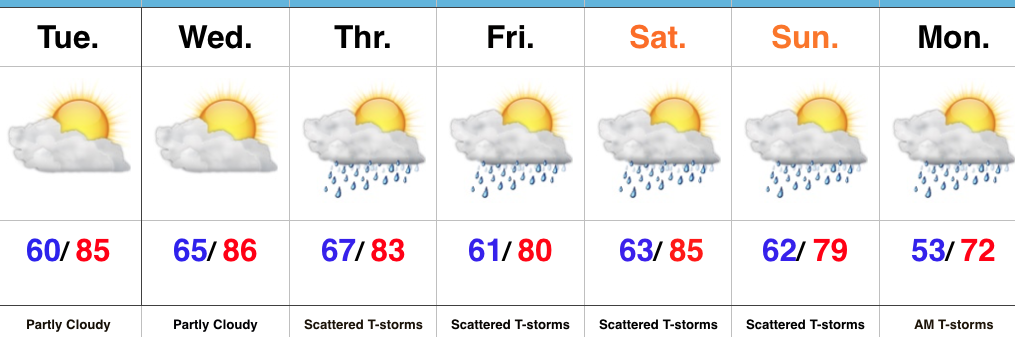
Very Warm And Increasingly Humid…High pressure will supply continued dry conditions, along with unseasonably warm temperatures through midweek. A southwesterly air flow will help push an increasingly muggy feel into the region by Wednesday. “Air you can wear” will be an appropriate way to sum things up! 🙂
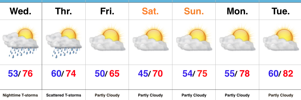
That increasing moisture will eventually yield better coverage of showers and thunderstorms as we move through late week into the weekend. It certainly won’t rain the entire time, but periods of scattered thunderstorms will be with us Thursday through Monday morning. With high moisture content, locally heavy rains will be possible.
A cold front will move through the state Sunday night and Monday and result in a significantly cooler trend next week.
Upcoming 7-Day Precipitation Forecast:
- Snowfall: 0.00″
- Rainfall: 1.50″ – 2.00″
 Highlights:
 Highlights:
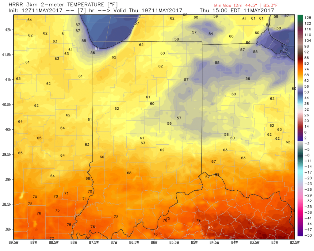 A new batch of showers will ride east and impact areas mainly along and south of I-70 as we move into late morning and early afternoon. While some embedded thunder is possible, severe weather isn’t expected today.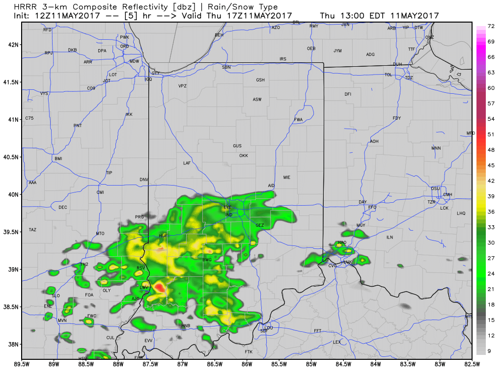
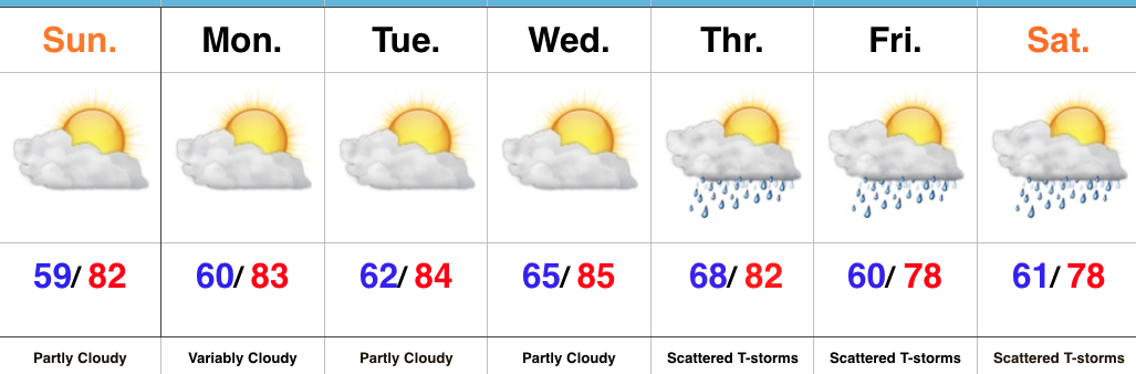
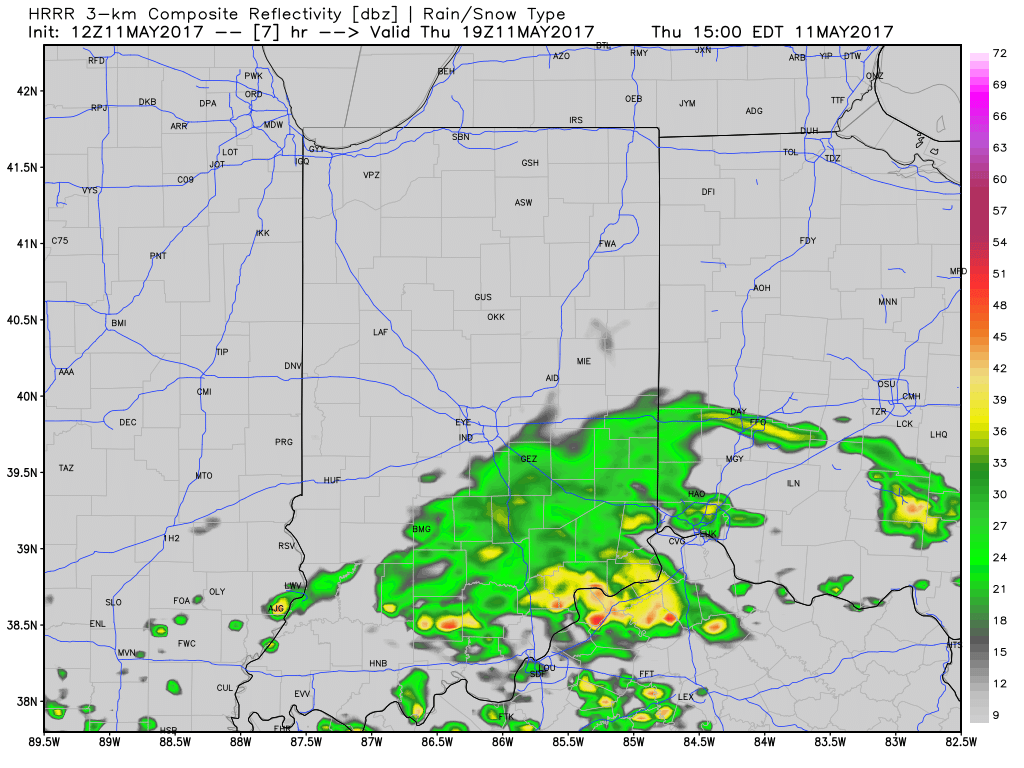 Drier and cooler air wins out for all tonight and paves way for a gorgeous weekend ahead. High pressure will support plentiful sunshine and comfortable conditions. More on the weekend and next week’s weather later today in an updated 7-day!
 Highlights: