
 Highlights:
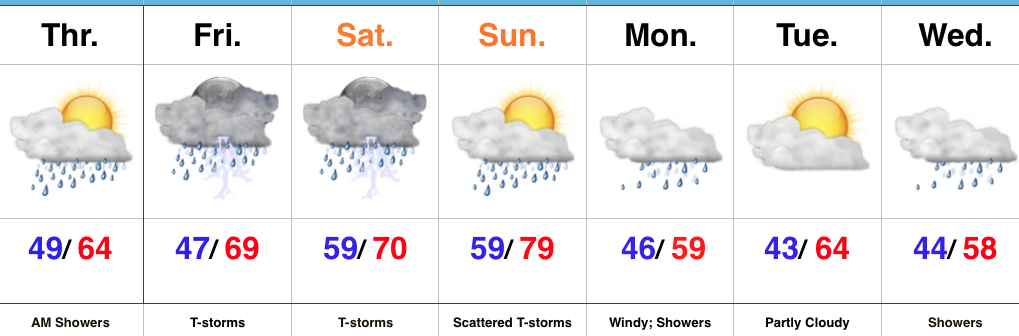
- AM showers then cooler and windy
- Stormy weekend ahead
- Cooler next week
Busy Times In The Weather Office…A cold front will sweep through the state this morning with lingering showers and an abrupt wind shift. Gusty westerly winds and cooler air (we’ve already seen our high for the day) will be with us this afternoon, along with a variably cloudy sky.
Unfortunately, we don’t have many changes to the ongoing idea of hefty weekend rains. A warm front will begin to slowly lift north Friday into Saturday and this will be the focal point for heavy rain and thunderstorms. Overall coverage and intensity of rain and thunderstorms will increase as we rumble through the second half of Friday. A couple of storms could be strong to severe- especially across southern Indiana Friday afternoon and night.
The aforementioned warm front will lift north and be located across the southern Great Lakes region Sunday. This will put our neck of the woods squarely into the warm and humid air mass Sunday. Though storm coverage will likely be more scattered in nature when compared to Saturday, heavy thunderstorms will develop, especially during the afternoon and evening hours. With a deep-rooted tropical connection along with saturated soils in place from early weekend rains, flood and flash flood potential will be high as we go into early portions of next week.
As we open up the work week, we’ll shift gears from a moisture-rich southerly flow to one that’s out of the northwest and much cooler. Showers will continue through Monday. Our next storm system will then set it’s eyes on the region by the middle of next week.
Upcoming 7-Day Precipitation Forecast:
- Snowfall: 0.00″
- Rainfall: 2.50″ – 3.50″
 Highlights:
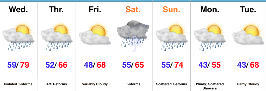
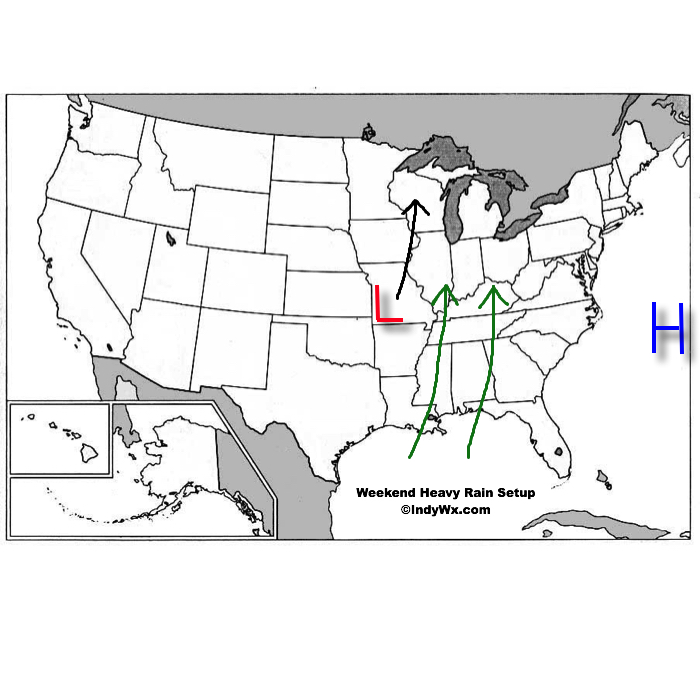 An area of high pressure will be located off the Mid Atlantic coast while surface low pressure develops in the southern Plains and tracks north over the weekend. The combination of these two ingredients will help pull abundant Gulf of Mexico moisture northward into the Ohio Valley. With a true Gulf connection, moisture-rich air will overspread the region this weekend. In addition to feeling truly muggy for the first time this year, this will also aid in periods of heavy rain this weekend.
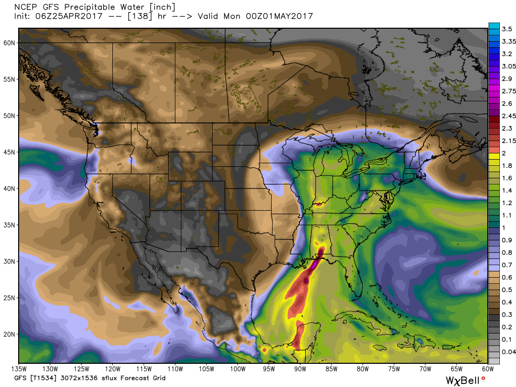 From this distance, it appears like widespread 2″ to 3″ of rain will fall over the weekend, but localized heavier totals are expected where thunderstorms “train” over the same areas. While it won’t rain the entire weekend, times of wet weather will outnumber dry hours and if you live near a creek or stream, keep abreast of this developing weather situation as significant water rise is expected over the weekend.
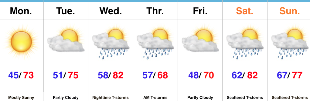 Highlights: