Snow Squalls Thursday Evening; Active Pattern…
 Highlights:
- Showers this evening
- Snow squalls develop Thursday evening
- Active weather pattern into next week
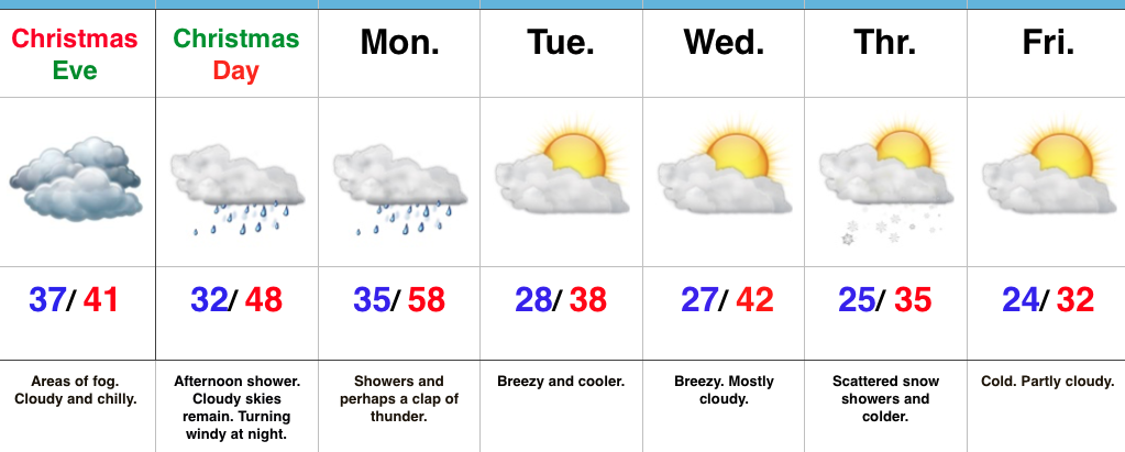
Early Sun Gives Way To Showers By Evening…A sunny, frosty start to the day will give way to an increasingly cloudy sky by afternoon and scattered showers by evening. Latest data suggests showers arrive into central Indiana by 6-7p. This won’t be a significant rain maker, but just enough to create damp conditions as we put a wrap on Wednesday.
A reinforcing push of cold air will blow through Thursday evening. With enough instability and upper air energy, scattered heavy snow squalls will become likely across the region by afternoon into the evening. This won’t be a “uniform” snow event, but some localized accumulation (thinking a coating to less than 1″ in spots), along with dramatic drops in visibility can be expected by evening as these scattered snow squalls increase in coverage. Additionally, winds will gust to 40 MPH and will aid in creating hazardous travel at times tomorrow PM. Scattered snow showers will continue into the day Friday.
Moving forward, we continue to eye the potential of a light wintry mix arriving on New Year’s Eve. As of now, this doesn’t appear to be a big deal, but we’ll monitor things as new data streams in. “Light” is the key word for now and temperatures look marginal, at best, for wintry issues.
As we rumble into next week, model consistency and overall agreement is rather non-existent. This leads to a lower than normal confidence on the important details in regards to the early week storm system (and looking forward, towards a second storm coming along just beyond the current forecast period). For now we’ll go with showers Monday afternoon paving way to more widespread rain Tuesday. As colder air rushes in Tuesday night, precipitation will change to snow along with a strengthening northwest wind and an increasingly bitter feel by the middle of next week.
Upcoming 7-Day Precipitation Forecast:
- Snowfall: 1″ – 2″
- Rainfall: 0.50″ – 1.00″
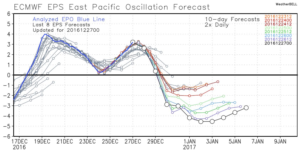
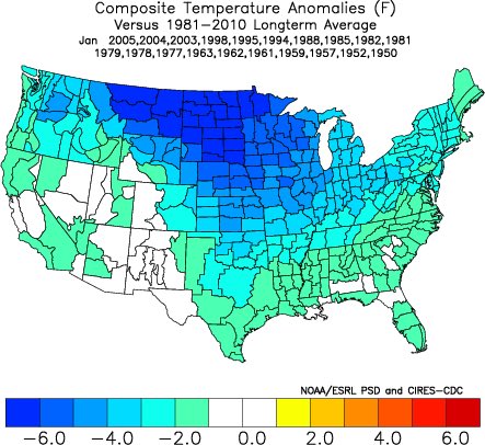
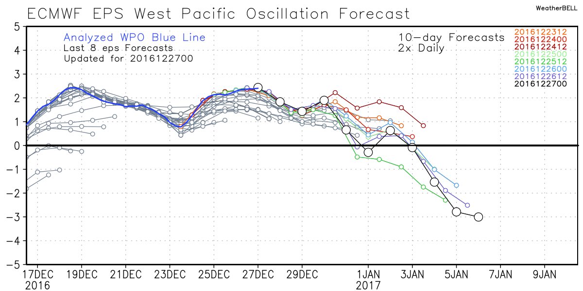
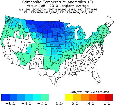 Accordingly, we see the ensemble data flipping to a colder pattern over the upcoming (10) days. Note the low anomalies in the higher latitude regions today (Image 1) versus Day 10 (Image 2).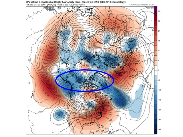
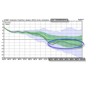
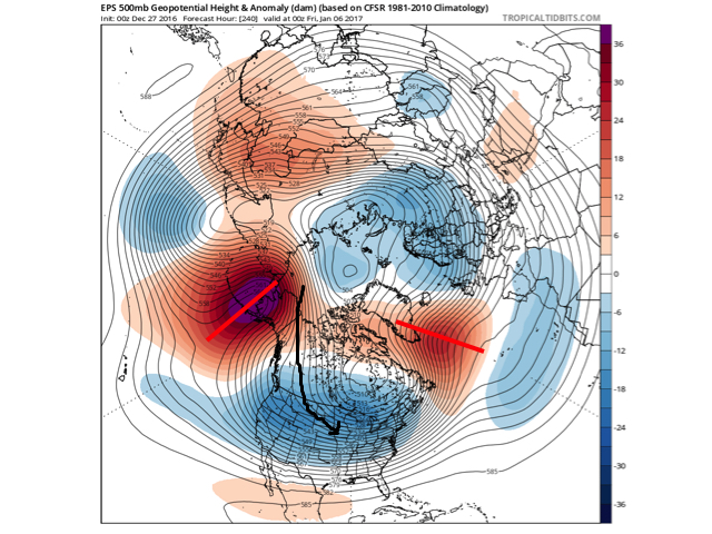 The pattern developing by Day (10) is one capable of producing another frigid regime- only January style. Cross-polar flow sets up shop and, unlike, December, some blocking is noted, as well. This can help the mean storm track shift further south. (Bye-bye Great Lakes cutters, though Mid Western and Ohio Valley Snow Lovers will find a new worry in the form of suppression potential ;-)). Individual storms will have their respected challenges, as always. As a whole, it’s a very cold, stormy look and a pattern capable of leading to an expanding snow pack across the Lower 48.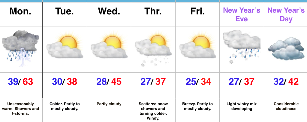
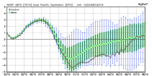
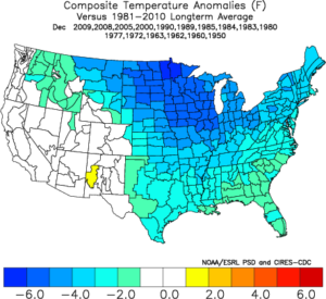 We note ensemble data is suggesting high latitude blocking tries to develop towards Day 10. Recall this was the missing ingredient in the bitterly cold blasts of air that occurred during the first few weeks of December. Both the GEFS and EPS agree on the increasingly blocky look to the pattern by Day 10. This would help drive a cold, stormy pattern by early January. Instead of storms cutting, we would see more suppression. With a “stubborn” southeast ridge, things could get interesting across the Ohio Valley from a wintry perspective….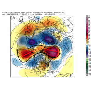
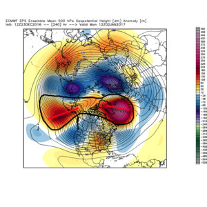 We don’t want to jump the gun, but it the positives can “hook up” over the pole, we stand the chance of locking into a rather lengthy cold, snowy regime as we rumble deeper into the heart of winter.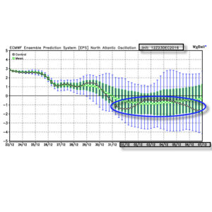
 Summary: A rather mild regime remains as we rumble through Christmas before trending more seasonable next week. From a wintry perspective we need to continue to keep an eye on the period around New Year’s Eve/ Day. Confidence continues to increase on the potential of a return of arctic air come early January.