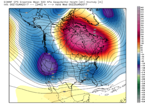
Weekend Video Update…
You must be logged in to view this content. Click Here to become a member of IndyWX.com for full access. Already a member of IndyWx.com All-Access? Log-in here.
You must be logged in to view this content. Click Here to become a member of IndyWX.com for full access. Already a member of IndyWx.com All-Access? Log-in here.
January-to-date is running milder than normal across the region- to the tune of 3.3 degrees (F). This is after a frigid open to the month, as you recall.
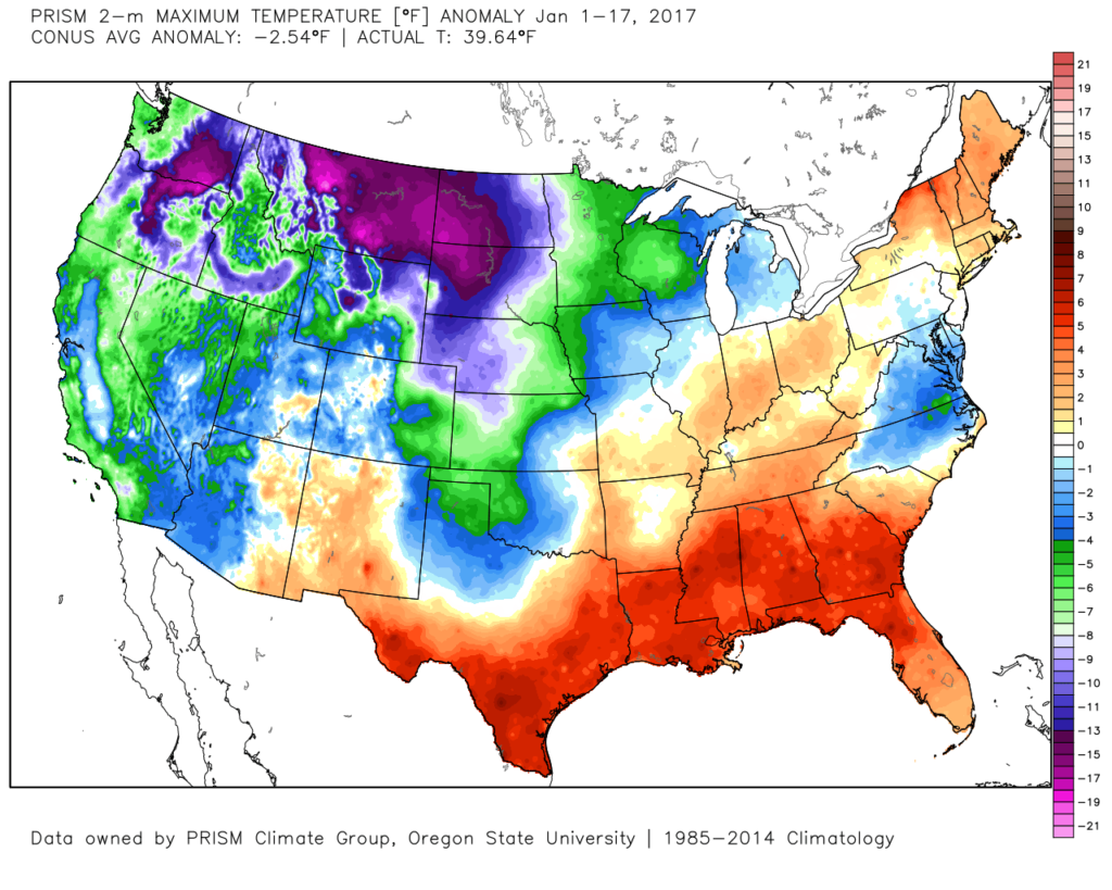 The second week of the month warmed significantly and continues, overall, for the next week.
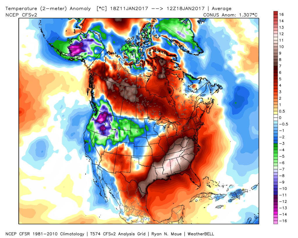 The mid-January warmth is attributed to a roaring PAC jet which is currently helping flood the country with temperatures much more like spring than the dead of winter. We continue to forecast 60+ this weekend across central IN.
Winter lovers, have no fear as changes appear to be in the offing as we go through the last few days of January and head into February. The winter so far has featured conflicting signals that continue to try and compete with one another to take hold of the pattern. Can we get these drivers to align in a way that would pull a more persistent trough into the east for the second half of the winter and, ultimately, set-up a sustained cold pattern helping make up for lost time in the snowfall department? Time will tell, but we do note the following late month:
All are encouraging for a shift back towards a wintry regime. As always, the devil is in the details and we’re skeptical as to the longevity of these signals. “Cautiously optimistic” would be the way to sum up our current feel longer-term into the month of February, but we’re not as bullish on lock and hold cold, wintry conditions at this time as what you may hear from some of our national compadres. Understanding that various drivers can have a different impact mid and late winter as opposed to early is one thing. It’s also important to note that long term modeling has been abysmal as of late and we want to tread through the next couple of weeks with caution to see whether or not the cold drivers can finally take hold.
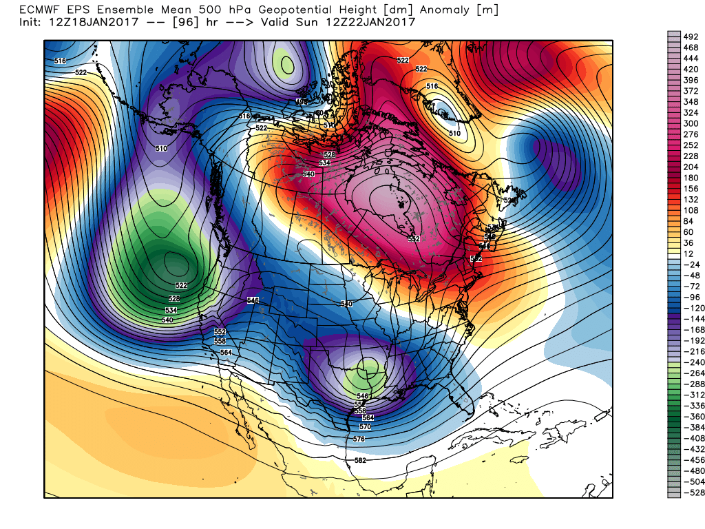
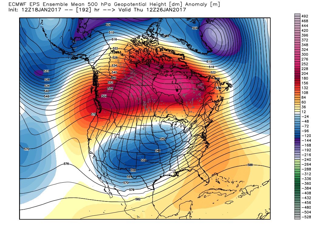
Needless to say, at least through late month, one can see the significant changes take place at 500mb.
Thursday:
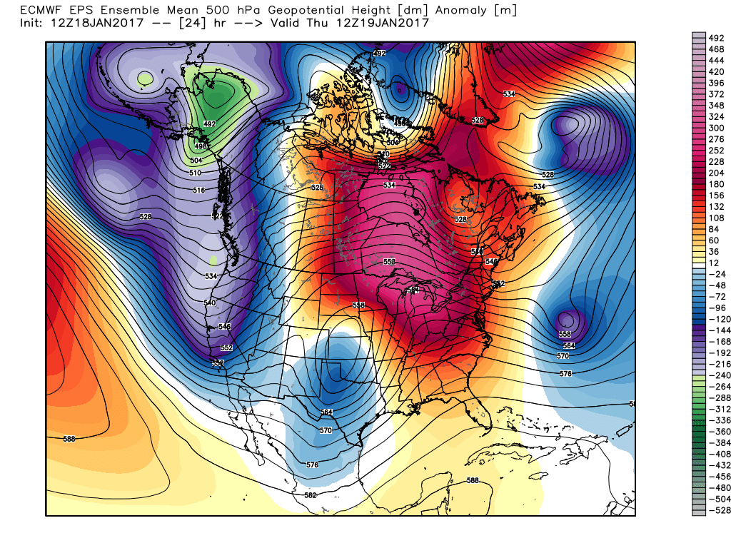 This Weekend:
 Next Thursday:
 Next Weekend:
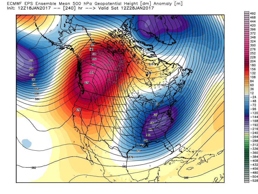 The pattern begins in the short-term with a look that will power anomalous warmth through the weekend, along with renewed rain chances Thursday night into Friday (another 1″+ for most), but begins to shift next week towards the colder look. The 2nd (weekend) storm system will be significant and poses a severe risk to the southeast region. Modeling has backed away on the heavy rain threat Sunday, but showers will be around early next week along with very windy conditions (40+ MPH gusts). Blocking is forcing the low south. By the time we get to next weekend, the pattern has done a 180 and in a position to drill unseasonably cold air back into the central and eastern portions of the country.
As far as storms go later in the period, it’s far too early to discuss specifics, but the pattern seems to be one that will promote the chance to get into the act on high-ratio producing clippers. It’s the first time we can say that this year. Time will tell…
 Highlights:
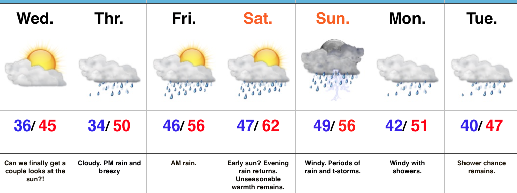
Hang On To The Rain Gear…We’re in the midst of a downright gloomy stretch of weather and, unfortunately, the overall trend remains locked in to a dreary regime. That said, there will be an opportunity for at least a few looks at the sun Wednesday as we’ll be in between storm systems. Our fingers are crossed!
Any sun will quickly fade and give way to increasing clouds Thursday and blustery, rainy conditions by the afternoon. Rain will likely grow heavy at times Thursday night into early Friday morning before another stretch of briefly drier conditions build in Friday PM through early Saturday.
Our active pattern remains this weekend, as a wound-up storm system promises a wet, windy, and stormy close to the weekend. Similar to our late week storm, additional heavy rain seems likely, as a gulf connection will be in place. Though heavy rain will take the headlines, the “spring fling” is also noteworthy. Highs this time of year normally are in the middle 30s. For some through central IN, highs will approach a whopping 30 degrees above normal.
Upper level energy remains early next week with pesky showers continuing, along with breezy conditions.
Upcoming 7-Day Precipitation Forecast:
 Highlights:
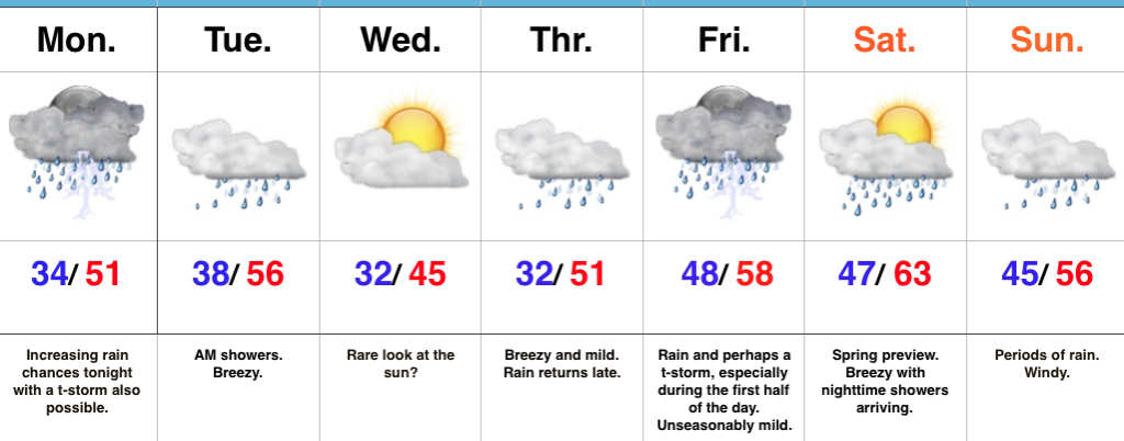
Have The Rain Gear Handy…While we’ll enjoy unseasonably mild temperatures, the wet and unsettled theme we’ve been dealing with as of late we’ll continue this week.
Most of the daytime today will feature more dry time than wet with just scattered showers expected before more widespread rain and embedded thunderstorms arrive by nightfall. Wet and periodically stormy times continue tonight into the early morning hours Tuesday. After a predawn high in the mid 50s, temperatures will slowly fall during the day Tuesday before remaining steady in the middle to upper 40s for the balance of the afternoon.
We may get a brief (rare) look at the sun Wednesday as we’ll be in between weather systems, but have no fear, as our next storm will be developing to our south and arrive with showers Thursday. 🙂 Rain and perhaps a thunderstorm continue Friday, especially through the first half of the day.
The majority of Saturday will feature dry and warm (early spring-like) conditions, but clouds will increase during the second half of the day and showers will push north into the state at night. Windy, wet conditions continue Sunday.
Longer-term, forecast models continue to paint a significantly colder, wintry pattern as we go through the last week of the month.
Upcoming 7-Day Precipitation Forecast:
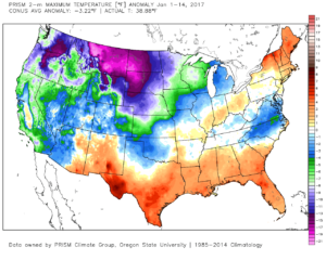
1.) January, month-to-date, is running slightly above normal at IND (+1.2 F) and nearly 1″ above normal in the precipitation department. Keeping true to the winter, overall, greatest cold departures are centered over the northern Plains and northern Rockies.
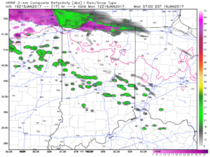
 2.) Showers will creep north overnight into Monday morning, but shouldn’t amount to much. They will be scattered in nature across central Indiana.
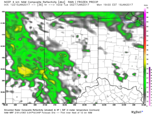
 3.) More widespread rain and embedded thunder will develop Monday night into Tuesday morning. This should amount of widespread half inch to one inch totals across the viewing area.
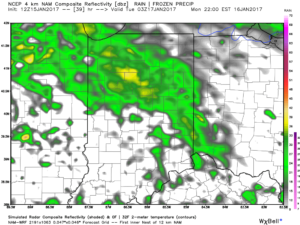 4.) A moist southwest flow will help push a warmer regime northward for the second half of the week. Though warm, we’ll also have to deal with periods of rain as disturbances track northeast. We circle Friday and Sunday as the wettest days and remain optimistic Saturday will feature dry and unseasonably warm conditions (lower-middle 60s). Between the rainy days Friday and Sunday, additional rainfall totals of 1″-2″ seem like a good bet.
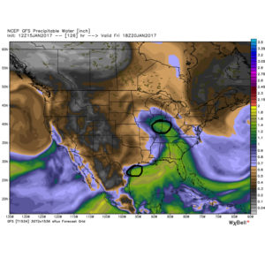
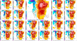 5.) The evolution of the pattern just beyond the 7-day period we’ll begin to take on an increasingly wintry look and we remain confident on a flip back to wintry conditions as we roll through the last week of the month. We’ll have to keep a close eye on a storm system in the 8-10 day period. It’s obviously way too early to discuss specifics, but this will be the time the pattern is beginning to turn back towards a wintry regime…