 Highlights:
- Spring-like weekend
- Unsettled times continue
- Winter returns
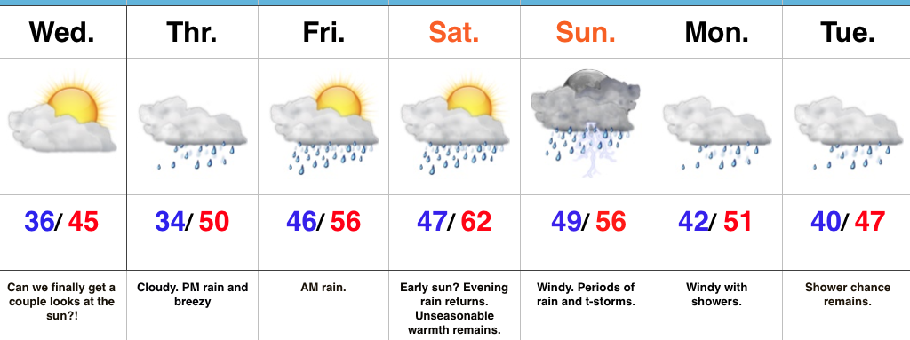
Rare January White Leg Alert…The big news this weekend will be temperatures close to 30 degrees above normal and a legitimate spring feel. Average highs across central IN this time of year are in the middle 30s and temperatures this afternoon will zoom to the lower-middle 60s. Patchy morning fog and drizzle will be with us, but we’re remaining optimistic we could squeeze a couple of looks at the sun during the day. Count yourself lucky if you do, indeed, see that weird giant bright thing in the sky! 😉
A developing storm system will track east across the central Plains and into the TN Valley this weekend. This will result in a significant severe weather outbreak across the south and increasing rain chances here for the back half of the weekend. The magnitude of the rain and potential embedded storms remains in question, but shower chances will at least be on the increase Sunday afternoon into the evening. We note short-term, higher resolution modeling hitting the locally heavy rain threat harder than global data early this morning (centered on Sunday evening) and we’ll keep a close eye on things as most central IN communities remain waterlogged. Winds will increase Monday- NE shifting to the N and gusts to 40 MPH with leftover showers continuing.
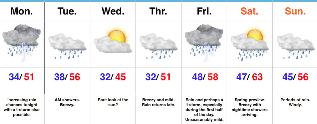
Tuesday will present a bit of a break in our active pattern before a fast-moving cold front blows into town Wednesday with scattered showers amidst blustery conditions.
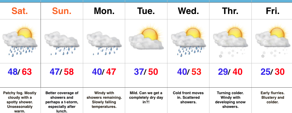
We turn colder (you knew this incredibly mild pattern had to break at some point) late week and upper level energy will help ignite snow showers with the return of the wintry feel Thursday into Friday.
Upcoming 7-Day Precipitation Forecast:
- Snowfall: Dusting – 1″
- Rainfall: 0.50″ – 0.75″
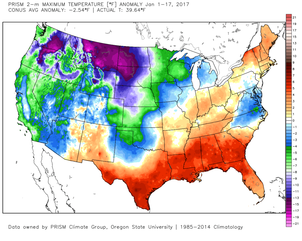 The second week of the month warmed significantly and continues, overall, for the next week.
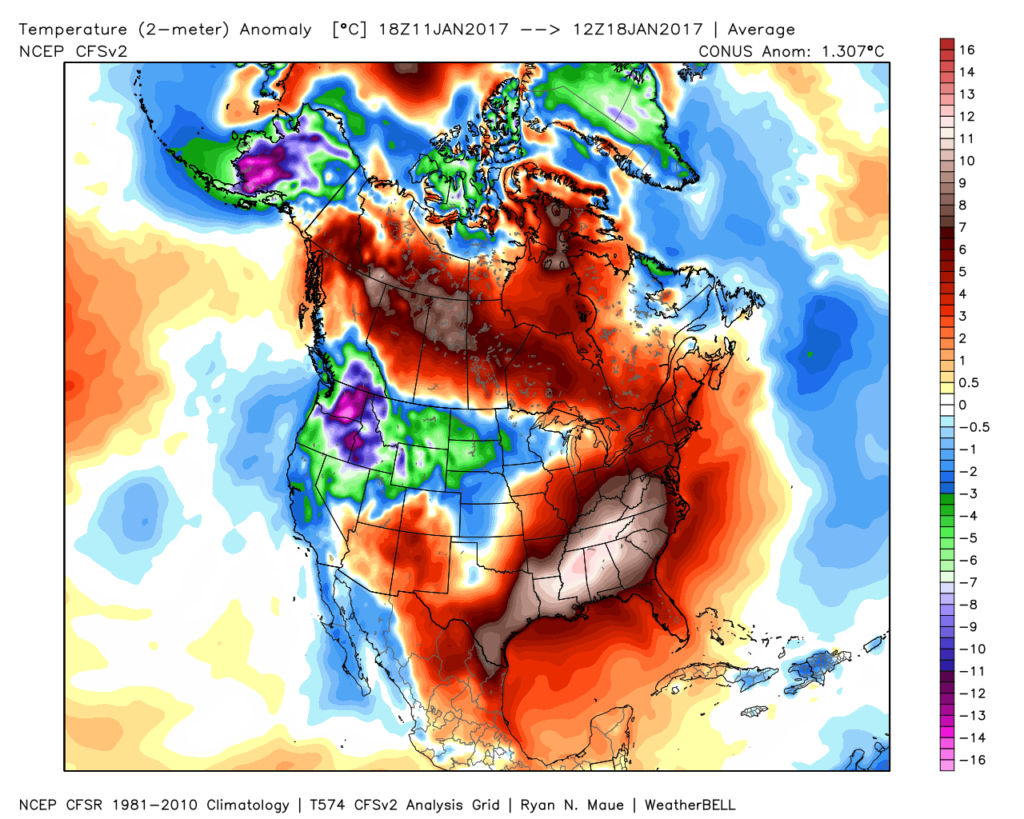 The mid-January warmth is attributed to a roaring PAC jet which is currently helping flood the country with temperatures much more like spring than the dead of winter. We continue to forecast 60+ this weekend across central IN.
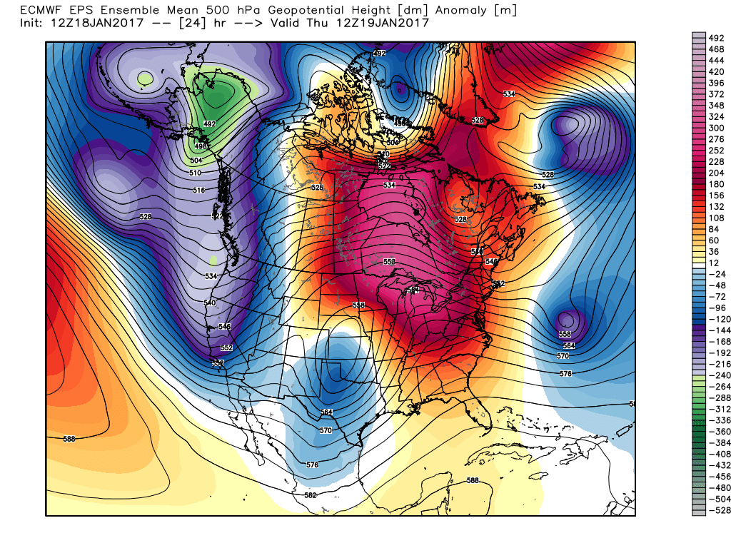 This Weekend:
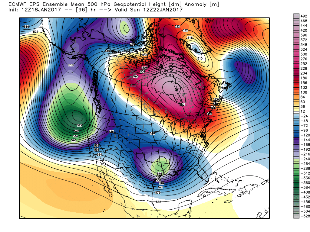 Next Thursday:
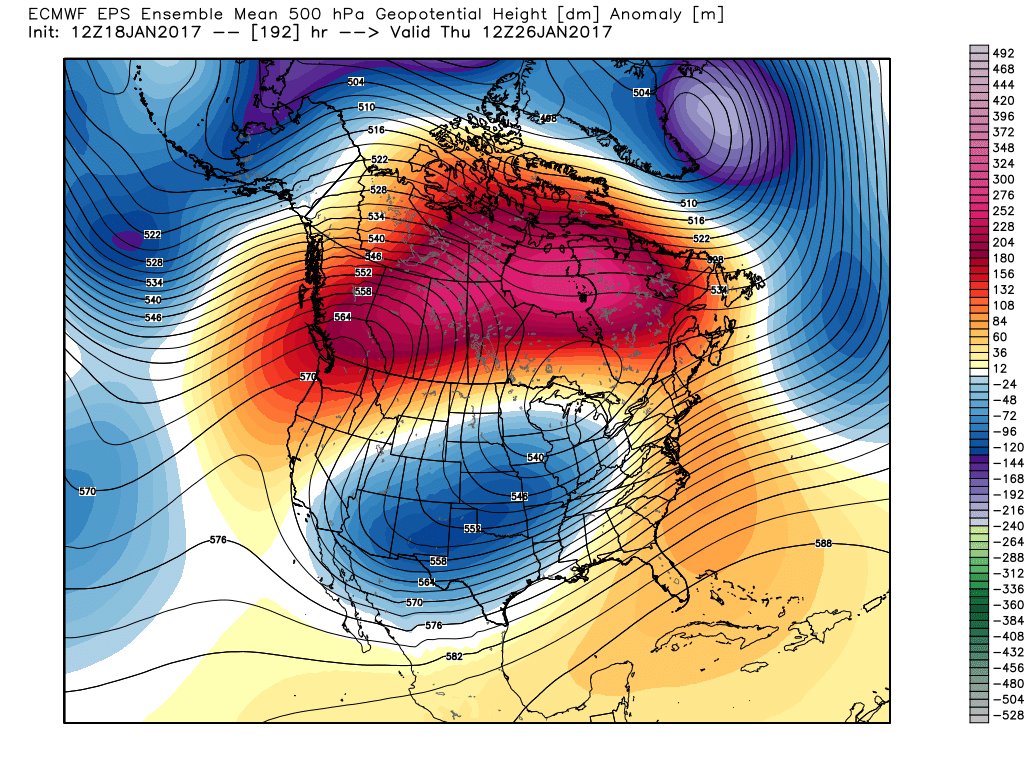 Next Weekend:
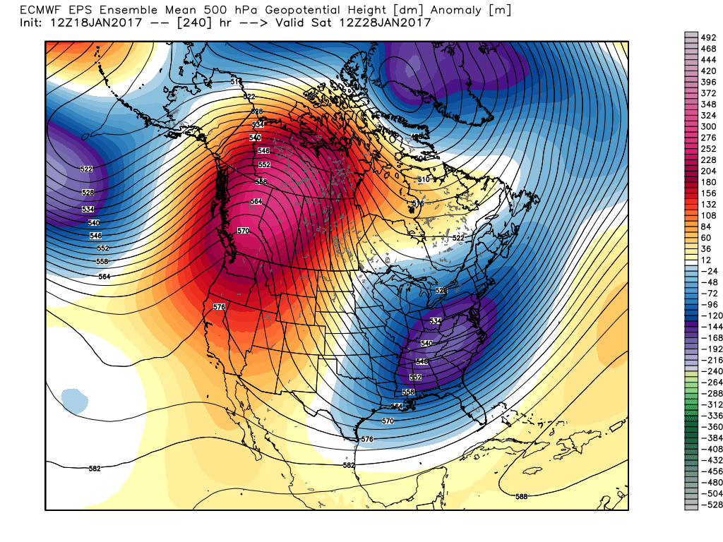 The pattern begins in the short-term with a look that will power anomalous warmth through the weekend, along with renewed rain chances Thursday night into Friday (another 1″+ for most), but begins to shift next week towards the colder look. The 2nd (weekend) storm system will be significant and poses a severe risk to the southeast region. Modeling has backed away on the heavy rain threat Sunday, but showers will be around early next week along with very windy conditions (40+ MPH gusts). Blocking is forcing the low south. By the time we get to next weekend, the pattern has done a 180 and in a position to drill unseasonably cold air back into the central and eastern portions of the country.