Turning Colder Today; Another Rain Storm As We Close 2018…

Highlights:

  • Falling temperatures today
  • Chilly, but sunshine this weekend
  • Wet weather returns New Year’s Eve

Spring This Morning; Winter Tonight…Temperatures are starting off on a downright balmy note for late-December, but that “spring fling” will come to a crashing end later this afternoon and evening as temperatures fall.  It’ll be a dry day, but blustery.  Jackets will be required by the afternoon on.

Sunshine remains in place this weekend before another big rain maker arrives on the scene as we close out the year.  Locally heavy rain can be expected Monday.  Much colder air will plunge in behind this particular storm system and left over moisture will fall as scattered snow showers New Year’s Day.

Tracking 2 Rain Events; Cold Open to 2019…

Highlights:

  • Wet with a few t-storms
  • Dry weekend
  • Wet then cold to open 2019

Rain Gear Needed…The pattern is transitioning from the predominantly mild stretch of the past couple weeks to one that will turn much colder as we move into January.  In between?  Active times, as we’re tracking two big storm systems between now and NYE.

The initial push of moisture has reached the I-65 corridor as of this forecast issuance early Thursday morning.  Periods of rain will continue through a good chunk of the day and we may even throw in some thunder into the mix later this evening- especially across southern portions of the state.  The other big story today?  Strong and gusty southerly winds.

Rain will end later tonight with dry, blustery, and colder times returning as we close the week.  Highs tomorrow will come predawn before falling through the day.  Dry and seasonable times will continue as we move through the last weekend of 2018.

A new storm system promises a return of wet times as we get set to ring in the new year.  Definitely plan on having the rain gear handy as you head out to those New Year’s Eve parties Monday.  Heavy rain is possible at times.  As the area of low pressure tracks northeast, it’ll swing a cold front through here Monday night and we’ll turn sharply colder with snow showers on New Year’s Day, itself.

Looking at the Holiday Week and Ahead to January…

Tomorrow will be a rather uneventful weather day across central Indiana, but things will begin to change as we head into Thursday.

An area of low pressure will track out of the central Plains into the Great Lakes by Friday. The end result will be increasing coverage of showers Thursday afternoon and perhaps even a rumble of thunder Thursday evening.

Most of the concentrated rain should come to an end around dark Thursday. By that time we forecast a general 1/2″ to 1″ to fall in area rain gauges.

More seasonable air will blow in here behind the storm system and we’ll have to keep an eye on energy “attacking” from behind over the weekend. With colder weather in place, snow is possible next weekend.

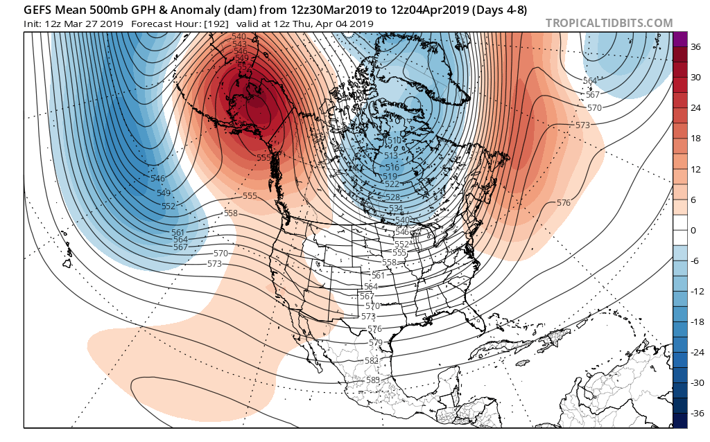
Looking ahead, a combination of ingredients appears to be coming together to create a rather significant transition in the pattern as we head into January. Note the developing positive PNA…

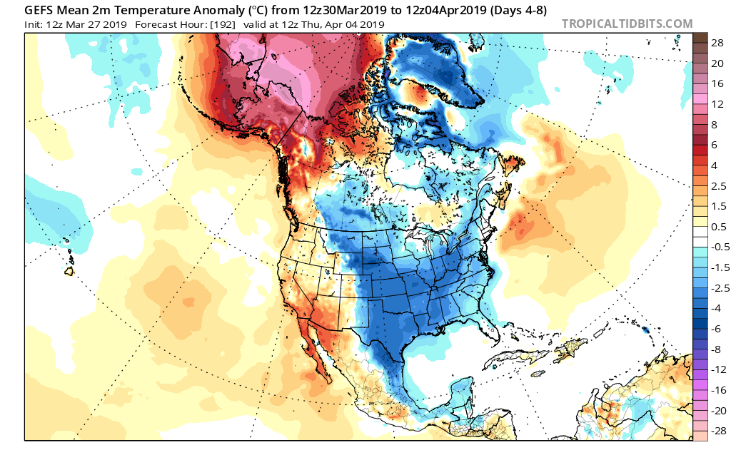
This will result in more sustained below normal temperatures making a return early January to our neck of the woods…

Additionally, it also appears an active storm track will continue. While impossible to say this far in advance, prospects for above average snowfall (average is 8.6″) appear likely through the month of January.