NEW JMA Weeklies Highlight Overall Mild Pattern…

Winter has been on hold over the past few weeks, and there’s really nothing that looks to shake that up anytime soon (at least through the upcoming 10-14 days).

The new JMA Weeklies are in this morning and they continue to highlight the mild times:

Week 1

Week 2

Weeks 3-4

This is a rather dramatic reversal from what this particular model was saying only last week- when it was bringing winter back with authority by Week 2 on.  One could easily argue that even out to the Weeks 3-4 time frame that this certainly isn’t an ideal look for “stick and hold” cold to eventually push into the East.

There is a lot going on “behind the scenes” right now and this isn’t us saying winter’s over before it really even began, but it continues to look more and more likely that any sort of sustained cold and potentially snowy times will have to remain on hold until potentially late month.  The roaring PAC jet will likely continue to have it’s say until then…

(More later tonight on some of the items that argue for winter to get going as we progress into late January and beyond).

Quiet Period Of Weather Into Early Next Week…

Although we’re dealing with areas of drizzle, low clouds, and fog this morning, a relatively quiet period of weather is ahead as we put a wrap on the week and head through the weekend.  At one time what I thought would be a more significant storm system and associated eastern wintry threat won’t come to fruition.  While the eastern seaboard will deal with rain Friday into Saturday, we should remain free of any significant precipitation here on the home front.

Weak high pressure will keep us dry with increasing sunshine through the weekend.

Our next storm system will arrive as we open up next week and we’ll forecast increasing rain chances next Monday.  From this distance, moisture return isn’t terribly impressive and rainfall amounts should remain generally in the 0.25″ to 0.75″ range.

Colder air will follow behind this storm system with more authority and those wishing and hoping for legitimate wintry conditions may finally have their wish as we get closer to mid month.  Speaking of cold and wintry times, we’ll have more on our updated long range thoughts later this week.

Wet Close To 2018…

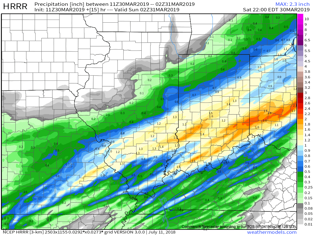
IND has already recorded over half an inch in the rain gauge this morning and there’s more where that came from between now and tonight. Steady rain will be replaced with scattered downpours late morning to around the lunchtime hour before widespread rain and embedded thunder returns early to mid afternoon.  Most can expect to tack on an additional half inch to inch of rain today and the latest HRRR sees this as well.

We’re also still monitoring the potential of strong to severe thunderstorms across southern portions of the state.  The Storm Prediction Center now includes far southern Indiana in a Slight Risk for severe weather today.  The primary concerns remain strong, damaging winds with a line of thunderstorms that may develop between 2p and 4p.  If your travels take you south towards Louisville today remain weather-aware.

Temperatures will run 25° to 30° colder New Year’s Day and a couple of scattered snow showers may fly- especially across the favored snowbelt areas to our north.

Have a happy and safe New Year’s Eve, friends!

Heavy Rain (And Thunder Downstate) Arrives For New Year’s Eve…

We’re enjoying pleasant conditions this afternoon with filtered sunshine and temperatures that should top out in the upper 30s to lower 40s later on.  Enjoy it, as a big rain event gets underway for New Year’s Eve.

This afternoon’s visible satellite shows sunshine dominating across the northern half of #INwx.

Clouds will increase tonight and rain won’t be too far behind.  We think wet weather builds into central Indiana before sunrise Monday (likely between 4a to 6a) and periods of heavy rain are still expected late morning into the afternoon and evening hours.

Rain will arrive into the city itself between 4a and 5a Monday. 

We continue to monitor the prospects of a skinny line of strong thunderstorms that may impact southern Indiana Monday afternoon and evening.  If your travels take you south to Louisville for NYE plans, this is something to monitor.  Widespread severe weather isn’t expected, but strong winds are possible if this line materializes.

Timing out prospects for a skinny line of storms to impact southern #INwx Monday afternoon. Best idea as of now will come between 2p and 4p.

This storm system will have a true tropical connection.  Precipitable water values will be quite “juicy” for late December and plenty capable of producing locally heavy totals.  Widespread 1″ to 1.5″ can be expected, but a few area rain gauges will likely see higher amounts.

Colder air will whip in here late tomorrow night and help lingering moisture fall as scattered snow showers New Year’s Day.  More later on the potential of wintry “mischief” later in the week…