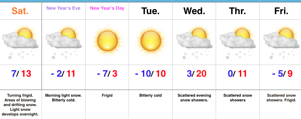
 Highlights:
- Blowing and drifting issues
- Snow returns late tonight
- Prolonged stretch of severe cold
Bundle Up; Snow Returns Overnight…Yesterday’s snow event went as planned and many Hoosiers are waking up to several inches of powder this morning. The winners yesterday stretched from Frankfort to Elwood to Winchester with a 6″ to 7″ band of snow. All of that fresh snow will be blown and drifted about today with strong and gusty northwest winds. If your travels take you into the open country, plan on significant blowing and drifting and leave extra time to reach your destination.
Additional upper level energy will scoot across the region late tonight into early Sunday and this will help kick up an area of light snow for central and southern portions of the state as we head into New Year’s Eve. With the arctic air mass in place, don’t be surprised if we squeeze a quick inch out in spots.
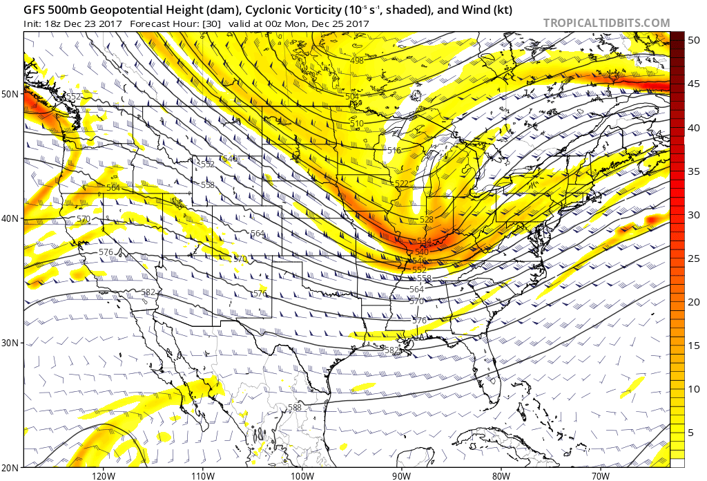
Otherwise, the big story is the prolonged nature of this severe cold. At times, wind chill values will drop to more than 30° below zero through early week. Take the frigid conditions seriously. Reinforcing arctic air will pour in here late next week and lead to scattered snow showers along with a bitter feel after slight midweek “moderation.”
Upcoming 7-Day Precipitation Forecast:
- Snowfall: 1″ to 3″
- Rainfall: 0.00″
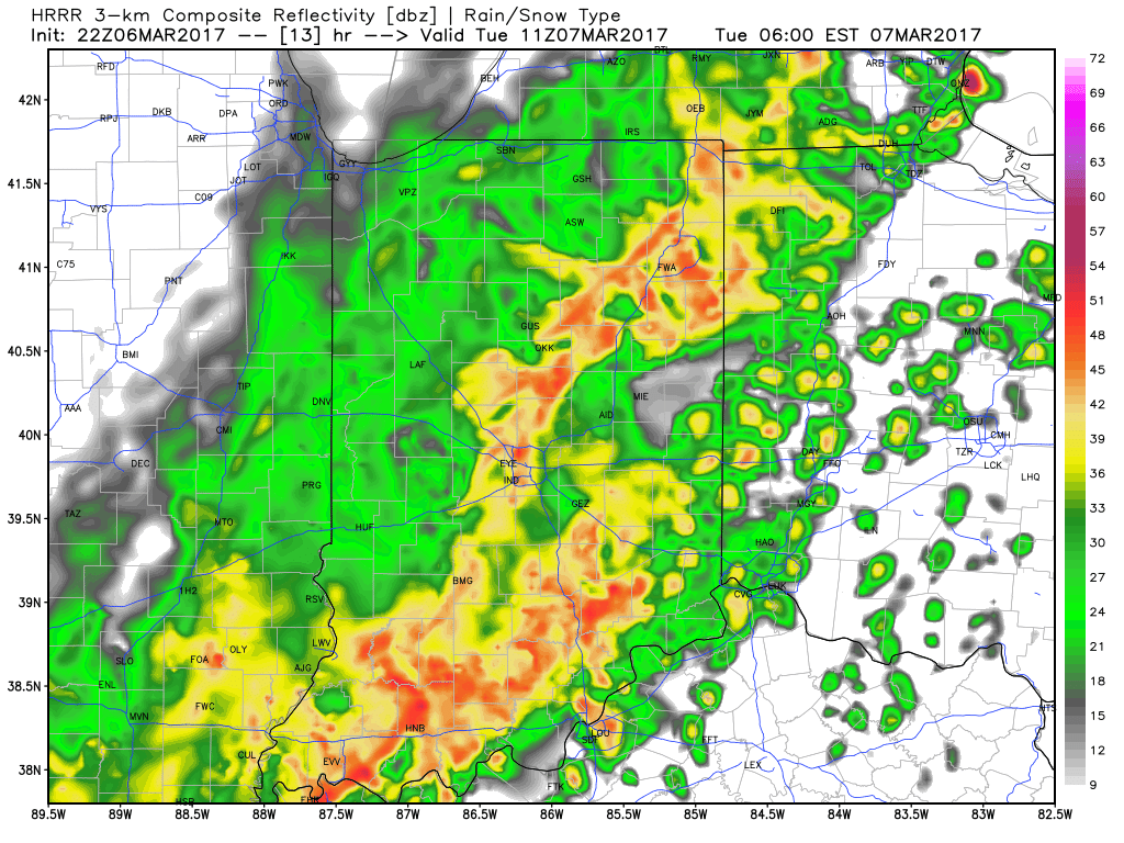
 Snow will then encompass most of the state as we progress into the late afternoon and evening hours.
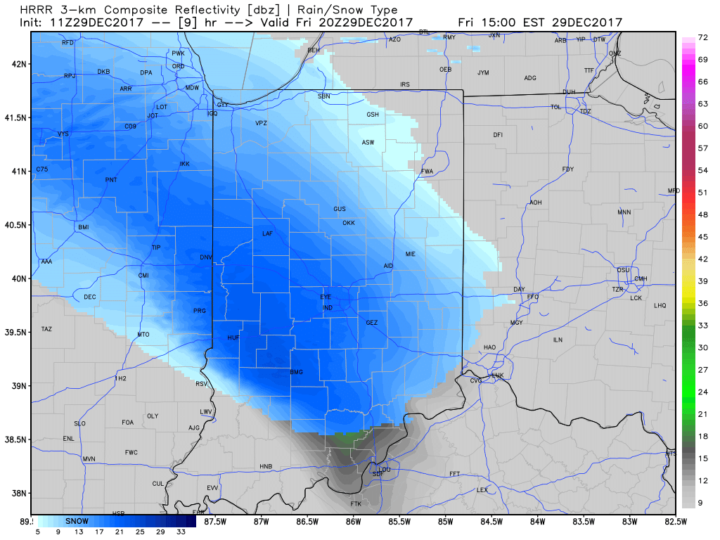
 At times, we expect moderate snow to be falling across central Indiana and this will, unfortunately, make for a messy evening commute. Plan for snow covered and snow packed roads and slick conditions. Leave extra time to reach your destination.
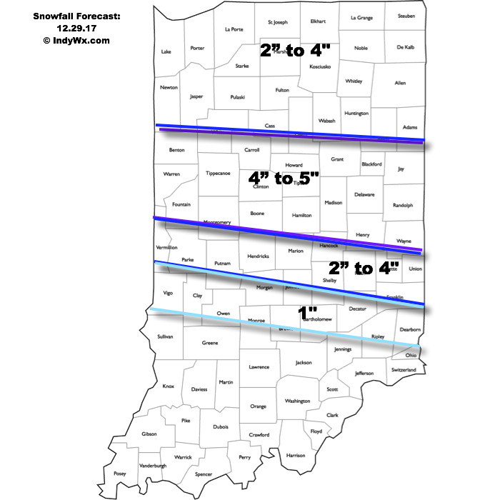 Attention once to Saturday will shift to the problems associated with blowing and drifting snow as winds increase and temperatures tumble. Strong and gusty northwest winds will continue into early next week and not only will this lead to continued issues with blowing and drifting, but will also drive dangerously cold air into the area.
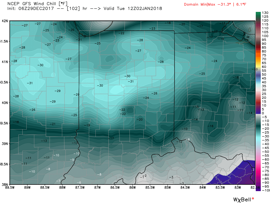
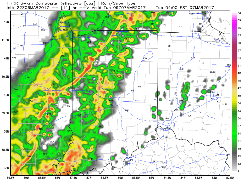
 Snow will begin to overspread the state, especially north of the I-70 corridor during the mid-to-late morning hours and we expect a steady snow to fall across the northern half of the state throughout the majority of the day. A period of moderate to heavy snow should develop during the mid-to-late afternoon, continuing into the evening hours across central Indiana. Road conditions will begin to really deteriorate during this time frame as surface temperatures fall into the 20s.
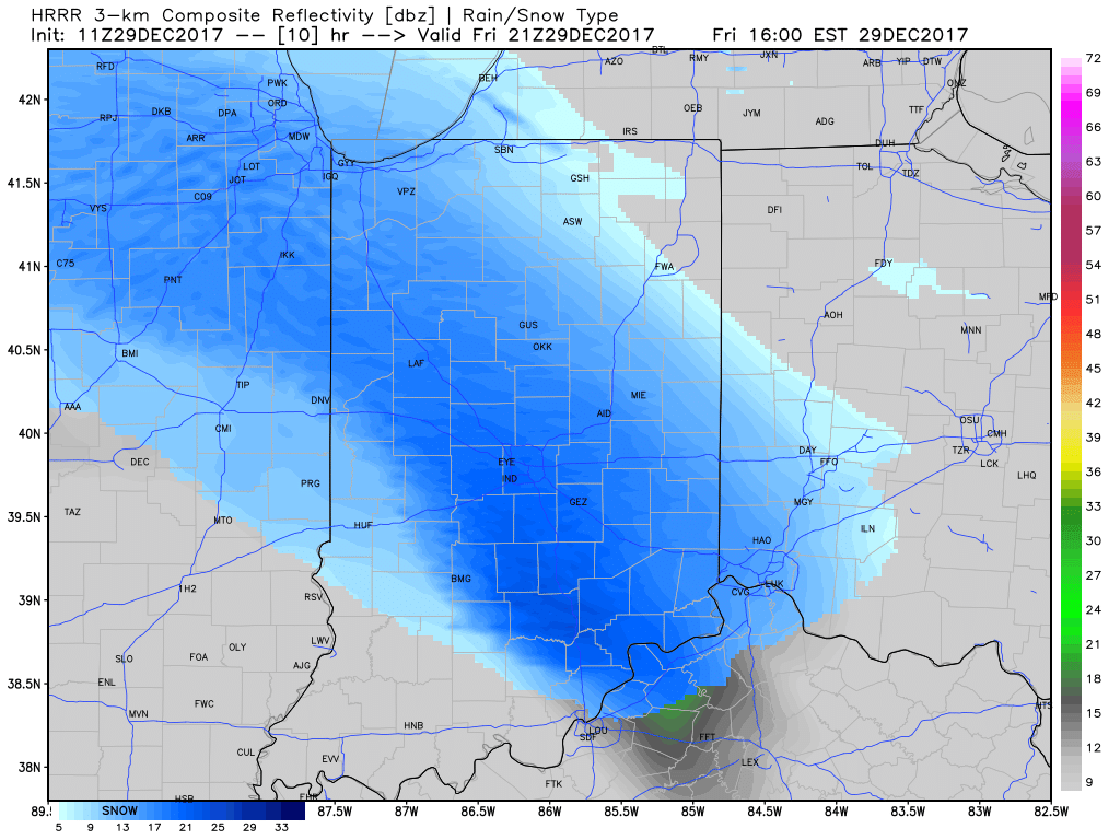
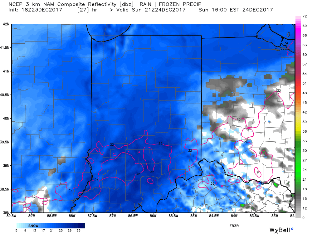 Eventually, snow will end from west (around 8p) to east (around midnight) tomorrow night, but not before depositing a widespread swath of 3″-5″ for areas generally north of I-70. For the city, itself, we think 2″ to 3″ is a good call, with generally an inch, or less across far southern portions of the state.
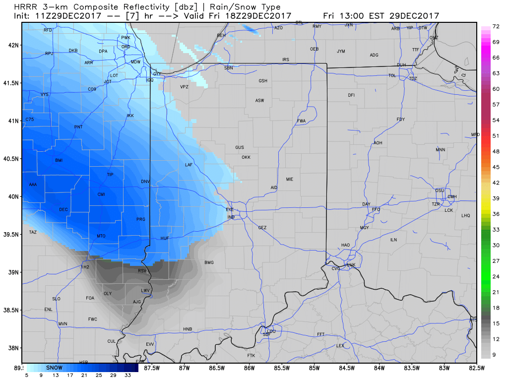
 Don’t be surprised if enough Christmas “magic” results in localized heavier totals with potential banding that develops tomorrow afternoon into the evening hours. All in all, this will be a classic, picturesque snow event for Christmas Eve. Hoosiers will wake up Christmas morning with a fresh blanket of white.