Before we discuss the weekend winter storm threat, we still have to get through the overnight period-morning hours Tuesday with embedded heavy rain and storms. Some of these storms could offer up gusty winds and a few could be strong as they rumble across central Indiana Tuesday morning.
Most of the storms should push through west-central Indiana well before the morning rush hour.
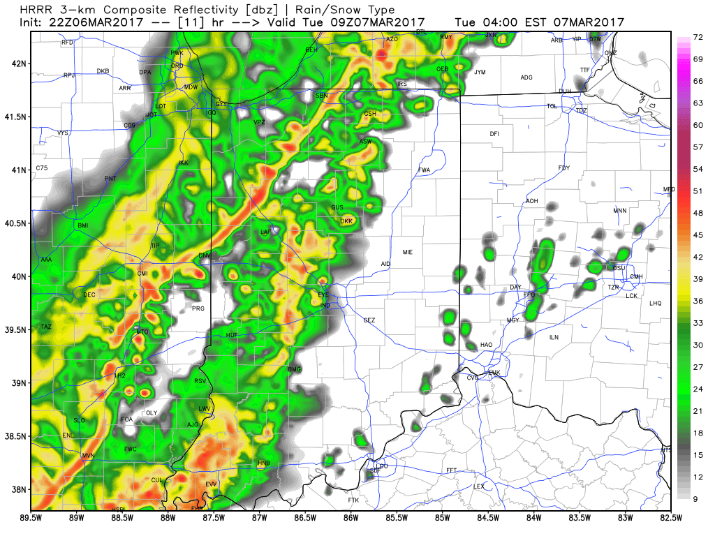
Forecast radar 4am Tuesday.
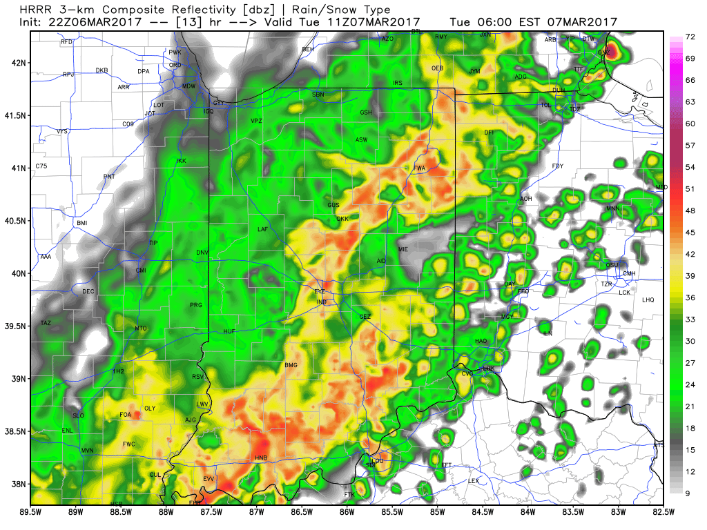
Forecast radar 6am Tuesday.
Attention will then shift to the winter storm threat this weekend- particularly Friday night through early Sunday morning. We still have to fine tune the all-important specifics, but confidence is rising on the possibility of a significant wintry event impacting at least portions of the region this weekend. March snow events provide added headaches of dealing with the impacts of marginal temperatures, higher sun angle/ time of day, etc. Conversely, the tight thermal gradients noted with most late season, spring snow events can be impressive, as they can quickly feedback, ultimately leading to swaths of thumping wet, heavy snow. Hoosiers don’t have to think back too terribly far to some impressive and impactful March snow events. Modeling today is in relatively good and surprising agreement, especially considering the lack of agreement models have dealt us weather ‘folk for the past few months. 🙂

GFS ensemble members are focusing in on a snow event this weekend.
It’s still early in the game and a lot can (and likely will) change with model runs over the next few days. It’s wise not to make knee-jerk reactions to the operational model solutions, but instead understand the overall pattern driving the potential of this memorable March wintry event. Anomalously cold air in southern Canada will spill south this weekend and help aid in the “fun and games” ahead. At the same time, given the time of year, “suppression depression” isn’t likely as their will be resistance from the south-central Plains and southeast ridging in place. As of now, we think the I-70 corridor could be the “sweet spot” for snow totals, understanding fine-tuning will be required moving forward. Where a snowpack accumulates this weekend, expect temperatures Sunday night/ Monday morning to fall into the 10s.
Much more later!
 Timing:
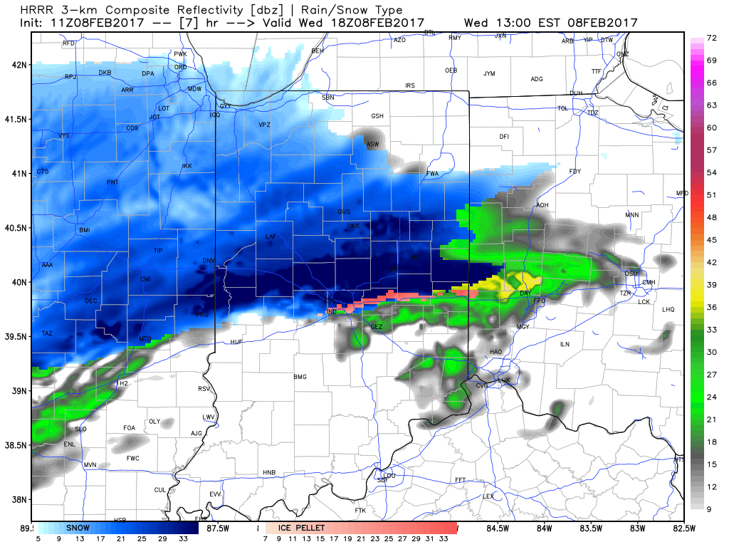


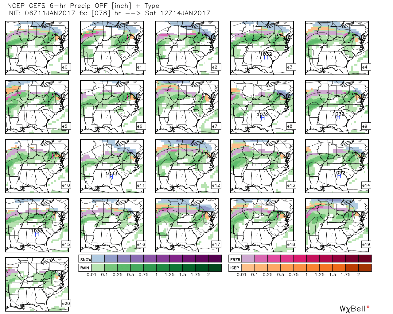 GFS ensemble members above show the overall good agreement on a central IN ice set-up for portions of the weekend.
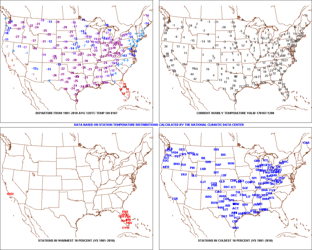 2.) Expanding Snowpack: 65.4% of the country is covered in snow this morning. The cold, arctic high suppressed the winter storm threat south as we alluded to in previous posts. Places across the Deep South that aren’t used to wintry precipitation are waking up to snowy and icy conditions this morning, including MS, AL, GA, SC, and into the Mid Atlantic. Heavier snowfall accumulated across east TN, including 5″-8″ in the high country. Heavy snow also fell through western and central NC and Blizzard Warnings are up in rare areas including VA Beach this morning.
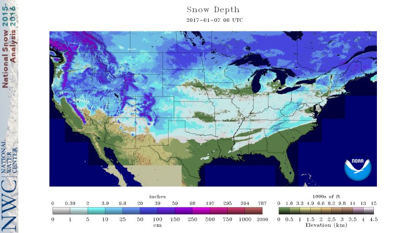 3.) Moderating Temperatures: Our air flow will back around to the southwest and this will help temperatures begin to moderate early next week (around freezing Monday and all the way to around 50 Tuesday). As the moderating trend gets underway, we may have to deal with a brief period of freezing drizzle/ freezing rain Monday evening.
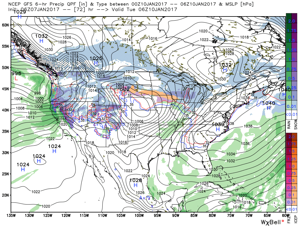 4.) Rainy Midweek: A more significant surge of moisture will arrive midweek and result in periods of moderate to heavy rain Wednesday PM into Thursday. Potential is present for 1″+ during this timeframe.
 5.) Weekend Wintry “Fun And Games?” A tremendous battle will take place next weekend between a strong and sprawling arctic high pressure system and the southeast ridge. In between it’ll be fascinating to watch things unfold, and as you’d imagine, that includes Indiana. Despite the southeast ridge flexing it’s muscle, the concern here is that the shallow dense arctic air will “ooze” south and present an icy set-up for portions of the Ohio Valley and Mid West for the weekend. We still have some time to watch this, but the potential of significant icing is very much present for some and this will require a close eye through the week.