Category: Winter Outlook

IndyWx.com Preliminary ’19-’20 Winter Outlook…

Where does the time go?! This will be the 10th consecutive year we’ve released a winter outlook as the IndyWx.com brand. Thankfully, most of those outlooks have been rather accurate! A few of you have been along for the ride from day 1 and your continued support means more than you realize!

Our official, finalized, winter outlook will be published just before Halloween. It’s our expectation that there won’t be many significant changes to what we present below, but fall storms and tropical activity can have big impacts on the sea surface temperature patterns and the impacts can be profound in the 2-4 month period that follows. That’s the primary reason we have never released an official outlook before mid-late October. With that said, let’s dig in to the drivers behind the upcoming winter:

I. Warm anomalies across the northeastern Pacific

II. Neutral ENSO

III. Warm anomalies across the eastern Atlantic

IV. Cold waters surrounding Australia

Let’s look first at the sea surface temperature anomalies:

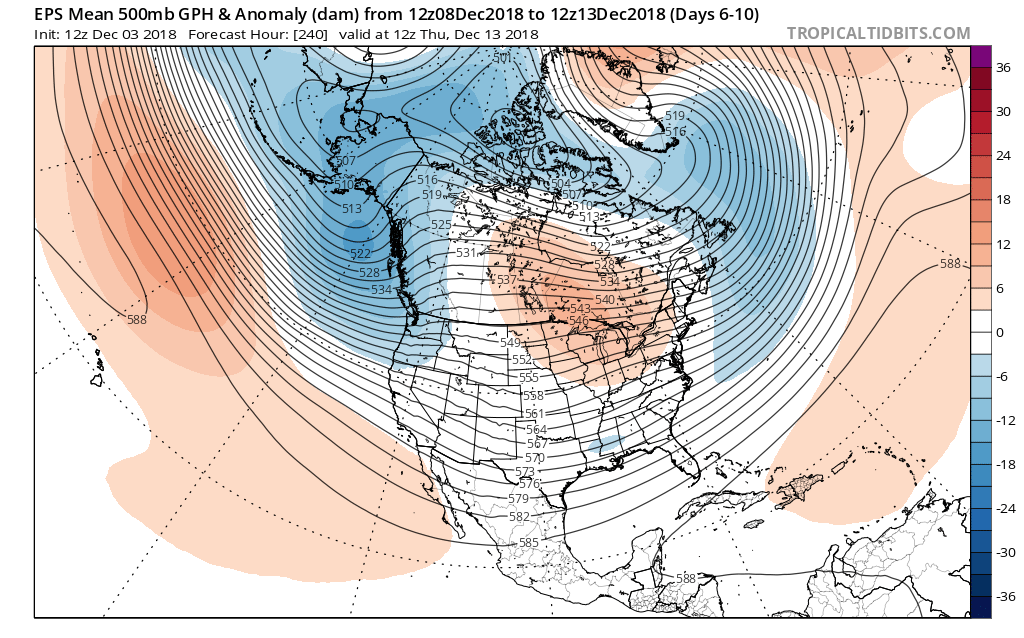
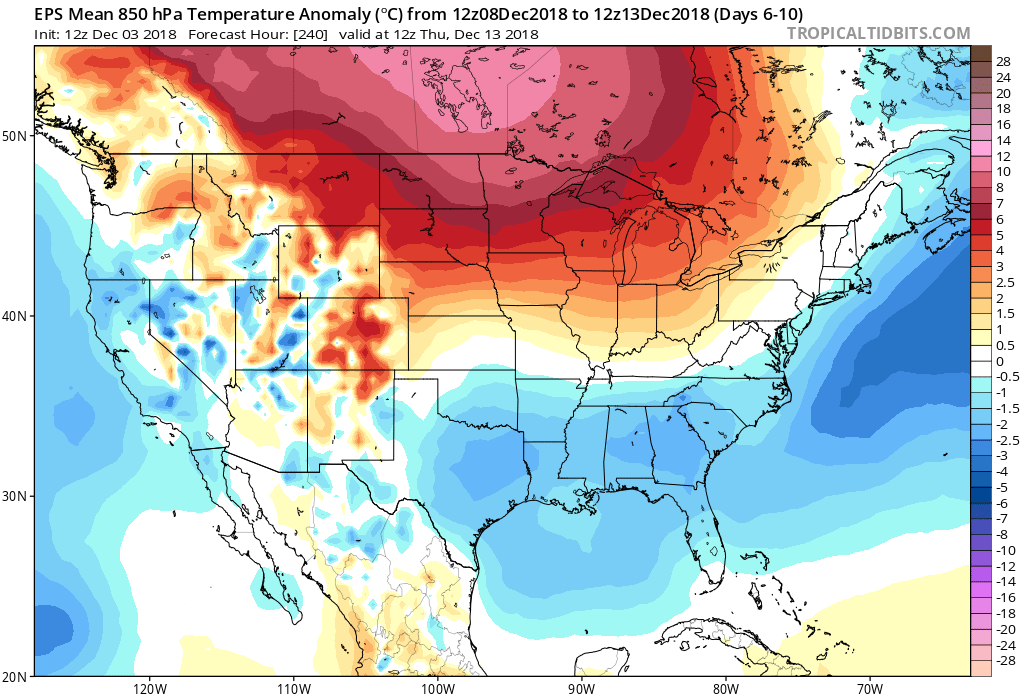
First and foremost, what’s absolutely screaming out as potentially wanting to take control as the driving force this winter is the significantly warmer than average eastern Pacific waters. This is significant as the warmer than average waters can alter the upper air pattern, promoting a ‘mean’ ridge across the western US and into Canada with a persistent eastern trough downstream. This kind of pattern can be rather persistent in “dislodging” cold Canadian air southeast and can promote a colder to significantly colder than average weather pattern across the Mid West, Great Lakes and into parts of the East. While the warmth across the eastern Atlantic can argue for warmer than average temperatures to kick-off meteorological winter across the eastern seaboard, the makeup of cold and warm off New England and into the Canadian Maritimes can argue for a negative NAO later in the winter (something to consider if we keep this configuration into the mid winter period especially).

All things considered above, here’s our early analog set from a temperature (image 1) and precipitation (image 2) perspective:

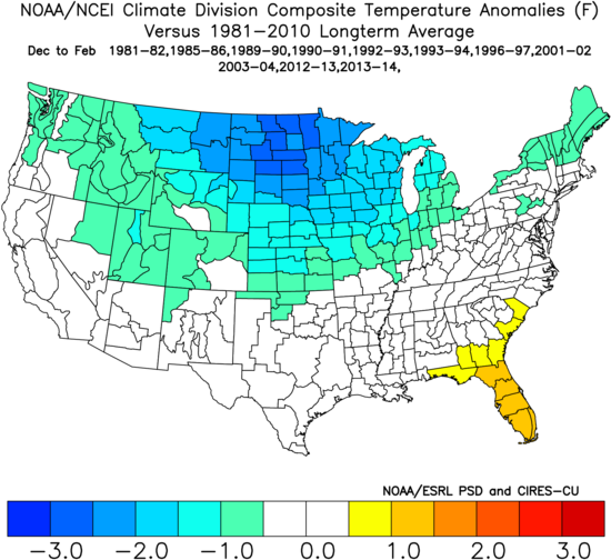
While we’ll most certainly have to tweak some of these years as we move through the next 30 days, or so, this serves as a great baseline of what our temperature and precipitation maps may resemble with the finalized winter outlook next month.

We’re fired up for what sure looks like a stormy time of things through the Ohio Valley into the Great Lakes and interior Northeast. Based on the direction the Pacific goes, the potential is there for more of a southeast ridge and warmer look across portions of the Deep South. We’re also beginning to think the West Coast is likely to run warmer than what is shown above based off the Pacific temperature pattern.

The early call here for central Indiana is for a colder than normal winter with above average snowfall. We’ll have our finalized numbers with respect to temperatures and snowfall amounts next month, along with the latest seasonal and climate data included with our updated analog sets.

In the meantime, it might not be a bad idea to take advantage of those early season snow thrower deals out there!

Permanent link to this article: https://indywx.com/indywx-com-preliminary-19-20-winter-outlook/

VIDEO: Preliminary 2019-2020 Winter Idea…

You must be logged in to view this content. Click Here to become a member of IndyWX.com for full access.  Already a member of IndyWx.com All-Access?  Log-in here.

Permanent link to this article: https://indywx.com/video-preliminary-2019-2020-winter-idea/

Trying to Answer Questions When Winter Will Show Up…

Daily, we’re receiving questions around if and when winter will show up. While admittedly later than originally thought here, we’ve never been in the camp of “throwing the towel” in on winter. Our winter outlook that includes below normal cold and near average snowfall remains unchanged.

Before we get into some of our reasons why we think winter will show up (and likely make up for lost time), the upcoming week will remain much warmer than average.

We’re tracking (3) storm systems that will deal the region rain over the upcoming week:

  1. Southern IN this afternoon and evening
  2. All of the state Monday
  3. All of the state next Friday into Saturday

As a whole, rainfall amounts won’t be particularly impressive for most, with 7-day totals between 0.25″ to 0.75″ for central portions of the state. Heavier amounts can be expected across southern areas.

Now, let’s look ahead to some potentially colder times. Before moving forward, it’s important that we recognize models have attempted once already to drive in a wholesale pattern change to colder (originally thought to be underway now). Perhaps it’s a case of “delayed, but not denied.” There’s a lot going on behind the scenes:

  • Sudden stratospheric warming event and potential polar vortex displacement, etc.
  • SOI flipping from a Niña-like state to one we’d expect to see associated with an El Niño
  • Active MJO remains

There are significant changes brewing in the arctic/ higher latitudes that have to raise an eyebrow at the very least.

Today

Mid-January

Note the higher pressures building over the upcoming 10-14 days in the arctic regions.

Not surprisingly, the models begin to tank the AO.

The PNA rises…

Something that also lends credence to a potential pattern shift is the recent SOI drop.

This would tend to suggest that an active storm track may be in place as the more bonafide cold shift is underway.

The moral of the story? Despite the milder period being extended a couple weeks longer than originally thought, there’s still a lot on the table this winter. It’s far too early to think winter’s over before it’s really even begun for most. We expect to see increasingly wintry conditions show up around the middle of January…

Stay tuned.

Permanent link to this article: https://indywx.com/trying-to-answer-questions-when-winter-will-show-up/

Mid-December “Relaxation” Coming, But Winter Set To Roar Back With Authority Around The Holidays And Beyond…

Since this cold pattern took over in mid-October, I thought we’d see a “pull back” of sorts develop at some point.  Initially, the thinking was this would come in the middle parts of November, but that never developed.  Fast forward to where we are now, and it still appears a relaxation of the cold will develop- albeit much later than originally anticipated.  Please understand this doesn’t mean there can’t be cold days or, for that matter, even wintry “mischief.”  What it does mean is that the sustained significantly colder than normal air should reverse to seasonable levels and above normal conditions for a time around mid-month.

With that said, we’re as fired up as we’ve been for what we continue to think will be a very cold winter and, at times, snowy- as outlined in our winter outlook published last month.  In fact, the latest European Weeklies in this evening suggest winter roars back with authority around Christmastime, continuing deep into the New Year period.  Analog data and other key components (some of which were outlined in our winter outlook) would back up this idea.  Taken verbatim, the new European Weeklies like the idea of “coast-to-coast” cold developing for the holidays this year.  While I’m not ready to go that far just yet (still think the mean ridge will set-up shop in a manner to keep the northwest balmy, compared to normal), I do like the idea of a cold and active period returning late December for our part of the country…

Anyone else dreaming of a white Christmas (for the 2nd year in a row)?!

Permanent link to this article: https://indywx.com/mid-december-relaxation-coming-but-winter-set-to-roar-back-with-authority-around-the-holidays-and-beyond/

2018-2019 IndyWx.com Winter Outlook Now Available…

Our 2018-2019 Winter Outlook is now available!  Much more later this weekend around both short term and longer range items of “interest!”  Happy Black Friday to all!

You must be logged in to view this content. Click Here to become a member of IndyWX.com for full access.  Already a member of IndyWx.com All-Access?  Log-in here.

Permanent link to this article: https://indywx.com/2018-2019-indywx-com-winter-outlook-now-available/