Category: Windy
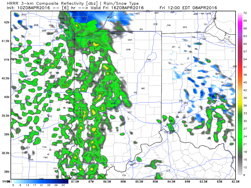
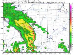
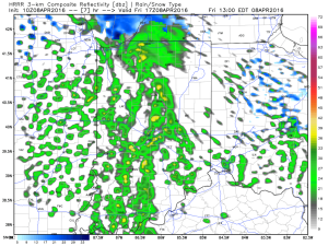
Heaviest concentration of storms Tuesday was along the I-70 corridor and points south. We think today coverage of rain and thunderstorms will be more widespread across the state…
We’re off to a cool and quiet start this morning, but think things will turn rather busy yet again as early as the early-mid afternoon hours. Unsettled conditions will continue through the night.
Latest scans of the HRRR future-cast radar product suggests we need to monitor for high wind potential during the early to mid afternoon hours. We’ll keep a close eye on this.
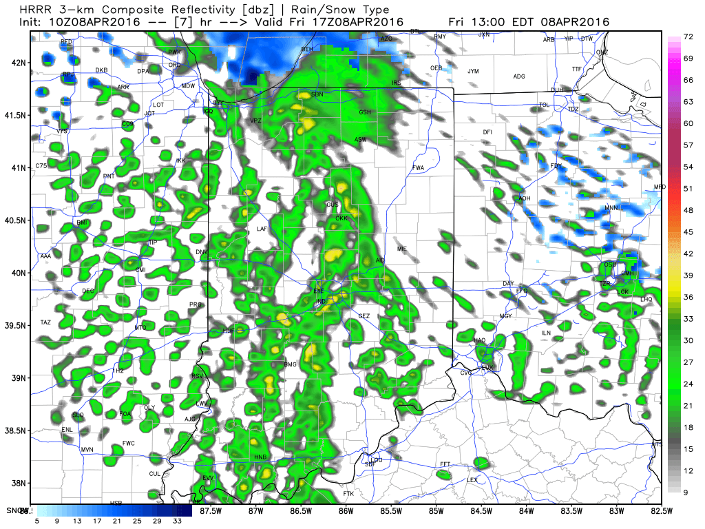
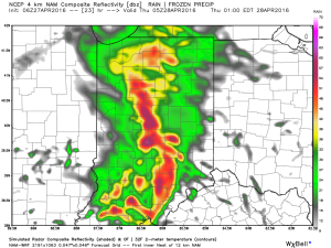
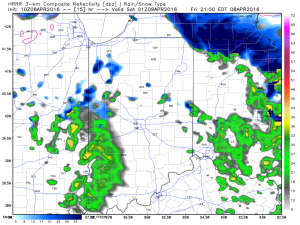
 The high resolution NAM future-cast radar is slower, but also shows strong to possibly severe storms into central IN late tonight.
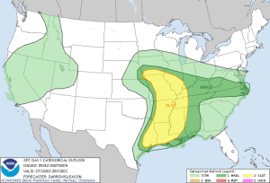
 The current SPC outlook highlights far southwestern IN for the chance of severe weather today. Don’t be surprised if this is expanded northeast with later updates today.
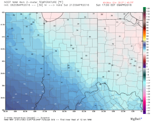
 Rainfall potential today-tonight should feature many neighborhoods accumulating an additional inch, with some locally heavier totals.
Permanent link to this article: https://indywx.com/another-round-of-storms-this-afternoon/
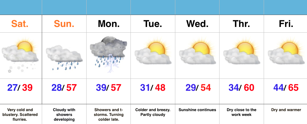
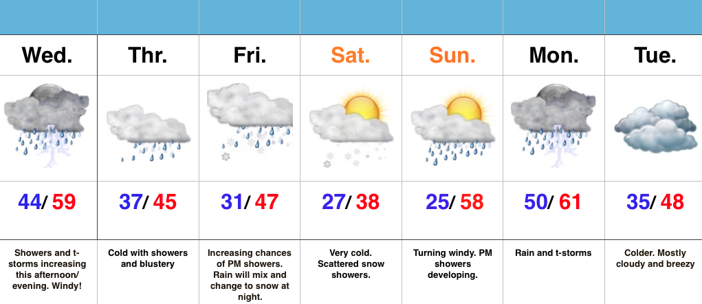
 Highlights:
- Lots of sun through the daytime
- Storms rumble in late tonight
- Unsettled mid week pattern
- New storm delivers rain and wind this weekend
Beautiful Today; Storms Arrive Late Tonight…We couldn’t ask for better weather through the daytime today (despite a gusty SW wind), but chances for rather noisy thunderstorms increase late tonight into the predawn hours Tuesday. Unsettled conditions remain Tuesday, including scattered thunderstorms especially across the I-70 corridor and points south. Locally hefty downpours will be possible.
More widespread showers and embedded thunder are on tap Wednesday into Thursday, especially through the morning hours Thursday. Widespread 1″-1.5″ rain totals are a good bet between now and Thursday morning, with some locally heavier amounts.
We still think we get a briefly drier air mass in here to close the work week, but this won’t last long. Our next storm system is dialed up for a weekend arrival and will provide a stiff easterly breeze and rain Saturday PM through Sunday.
Permanent link to this article: https://indywx.com/bumpy-ride-this-week/
 Highlights:
- Cold times continue
- Rain arrives Sunday
- Monday storms
- Slowly moderating late next week
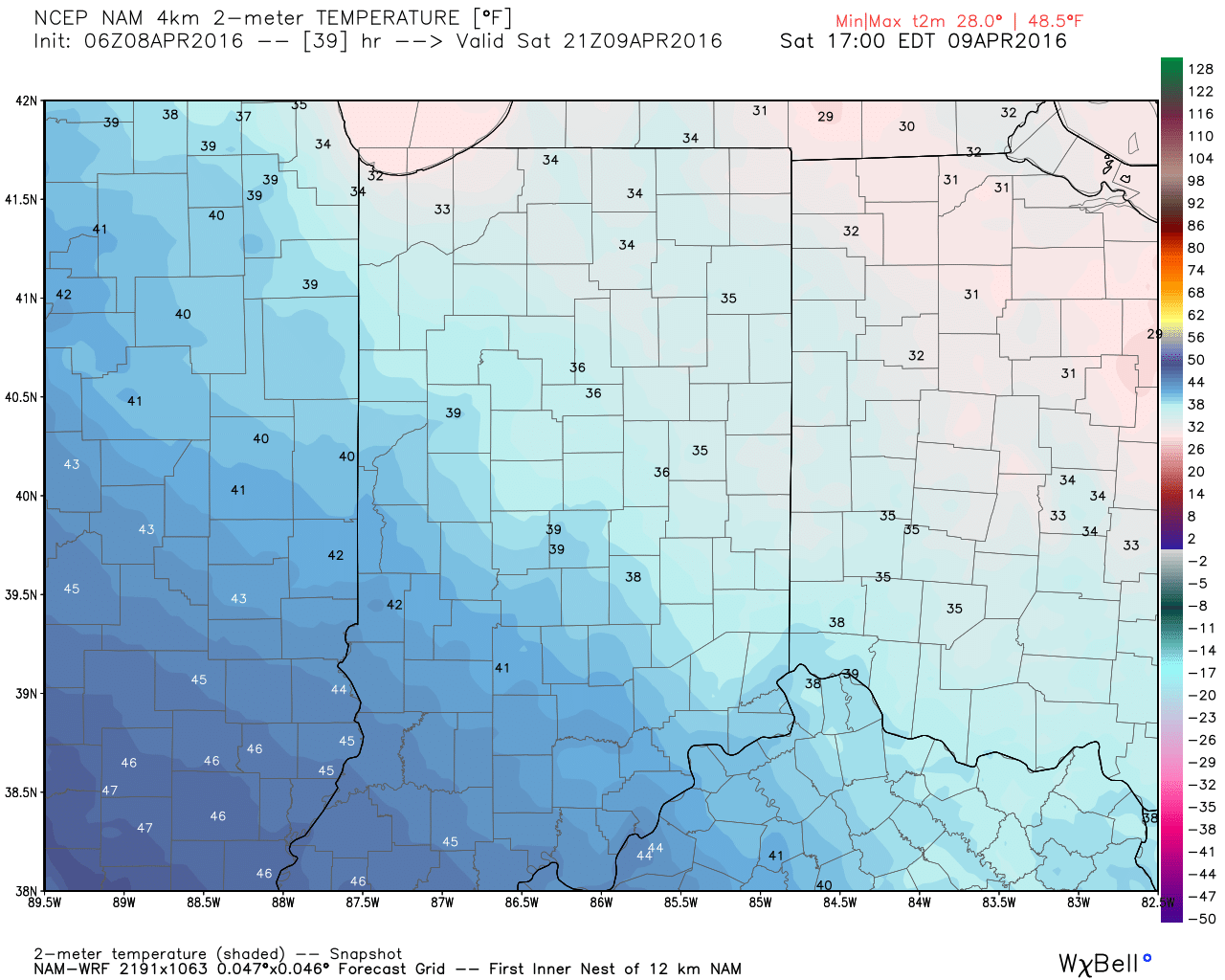
Bundle Up…With temperatures in the middle and upper 20s this morning and ‘chills in the 10s, it’s hard to believe we’re nearing mid-April! It’s simply downright bitter by April standards. Early snow showers and flurries should diminish as we progress into the afternoon hours with decreasing cloudiness, as well.
Dry times won’t last long as a warm front approaches Sunday. This will deliver a thick overcast back to the region, along with developing showers and embedded thunder into Monday. Early rain numbers into the forecast office offer up the potential of 0.75″-1.25″ on average in the Sunday-Monday time period.
We’ll turn colder and breezy (surprise, surprise) Monday night into the middle of the week, BUT moderating temperatures will develop by late week! 60s are in store for afternoon highs Thursday-Friday with lots of sunshine! Hang in there, friends!
Permanent link to this article: https://indywx.com/bitterly-cold-by-april-standards/
While the morning is off to a frigid and quiet start, changes will begin to take place as early as late morning into the early afternoon hours. Another disturbance will rotate through central IN this afternoon and evening and interact with the unseasonably cold air (both aloft and at the surface) to ignite convective showers. Some of these showers, mixed at times with sleet and snow, will be accompanied by thunder.

 Eventually, as cold air is reinforced this evening, all precipitation should transition to snow this evening into early Saturday. While it won’t snow for everyone, scattered heavy snow bursts will be plenty capable of producing a quick coating for some neighborhoods tonight.
 Speaking of the cold, highs Saturday will remain in the 30s for most. Yes, this is April…
 Hang in there, friends. After another chilly week next week, changes are in the offing for late month. Warmth is coming….eventually. 🙂
Permanent link to this article: https://indywx.com/thundersleet-and-thundersnow-possible-later-today/
 Highlights:
- Increasing rain chances today
- Turning colder and continued unsettled to wrap up the work week
- Snow showers Friday night-Saturday
- Wet start next week
Active Times Continue…Despite some thunderstorms across northern portions of the state this morning, most are dry. That will change this afternoon and evening as widespread showers and embedded thunder increase in coverage. On average, expect 0.25″-0.50″ by tonight. Winds will also be gusty (40 MPH+).
We’ll shift into a much colder pattern to wrap up the work week and upper level energy will help produce showers Thursday. As even colder air gets involved, rain will transition to snow Friday night into Saturday morning. Saturday will be downright cold.
Another wet weather maker approaches early next week. After a hard freeze Sunday morning, things will cloud up, turn windy, and feature evening showers. More widespread rains and storms arrive on the scene Monday. Colder air returns Tuesday!
Permanent link to this article: https://indywx.com/cold-and-unsettled-pattern/


 The high resolution NAM future-cast radar is slower, but also shows strong to possibly severe storms into central IN late tonight.
 The current SPC outlook highlights far southwestern IN for the chance of severe weather today. Don’t be surprised if this is expanded northeast with later updates today.
 Rainfall potential today-tonight should feature many neighborhoods accumulating an additional inch, with some locally heavier totals.