VIDEO: Significant Fall Storm Brewing…
You must be logged in to view this content. Click Here to become a member of IndyWX.com for full access. Already a member of IndyWx.com All-Access? Log-in here.
You must be logged in to view this content. Click Here to become a member of IndyWX.com for full access. Already a member of IndyWx.com All-Access? Log-in here.
Type: Heavy Rain
What: Heavy rain and gusty winds
When: Overnight Friday through Saturday
Rain Amounts: 1″ to 3″- see below on current thoughts
Wind: East 10-20 MPH with gusts to 30 MPH+
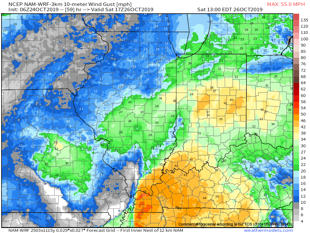
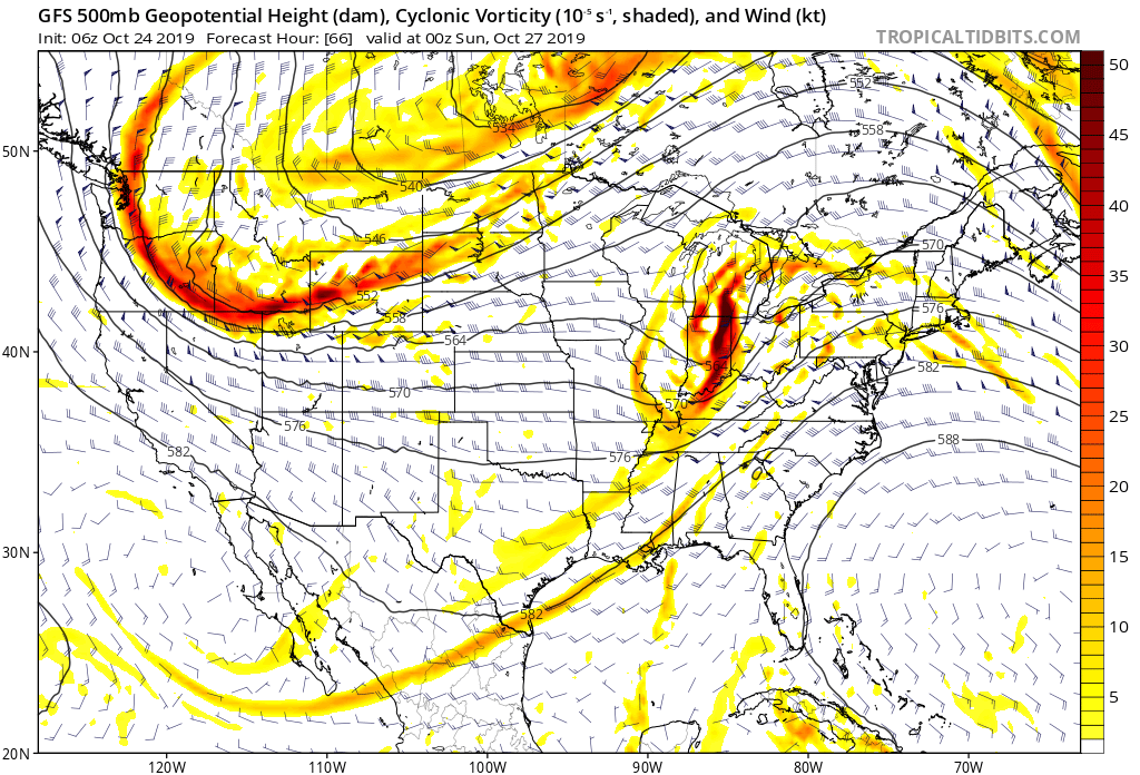
After a fairly quiet close to the work week, a vigorous upper low will track east out of OK, across northern AR, and northeast into the Ohio Valley. In response, a surface low will develop across the MS Valley Friday night, moving northeast into OH by Saturday night. The end result will be close to a (24) hr period of steady rain, at times heavy, across all of central Indiana. Additionally, we anticipate a period of gusty easterly winds Saturday morning into the afternoon hours. Widespread 1″ to 1.5″ rainfall can be expected with locally heavier amounts across central Indiana. Meanwhile, southern and southeastern Indiana can expect rainfall totals of 2″ to 3″ with locally heavier amounts. Rainfall coverage and intensity will diminish from southwest to northeast Saturday night.

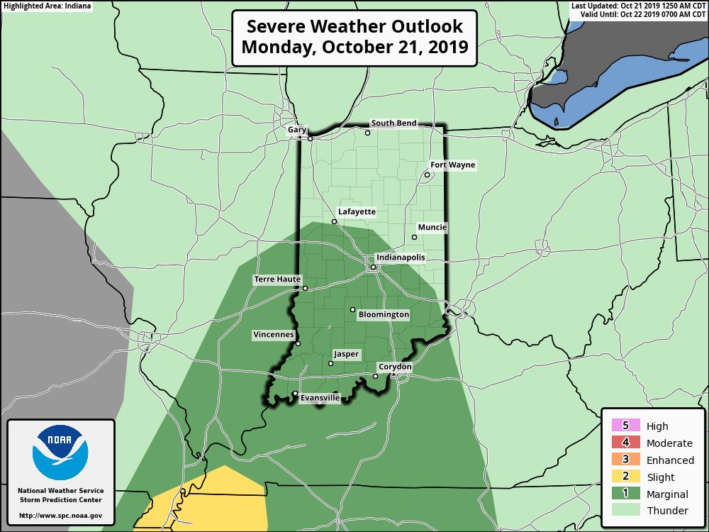
A cold front will push across the Ohio Valley today. Ahead of the front, widespread showers and thunderstorms are expected. A few of these storms may become strong to severe with damaging straight line winds being the biggest concern.
The Storm Prediction Center now includes portions of central Indiana in a ‘marginal’ risk for severe weather.
We expect a couple of rounds of storms today- one mid to late morning followed by another this evening directly ahead of the cold front.
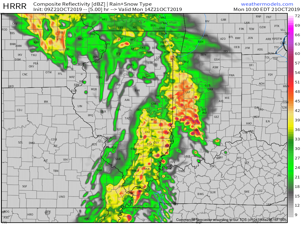
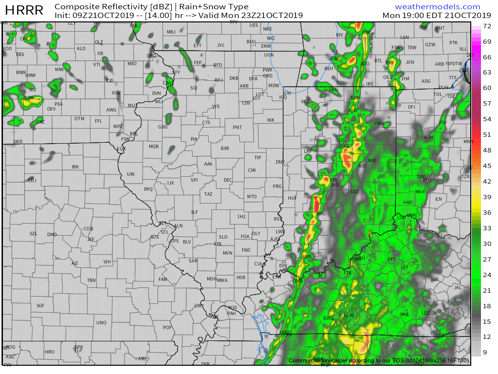
Rain will end from west to east during the evening as the cold front sweeps across the state. Before that, some area rain gauges may accumulate around an inch of rain today (a few locally heavier totals possible).
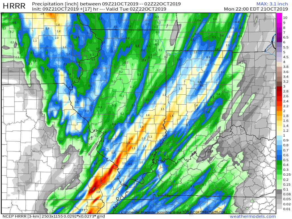
The other headline today will be strong and gusty winds (originally out of the southwest before shifting to west this evening). Even outside of thunderstorms, gusts in excess of 40 MPH can be expected.

Drier and cooler air will arrive Tuesday through Thursday before another chilly, wet weather maker blows into town Thursday evening into Friday.
You must be logged in to view this content. Click Here to become a member of IndyWX.com for full access. Already a member of IndyWx.com All-Access? Log-in here.
You must be logged in to view this content. Click Here to become a member of IndyWX.com for full access. Already a member of IndyWx.com All-Access? Log-in here.