VIDEO: Rain Develops By Evening; Potential Of Pre-Halloween Snow?
You must be logged in to view this content. Click Here to become a member of IndyWX.com for full access. Already a member of IndyWx.com All-Access? Log-in here.
You must be logged in to view this content. Click Here to become a member of IndyWX.com for full access. Already a member of IndyWx.com All-Access? Log-in here.
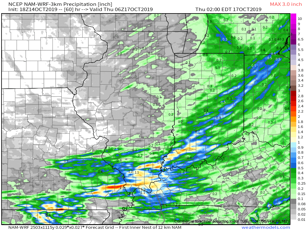
A cold front will whip through central Indiana Tuesday evening. Showers will accompany the frontal passage, but we still don’t anticipate much in the way of significant moisture across central Indiana. Heavier rainfall totals in excess of 0.50″ will likely fall across drought-stricken areas downstate.
Colder and blustery conditions will be with us Wednesday and Thursday, including wind chills in the upper 20s at times Wednesday morning.
A moderating trend will get underway this weekend as a gusty southwesterly breeze takes hold on the backside of retreating high pressure. This will lead to a couple of days of above normal warmth early next week (not quite done with the 70s just yet).
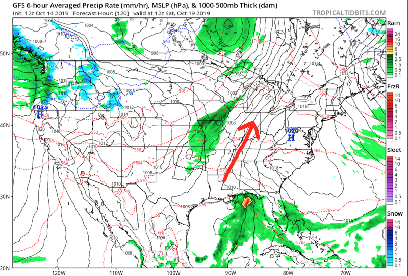
We’ll continue to monitor for a wet and stormy time of things Monday PM into Tuesday. The severe threat is to be determined and will require fine tuning as we push ahead over the next several days.
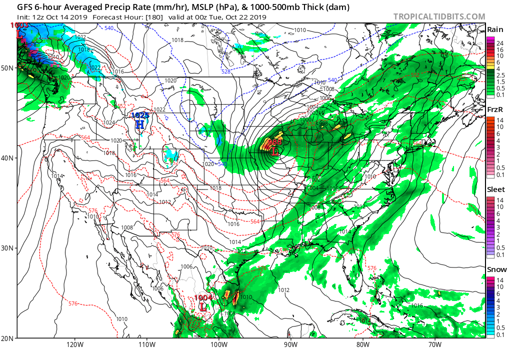
Once this area of low pressure and associated cold front blow through, colder air will arrive on gusty northwest winds by the middle to latter portions of next week.
This will set the tone for a rather significant colder shift as we get set to put a bow on the month of October. A secondary and more significant trough will descend into the region just after Day 10. With a developing negative EPO, positive PNA, and MJO heading for Phase 2, it’s time to start “beating the cold drum” a bit harder. In fact, latest 500mb charts would indicate there’s the potential of at least a little wintry mischief present to go along with the colder shift.

This should at least kick up the lake effect snow guns for the first time this season, and we’ll have to monitor things for the possibility of “backside” energy digging south at the base of the trough that would present the possibility of a little early season snow across parts of the Ohio Valley region as Halloween week nears…
Times, they are, indeed, ‘a changing…
You must be logged in to view this content. Click Here to become a member of IndyWX.com for full access. Already a member of IndyWx.com All-Access? Log-in here.
Our Friday is starting off with heavy rain and embedded thunder across western portions of the state.
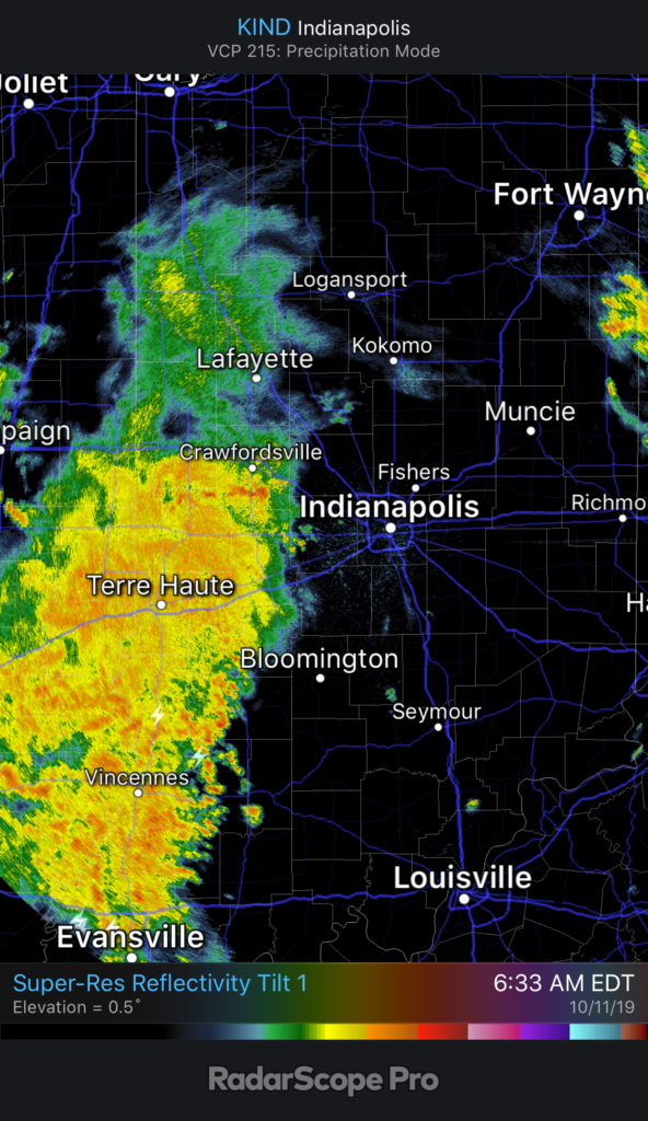
It’ll still be a while before central Indiana gets in on the more concentrated, widespread rain. We think this arrives later this afternoon into the early evening hours. Most can expect to pick up between 0.20” and 0.40” across central parts of the state, but there will be a few locally heavier totals.

Before the rain arrives, a strong southerly wind ahead of the front will send temperatures to around 70°. Meanwhile, note temperatures at the same time already into the 40s across eastern IL.
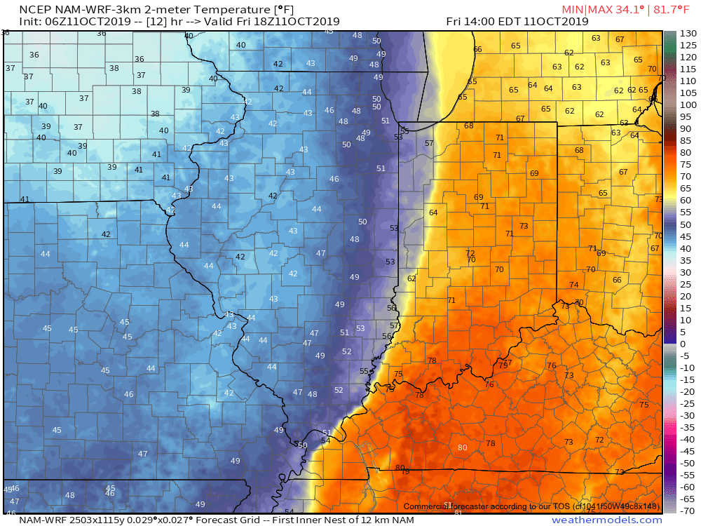
The temperature crash will continue through the evening hours advancing east. By 7p, temperatures in and around Indianapolis and points west will be in the 40s. A gusty wind will result in “feels like” temperatures into the 30s.

The first freeze of the season is expected Saturday morning for many across central Indiana into western and northern portions of the state. We anticipate wind chill values to fall into the middle 20s.
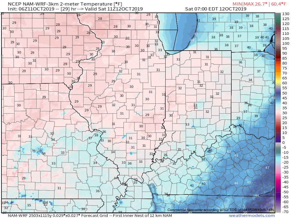
Another reinforcing shot of chilly air is dialed up next week. More on this and other items a bit later…
You must be logged in to view this content. Click Here to become a member of IndyWX.com for full access. Already a member of IndyWx.com All-Access? Log-in here.