Soon-To-Be “Delta” Makes For A Busy Week Along The Gulf Coast; 3-Week Outlook For Central IN…
Before we talk tropics, frost is widespread this morning across the state. We note some are even at the freezing mark as we start the new work week.
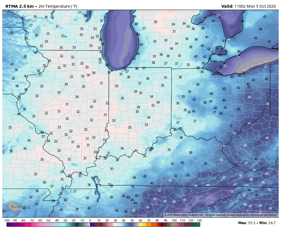
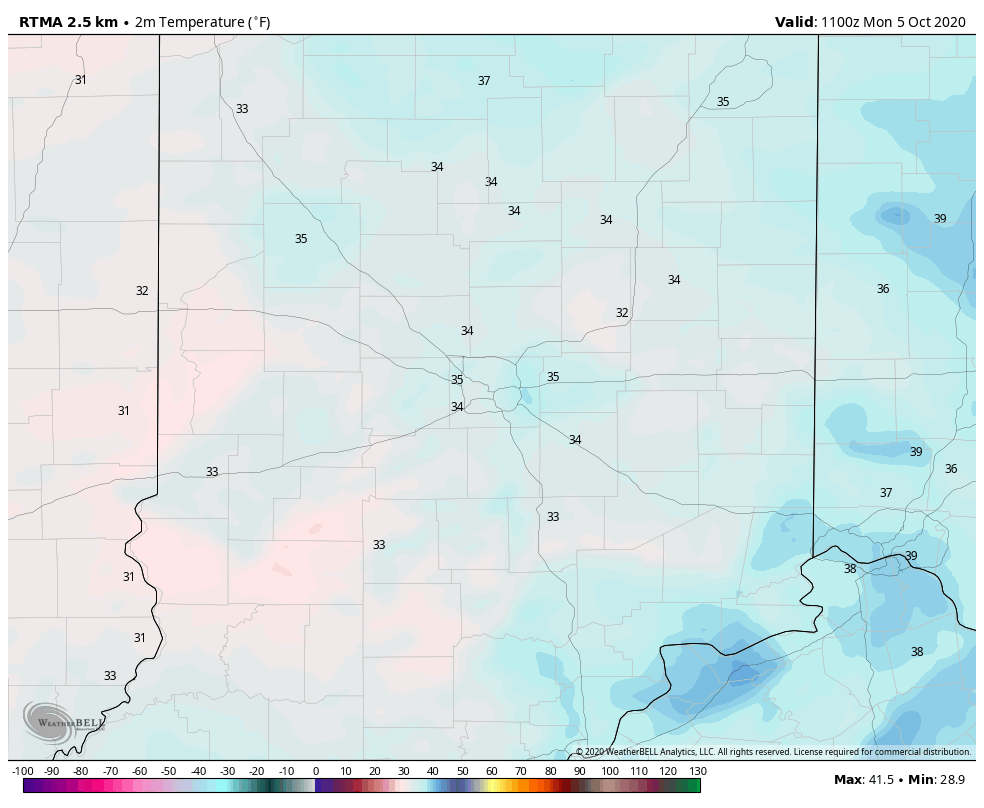
This is right around average, or just a few days early, for our first 32° freeze of the year across central Indiana.

Expect bright sunshine and another classic fall sky this afternoon which will help warm us to around 60°.
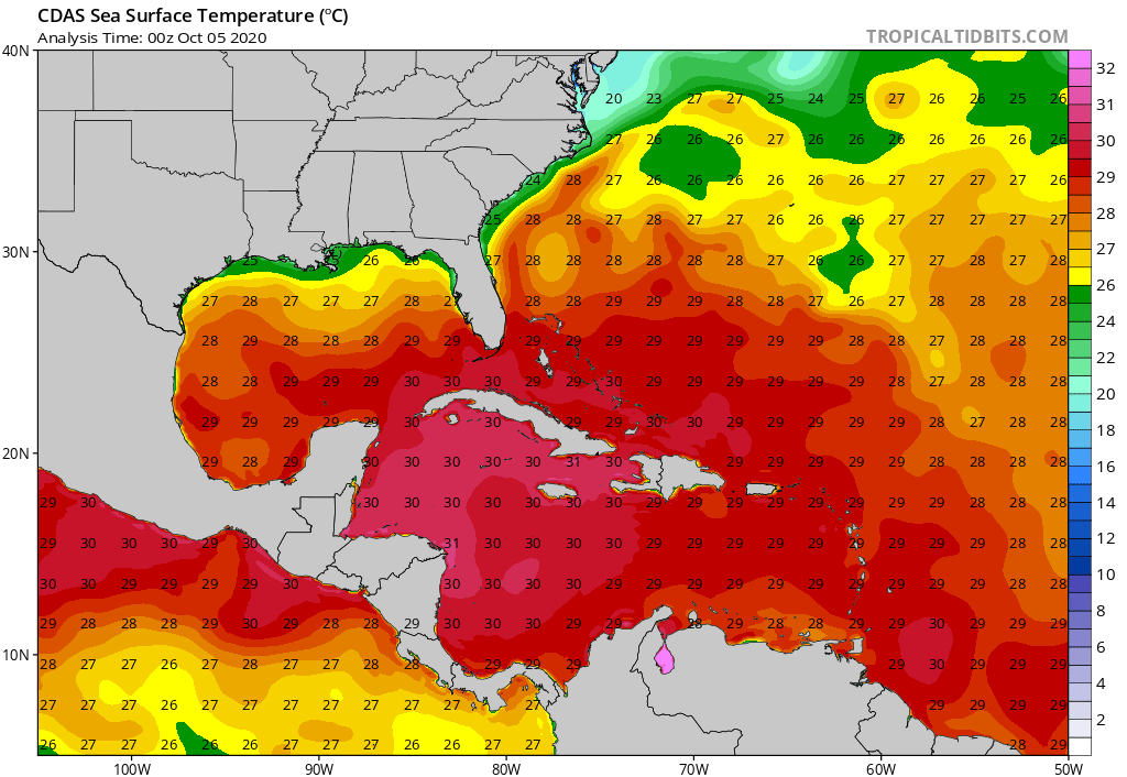
The week ahead will feature quiet conditions across the region. We’ll watch a couple of cold fronts scoot by to our northeast and, of course, soon-to-be Delta in the Gulf of Mexico. Delta will likely strengthen into a hurricane before reaching the north-central Gulf Coast late week. There are ingredients in place that may result in rapid intensification later this week and the potential of Delta strengthening into a major hurricane is on the table, IMHO. Thankfully, the combination of increasing wind shear and cooler sea surface temperatures right along the coast (thanks to the early fall fronts that have made it unusually far south) should help lead to weakening prior to landfall. The problem with that, however, is if the system is coming in as a major, storm surge will still be quite significant.


If you have plans to travel to the northern Gulf Coast, please pay particularly close attention to the develops over the coming hours and days. As of this morning, it appears as if we’ll be looking at a Friday landfall.
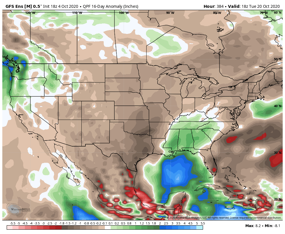
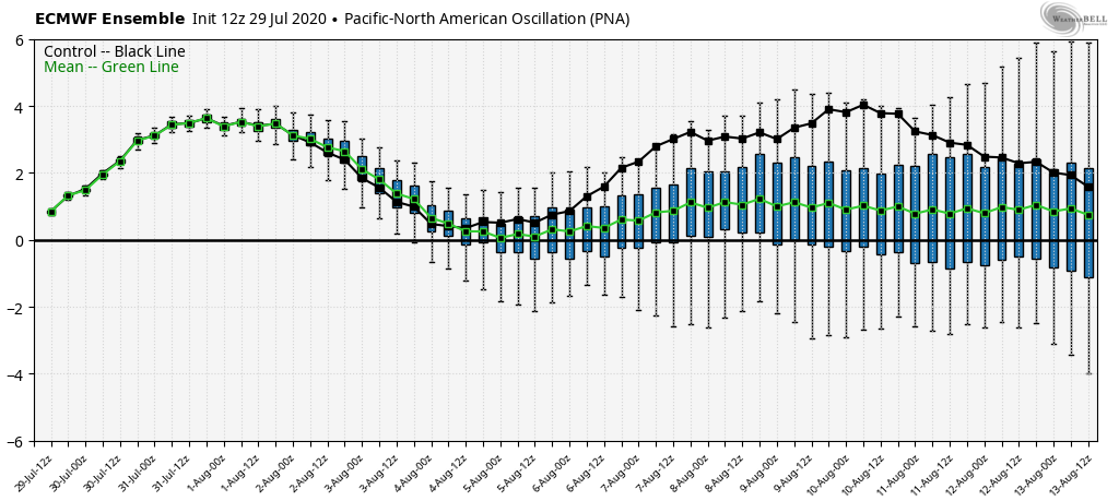
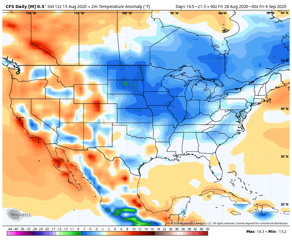
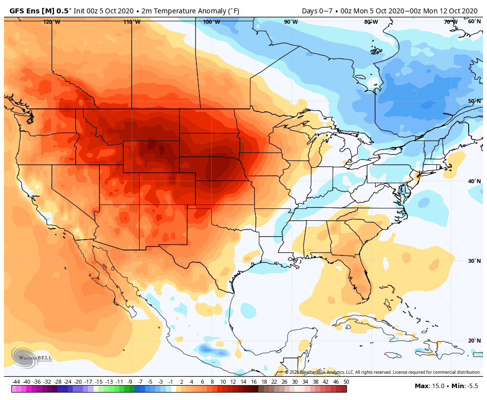
Back here on the home front, quiet conditions are expected this week- and for the most part over the next few weeks. Perhaps the next item of excitement will be a cold front pegged to move through the region in the 8-10 day period. We’ll need to keep close eyes on the EPO/ PNA trends in the Week 2 period for the possibility of a sharp jab of colder air behind that cold front. This would come after a nice surge of warmth (Indian Summer) compared to normal. Additionally, looking even further ahead, longer range guidance is beginning to get excited around the potential of unseasonably cold (wintry like) air to open November.
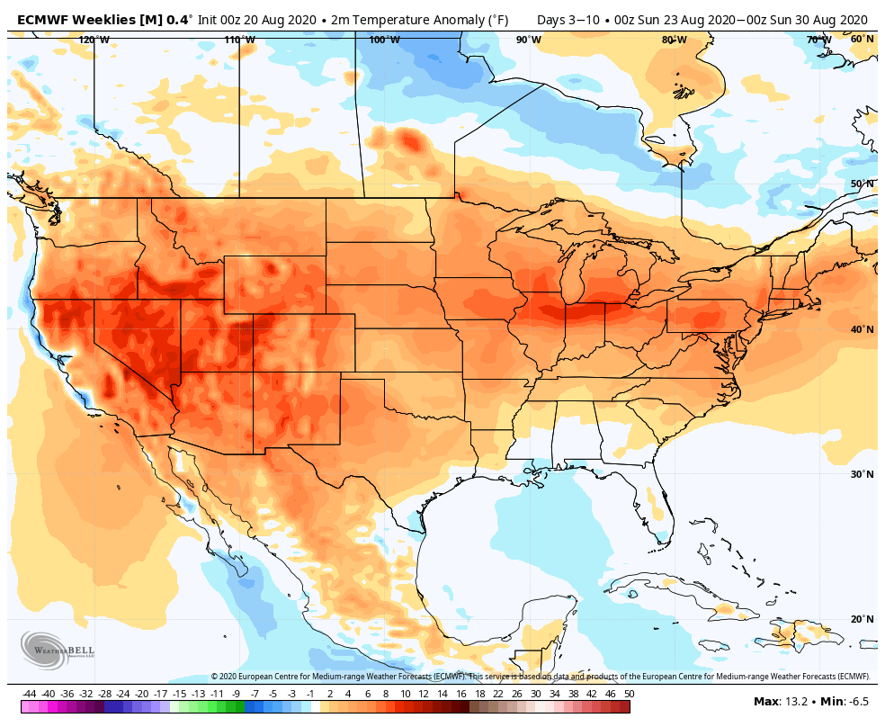
Week 1
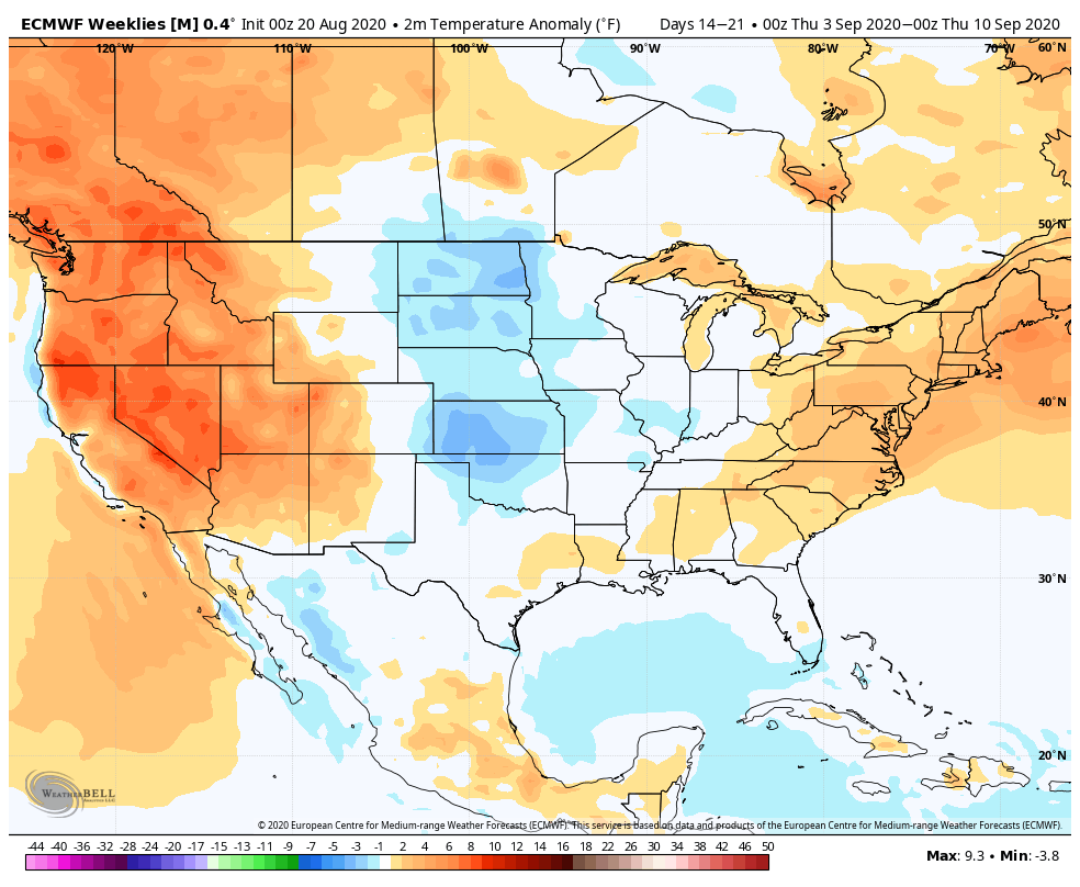
Week 2
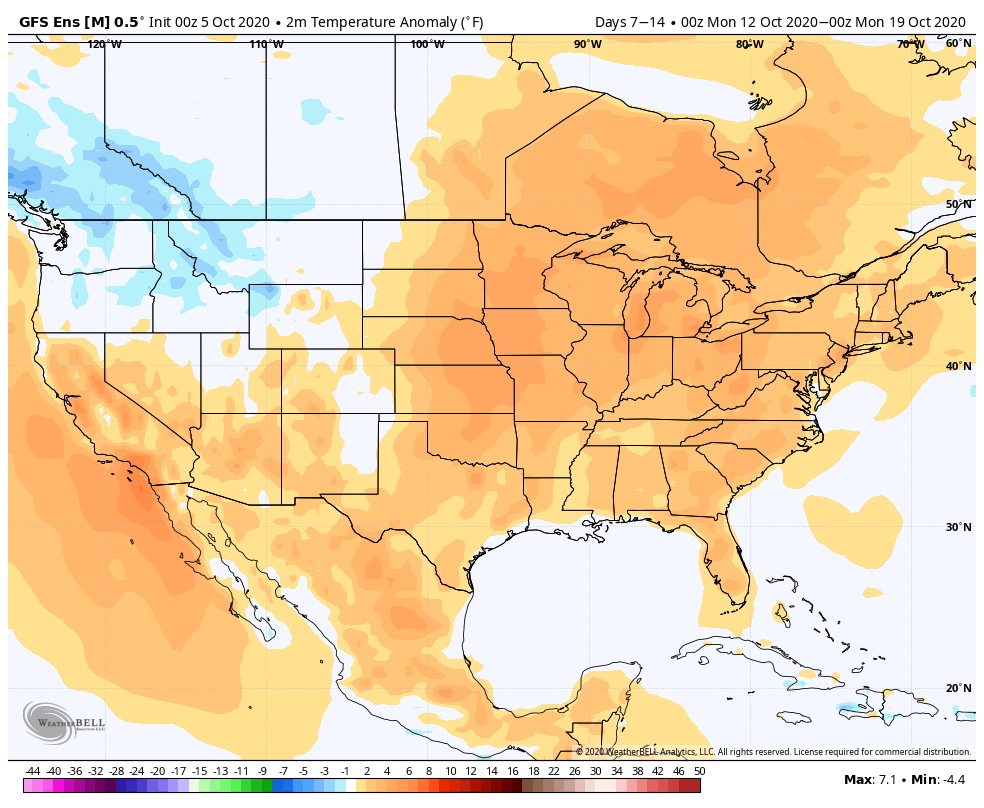
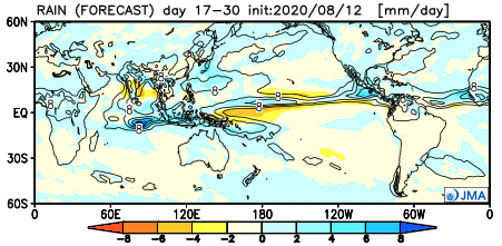
As expected, the pattern should continue to run quite dry through the better part of the period: