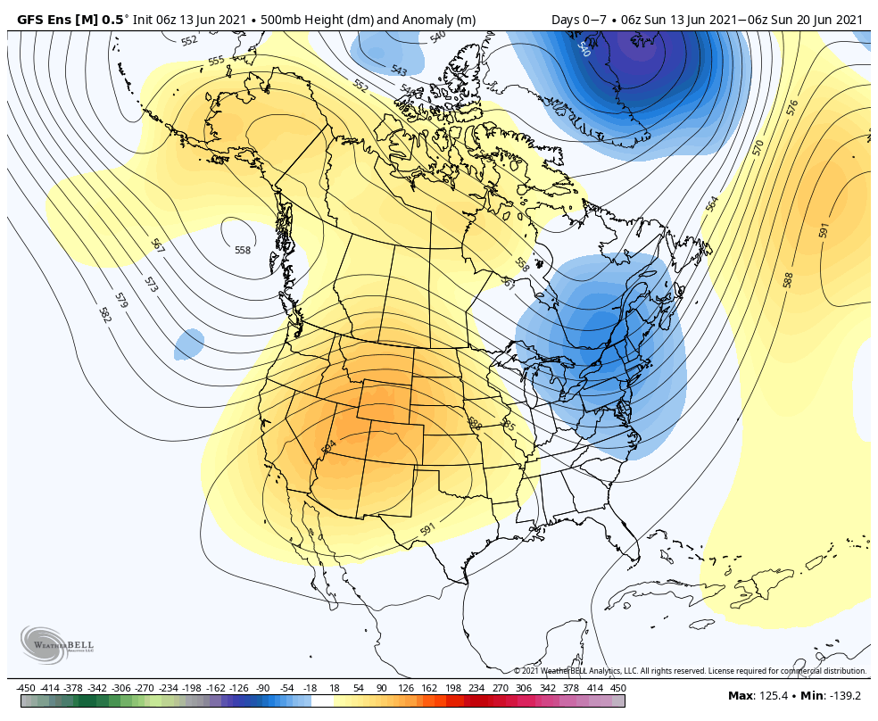
The upper air pattern this week will feature a trough across the Northeast and Great Lakes with an upper ridge anchored over the Four Corners.
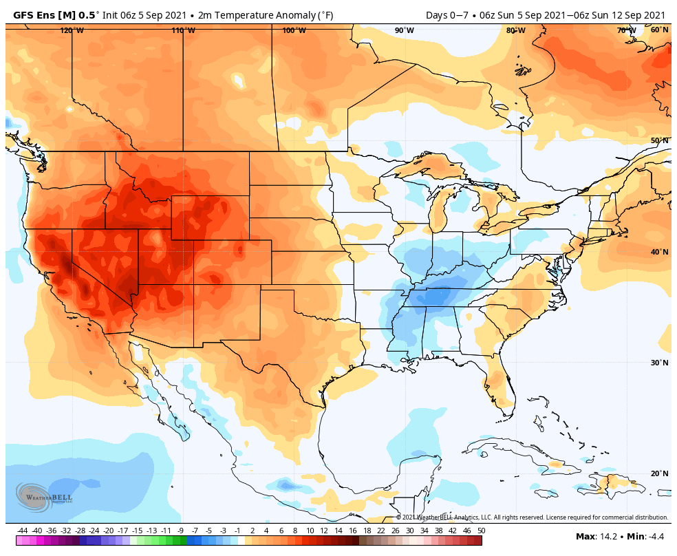
Temperatures will run below average from the Ohio Valley into the MS Valley, with well above normal temperatures expected across the West.
Most of the country can expect below to well below average precipitation in the week ahead. The one exception? Northern New England.
We only forecast 0.10″ to 0.25″ of rain here in central Indiana during the 7-day period.
Forecast Period: 09.05.21 through 09.12.21
A very quiet weather pattern will settle into the region as we go through the upcoming week. The one exception to that is Tuesday night as a cold front quickly passes through the area. Moisture levels will return ever so slightly ahead of the boundary and may be enough to produce a couple of storms Tuesday evening (widely scattered coverage). The front will help to reinforce the dry airmass in place, along with provide cooler temperatures for mid and late week. As we look ahead beyond this week, indications are that things will moderate and turn a bit more active (though that’s admittedly not saying much, considering just how quiet things will be this week).
A persistent trough will remain in place across the northern Rockies while weak ridging takes up shop across the Great Lakes region.
Warmest anomalies through the forecast period can be expected across the Mid-Atlantic and central Plains, into the Southwest. The northern Rockies will remain cooler than normal. The cooler than normal conditions across the central Gulf Coast region is associated with the daytime highs being lower as Ida moves north early in the period.
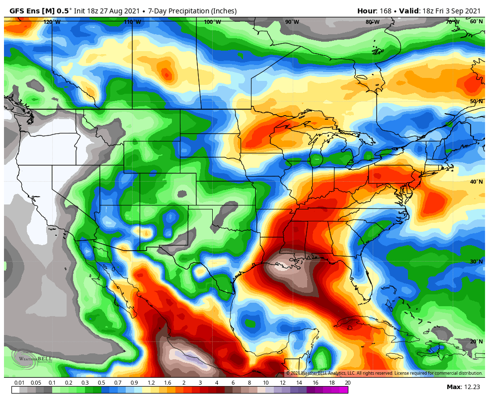
The biggest focus through the middle of the week will have to do with the remnant moisture associated with Ida. Active times will return to the upper Midwest as well.
We forecast 7-day rainfall amounts to check-in between 1″ and 1.5″ for most of central Indiana.
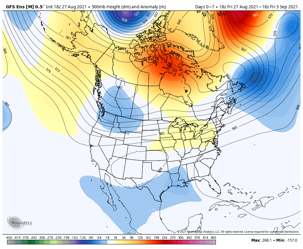
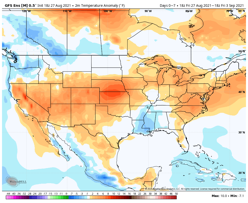
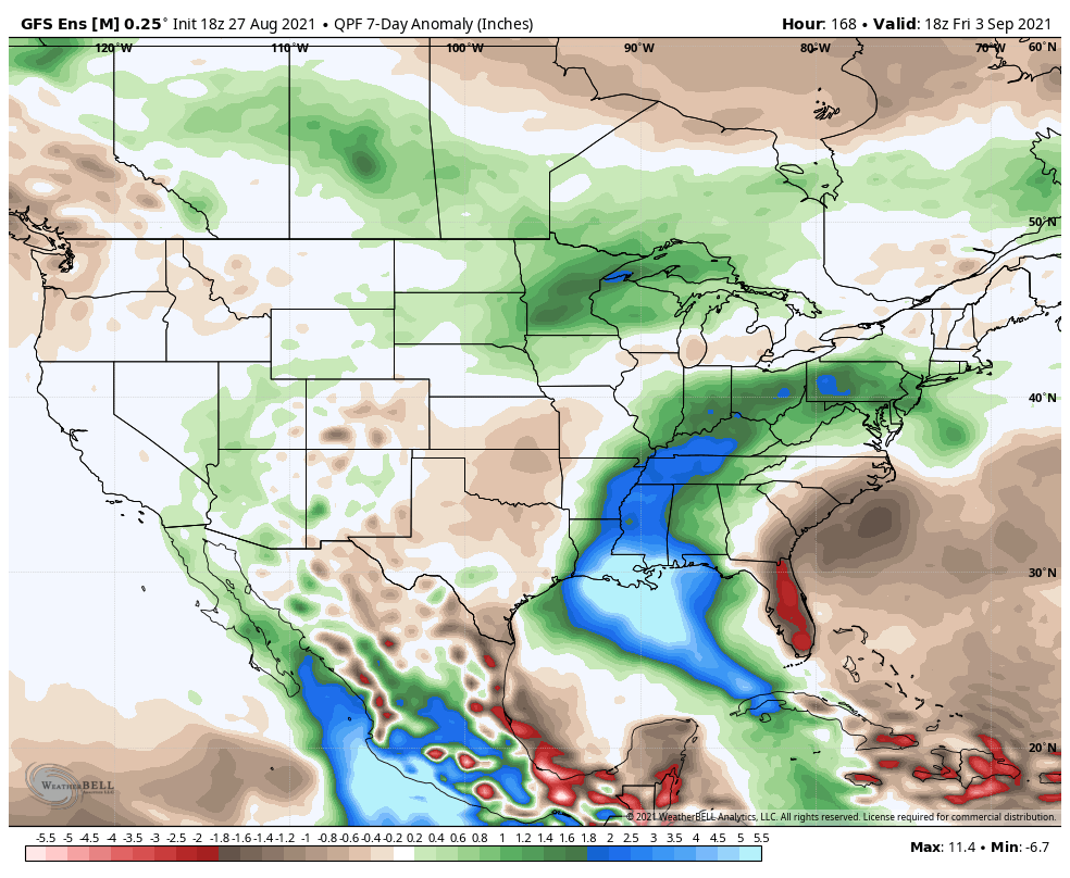
Forecast Period: 08.28.21 through 09.04.21
The period will open with an active weather pattern. A cold front will slowly press south through early week. At the same time, Hurricane Ida is forecast to make landfall along the north-central Gulf Coast (likely along the LA coastline) Sunday afternoon, and as a major hurricane at that. The remnant moisture of Ida will lift north before curling east. Eventually, we believe the remnant moisture of Ida will get tangled up with the aforementioned cold front. While we’ll need to keep a close eye on data to see if any adjustments are needed early week, as of now, we believe the heavy rain threat will lie just south of our immediate area (more so along and south of the OH River). We’ll keep a close eye on things. Regardless, scattered to numerous showers and thunderstorms are expected as the cold front sinks south. By midweek, the region will be in a much drier (and somewhat cooler) northeasterly airflow. Dry conditions are expected to continue into the holiday weekend ahead with slowly moderating temperatures.
An upper level ridge will expand across the Ohio Valley through the upcoming week. Meanwhile, a trough will continue to provide unseasonably chilly air for the northern Rockies and inner-mountain region.
Well above average temperatures will take up shop from the central Plains into the Great Lakes and Northeast. Unseasonably chilly conditions will prevail across the northern/ central Rockies.
Above normal precipitation is expected in association with Henri across New England. The northern Plains and upper Midwest can also expect above normal rainfall in the week ahead.
We forecast on average between 0.50″ and 1.00″ of rain across central Indiana in the upcoming 7-day period.
Forecast Period: 08.22.21 through 08.29.21
The overall weather pattern in the week ahead will feature an expanding ridge of high pressure into the Ohio Valley and lower Great Lakes. This will lead to oppressive heat and humidity expanding northeast (multiple days of highs into the lower 90s with high humidity values will make it feel closer to 100° through early and middle parts of the work week). Meanwhile, a persistent trough will continue to take up residence through the early part of the forecast period across the northern Rockies (additional early season snow will fly for the high peaks above 12k feet). The other big story during this forecast period? Henri, of course. Henri will deliver quite a blow to our friends in New England beginning later today, continuing a heavy interior rainfall threat through the early and middle part of the work week.
Back here on the home front, each and every day will feature isolated storm coverage. While “isolated” is the key word, if you find yourself under one of these storms, a quick 1″+ of rain is a good bet with the moisture content we’ll be dealing with. Somewhat better storm coverage is anticipated during the 2nd half of the work week (we’ll label it “widely scattered to scattered.” ;-)).
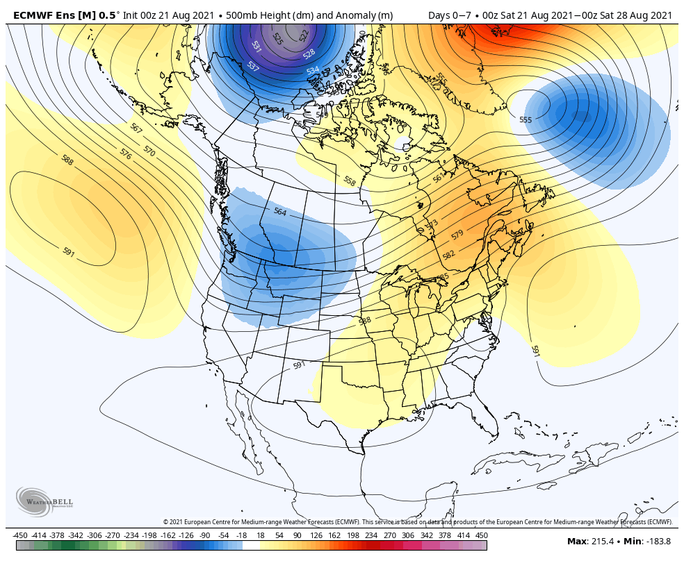
The 7-day period will be dominated by an eastern ridge while a trough carves itself into the inner-mountain West.
Below normal temperatures will take up shop across the inner-mountain West and spread throughout the south. Meanwhile, anomalous warmth will prevail across the upper Midwest, Great Lakes, and into the Northeast, and Mid Atlantic.
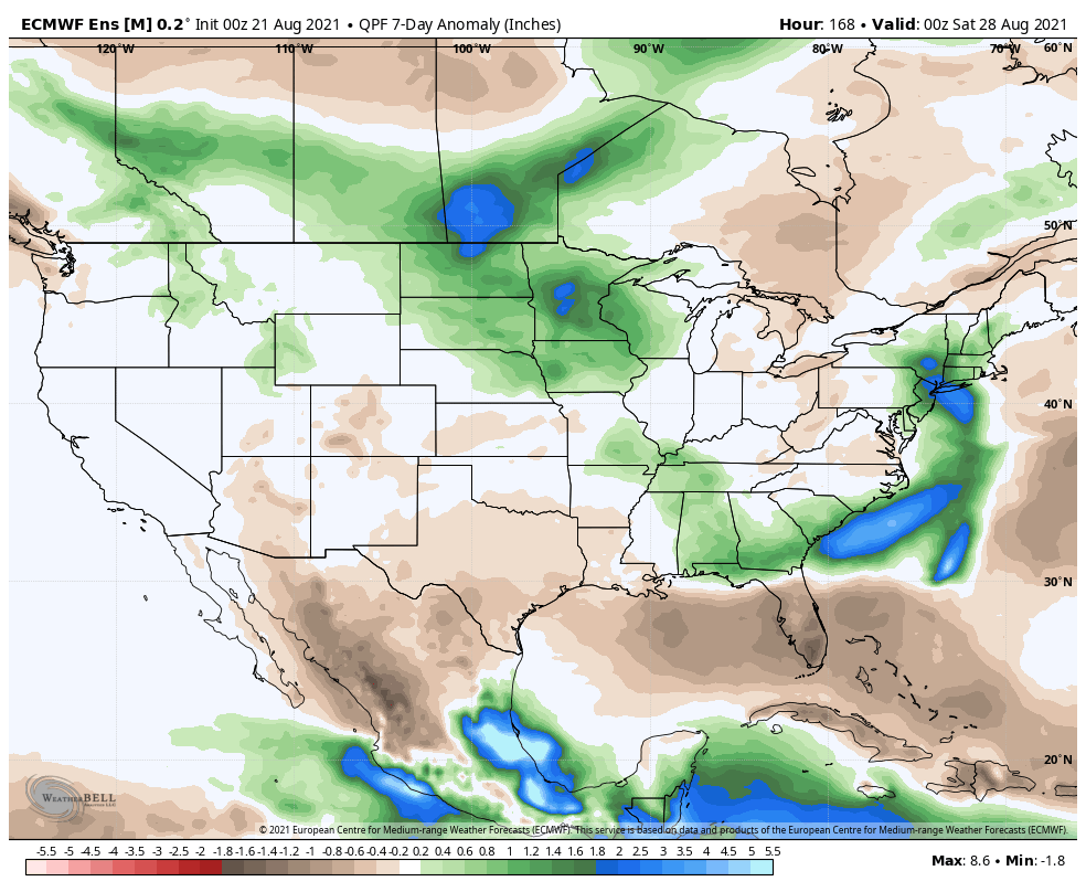
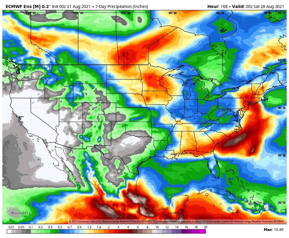
Tropical moisture will lead to well above normal rainfall across the Southeast and into southern Appalachia.
We forecast on average between 0.50″ and 1.00″ of rain across central Indiana during the week ahead.
Forecast Period: 08.15.21 through 08.22.21
The past 36 hours has provided a nice change of pace as of late with lower humidity and cooler temperatures. (Several reporting sites across northern Indiana are in the lower 50s this morning with middle 50s as far south as the Indianapolis suburbs). As we look to start the new week, humidity will be on the increase along with a daily chance of scattered thunderstorms beginning as early as Monday, continuing Tuesday. We will try and inject briefly drier air in here Wednesday which should reduce coverage of “splash and dash” storms before scattered storms return to close the week. As we look ahead to Saturday, better storm coverage is expected as a cold front moves through the region.
A couple of other items of interest on a broader scale include the first snow of the young season falling across the northern Rockies this week, as an early shot of winter-like air descends south from Canada. Also, from a tropical perspective, we’ll keep close eyes on what comes of Fred and Grace. As it sits today, we still don’t anticipate impacts here in central Indiana from either systems.
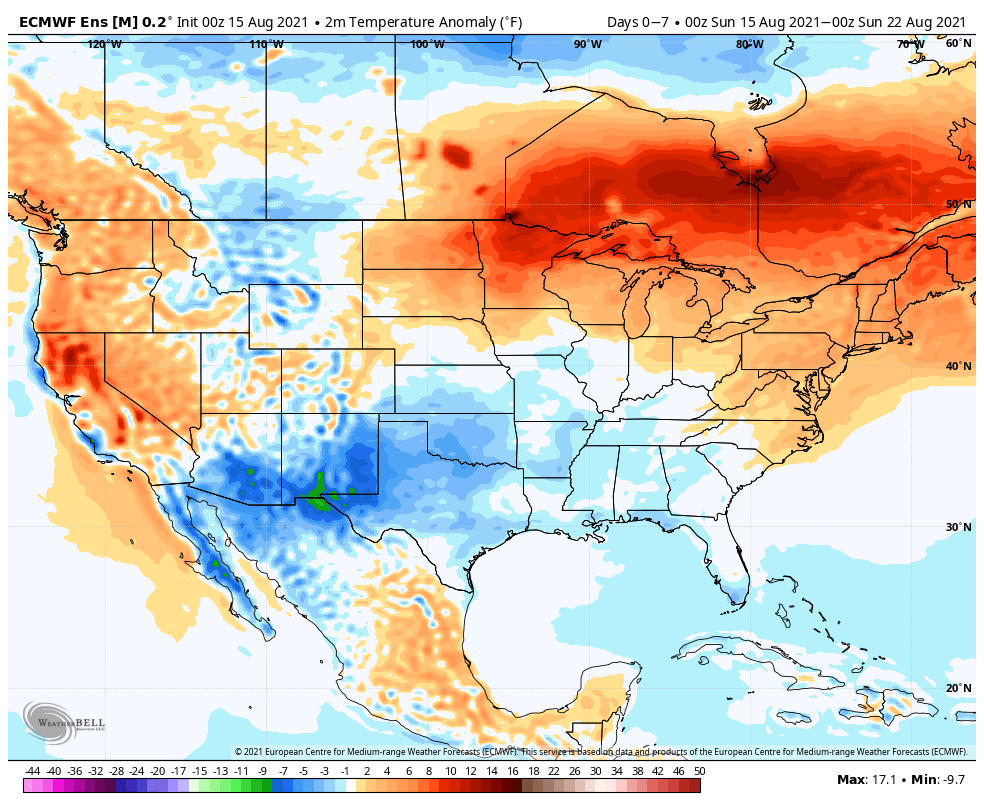
The “hot dome” will shift to the Four Corners in the upcoming week. A much cooler and less humid airmass will infiltrate the Ohio Valley and Great Lakes, into the Northeast.
The upcoming 7-days will feature unseasonably cool air from the Ohio Valley into the Northeast. Meanwhile, significant heat will bake the West.
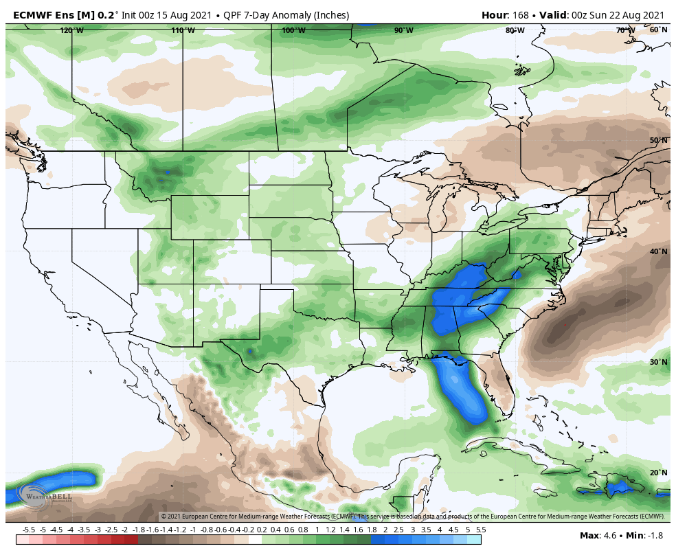
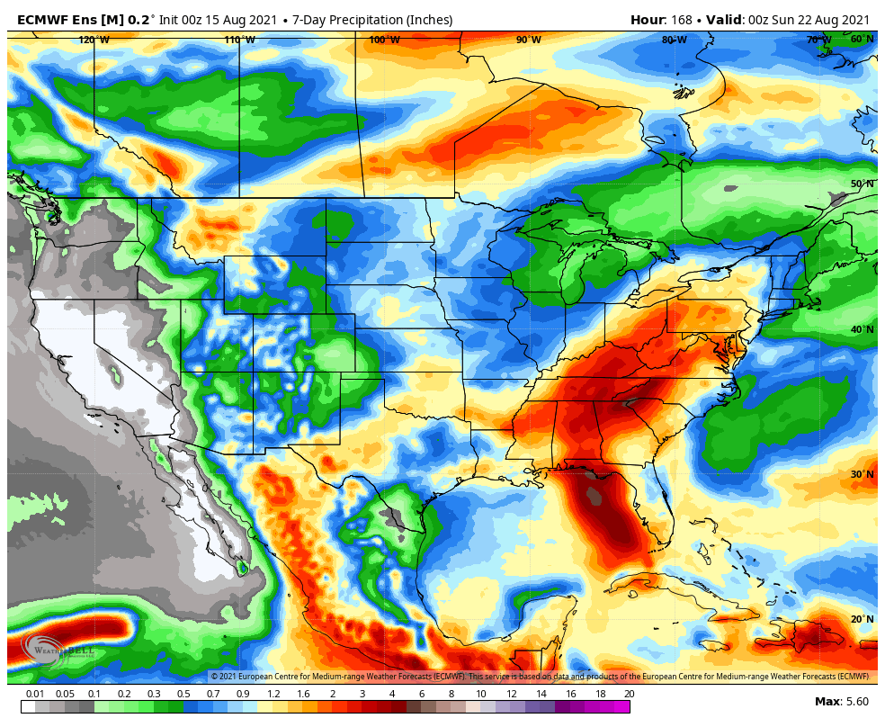
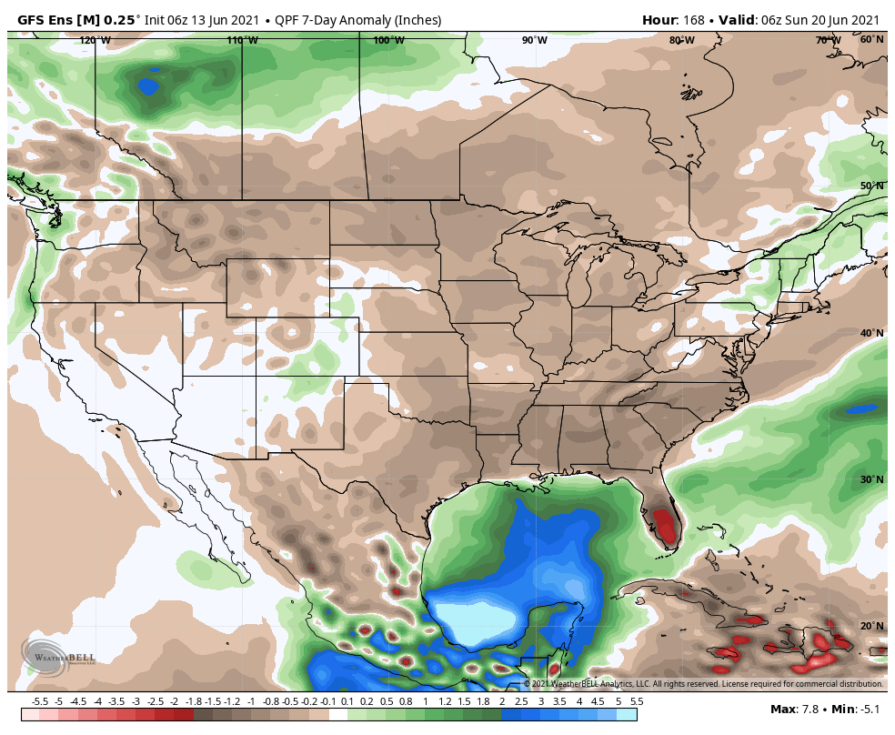
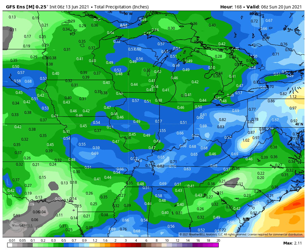
A much drier pattern will emerge in the upcoming forecast period for a large chunk of the country.
We forecast rainfall amounts to run around 0.50″ or less across most of central IN in the upcoming week.
Forecast Period: 06.13.21 through 06.20.21
While not AS hot and sultry as Saturday, today will once again flirt with 90° across most of central Indiana under a mostly sunny sky. If you’re a fan of the heat, enjoy today as a transition in the overall pattern will deliver a much less humid and cooler airmass to our neck of the woods throughout the majority of the upcoming week (and what is looking more and more like beyond). We’ll track two cold fronts that will push through the region between Monday and Tuesday afternoon. Both of these frontal passages should be mostly uneventful from a precipitation perspective (only an isolated shower or storm is expected). As we look ahead, somewhat better chances of scattered showers and thunderstorms look poised to impact our region Friday (30% to 40% aerial coverage) as yet another cold front moves through. This will set us up for drier conditions once again for Father’s Day weekend.