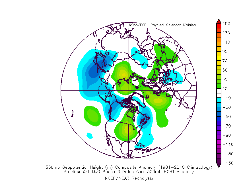
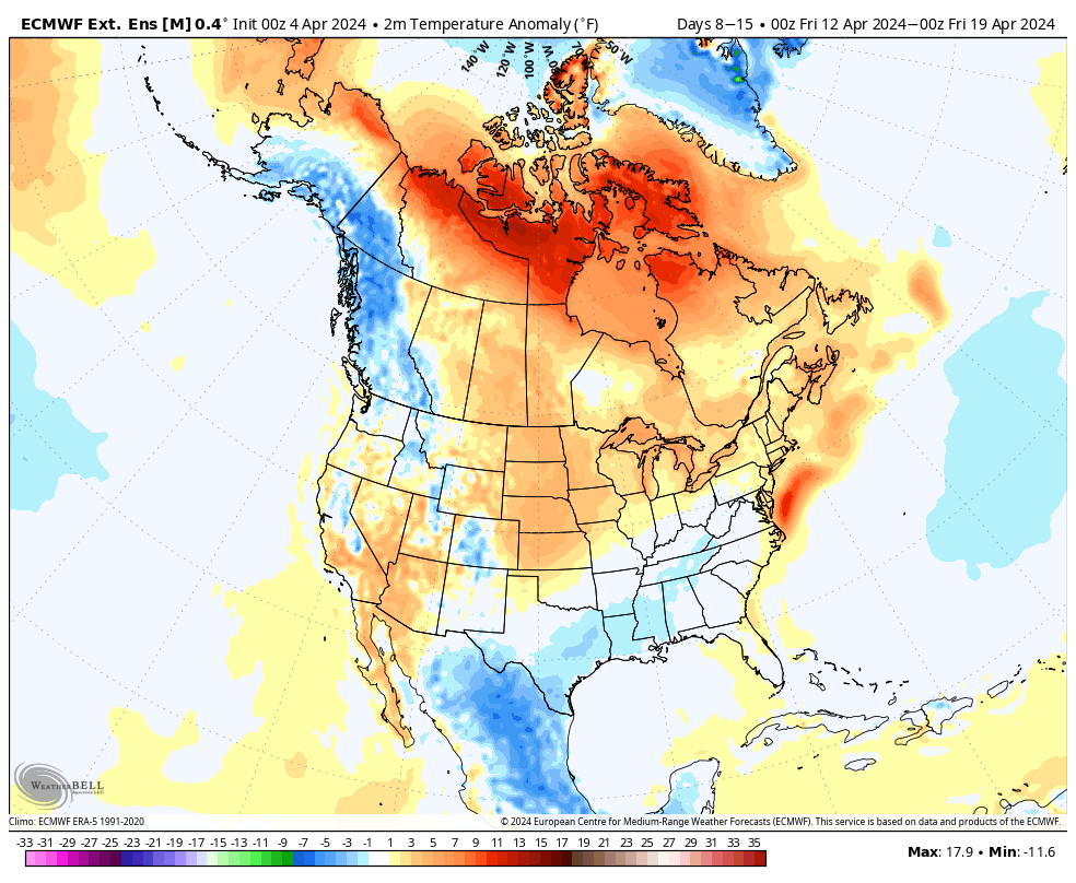
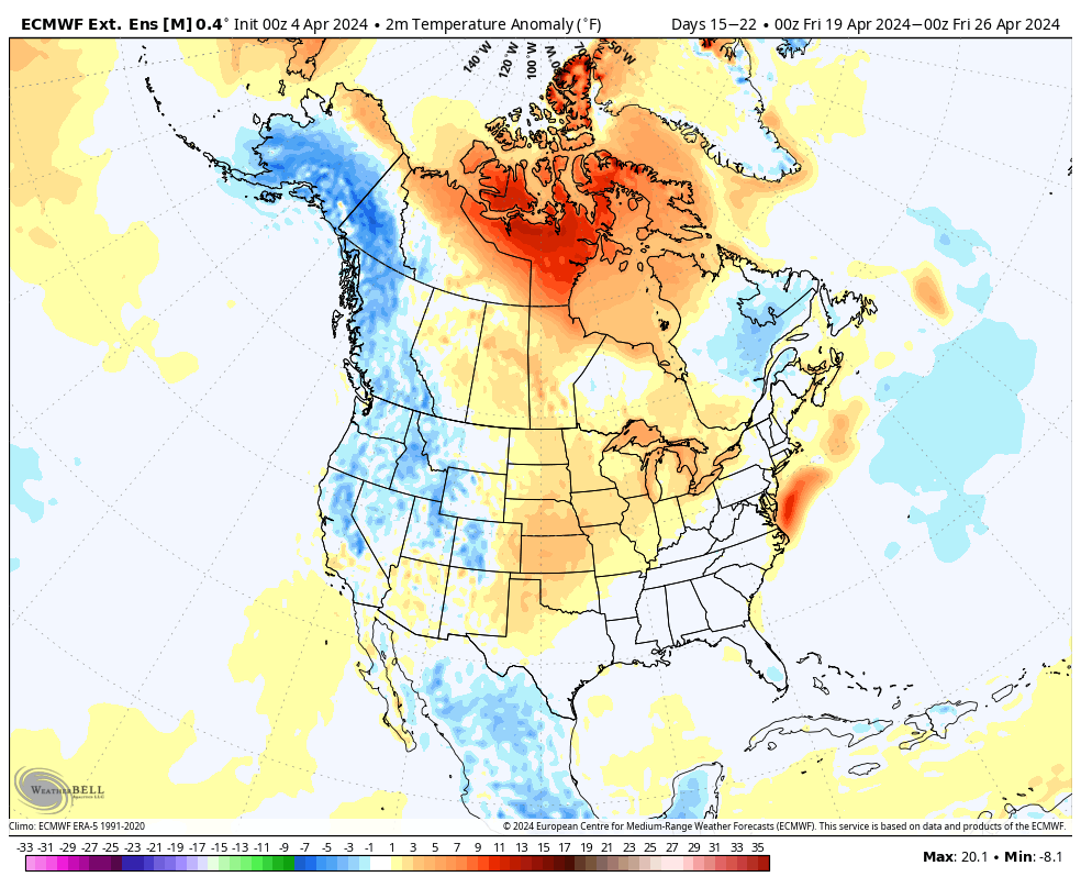
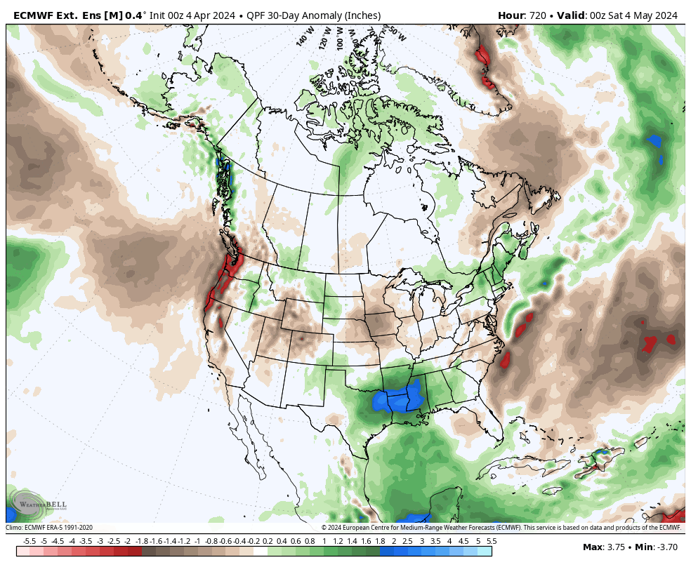
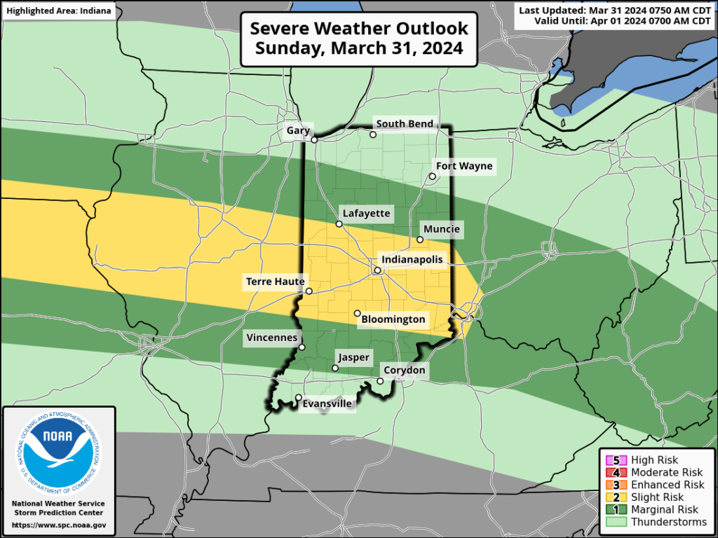
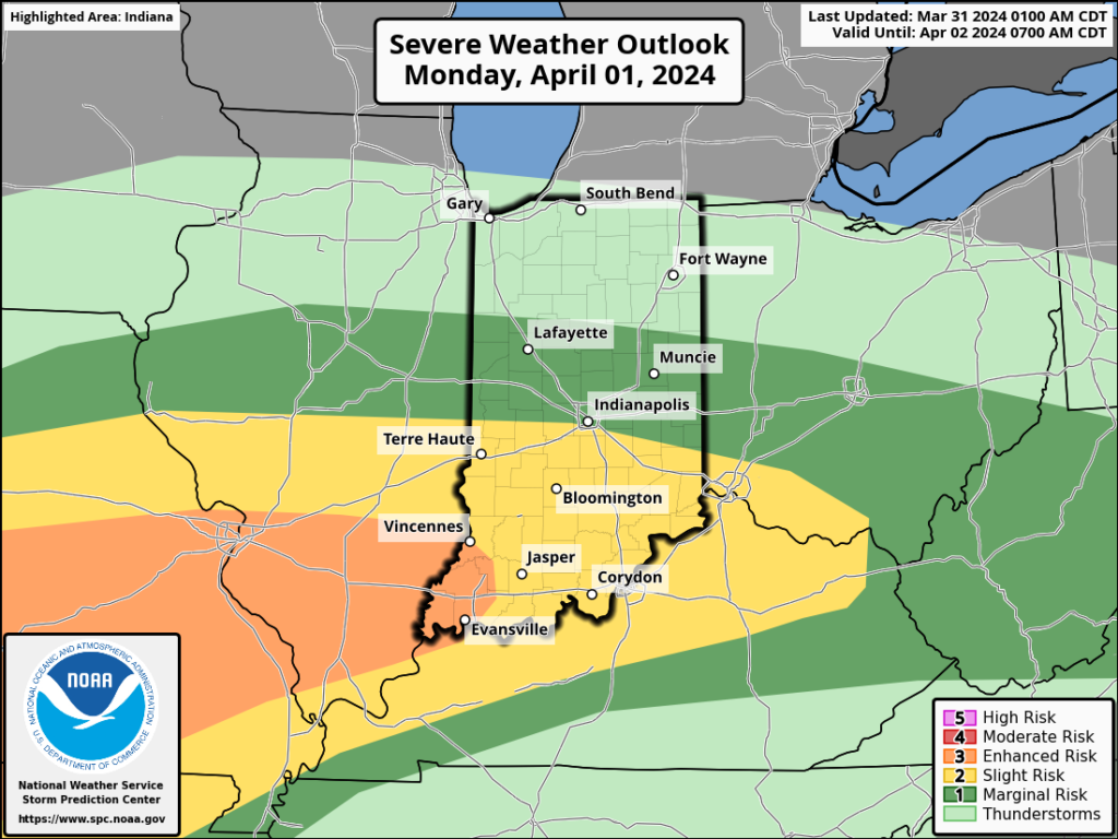
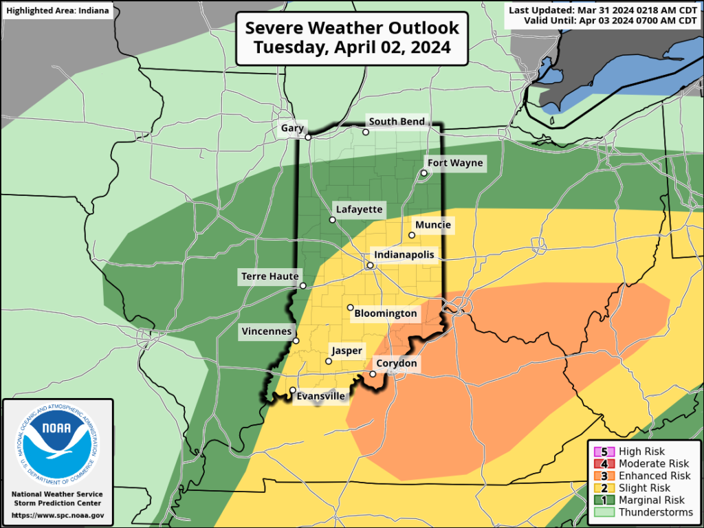
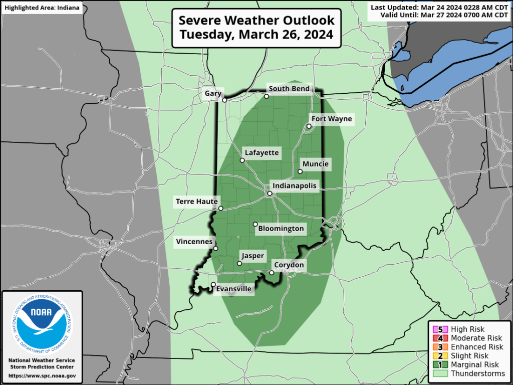
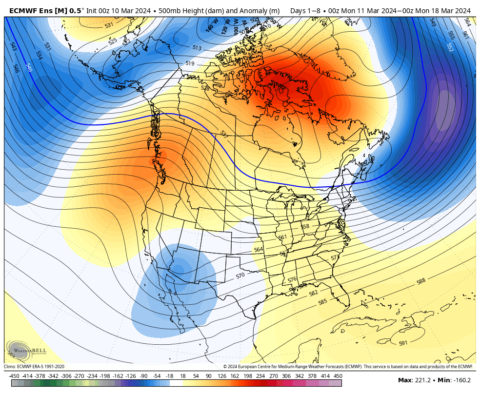
While a period of unsettled weather looms late Monday and Tuesday, the majority of the upcoming week will feature quiet conditions across our neck of the woods. We’re watching Tuesday afternoon for the potential of severe weather across the state.
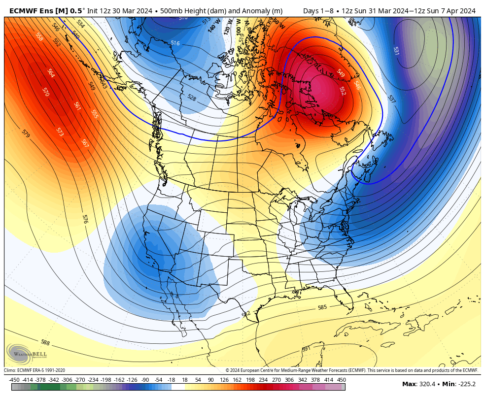
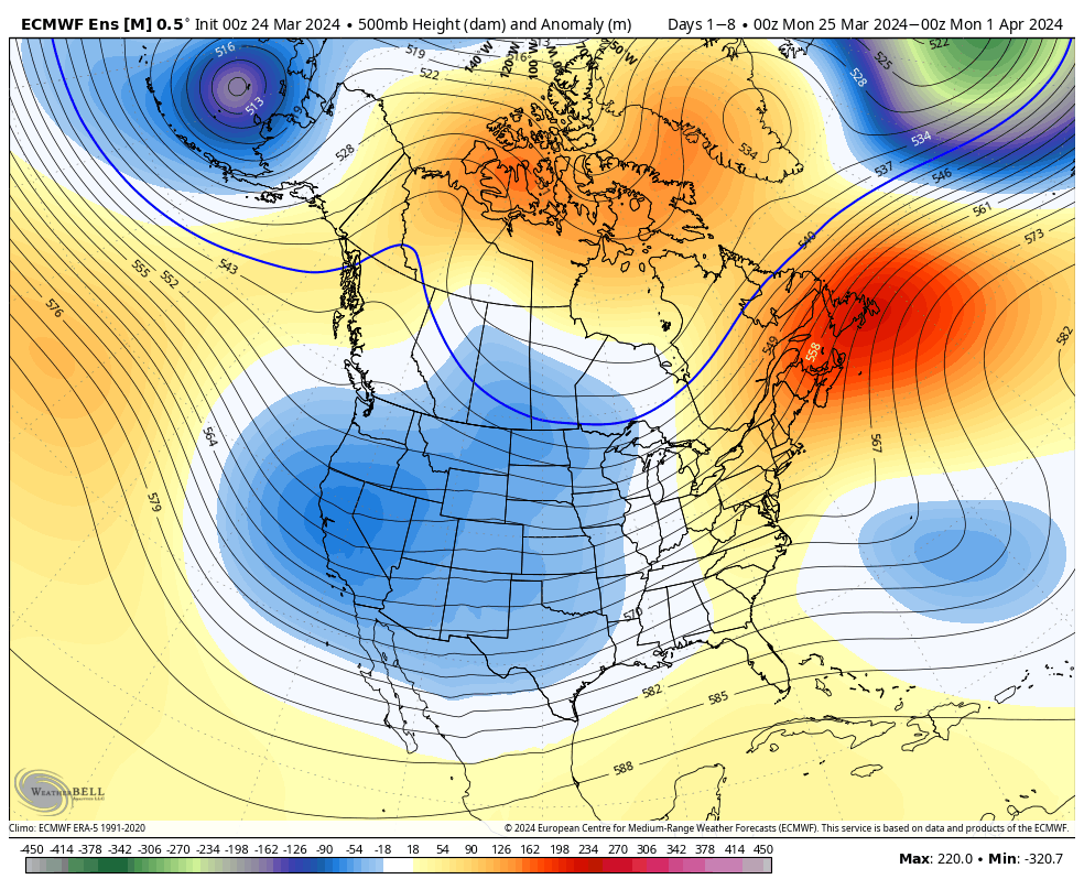
The ‘mean’ trough will settle into the western CONUS and that’s where the coldest anomalies will setup shop.
A trough will take up residence across the West with only glancing blows of cooler air, locally.
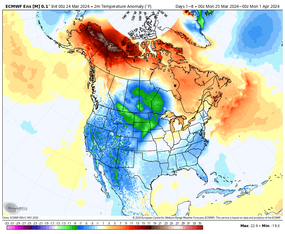
A chilly week is in store for the West with the temperature swings balancing out very close to average across our area this week.
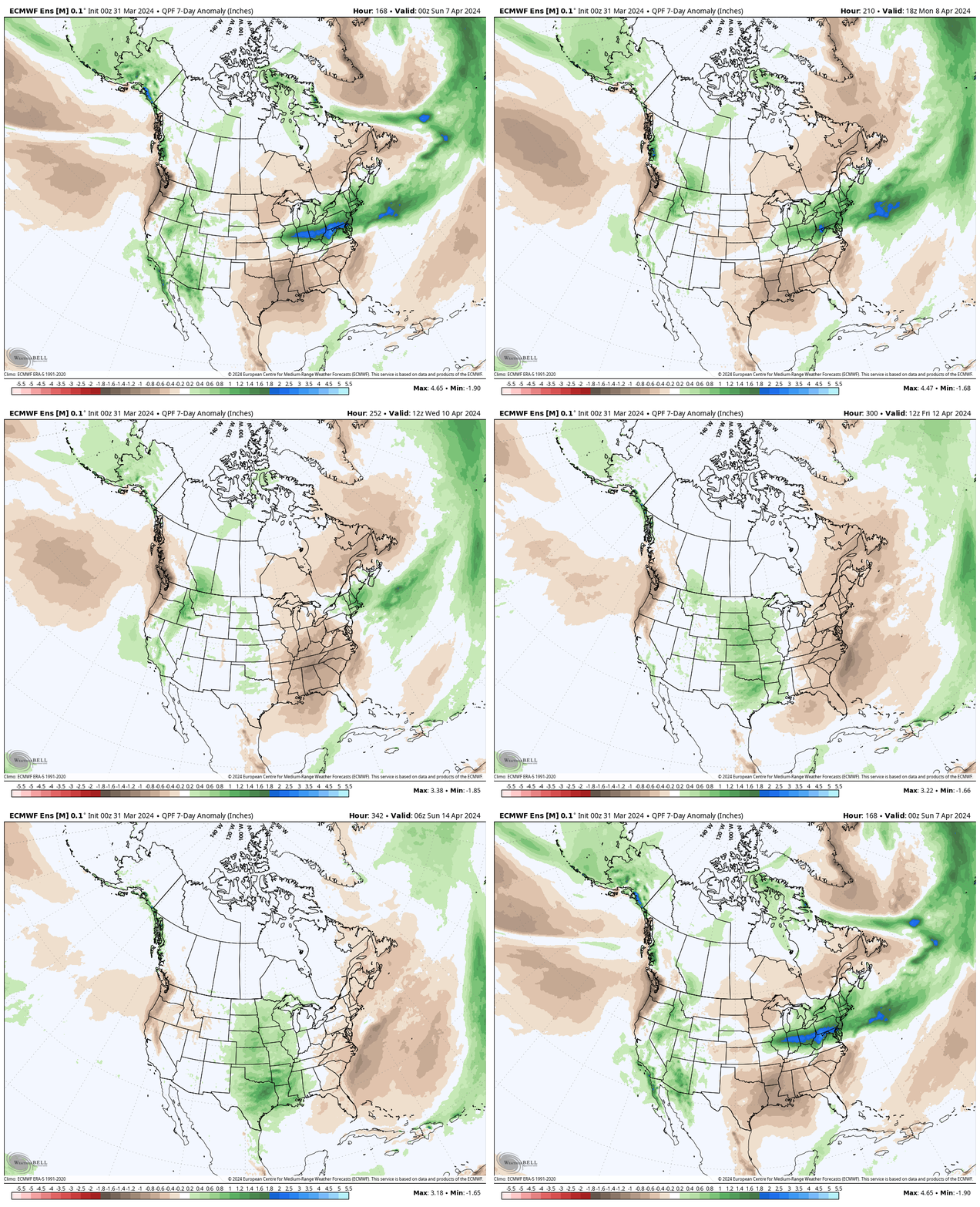
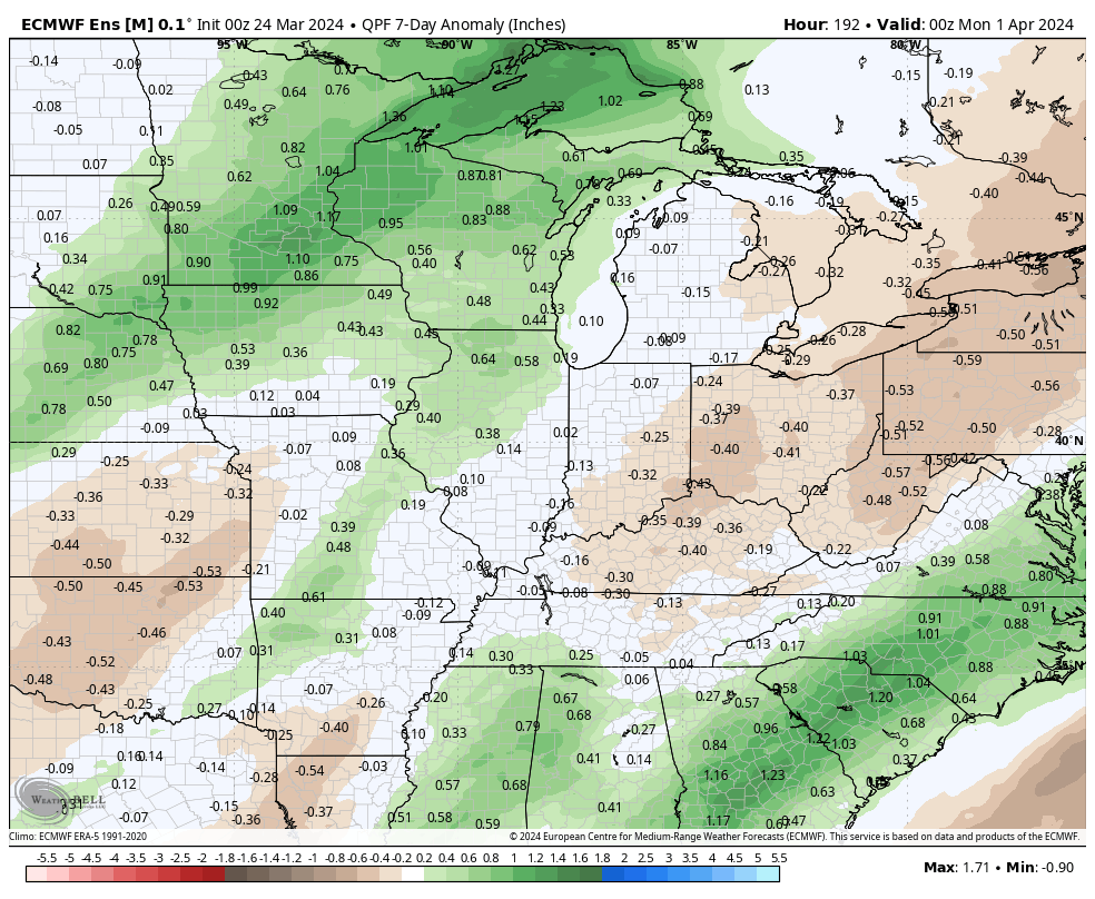
Rainfall will run average to slightly below average in the week ahead south and east.
Forecast period: 03.24.24 – 03.31.24
We’ll close the weekend with quiet conditions in place. Anticipate gusty winds to kick up Monday as our next storm system approaches from the west. This will also deliver a few showers Monday night before heavier rain and embedded thunder arrives Tuesday predawn. An additional round of thunderstorms is expected Tuesday afternoon and a few of these could become strong to severe (damaging straight line winds are of greatest concern, but an isolated tornado can’t be ruled out).
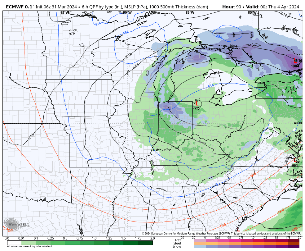
A cold front will sweep east and end the rain/ storm threat Tuesday night with calmer weather returning for mid and late week. The next chance of rain will arrive next weekend. Speaking of next weekend, though early, model guidance is suggestive that we may be looking at a heavy rain event around the time that we close out March and open April. Just something we’ll be keeping an eye on in the days ahead.
Indianapolis is running right at average month to date from a rainfall perspective (1.78”).
We’re transitioning to a much drier pattern in the week ahead as a cooler, Canadian airmass dominates (for a change).
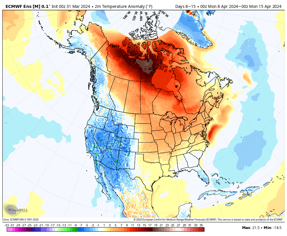
Several hard freezes (mid-upper 20s) are on tap in the upcoming 7-10 day period: Monday/ Tuesday morning and again late next week/ next weekend.
Cooler? Yes, but I still don’t see anything overly cold on the horizon as we navigate the next couple of weeks.
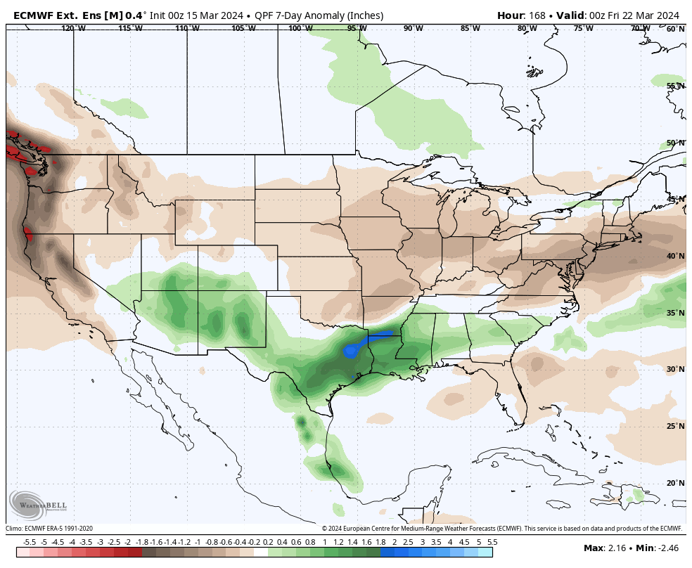
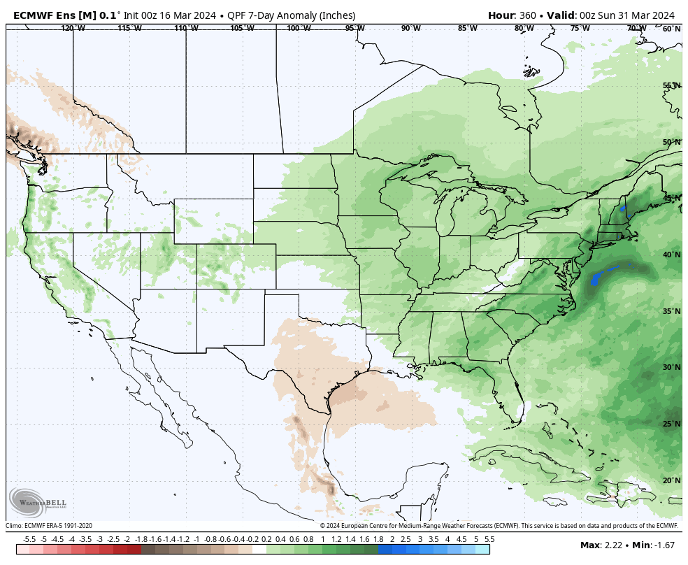
What’s more notable is the shift in the precipitation pattern over the next few weeks. The dry Week 1 (now) transitions to a significantly wetter and more active look Week 2 (below).
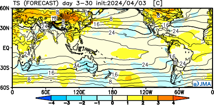
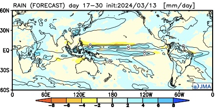
The JMA also sees the wetter regime.
This is forecast to continue in the Weeks 3/4 timeframe.
Continues to back up the idea of an active (wet) and stormy (more in the way of severe weather) spring as a whole.
Down the road, an eventual move into a hot, dry (compared to normal) summer may loom. (Yet one that is very active from a tropical perspective, continuing into the fall). More on that in the coming weeks…
Another unseasonably mild week awaits, but one thing is becoming increasingly clear: we’re not finished with the cold yet. The transition to a colder time of things next week will come with unsettled conditions late this week and the weekend (I know, timing isn’t on our side).
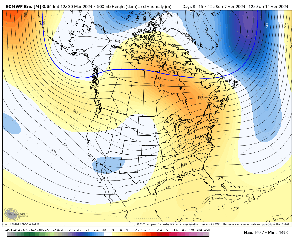
An upper level ridge will dominate in the week ahead, but note the building heights late in the period across western NA. That will help promote a different (colder) airmass here over the wknd into early next week.Warmer than average temperatures can be expected this week from the Plains and points east.Precipitation should check in right around average this week across central IN and the Ohio Valley as a whole.
Forecast Period: 03.10.24 – 03.17.24
The period will open with dry and seasonably chilly conditions before a southwesterly flow takes hold and helps promote yet another quick warm-up in the work week ahead. A weak and fast moving system may deliver some scattered showers midweek but the lions share of our moisture this week will come Thursday and Friday. Colder air then pours in here over the weekend with the potential of snow getting involved by this time next week.
Updated 01.25.24 @ 7:36a Dense fog is present yet again this morning, but at least we’re not dealing with heavy rain. That changes later this evening as a slug of…
You must be logged in to view this content. Click Here to become a member of IndyWX.com for full access. Already a member of IndyWx.com All-Access? Log-in here.
Right out of the gate, let’s look at the pattern drivers over the course of the next couple of weeks. By now, you know this starts with the MJO. One has to love the alignment of at least quickly moving out of the current warm phases and into the colder phases. By the 28th, both the GFS and European show us emerging into those colder phases.
The thought here is that we sneak into Phase 8 prior to month’s end and then roll into Phase 1 as we get into early January. The respective temperature composites are below.
MJO: Phase 8 December
MJO: Phase 1 January
That leads us to the PNA and EPO. (Remember, we’ll put more weight into the influence the NAO and AO can have on the regime after mid-January).
The PNA, or Pacific North American pattern, remains in a favorable state for eastern cold.
“Positive” PNA composite pattern
However, the EPO doesn’t want to play nice and will put pressure on any sort of sustained, meaningful cold getting involved over the next 10 days- that is until the MJO gets into the cold phases.
The JMA Weeklies show the progression of the upper pattern best, in my opinion, from any of the long range data that’s currently available for the late December-1st half of January timeframe.
Week 1
Week 2
Weeks 3-4
We’ve had several new subscribers of IndyWx.com All-Access over the past couple of weeks so I wanted to take time to drop a direct link to our annual Winter Outlook. As we get set to put a bow on the first month of meteorological winter, there’s no change to our ongoing idea of the winter as a whole here.
I originally thought the shift to a colder pattern would take shape around 12/20 (give or take a couple of days). While that idea appears to be too aggressive, there’s certainly no backing away from the colder pattern progression as a whole, at least from my perspective. The expectation is that we do, indeed, get into the colder phases of the MJO and that sets off the larger global signal that will likely shift the EPO into a colder phase. It’s interesting that the European Weeklies show this exact thing taking shape down the road (once past 1/1).
While we’re not of the thought this evolves into anything frigid (some sort of overwhelming arctic air mass, for example), we do want to double down on the idea of a slightly colder than normal regime taking hold as we get into the new year. The thought here is that this slightly colder than normal pattern will also have staying power through a good chunk of January, given where I believe the MJO will spend the majority of time. What’s also of interest is the energized southern stream beginning to show itself (going to be one heck of a storm roaring out of the Gulf this weekend). I’d imagine we’re only just beginning to see the active pattern take hold and it won’t take much to get a storm or two to try and phase with northern stream energy if we see the evolution take hold that I envision down the road. At the very least, it’s certainly not a boring pattern.
We’ll have more detailed thoughts on the weekend and next week’s pattern in our updated Client video that will be posted a bit later today!