Updated 03.22.25 @ 8:32a A weak and moisture-starved system is exiting stage right this morning and we’ll quickly get back to sunshine today. Northwest winds will remain gusty today (upwards…
You must be logged in to view this content. Click Here to become a member of IndyWX.com for full access. Already a member of IndyWx.com All-Access? Log-in here.
You must be logged in to view this content. Click Here to become a member of IndyWX.com for full access. Already a member of IndyWx.com All-Access? Log-in here.
Updated 06.21.24 @ 7:45a The theme as we enter the weekend will continue to be a dry one, along with increasingly hot temperatures. Low-mid 90s will be common each afternoon…
You must be logged in to view this content. Click Here to become a member of IndyWX.com for full access. Already a member of IndyWx.com All-Access? Log-in here.
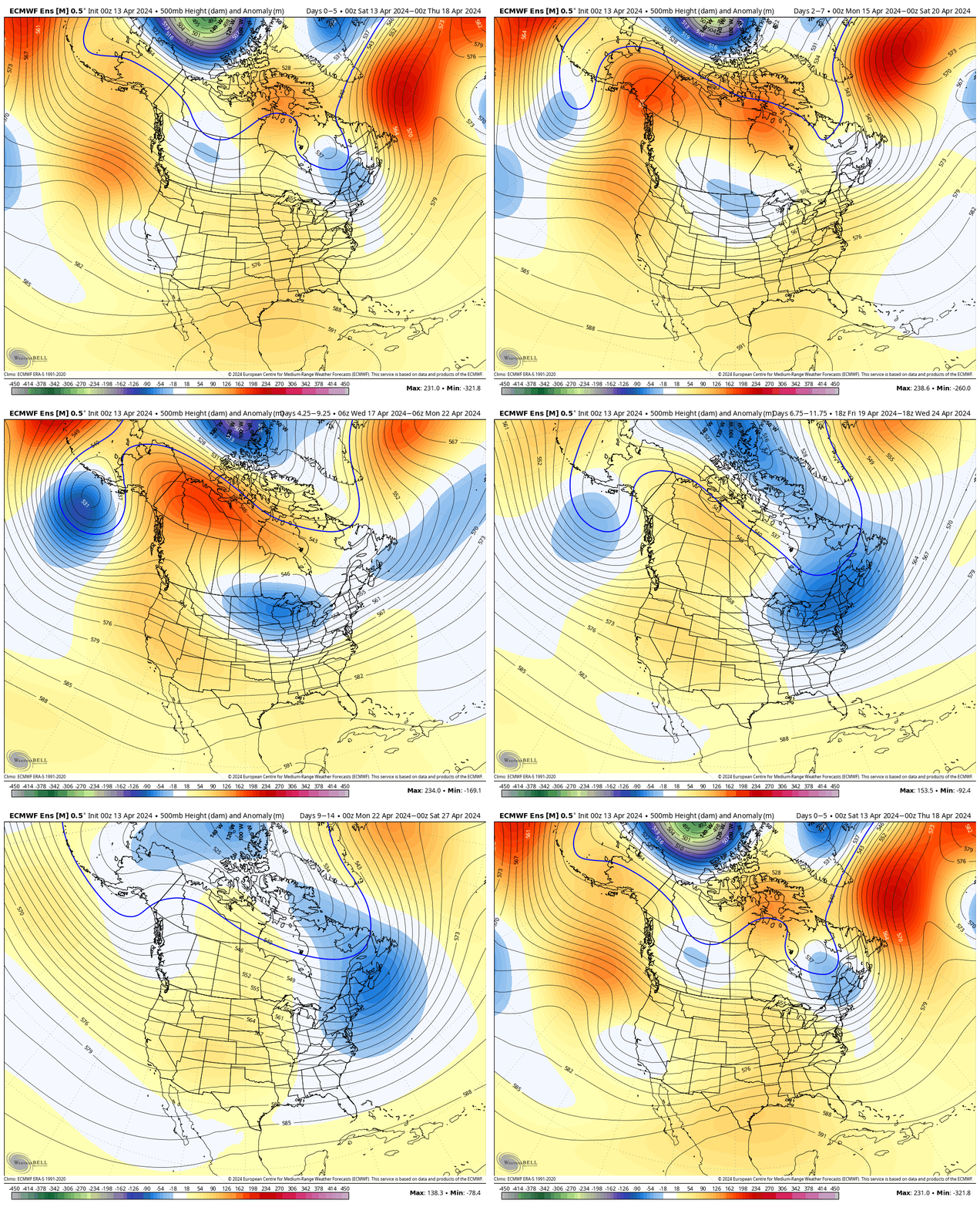
While unseasonably warm air will build in here early next week, don’t put away the cold weather gear just yet. We’re likely even looking at additional frost threats as we get towards late next weekend and/ or early Week 2. More details below in this week’s #AGwx and #Severe Weather Outlook.
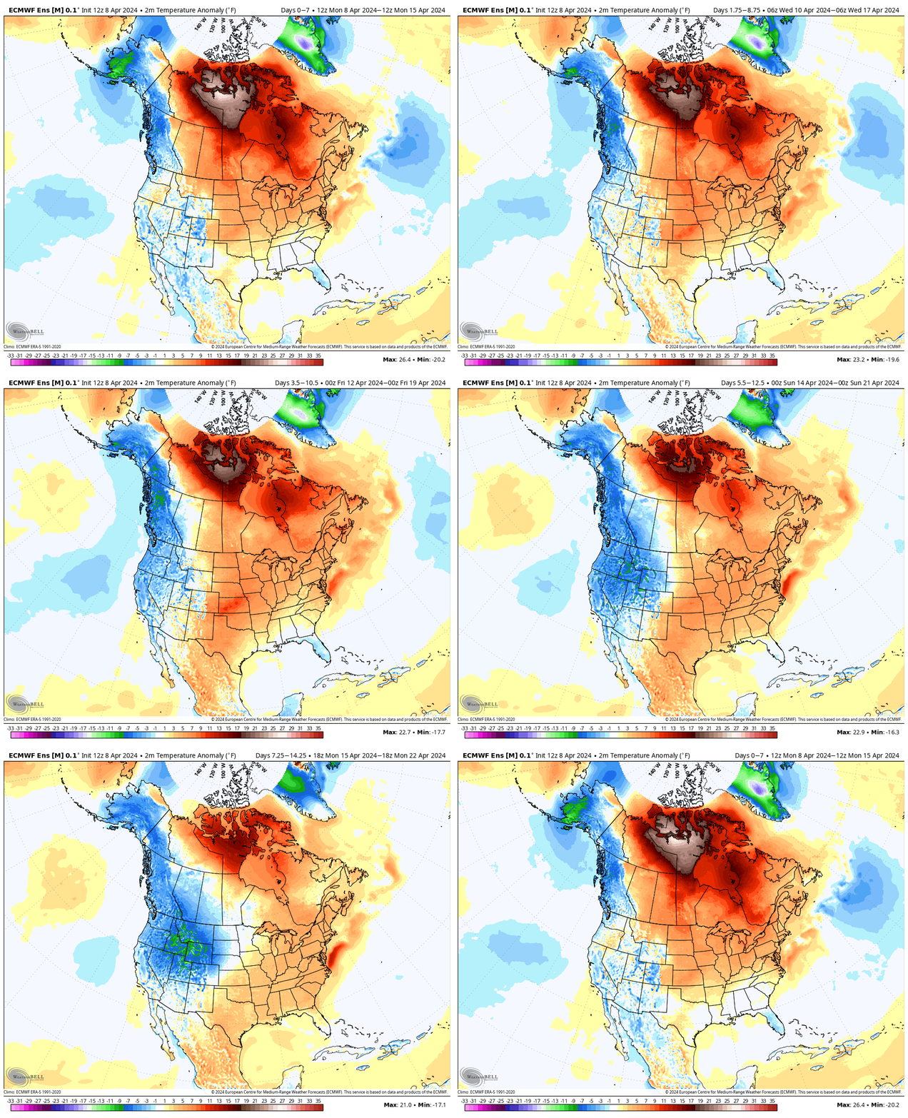
“Transitional” is the word to describe the upcoming couple weeks worth of weather around these parts. The warmth to open the period will cool significantly next weekend and early Week 2, only to give way to renewed warming late April.
Note the roller coaster in the temperature anomalies over the next couple of weeks.
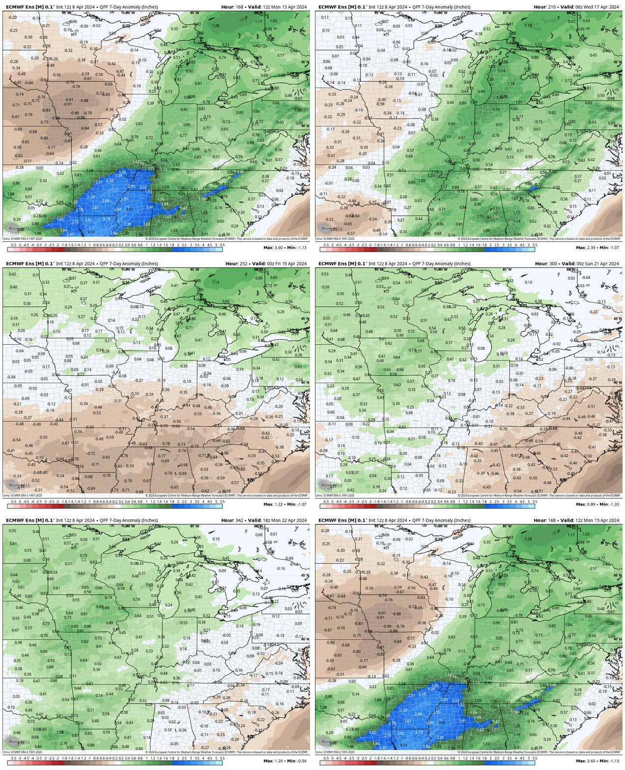
The active pattern in the week ahead will dry significantly late in the forecast period as the cooler airmass takes hold.
In the more immediate term, we’re tracking 2 storm systems in the week ahead: Tuesday – Wednesday and again Thursday night into Friday.
The Storm Prediction Center includes western Indiana in a risk of severe weather Tuesday. We’ll monitor for the potential of a further east extension of this risk area.
We think (2) rounds of storms are on deck Tuesday. The first round likely is associated with a warm front lifting north through the state Tuesday morning (hail threat) followed by a second round of activity Tuesday night into Wednesday morning (main concern being damaging straight line winds with this round). As of now, storm total rainfall amounts of 0.50″ to 1″ seem likely during this timeframe.
Another round of showers and embedded thunder will precede a blast of chilly air next weekend. We bracket Thursday night into Friday morning for this particular round of rain. An additional half inch, or so, of rain seems reasonable from this distance.
By the time we get to next weekend and early Week 2, drier and much cooler, more stable air should take up residence.
We note the warm open, chilly finish in the 10-day meteogram. Also note the frost threat at the end of this period.
We’re running a little more than 3° below normal to open the month, but changes are in the offing. The majority of the upcoming 7-day period should feature seasonal to above normal temperatures and that will likely only strengthen into the Week 2 timeframe.
Unfortunately, we have a big rain event set to unfold as we roll through the middle of the week. Rain (more “showery” in nature) will continue as we close out the work week before a gorgeous Saturday.
The recent chilly open to April will begin to transition to a warmer look over the upcoming week. Slightly cooler air Friday will give way to a significant warm-up through the weekend and into Week 2.
Our expected active spring will remain intact over the next couple weeks, including an overall above average look in the rainfall department.
In the short-term period, this is highlighted between what falls Wednesday-Friday.
Though severe weather won’t be a concern, heavy rain will during the aforementioned timeframe. We still think widespread 1.5”+ amounts are likely for many area rain gauges. As of now, severe weather isn’t expected, locally, based on the SLP track. Further east into Ohio, a few severe storms will be on the table. We’ll monitor for any last minute west adjustments leading into the system.
Widespread, soaking rains will turn more “showery” in nature Friday before dry air takes firm control and provides a pleasant Saturday.
Don’t get used to the dry weather. Despite the warmer trend, another round of rain and storms can be expected the 2nd half of the weekend into early next week.
Upcoming *10-Day Rainfall Projection: 1.5” to 2.5”