If you’re a fan of cold weather, including being on the field to “cash-in” on multiple winter storm threats, this is a pattern for you. In all honesty, it’s tough to ask for a better pattern to yield such things. With that said, each respected storm threat will have its’ own set of challenges that will have to be dealt with. While we’re confident on IND being above normal in the snow department for the month of December by the 20th, it’s impossible to put numbers (from an accumulation perspective) on specific storm systems from this distance. With that said, please know that the pattern is one that will have multiple impactful winter events lining up behind one another and it’ll be important to keep updated with forecasts as we progress through the next few weeks. Needless to say, there will be plenty of opportunities to get those favorite photos with Christmas lights/ decor in the snow this season!
We’re tracking (3) winter systems over the upcoming week:
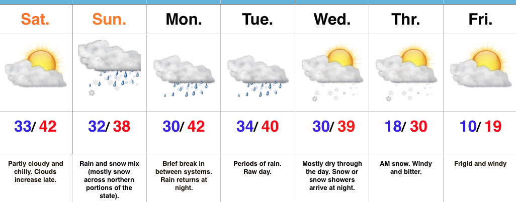
1.) Today: Dry air initially made it difficult for precipitation to make it to the surface this morning. Heavier precipitation rates will arrive after lunch and fall for a few hours (between 1p-6p for most of central IN). This will fall as mostly a cold rain from Indy and points south. Further north, including north-central IN, this will fall as a rain-snow mix (snow should become the predominant form of precipitation shortly after starting. Across northern portions of the state, this will be mostly snow and we note modeling trending colder with recent runs. With heavier snowfall rates this afternoon/ evening, travel may become dicey across northern IN and wet snow accumulations of 2″-4″. A coating to less than 1″ of snow is possible as far south as the northern suburbs of Indy. The following time stamps can give you an idea what the radar may look like this afternoon into the evening hours.
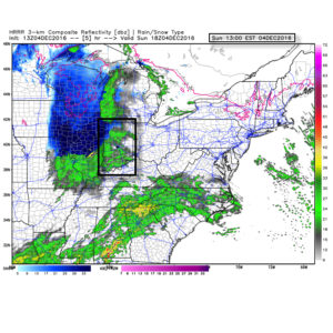
1p forecast radar
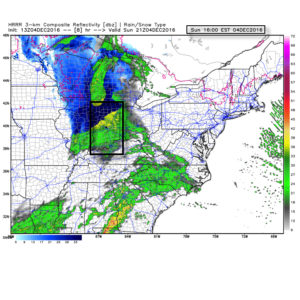
4p forecast radar
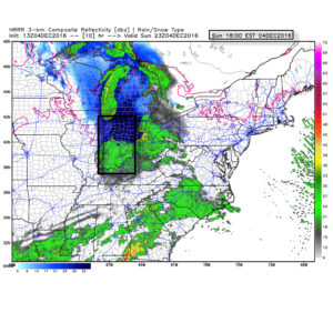
6p forecast radar
Temperatures tonight will fall below freezing for most (upper 20s to around 30) and with the lingering moisture on area roadways and sidewalks, a couple slick spots could develop here and there so be mindful. We don’t anticipate major issues, however.
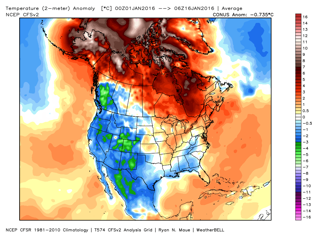
2.) Wednesday night-Thursday: An arctic front will blow into town mid week and we remain bullish on the idea a wave of low pressure delivers a shot of accumulating snow as the arctic plunge moves in. As we’ve relayed over the past few days, model data is far from being in agreement on this idea, but when one looks at the overall pattern, it’s easy to see how there should be more reflection of low pressure moving along the pressing arctic boundary. These can be tricky and many times modeling is “forced” to play catch-up at last minute. For now, we continue with the idea of accumulating snow across central IN in the Wednesday night-Thursday time frame ahead of the coldest air so far this season. Temperatures will fall to between 10-15 degrees for lows by late week, including single digit ‘chills.
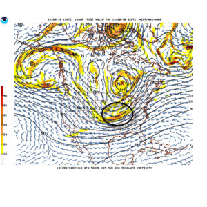
Arctic waves can be tricky in the medium range and must be watched closely.
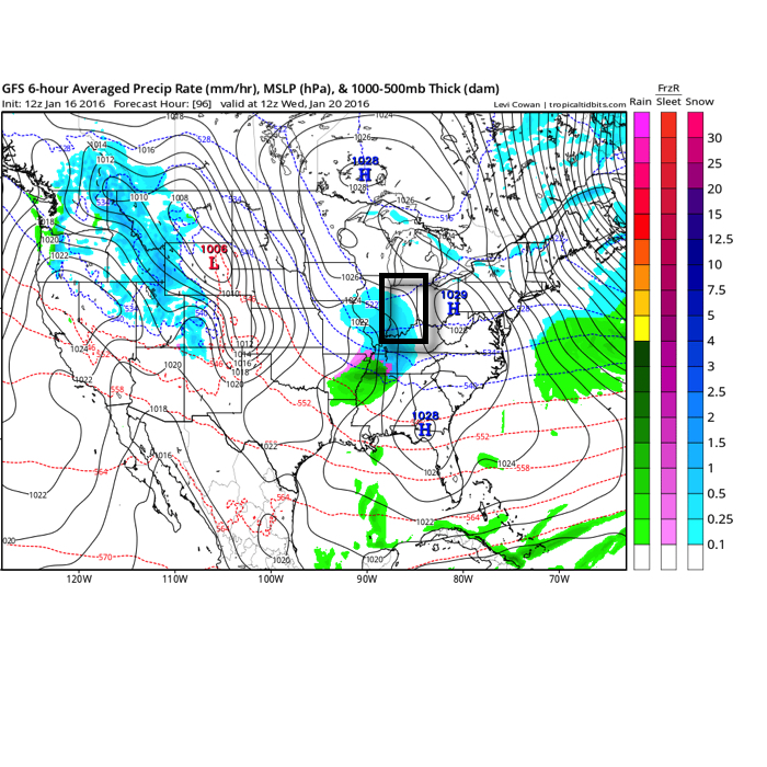
3.) Saturday-Sunday: Our next wintry threat appears to roll into town next weekend. Similar to mid week, this, too, could be an accumulating event. It’s far too soon to get specific on timing, snowfall amounts, etc., but just know we’re keeping a close eye on next weekend for potentially more of a widespread wintry event and will sure-up details as we progress deeper into the week.
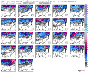
GFS ensemble members show the snowy pattern ahead over the upcoming week.