I. Drier air will work into the region and limit rain chances today and Wednesday (isolated coverage at best). Highs will also warm back up to seasonal levels during the time.
Drier air will work into the Ohio Valley today and Wednesday. Image courtesy of weathermodels.com.
II. Our next frontal boundary will arrive Thursday afternoon. Scattered showers and a few thunderstorms are expected ahead of the front during the afternoon and evening hours. Behind the boundary, cooler and refreshing air will return to wrap up the work week.

Cooler, more refreshing air will return to wrap up the work week. Image courtesy of weathermodels.com.
III. We’re timing out our next storm system for a weekend arrival. While the weekend won’t be a wash out, rain chances will return late Saturday into Sunday. Forecast models differ on the specifics with respect to timing, track, and rainfall amounts and all will have to be fine tuned over the next few days.
The GFS is faster and more aggressive on weekend rain. Image courtesy of weathermodels.com.

Meanwhile, the European is slower with rain, bringing the bulk of precipitation in AFTER the weekend. Image courtesy of weathermodels.com.
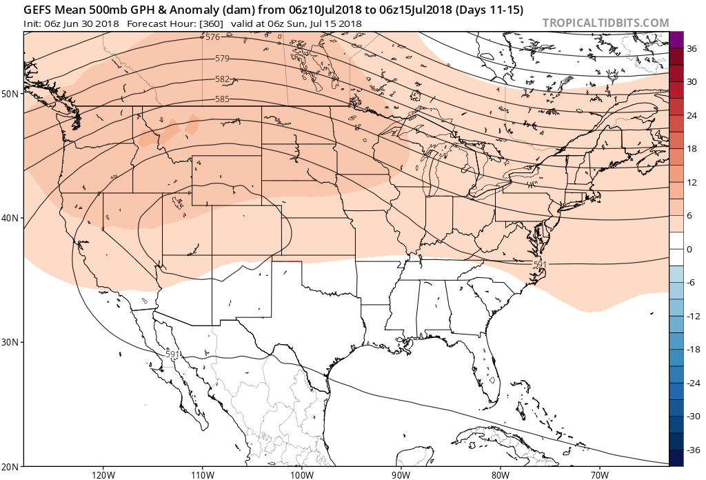
IV. Longer range, we don’t see any significant heat on the immediate horizon. On that note, while we aren’t saying additional hot days won’t occur the rest of the way in, we continue to believe the hottest weather of the summer is behind us. The new European Weeklies in last night continued a seasonal to cooler than average theme for August into early September. All images below are courtesy of weathermodels.com.
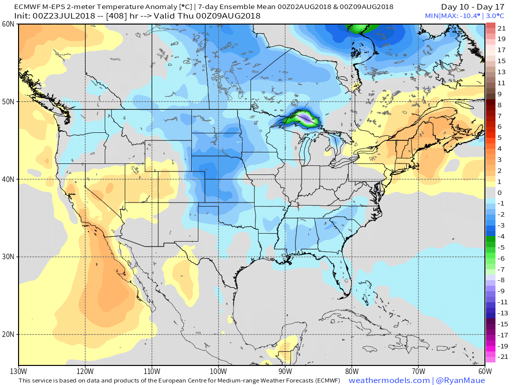
Days 10-17

Days 18-25

Days 25-32

Days 32-39
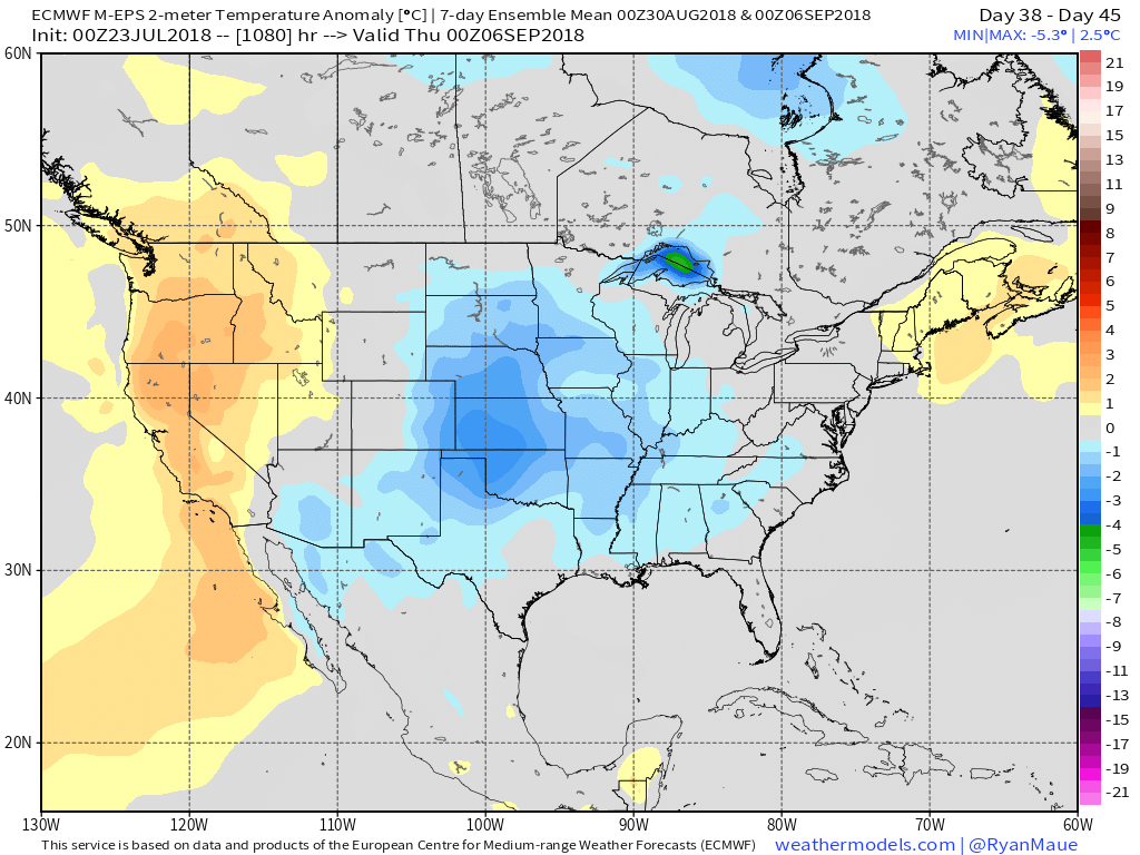
Days 38-45
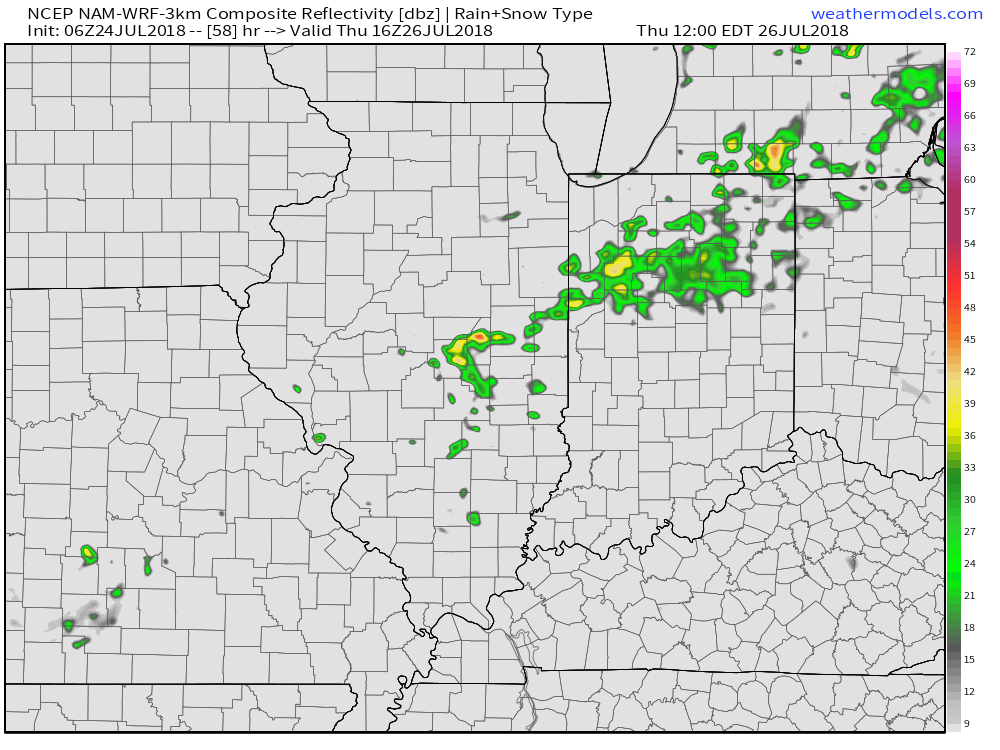
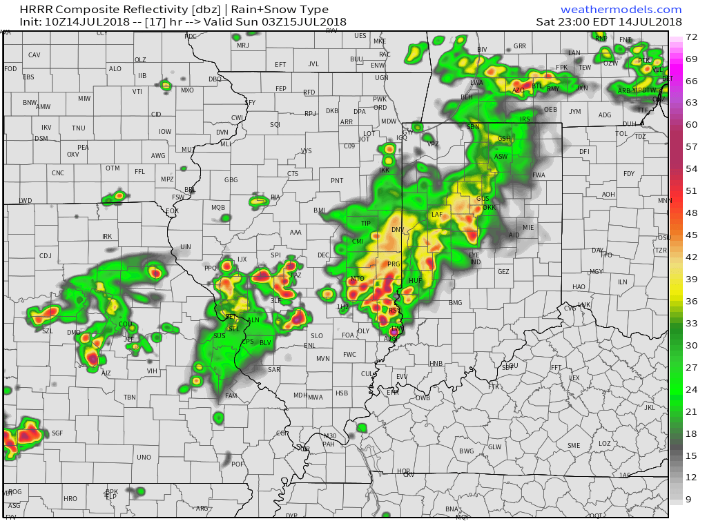
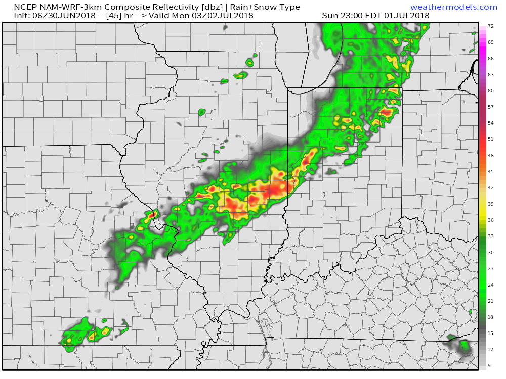
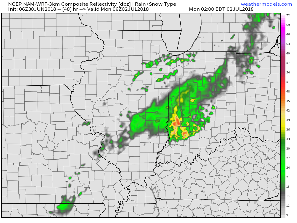
 We’ll notice thunderstorms becoming more numerous for our friends in Illinois through the afternoon and evening, but central Indiana should remain mostly dry until tonight. Forecast radar products want to bring these storms into the state after the 7p to 8p time frame. We’ll keep close tabs on radar trends this afternoon.
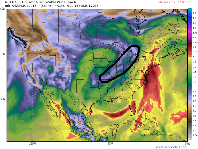
 (Again, with high moisture content, any thunderstorm that passes through your neighborhood will be capable of producing torrential rainfall). For that matter, the same story can be said with storms that develop Sunday and Monday, as precipitable water values will remain around 2″ until the front sweeps through the state.
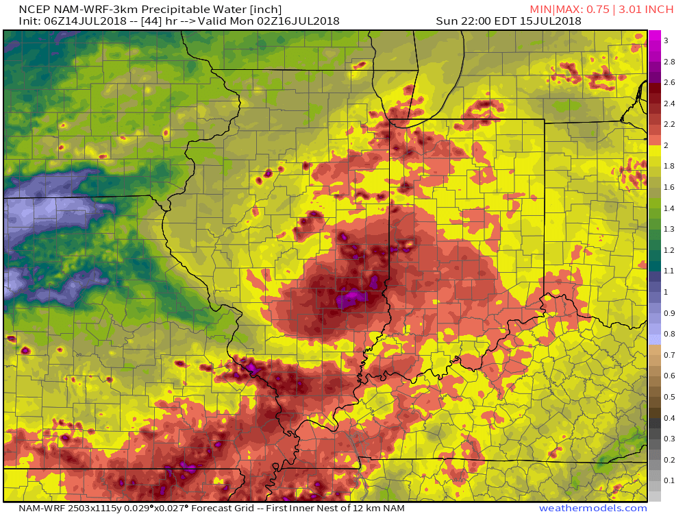
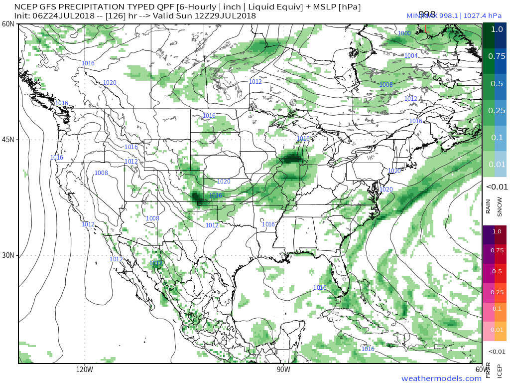
 Overall, dry conditions should prevail until late next weekend when a secondary, even stronger, front will make a run at the region. We’ll ramp storm chances back up ahead of this expected front and the air mass behind the boundary in the Week 2 time period will be even cooler than we we’ll enjoy the middle part of the upcoming week.
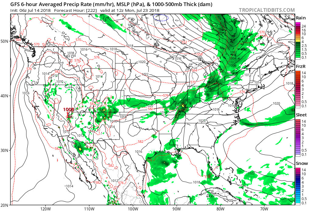 Speaking of cool, the pattern continues to look vastly different as we put a wrap on the month than what we’ve grown accustomed to over the past couple of weeks. Note the dominant trough the models show setting up shop over the Mid West…
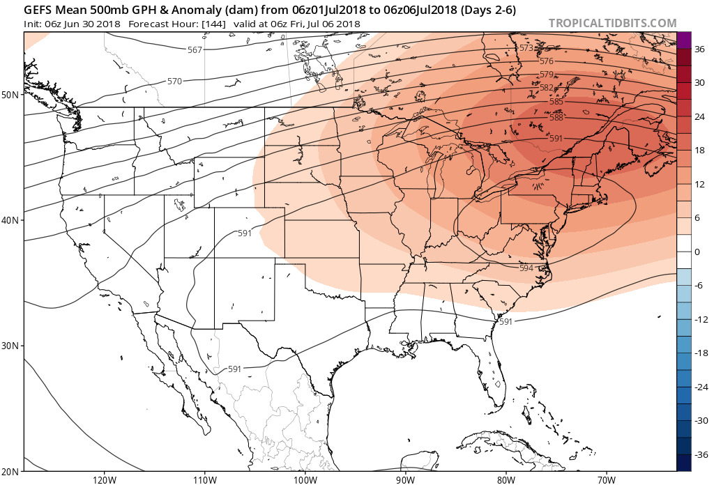
 More specific to central Indiana, daily highs in the lower to middle 90s and overnight lows in the lower to middle 70s will continue into late next week. For the most part, this is a dry pattern, as well, BUT there will be a few exceptions.
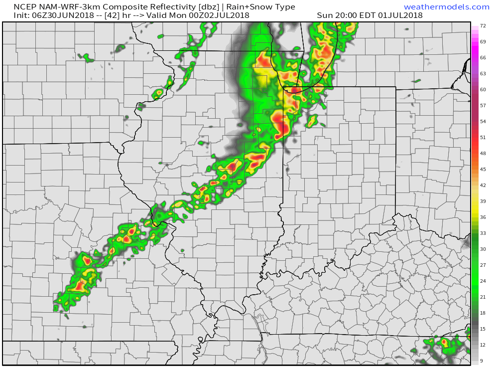
 Thereafter, additional isolated to widely scattered storm coverage is possible- primarily during the afternoon and evening hours, but more than not will remain rain-free. 7-day precipitation totals check in this morning in the 0.25″ to 0.75″ range.
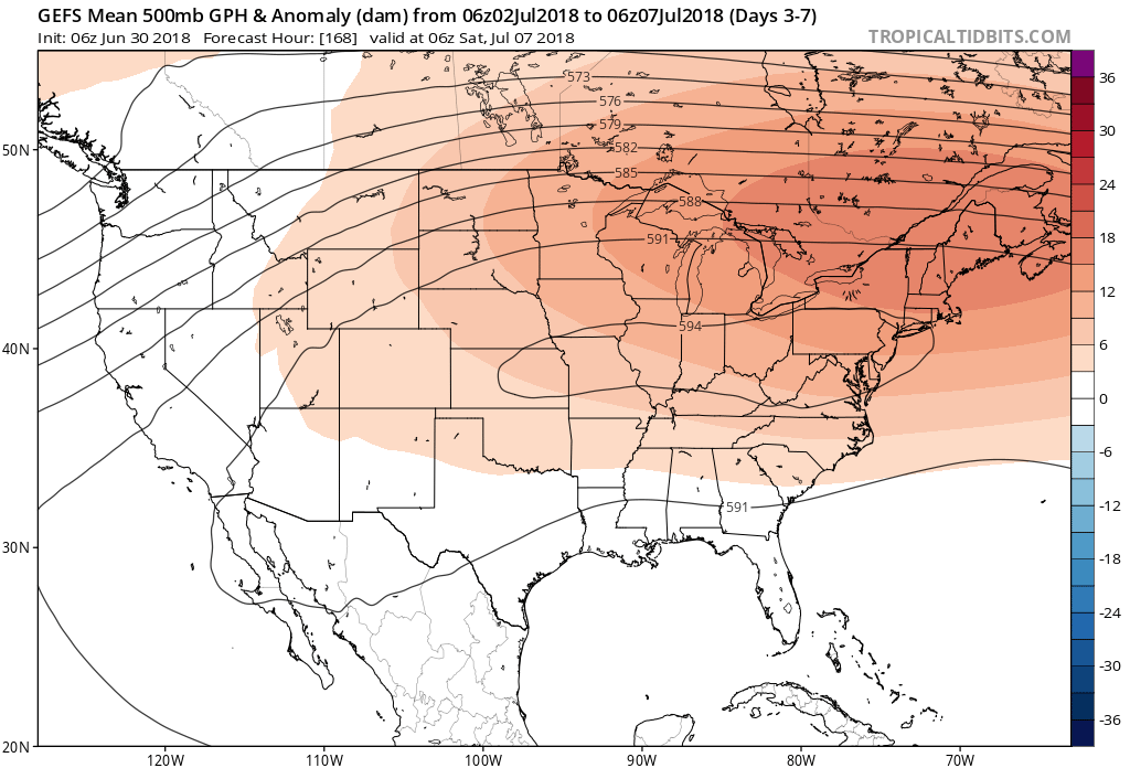

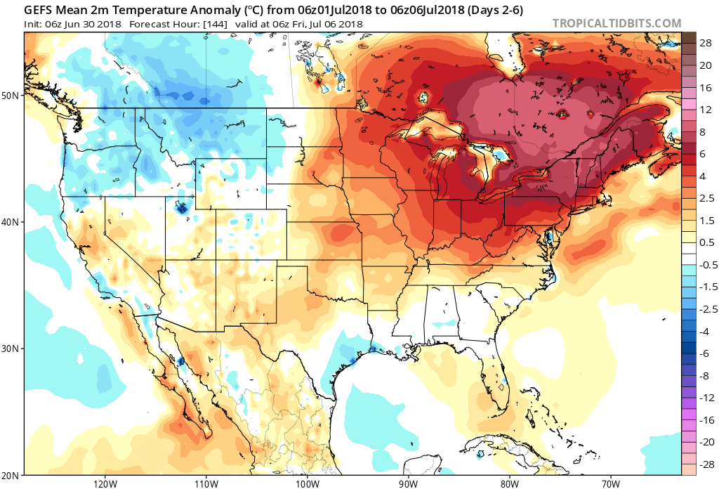
 Not only will this likely lead to a cooler second half of July, but should also offer up an increasingly active and wetter northwesterly flow for our immediate region.
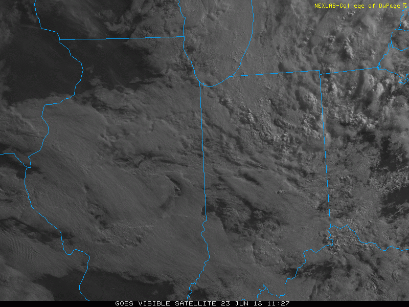 Sunshine will increase for the second half of the weekend and highs will respond- mid 80s after a refreshing start Sunday morning.
 While it’ll certainly turn more humid through midweek, the rain and storms will keep temperatures at seasonable levels. All of that changes once to Thursday and Friday as a building ridge of high pressure expands across the Ohio Valley.
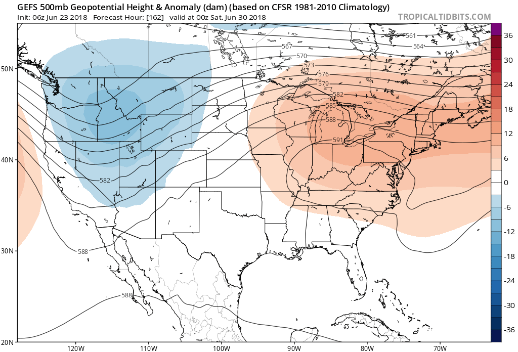 This will limit rain chances and potentially offer up the hottest air of the summer. We expect 5-6 days of low-mid 90s for highs and oppressive overnight lows in the lower to middle 70s.
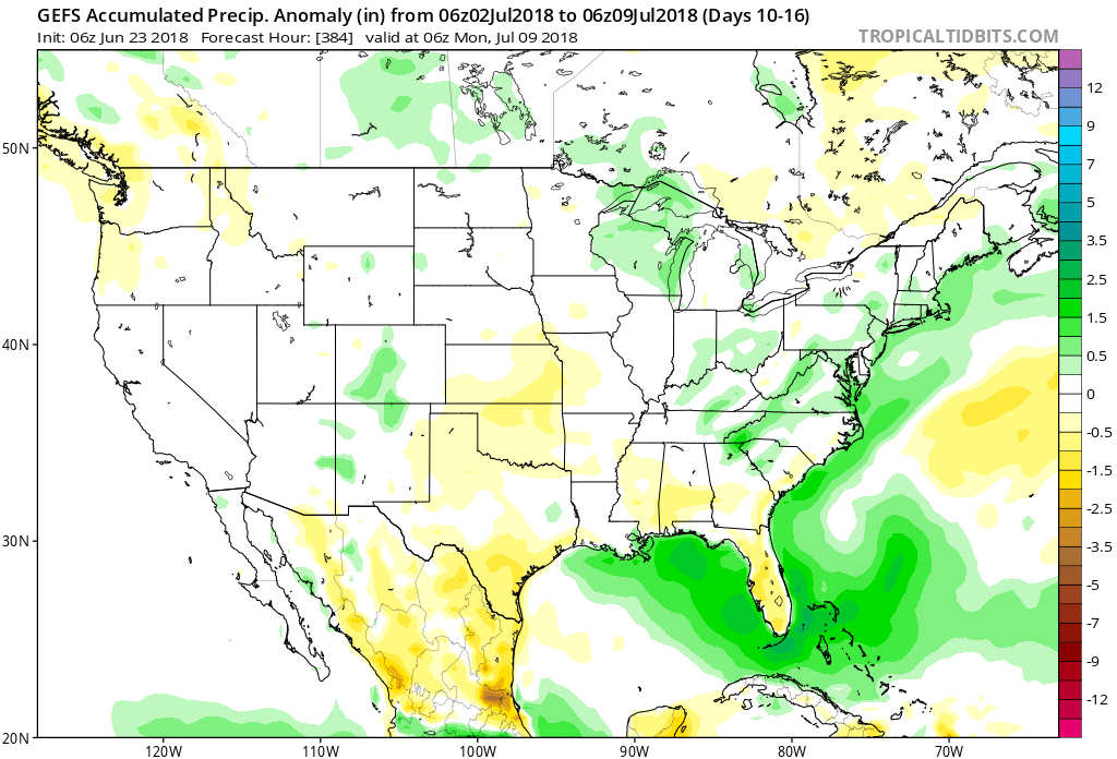
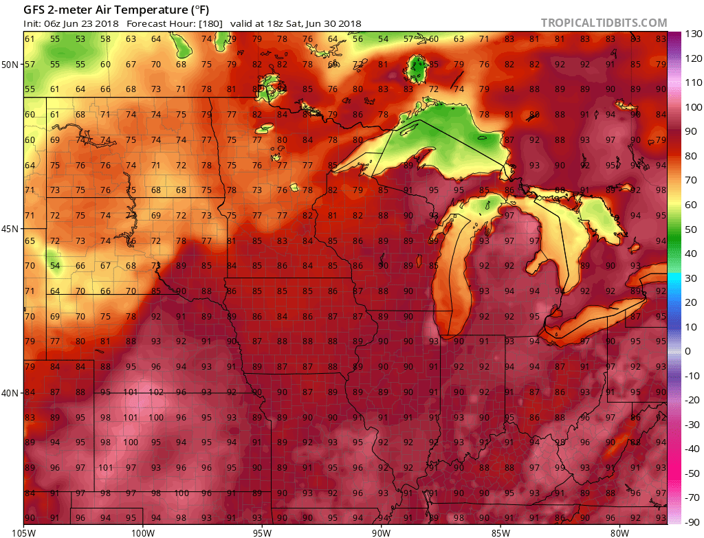 Thankfully, the hot dome will retrograde west and lead to “less hot” and increasingly stormy conditions after the first week of July. An active northwest flow pattern will take hold and provide an active time of things during this period.