Updated 02.01.24 @ 7:45a Aside from a dry back door cold front overnight, all is quiet in the weather world, locally, but changes are on the horizon around the 10th…
You must be logged in to view this content. Click Here to become a member of IndyWX.com for full access. Already a member of IndyWx.com All-Access? Log-in here.
Updated 01.30.24 @ 7:16a A weak clipper will deliver mixed showers this morning and a round of light snow showers this evening. Totals with both rounds of precipitation will be…
You must be logged in to view this content. Click Here to become a member of IndyWX.com for full access. Already a member of IndyWx.com All-Access? Log-in here.
Updated 01.29.24 @ 5:59a We’ll close January and open February with an extended stretch of unseasonably quiet (and mild) conditions. The only exception? A weak clipper that will offer up…
You must be logged in to view this content. Click Here to become a member of IndyWX.com for full access. Already a member of IndyWx.com All-Access? Log-in here.
We’ve noticed a north and western trend with respect to our storm system tonight and early Sunday morning. Before we get there, it’s another gloomy start to the day (becoming the norm, huh?!). Rain will build north into the region this evening and fall at a moderate clip at times. We still anticipate a wet snow band to develop on the northwestern periphery of this rain shield overnight and Sunday morning and the video dives in further around current thinking.
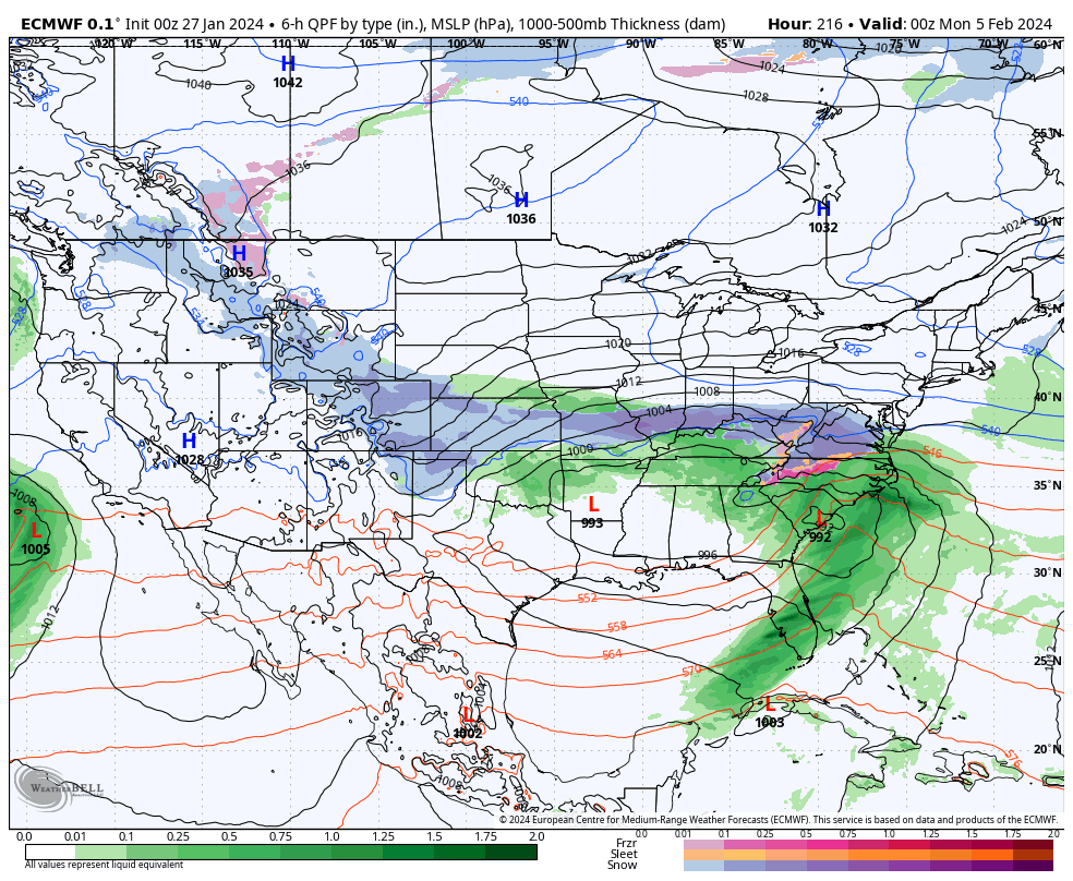
Down the road, a Hudson Bay Block will present additional challenges and the potential of another “interesting” setup late next week. This blocking pattern will help “string out” a stronger storm threat late week and force just enough cold air south where the potential of a winter storm threat will be on the increase across portions of the lower Ohio Valley region and Appalachians. More on this threat as we progress through the week ahead.
Updated 01.26.24 @ 7:38a A quiet but gloomy and unseasonably mild close to the work week can be expected before a weak system skirts the region Saturday evening into predawn…
You must be logged in to view this content. Click Here to become a member of IndyWX.com for full access. Already a member of IndyWx.com All-Access? Log-in here.