Quick video update this morning before church. A more extensive update will hit later this evening. Have a great day!
You must be logged in to view this content. Click Here to become a member of IndyWX.com for full access. Already a member of IndyWx.com All-Access? Log-in here.
We wanted to dive into some of the various ensemble data for this evening’s video. While we’re very confident on a significant storm brewing Christmas Eve, we’re much less confident…
You must be logged in to view this content. Click Here to become a member of IndyWX.com for full access. Already a member of IndyWx.com All-Access? Log-in here.
Additional showers will rotate through central Indiana during the overnight, followed by a colder mid week stretch. All eyes remain on the weekend for an impactful winter weather event across…
You must be logged in to view this content. Click Here to become a member of IndyWX.com for full access. Already a member of IndyWx.com All-Access? Log-in here.
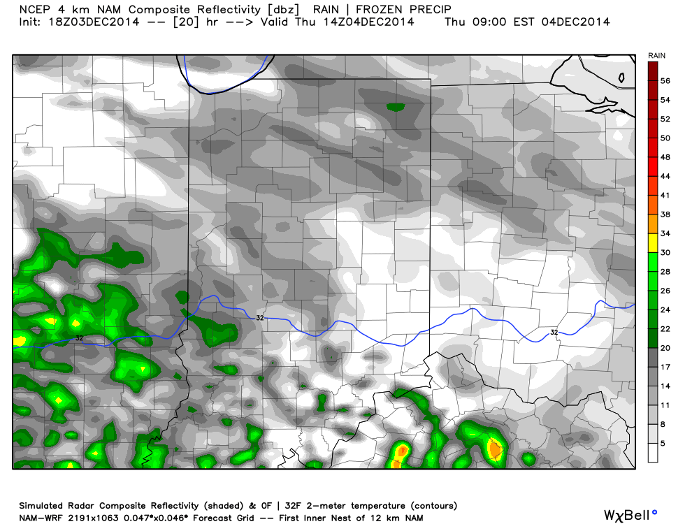
We think we’re dealing with another round of light freezing drizzle and a wintry mix for the Thursday morning commute. Plan to allow extra travel time.
Forecast radar Thursday morning suggests freezing drizzle and a light wintry mix is in play across central Indiana.
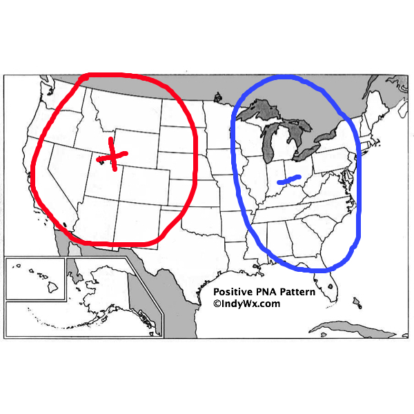
There’s some longer term data that’s in stark contrast from what a positive PNA should produce (yet alone a strong positive PNA). Typical positive PNA pattern should promote an eastern trough and associated colder than normal pattern as drawn below:
Needless to say, we disagree strongly with the NAEFS and GFS ensembles:
We cover rain chances later this week and some of the conflicting data that’s currently out there regarding amounts. We’ll post a more extensive piece about the longer range later…
You must be logged in to view this content. Click Here to become a member of IndyWX.com for full access. Already a member of IndyWx.com All-Access? Log-in here.