When we look at the “big driver” teleconnections over the next 10-14 days, it’s easy to understand why the active weather pattern is expected to continue. The NAO is expected to run predominantly negative over the next couple weeks (which favors eastern chill), but the EPO is expected to fluctuate between positive and negative phases and the MJO is showing signs of pushing into Phases 7 and 8 (favors eastern warmth this time of year).
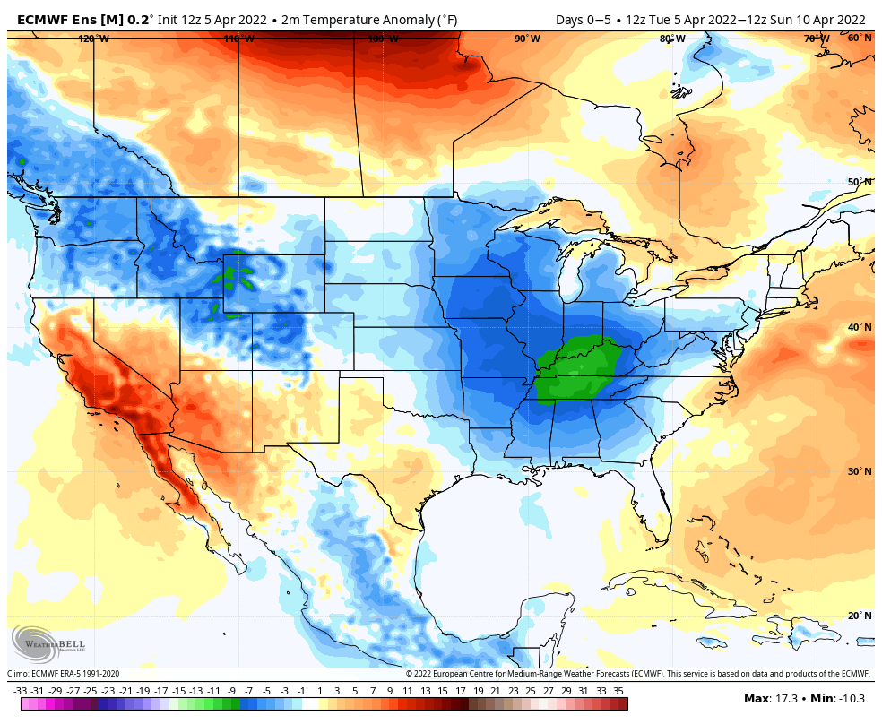
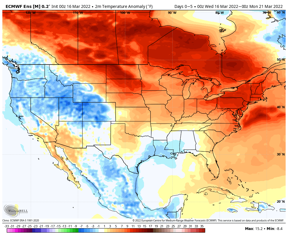
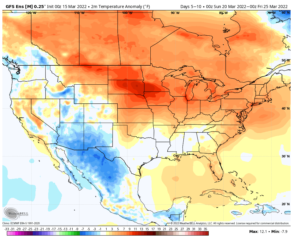
The temperature regime over the next couple of weeks will fluctuate between periods of above normal warmth and well below normal chill. Despite a significant bump in the temperature regime next week, the unseasonably chilly conditions will return with authority late next week, including the threat of frost.
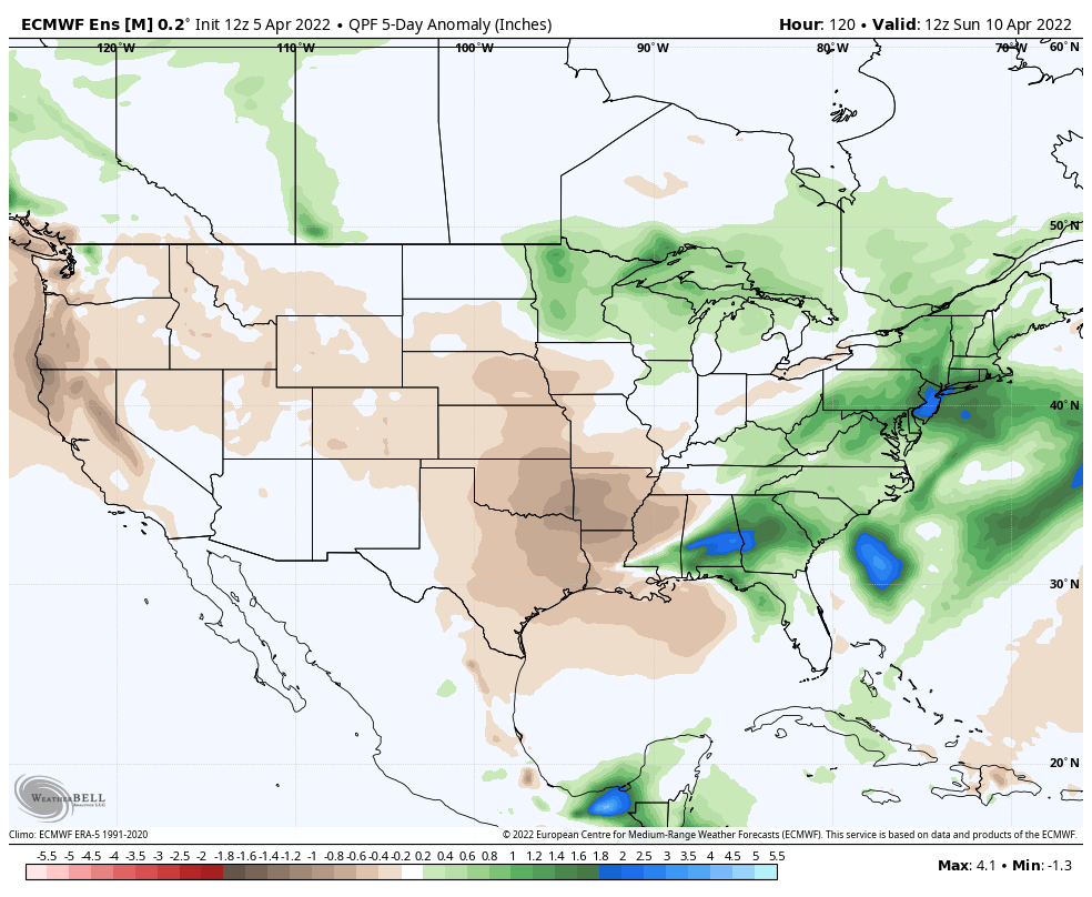
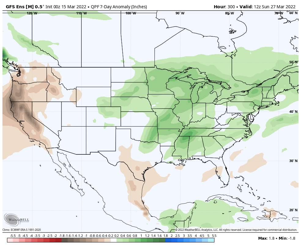
As you’d imagine in this kind of setup, the precipitation pattern will also go through a period of fluctuation. The heaviest precipitation anomalies will center in on the middle of next week through the latter part of the week and may also be met with the potential of severe weather during this time frame (targeting next Thursday for this threat, though this is subject to change as we draw closer and may have to be fine tuned).
Much more in tomorrow’s long range video discussion which will be posted Thursday night due to morning travel.
Our region will undergo a weather whiplash of sorts over the next 24-36 hours. We’ll briefly spike into the low-mid 70s with a strong southerly wind this afternoon- only to crash Thursday, including the opportunity for snow showers by evening.
The “transition” will be met with rain and storms tonight. The Storm Prediction Center (SPC) includes southern Indiana in a “slight” risk of severe weather and this is for storms that will arrive this evening. The primary concern from a severe perspective is damaging straight line winds. The idea here is that the approaching line of storms may include a couple “bowing” segments across southern Indiana (along and south of a line from Terre Haute to Bloomington) roughly between 7p and 10p west to east.
Temperatures will then fall through the day Thursday and wrap around moisture will begin to mix with and transition to wet snow showers Thursday evening into Friday morning… (Remember, we’re only the messenger).
While relative warmth will dominate headlines in the short-term, there’s plenty of reason not to buy into the idea that we’re finished with the chilly late winter temperatures just yet.
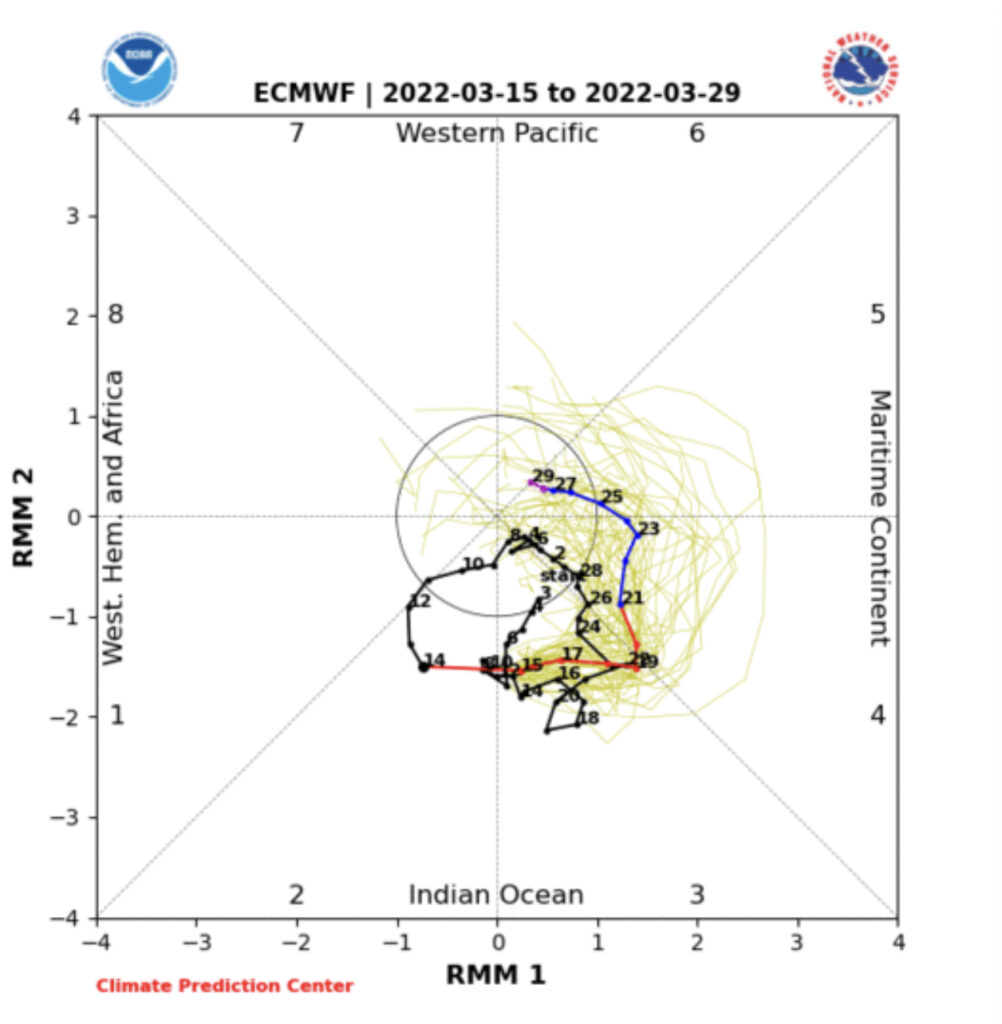
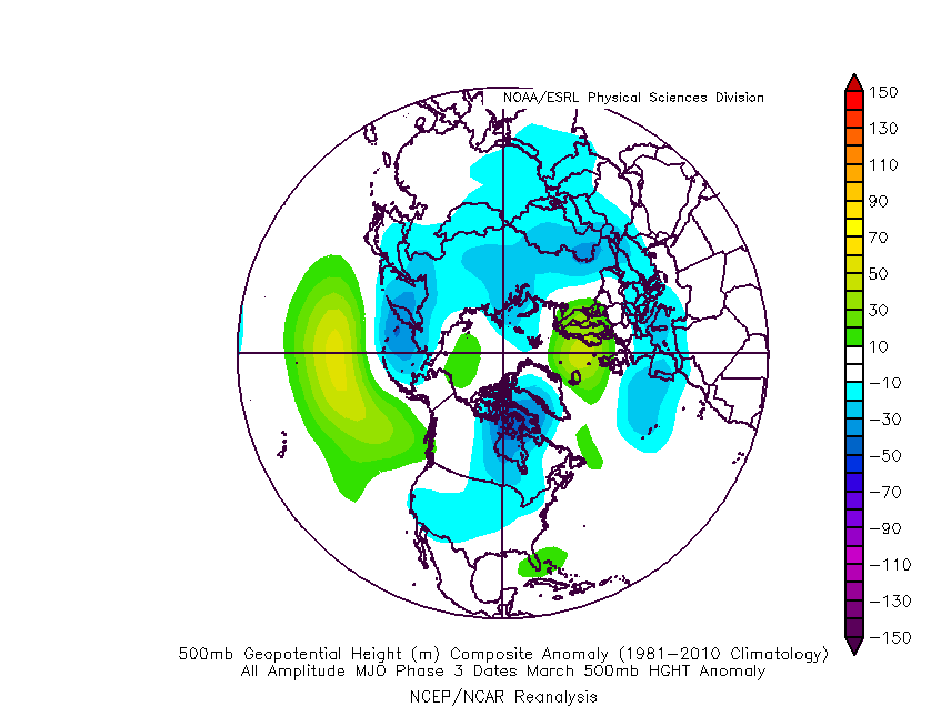
First, let’s start with the MJO. We’re in Phase 2 now, but what is most intriguing is the duration spent in Phase 3 (favors a pressing trough east and south similar to what image 2 shows below).
Should the MJO continue to move forward with similar amplitude then milder conditions would prevail as we get set to wrap up the month.
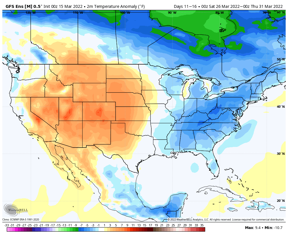
By that point, however, we’ll have to pay particularly close attention to the EPO and NAO phases. There are growing signals that both teleconnections will favor a return of colder than normal conditions prior to closing out the month. Couple that with the MJO movement and confidence continues to increase that we aren’t quite finished with the chill just yet. The question then becomes what takes place in April? We’ll lean into that with more detail during tomorrow’s update.
It’s important to enjoy the relatively quiet times this week as all indications point towards an active stretch before wrapping up the month. Of course we’ll have to contend with the late week system that will move through Friday (still looks like a 0.50” producer for most) but there are likely far more significant storm systems that loom the following week.
This is all part of what continues to look like a setback to cooler than normal conditions by late month. The duration of such will ultimately be up to the EPO, NAO, and MJO as we rumble into April. Before we get to that point, plan on more significant and moisture-laden storm systems impacting the region (first of which likely arrives Tuesday into Thursday of next week).
Above normal precipitation is expected Week 2.
The wetter pattern is a byproduct of the “fight” from short and medium range warmth and longer term cooler anomalies returning prior to wrapping up the month.
Updated 02.22.22 @ 5:21p I. After digesting the 12z model suite, it continues to look like an impactful winter event is still slated to impact the state Thursday and into…
You must be logged in to view this content. Click Here to become a member of IndyWX.com for full access. Already a member of IndyWx.com All-Access? Log-in here.