Tuesday Evening Weather Notebook…
It’s been a cool and dry start to the month of September. Through the first few days, IND is running 0.70° below normal and 0.44″ below average precipitation.


The upper ridge currently in place will deliver more late summer heat through the end of the work week. It’ll remain mostly dry, as well.


Much better rain and storm chances will have to be built into our forecast Friday into Saturday, courtesy of a cold front moving into the region.

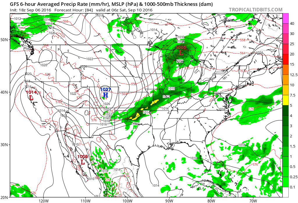

A much cooler regime will settle into the region over the weekend. Highs behind the front in the 70s with lows in the 50s will be common- after rain potential of 1″-1.5″ for most.


A reinforcing shot of cool air will arrive the middle of the following week. Early indications suggest the second shot of fall-like air will be even cooler than this weekends’ and could feature widespread 40s at night.
 It’ll be a downright hot week, as well. Temperatures will top out around 90 through the end of the short work week.
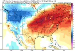 As we rumble into next weekend and the following week indications continue to point towards wetter and cooler times.
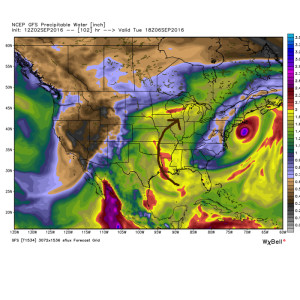
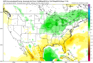 Early numbers off the press suggest 1″-2″ rains possible next weekend.
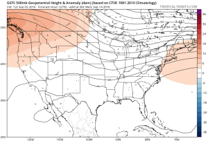 It’s possible the first push of widespread 40s loom around the middle of the month. Time will tell…
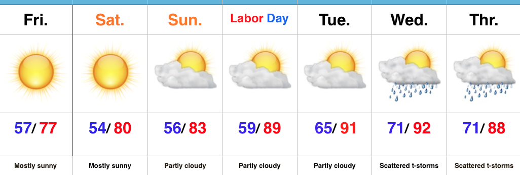
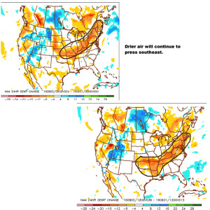 You’ll definitely notice the drier, crisp feel to the air upon stepping outside this morning. If you try hard enough, you can almost smell fall! 🙂
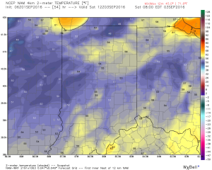 We know this is the beginning of the transitional time of the year. Eventually, these cold fronts will back more and more of a punch as we rumble deeper into fall. On the flip side, summer isn’t ready to go away without a fight. In fact, temperatures well above normal will return for Labor Day, itself, and continue into the majority of next week. A string of highs in the upper 80s to lower 90s will be common next week.
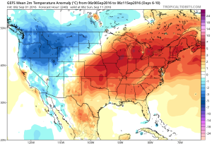 Longer term, there are indications that continue to support the idea of a potentially more significant cool down around mid September. Stay tuned…