You must be logged in to view this content. Click Here to become a member of IndyWX.com for full access. Already a member of IndyWx.com All-Access? Log-in here.
Category: Unseasonably Warm
Permanent link to this article: https://indywx.com/tuesday-evening-video-discussion/
Feb 15
Monday Evening Rambles…
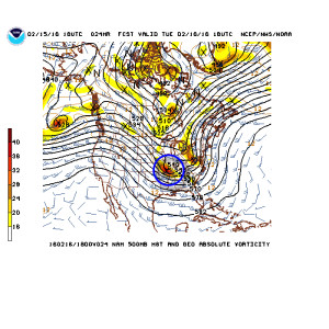
1.) Tuesday’s upper air disturbance looks to track further and further SW with each and every passing model run. While we’ll keep an eye on things, it’s apparent that best snow chances will be across far SW counties, and even that may be generous (this thing is tracking much further west than what appeared a couple days ago), courtesy of NCEP.
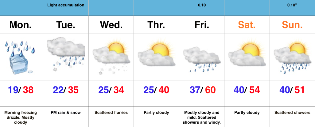
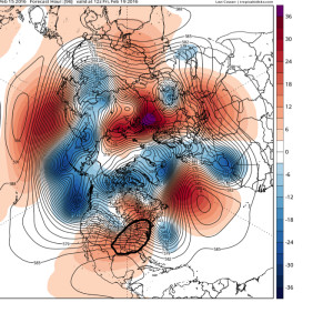
 2.) A significant warm-up is still on schedule for late week, centered on Friday, where temperatures will likely push to, or exceed, 60 degrees as ridging builds in. Image courtesy of Tropicaltidbits.com.
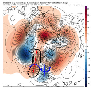
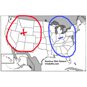
 3.) The warmth will be brief, however, as a colder pattern returns (thank you positive PNA), including an interesting look for winter storm potential across the east days 8-10. (No need to get fancy with specifics at this juncture).
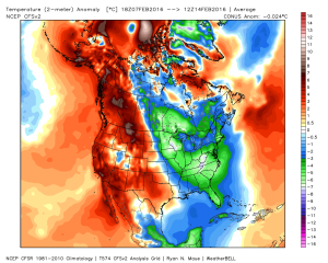
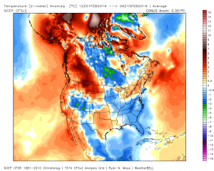
 4.) The significant cold over the past 7 days has really eaten away at the warm start to the month, courtesy of Weatherbell.com.
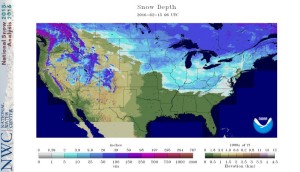
 5.) Nearly 44% of the Lower 48 is snow covered at present. That compares to 25.6% of the Nation covered in snow for the same time last year.
Permanent link to this article: https://indywx.com/monday-evening-rambles-2/
Feb 14
Messy Monday Morning Commute; Watching Tuesday…
- Freezing drizzle to start the day
- Watching another storm system Tuesday
- Mild and windy close to the week
Messy Monday Morning Commute; Watching Tuesday…After the snowy Valentine’s Day across the region, we’re concerned freezing drizzle will develop and add to what already will be a slick commute in spots overnight and Monday morning. Allow extra drive time and take it slow.
Attention will quickly shift to Tuesday as a vigorous piece of upper level energy dives southeast. We have to fine tune the track later Monday, but this has the potential to spread a swath of accumulating snow over portions of the state Tuesday afternoon and evening. Stay tuned.
We turn windy, but much milder to wrap up the work week. Friday and most of the weekend will feature a taste of spring as a strong SW flow takes hold and helps pump well above normal temperatures into the area. Don’t get used to the mild air, as cold will return to wrap up Feb and head into March.
Interested in our consulting services? E-mail bill@indywx.com for more information.
Permanent link to this article: https://indywx.com/messy-monday-morning-commute-watching-tuesday/
Feb 12
Bitterly Cold; Accumulating Sunday Snow…
- Bitterly cold
- Light accumulating snow Sunday
- Active pattern continues, but with questions
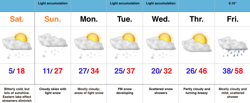
Bitterly Cold; Accumulating Sunday Snow…We label the cold that we’ll deal with Saturday “hurt your face” cold. It’ll be a bitter day with lows in the lower-mid single digits (even some areas below zero), a biting NW wind, and AM lake-generated snow streamers across eastern portions of the state. Bundle up, friends!
We still track accumulating snow for Valentine’s Day. Clouds will lower and thicken Sunday morning and snow should overspread the area as we progress into the late morning hours. The potential of a plowable snow still looks good from this distance, and we’ll have our initial snowfall map out later Saturday (want to get a look at the full 00z suite before issuing).
Right on the heels of Sunday’s snow maker will be another disturbance Tuesday. Modeling differs on the track (surprise, surprise ;-)), but the potential is there for additional accumulating snows Tuesday into Wednesday. Stay tuned.
After a final disturbance Wednesday (with light snow potential), we’ll see a marked wind shift to the south to close the week, followed by a brief, but impressive, surge of milder air.
Permanent link to this article: https://indywx.com/bitterly-cold-accumulating-sunday-snow/
Feb 04
Not A Bad Weekend; Winter Returns Next Week…
- Nice close to the work week
- Enjoy a mild weekend
- Much colder next week with snow
Not A Bad Weekend; Winter Returns Next Week…Weak ridging will be with us as we close out the work week. This will supply a very nice Friday, after some freezing fog concerns in spots early.
The upcoming weekend will feature a weak weather maker scooting through here Saturday and that could have just enough “umph” to produce a flurry or sprinkle. Otherwise, look for mild weather for Super Bowl weekend. Enjoy it!
A cold front will push through the region late Sunday. A band of moisture will likely accompany this front- rain to snow type deal. As we move into early and mid next week, the weather pattern will be dominated by strong western ridging and a significant eastern trough. Models will likely continue to struggle handling the specifics concerning timing and strength with the individual disturbances and we’ll have to keep a close eye on early to mid next week moving forward. As it stands now, we think most widespread snow showers/ squalls come Monday into Tuesday.
Permanent link to this article: https://indywx.com/not-a-bad-weekend-winter-returns-next-week/

