Wet To White (At Times) Through Early Week…
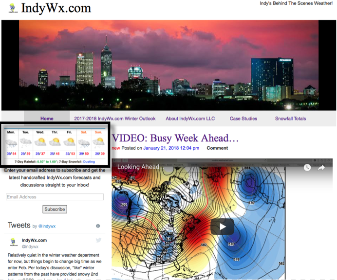
A quick note before we dive into the upcoming forecast pattern. Instead of issuing 7-day posts within the blog format, the most updated IndyWx.com 7-day forecast will now be featured at the top left of the site. We’re continuously trying to provide you the information and content you need in a quick and concise manner- eliminating having to “scroll and search” (unless you’re bored, of course ;-))!
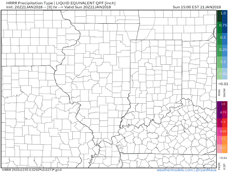
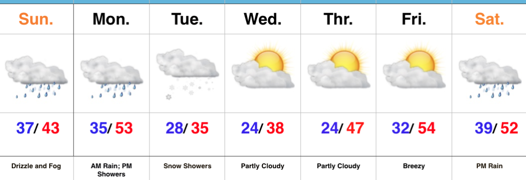
 Areas of fog and drizzle will continue this evening before a stronger southwesterly air flow pushes the low clouds and fog north during the overnight. As a cold front draws closer, steadier rains and perhaps even a clap of thunder (especially down state) will arrive Monday morning. Temperatures will remain nearly steady or even rise overnight into the lower 50s.
 The frontal passage, itself, will take place Monday evening and may feature a couple of gusty showers, especially across western and central portions of the state.
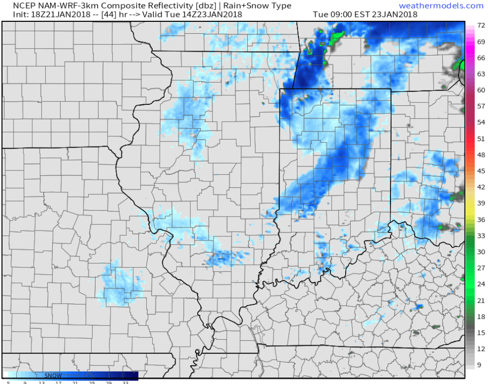
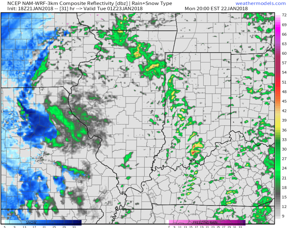 Temperatures will grow colder Monday night into Tuesday morning and precipitation will end as snow showers Tuesday.
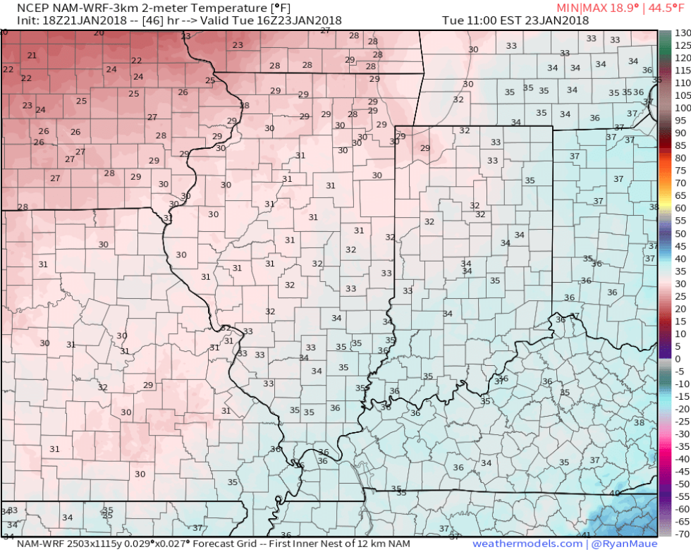
 High pressure will build in through midweek and provide dry conditions with increasing sunshine. The midweek stretch will begin seasonable before warming ahead of our next storm system.
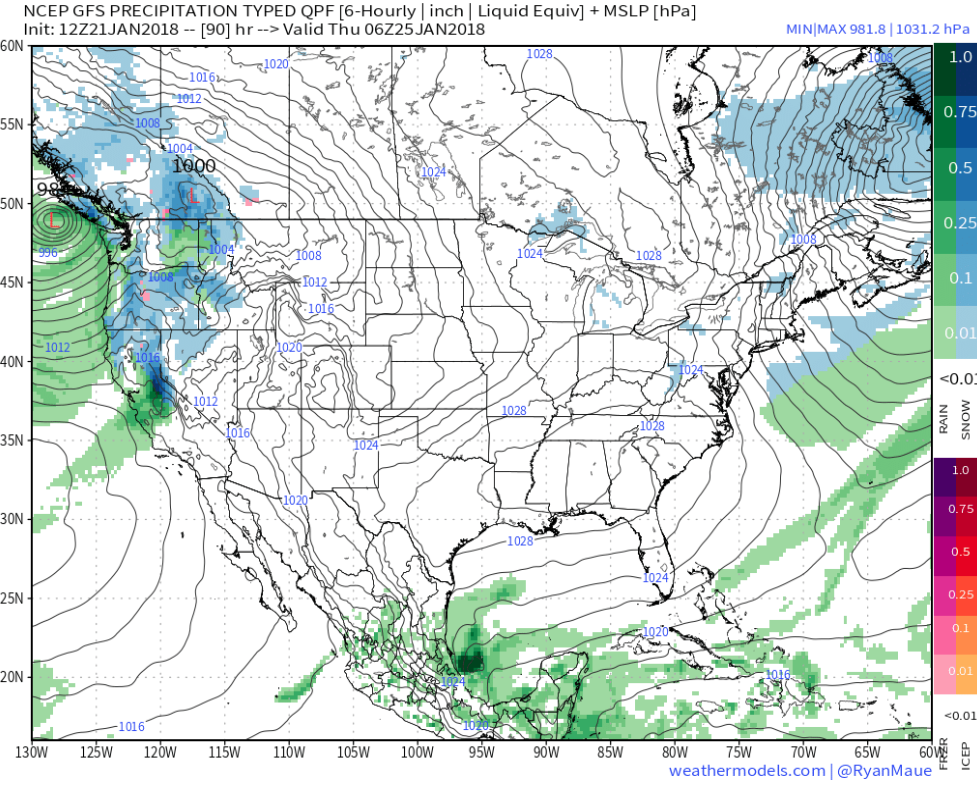 That next storm system will deliver rain as early as Friday evening into Saturday. We’ll note an increasingly gusty southwesterly breeze as we wrap up the work week, along with increasing cloudiness.
 Highlights:
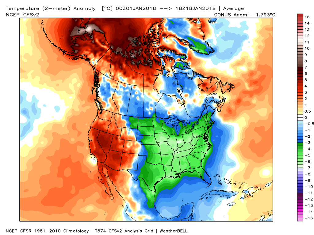
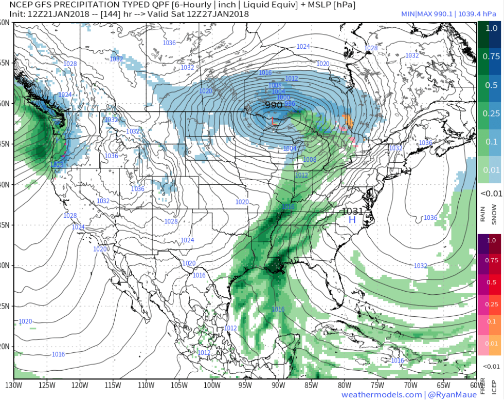
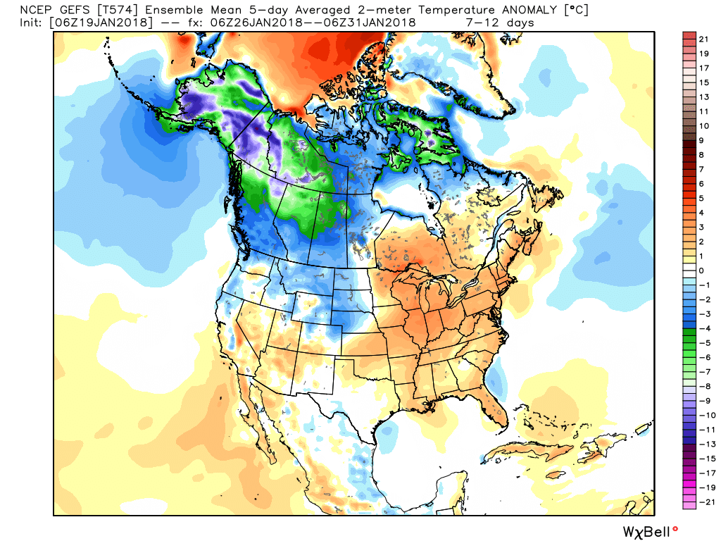
 However, big changes begin to take place this weekend and will remain intact for the majority of the next couple weeks. The mean trough position will back into the west while ridging takes hold across the east. This will feature temperatures that will push to above average values and lead to an active and moist southwesterly flow.
 Over the upcoming (10) days, temperatures may reach 50°, or greater, on 3 to 4 of those days. Compared to how frigid we’ve been (already had 7 mornings this month with sub-zero lows), this will feel like a heat wave.