Stormy For Some This Morning; Transient Pattern Into August…
You must be logged in to view this content. Click Here to become a member of IndyWX.com for full access. Already a member of IndyWx.com All-Access? Log-in here.
You must be logged in to view this content. Click Here to become a member of IndyWX.com for full access. Already a member of IndyWx.com All-Access? Log-in here.
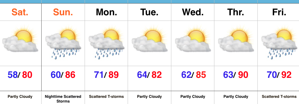 Highlights:
Refreshing Feel…A weak disturbance is tracking through central IN this morning with a band of clouds and a couple sprinkles. That said, sunshine will quickly return late morning into the afternoon and set up a beautiful day, along with pleasant temperatures and low humidity.
Our next round of storms will arrive from the NW late Sunday night into Monday. A few of these storms could be strong to severe and also include locally heavy rain.
Modeling disagrees on the magnitude of cooling and drier weather behind Monday’s front. The more aggressive GFS would imply another push of pleasant air for a couple days Tuesday-Wednesday, while the European isn’t as bullish. For now, we’ll split the difference and revisit tomorrow.
One thing that modeling does agree on is building late week heat. Expect a hot, humid close to the work week.
Upcoming 7-Day Precipitation Forecast:
You must be logged in to view this content. Click Here to become a member of IndyWX.com for full access. Already a member of IndyWx.com All-Access? Log-in here.
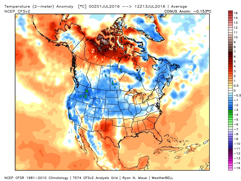
We’ve been relatively spoiled so far this summer- both in regards to temperature and precipitation. That said, as we approach the second half of July, things appear to be changing for the hotter and drier side of things.
July, so far, has been very pleasant, locally. BTW- another push of drier air is inbound that should lead to a nice weekend, including low humidity values.
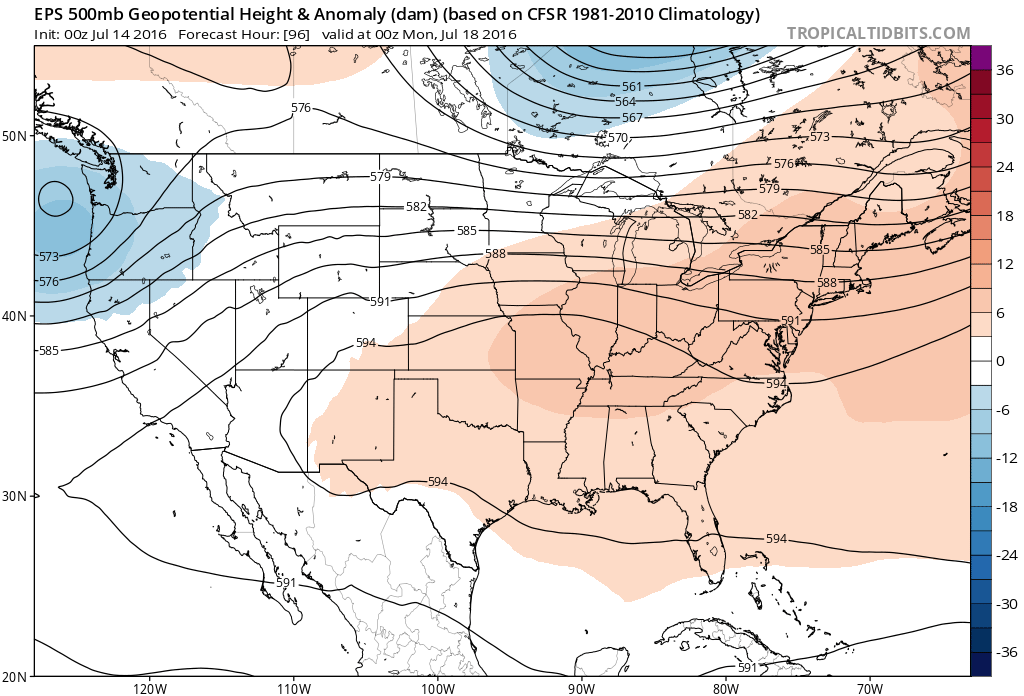
 Ensemble data continues to suggest that the mean ridge position (hot dome) develops over the eastern portion of the country early next week before slowly retrograding northwest with time.
 By the middle and latter portions of next week, the hot dome is set up in a position that will yield an extended stretch of hot temperatures across the state, including multiple mid-90 degree highs across central IN.
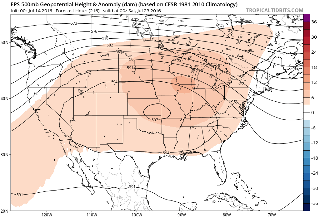
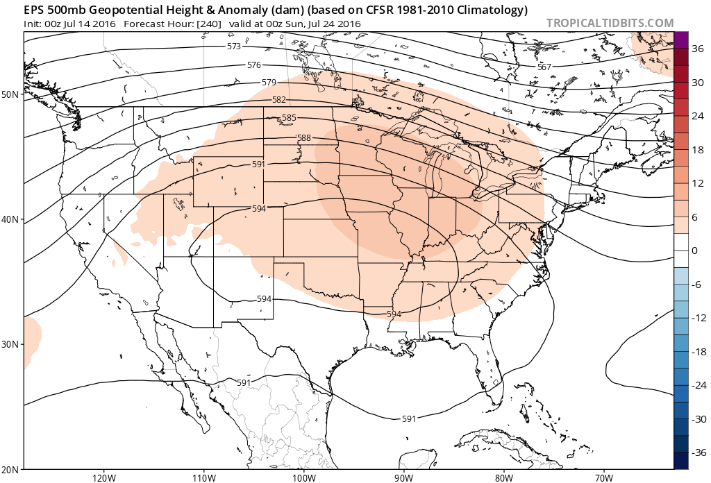 Given the current look of the ridge position, this would also be a rather dry pattern, as well, as the storm and rain track would shift north across the Canadian border into the northern Great Lakes states. (Follow that 588 line above for a good indicator of the storm track).
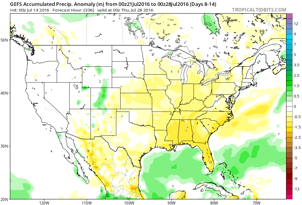 One always has to be careful in trying to predict the timing of the ridge breaking down/ overall placement this time of year (models can struggle), but for now it appears as if we really heat things up and dry things out as we move through next week- especially the middle and latter portions of the week.
 Highlights:
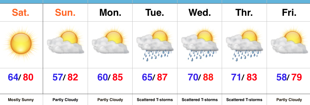
Sunglasses Required…What a great feel we’re greeted with out there this morning! Low humidity and pleasant temperatures will be with us through the weekend, along with lots of sunshine. Sunday morning will feature many neighborhoods in the middle to upper 50s across central IN. Mid-July, what?! 🙂
Moisture will slowly return as we back our air flow around to the SW early next week. Additionally, we’re tracking multiple disturbances mid week that will promote increased chances of thunderstorms.
An early look at late week shows potentially another push of dry and cool air to set-up a beautiful close to the work week. We’re getting spoiled.
Upcoming 7-Day Precipitation Forecast: