Even Cooler Next Weekend: Early Taste Of Autumn…
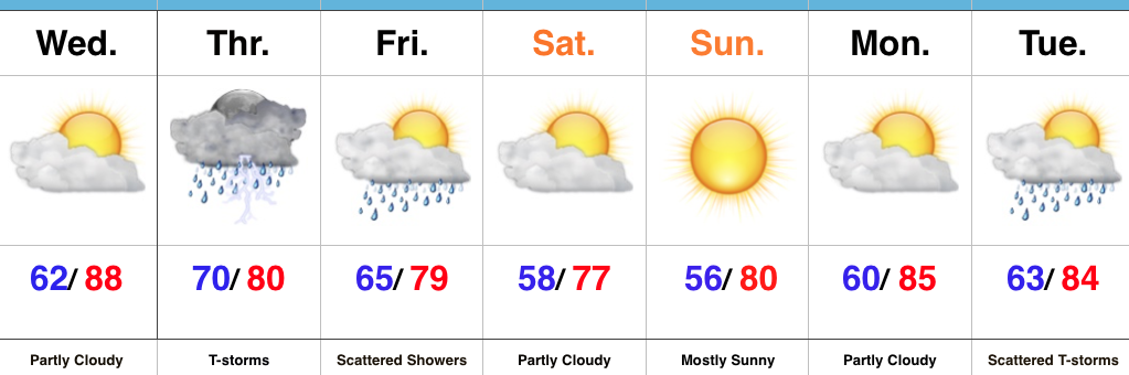
The weather this weekend has been simply stunning. We’ve enjoyed unseasonably cool and refreshing air to go along with wall-to-wall sunshine. If you’re a fan of the unseasonably refreshing conditions, you’re in luck, as another blast of September-like air will arrive next weekend.
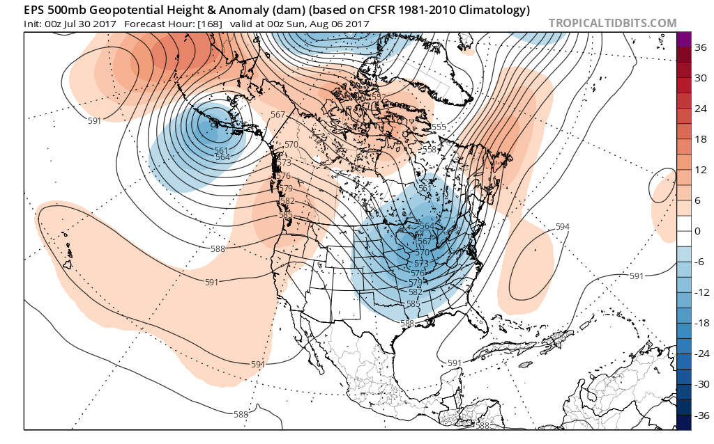
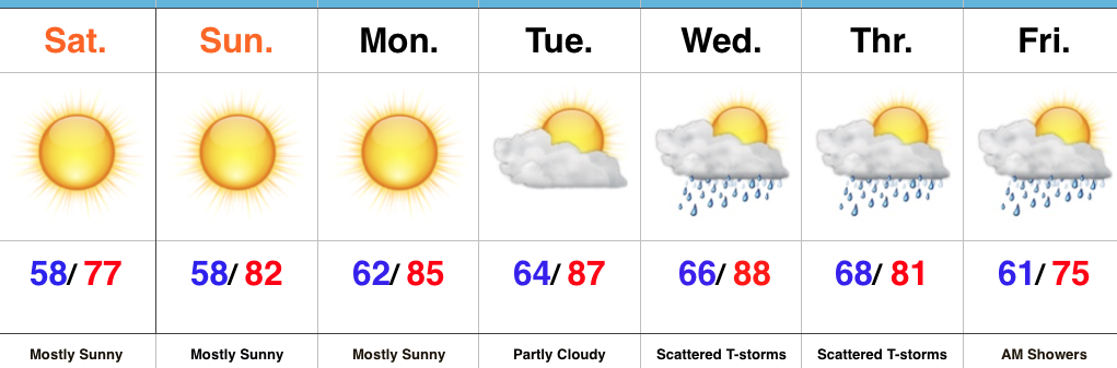
A cold front will sweep through the state Friday morning. While we’ll handle the specifics from a precipitation perspective in later posts, most widespread showers and thunderstorms appear to arrive Thursday. A deep trough will take up residence across the Mid West and East next weekend and result in temperatures more like late-September that early-August.
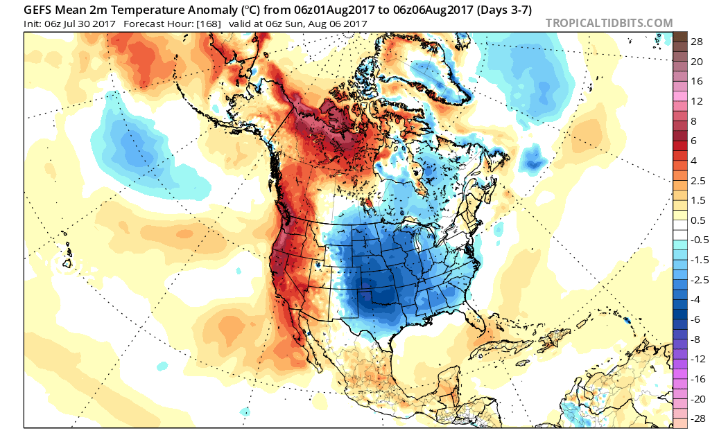 Look for fairly steady or slowly falling temperatures Friday afternoon (how often can we say that in early August?!) along with a gusty northwest breeze. That will set the tone for the weekend that will include low temperatures in the lower to middle 50s and highs in the middle 70s. Unlike this weekend, we’ll have a few more clouds and the threat of a passing shower with enough upper level energy around.
Much more later! Enjoy your Sunday, friends!
 Highlights:
 Week 2:
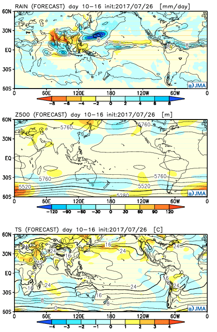 Weeks 3-4:
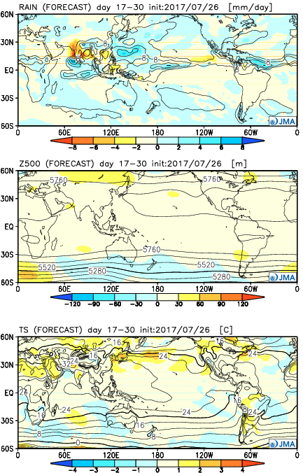
 Highlights: