 Highlights:
- Evening light rain
- Clipper watch
- Mild weekend ahead
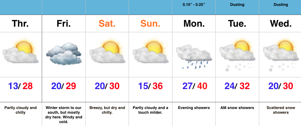
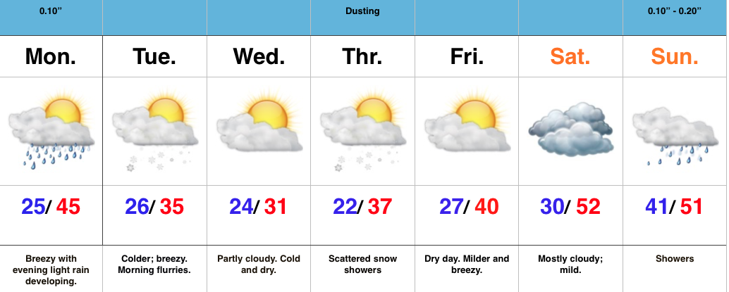
Evening Showers…A weak cold front will press through central IN tonight. Moisture return isn’t impressive with this system, but light showers will scoot through the area this evening. Rainfall amounts won’t add up to much.
A few flurries may fly Tuesday morning as cold air moves back into the area. Temperatures during the day time Tuesday will be below freezing for the most part after a predawn high.
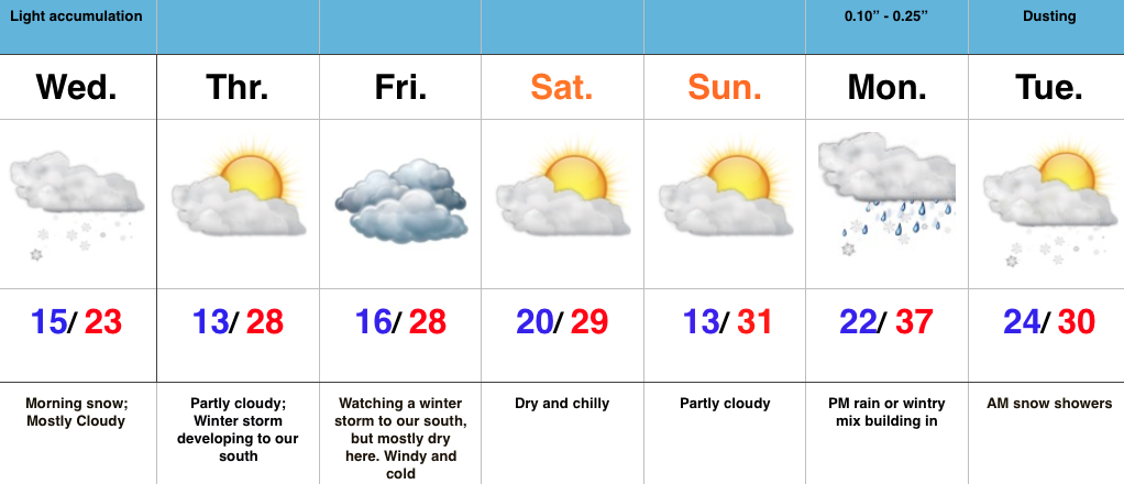
Forecast models still disagree with the overall track of a clipper system Thursday. The GFS and European models don’t suggest we deal with any snow, whatsoever. Meanwhile, the Canadian model remains consistent on Thursday snow showers. Either way, this shouldn’t be a big deal. We’ll keep an eye on things.
The weekend will shift unseasonably mild as we get into a strong SW flow. We’ll eye a developing strong storm across the Plains early next week…