Category: Unseasonably Cool Weather

Chilly Pattern…

Screen Shot 2016-04-04 at 8.45.32 AMHighlights:

  • Prolonged unseasonably chilly pattern
  • Mid week thunderstorms
  • Snow flurries and another hard freeze late week

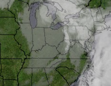
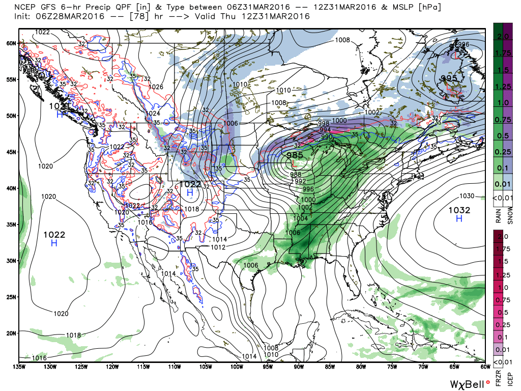
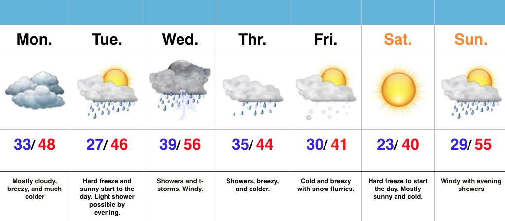
Have The Jackets And Sweaters Handy…A cold front slipped through central IN this morning and a NW wind shift is already doing the “dirty work” in delivering a much colder air mass to greet us out the door this morning.  Get used to it, as a very chilly week is on tap!

A hard freeze will occur tonight as skies turn mostly clear and winds diminish.  Tuesday will dawn sunny, but clouds will increase late and a light shower is possibly by the evening hours.

Better coverage of showers and thunderstorms will push into the region Wednesday morning.  While it’ll be briefly warmer (still slightly below average though), don’t get used to it.  Much colder air will be with us to wrap up the work week.

A secondary push of late season arctic air will blow into town Thursday with showers before transitioning to snow flurries/ scattered snow showers Friday morning.  The coldest morning in this late season chilly pattern looks to arrive Saturday morning, including widespread lower 20s.

Permanent link to this article: https://indywx.com/chilly-pattern/

Unseasonably Chilly, Active Pattern…

Screen Shot 2016-04-02 at 9.39.00 AMHighlights:

  • Busy, active pattern
  • Unseasonably cool
  • Multiple hard freezes ahead

Fast-Moving Weather Pattern…The upcoming forecast period will feature multiple fast-moving weather systems in an almost every other day format.  It’s an unseasonably chilly pattern, as whole, as well.

Saturday has opened with plentiful sunshine, but clouds will quickly increase and winds will turn strong (50+ MPH gusts) as we progress into the afternoon.  Batten down the hatches.  A few showers will accompany those clouds and some small hail is also possible with a few “stronger” showers.  As colder air pours in this evening, widely scattered snow showers will impact north-central IN.

A hard freeze will take place tonight into Sunday morning.  High pressure will briefly supply a mostly sunny day Sunday, but our next system will approach late Sunday night.  Consequently, SW winds will turn strong and gusty late Sunday and a broken band of showers will be associated with reinforcing chilly air late Sunday night into the pre dawn hours Monday.

A more significant storm system will arrive on the scenes mid week and feature more widespread rains Wednesday (perhaps an embedded thunderstorm, as well).  As a cold front slides through here Thursday, MUCH colder air will push into central IN and transition lingering left over moisture into scattered snow showers/ flurries late Thursday night into early Friday morning.  Friday certainly won’t feel much like April around these parts…

Permanent link to this article: https://indywx.com/unseasonably-chilly-active-pattern/

Chilly Open To April…

The overall weather pattern is transitioning to open April and the end result will be a colder than average time of things for the better part of the first half…

You must be logged in to view this content. Click Here to become a member of IndyWX.com for full access.  Already a member of IndyWx.com All-Access?  Log-in here.

Permanent link to this article: https://indywx.com/chilly-open-to-april/

Clouds Slowly Diminish Today; Rain Returns Mid Week…

It’s a much cooler and overcast start to the work week.  A quick snap shot of the morning satellite shows a stubborn low cloud deck that will slowly erode as we progress into the back half of the day from west to east.

Screen Shot 2016-03-28 at 8.02.27 AMChilly high pressure will settle over the region through the early week and provide drier conditions.  Temperatures will fall to frosty levels tonight (30-32 degrees for most).

1

4Our air flow will back around to the SW Wednesday into Thursday and this will transport warmer, more moist air northward.  As such, rain chances will begin to go up late Wednesday into Thursday.

2

3Rainfall amounts don’t look particularly impressive from this distance (0.50″-0.75″), but we’ll continue to keep an eye on things.

A secondary cold front will move through the region to close the work week and send much cooler air south.  The good news?  While still colder than normal, model trends haven’t been as cold in recent runs.  We still think multiple nights of sub-freezing temperatures are ahead, but the “absurd cold” looks to remain to our north/ northeast as of now.

Permanent link to this article: https://indywx.com/clouds-slowly-diminish-today-rain-returns-mid-week/

Saturday Morning Video Update…

We open the forecast period dry and pleasant, but we turn stormy late Easter Sunday and MUCH colder air still looks to arrive as we welcome April.  Details can be…

You must be logged in to view this content. Click Here to become a member of IndyWX.com for full access.  Already a member of IndyWx.com All-Access?  Log-in here.

Permanent link to this article: https://indywx.com/saturday-morning-video-update-4/