Growing Severe Threat Sunday…
We have growing concerns of a severe weather event Sunday afternoon and evening across the state. This morning, the Storm Prediction Center (SPC) has included most of Indiana in an “Enhanced” risk of severe weather. From this distance, all modes of severe weather seem possible, including large hail, damaging winds, and even a tornado or two.
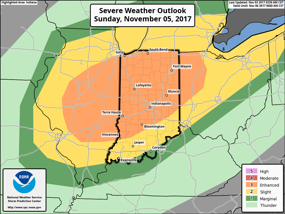 A trough and associated cold front will slice into an unseasonably warm and increasingly moist air mass Sunday. Ahead of the approaching front, temperatures should climb into the lower 70s Sunday afternoon (average high is in the upper 50s) and dew points will reach the lower to middle 60s. While the developing surface low isn’t expected to be terribly strong, as this feature moves northeast, it’ll help drag a cold front into this warm and increasingly unstable air mass late Sunday. From this distance, conditions seem favorable for a couple of super cells to develop Sunday afternoon and evening. We’ll have to keep a close eye on the northward extent of the warm front as this would be the areas of greatest concern for potential tornadic activity Sunday afternoon. Large hail and damaging winds are also included in Sunday’s severe threat. We’re in the second severe weather season, after all, and this kind of event isn’t unusual. Late November 2013 comes to mind.
It’ll be important to remain weather-aware Sunday and stay tuned all weekend for future updates. We’ll transition to a much cooler regime (back to below average) next week.

 Highlights:
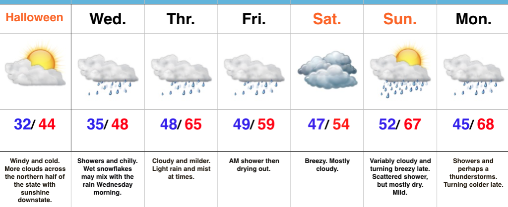 Highlights:
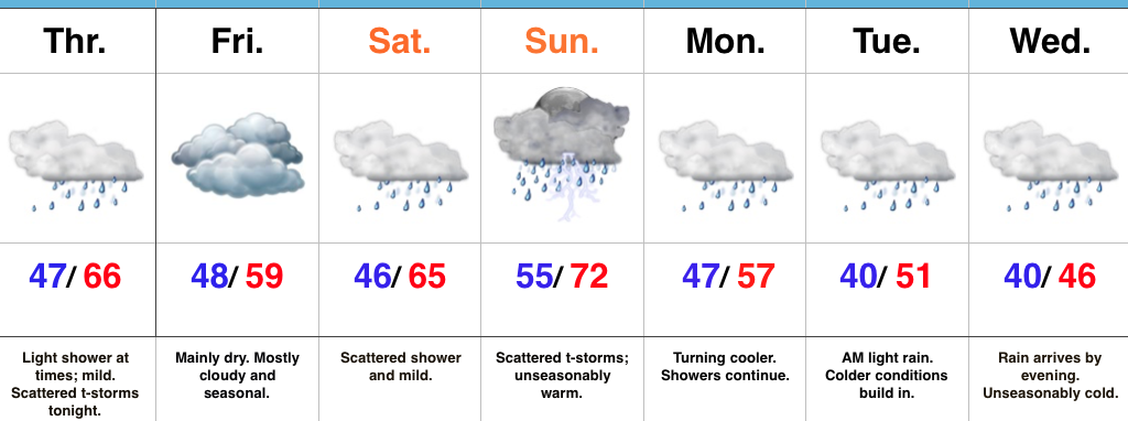
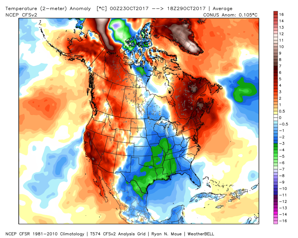 The upcoming few days will feature additional unseasonably chilly conditions before moderating through the second half of the week.
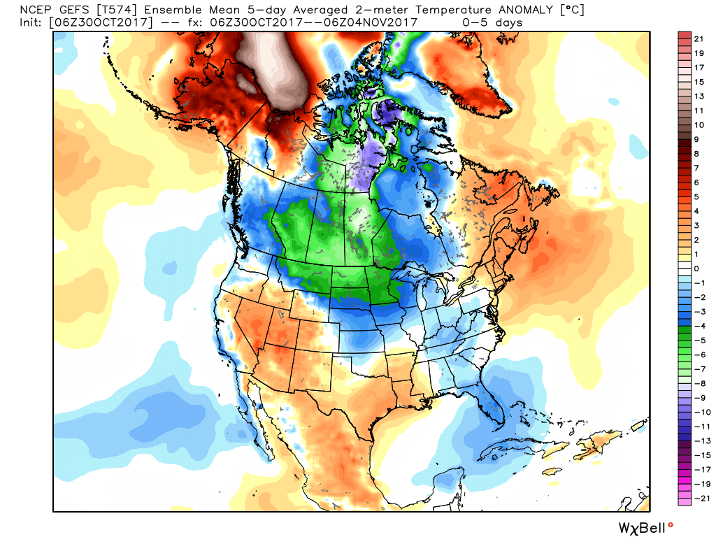 This will feature a hard freeze for central Indiana tonight. We dipped to the first 32° temperature of the season here at IndyWx.com HQ this morning and will likely beat that Halloween morning. Widespread upper 20s to around 30° can be expected.
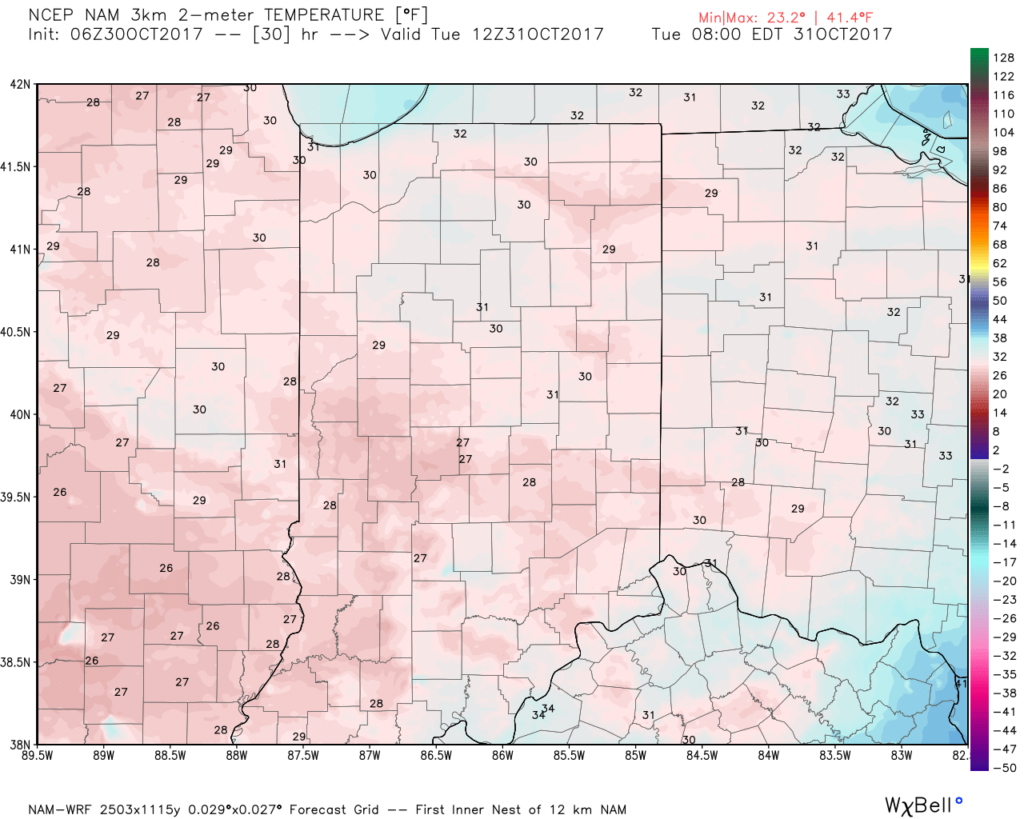 This cold air is thanks to a cold front and reinforcing chill that will feature a band of showers that scoots through the state late morning into the early afternoon.
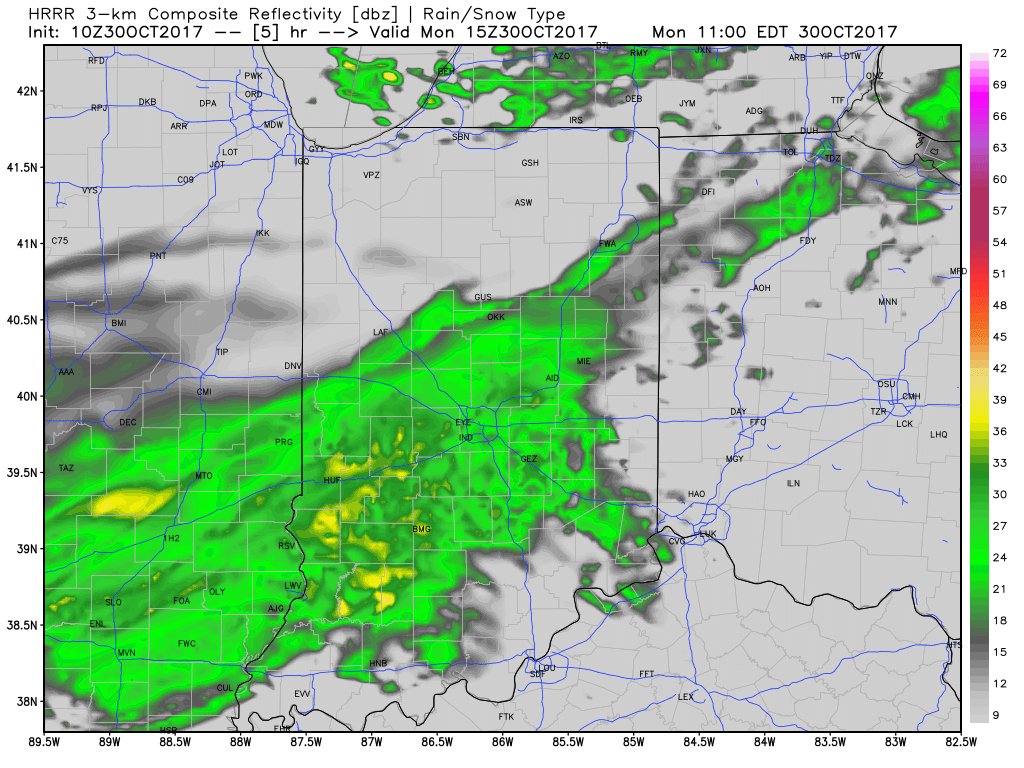 Rainfall amounts won’t be significant and feature totals between 0.10″ to 0.20″ through most of central Indiana.
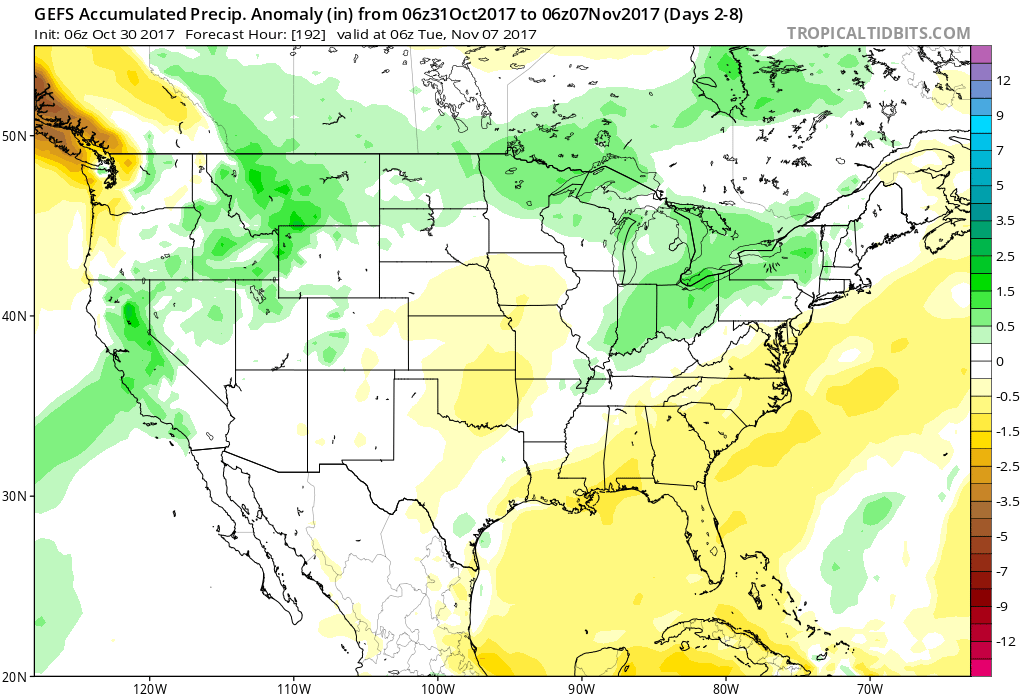
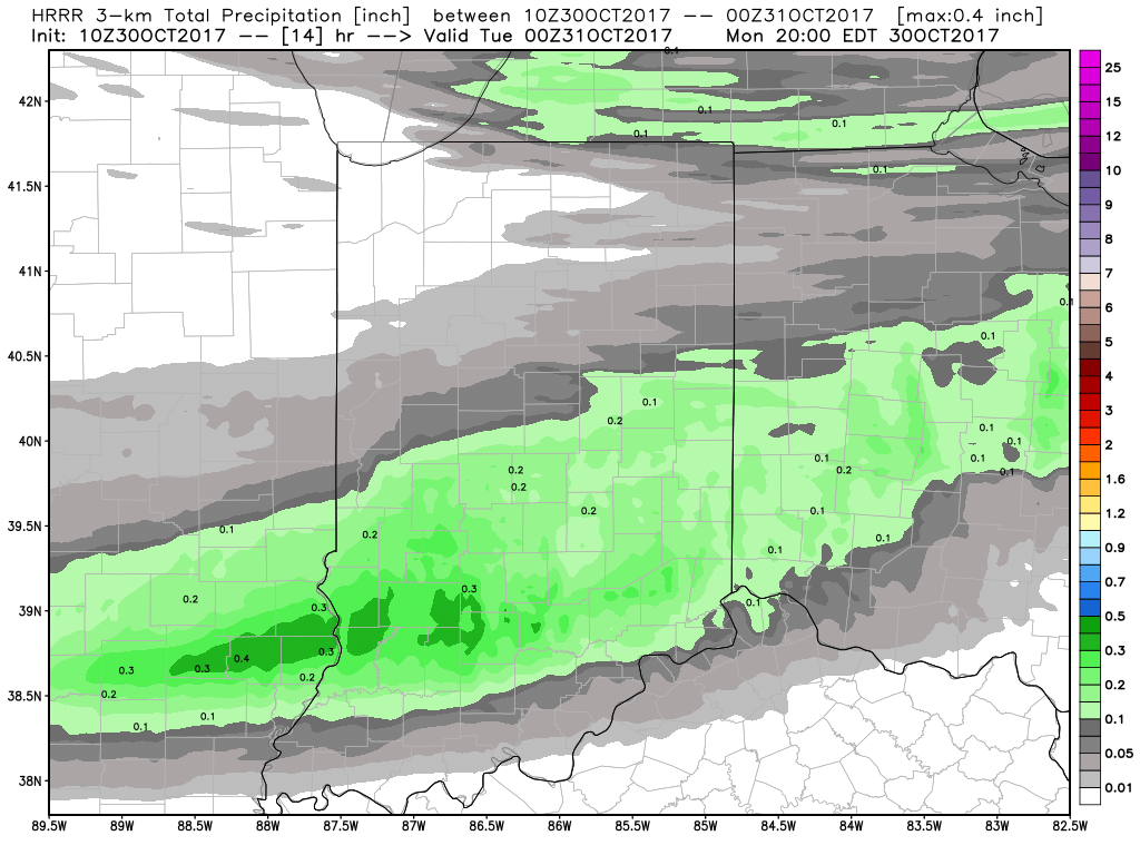 Unsettled weather will return late week and through the upcoming weekend, but temperatures will moderate and return to levels that are above average. There are indications cold will push again in the 8-10 day period, but a warmer pattern will engulf our region during the medium range period and feature temperatures that will reach the 60s by Thursday and Friday.
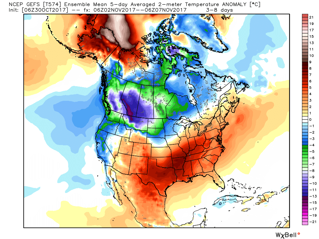 The warmer conditions will also come with rain. A “wavy” cold front will approach late week with showers before returning north as a warm front late in the weekend. Finally, this frontal boundary will push southeast early next week with cold air returning. With the movement and stubborn nature of the front, expect a prolonged duration of unsettled conditions. It won’t rain the entire time, but we’ll keep showers in our forecast beginning Wednesday into the weekend.