Telling Time Ahead…
Models have been suggesting that the middle of June (roughly June 10th-20th) would turn increasingly stormy and wet. The JMA led the charge several weeks ago with this idea. The GFS and it’s ensemble data has, for the most part, been on board with this line of thought, as well. On the flip side, more times than not, the powerful European forecast model has suggested we shouldn’t “hold our breath” on the prospects of a wetter shift. With the target period now only a few days out, it’s time to “put up or shut up.” I was chatting with a good friend of mine Tuesday evening concerning the recent dry conditions for the heart of central Indiana and that we’re heading into a “telling time” starting as early as this weekend. Should the wetter scenarios pan out I think it’ll be enough to keep the worst of the heat and droughty conditions west of Indiana for the balance of the summer. (Please know that’s not us saying it won’t turn dry at times, but instead just that the worst of the heat and dry conditions would be placed to our west).
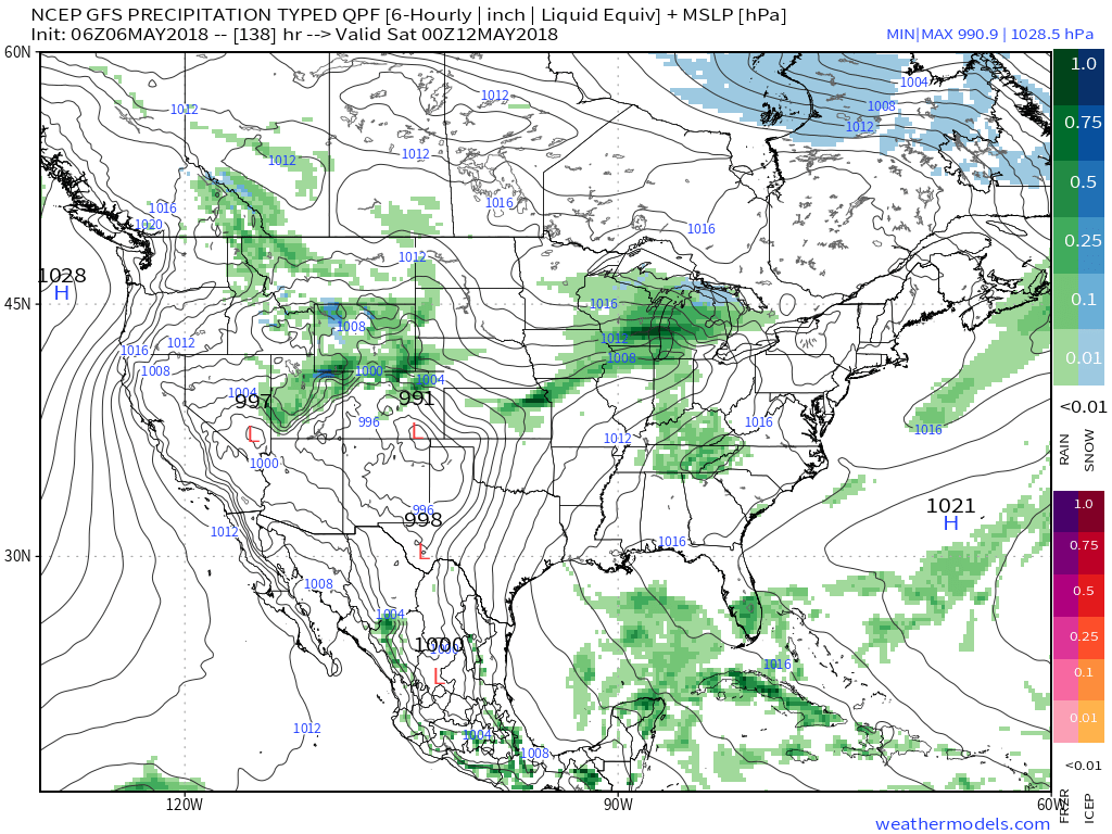
While the all-important surface results differ, it’s encouraging to see that at least from the perspective of an upper air pattern standpoint, both models are rather similar. More significantly, this pattern would support rounds of thunderstorm complexes tracking southeast into the Ohio Valley this weekend and into early next week.

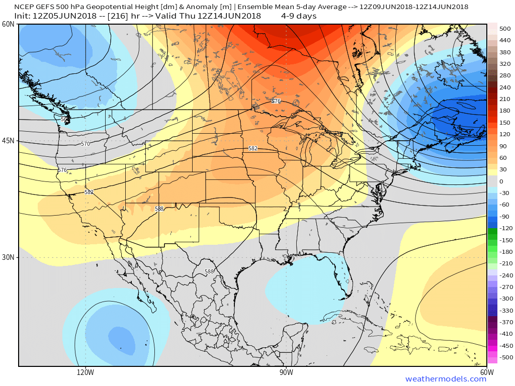 While impossible to nail down exactly which back yards would see beneficial rainfall, it would be an overall more conducive pattern for widespread showers and thunderstorms for our general region. We’ll have to lean on high resolution, shorter-term models as time draws closer to gain more insight around more precise timing and track details, but we continue to trend our forecast wetter Friday through Sunday than we’ve been over the past couple weeks- Alberto remnants excluded.
Come this time next week we’ll have a much better idea of where the balance of the summer is going, locally. Should beneficial rains fall, it’s still not too late in the season to have a significant longer term impact on summer as a whole. In fact, if we can get water in the ground, it would be easier to buy into the cooler regime the models are currently showing late-June. At the very least, an interesting weekend lies ahead…
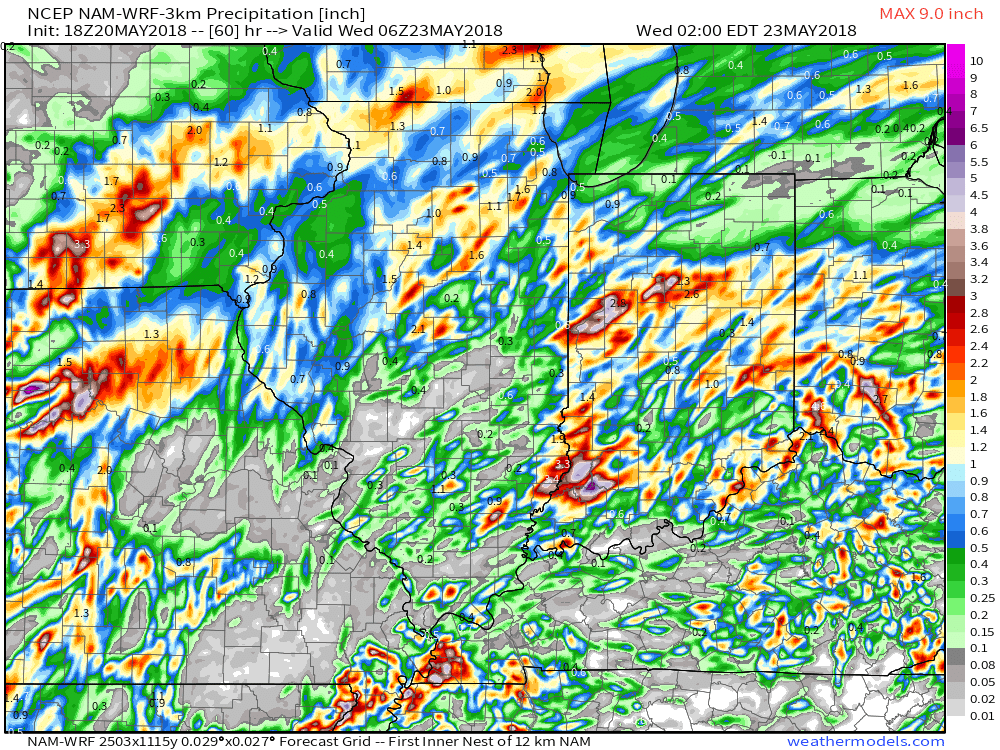
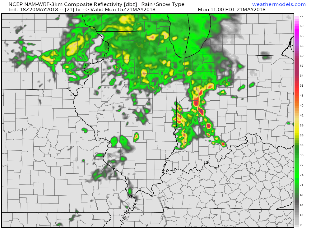 By the time all is said and done late Monday night and early Tuesday, expect widespread rainfall totals between 0.50″ and 1″ with locally heavier amounts where the stronger storms track.
 High pressure will build into the region through the midweek stretch and result in increasingly sunny and pleasant conditions. With a drier air mass in place, overnight lows will fall into the 50s through the midweek period.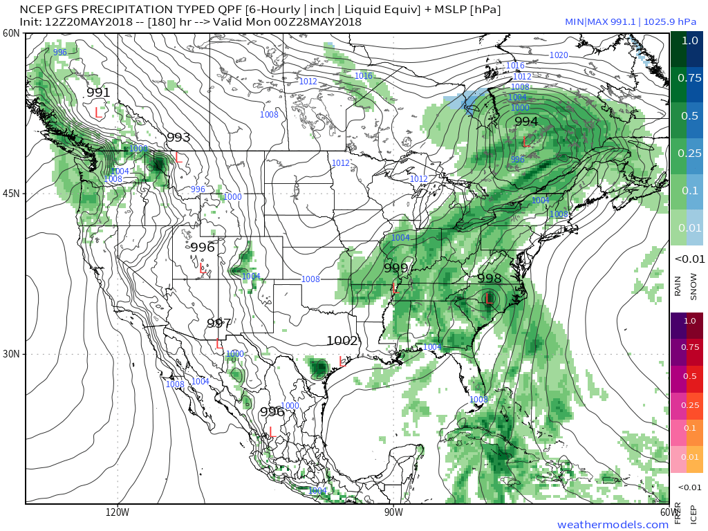
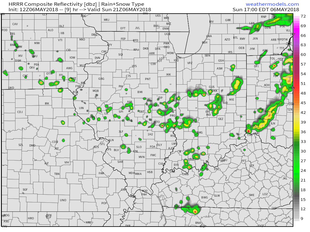 Drier and slightly cooler air will build in as we open the new work week. Overnight lows will fall into the mid and upper 40s both Monday and Tuesday mornings. High pressure will supply plentiful sunshine.
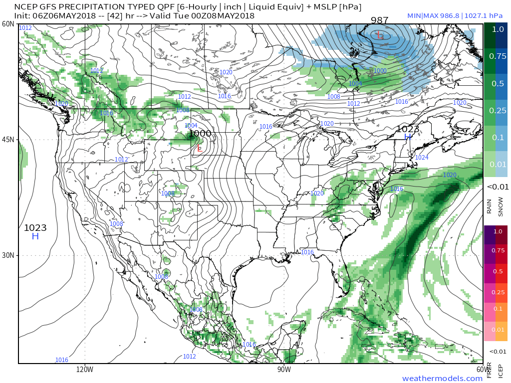 A broad southwesterly air flow will return as we progress through the latter stages of the work week and head into next weekend. We’ll certainly notice an uptick in humidity by Thursday and that summer-like feel will remain into the weekend. The increased moisture will also result in periods of scattered showers and thunderstorms. Expect “splash and dash” variety of storms in a daily fashion beginning Wednesday evening.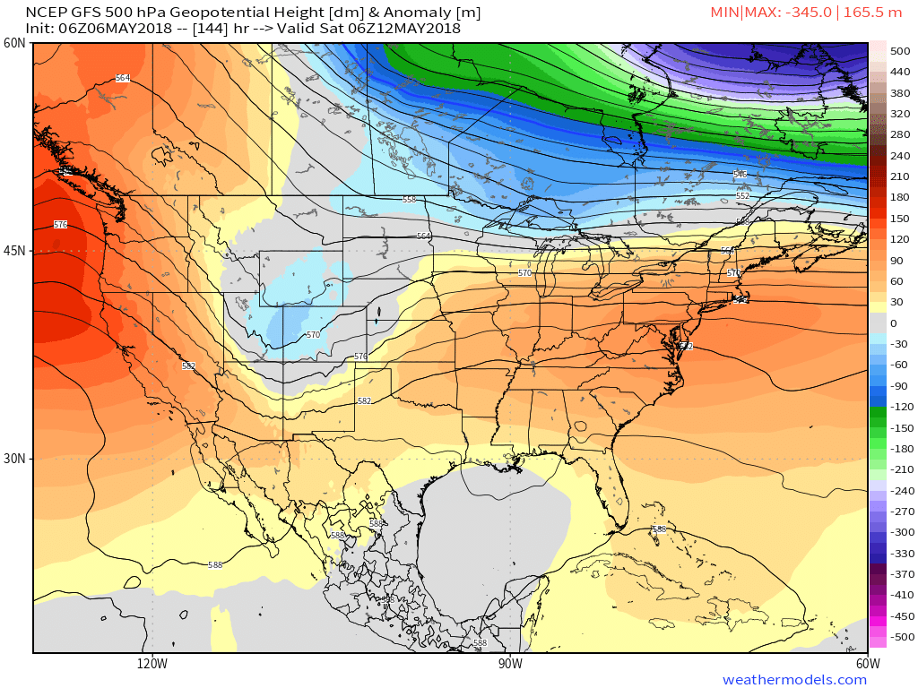
 While scattered storms will be on the radar daily from midweek on, significant widespread rainfall isn’t expected. There will be some locally heavier amounts, but for the most part across central Indiana, 7-day totals won’t exceed three quarters of an inch.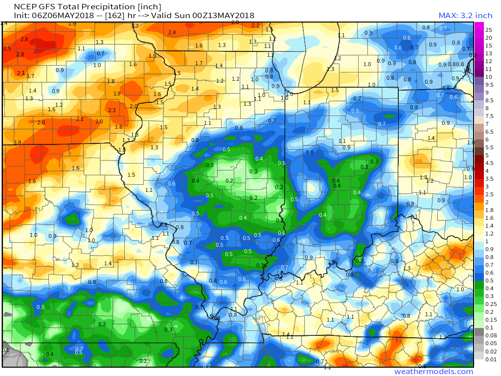
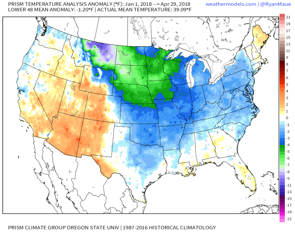
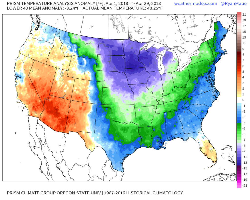 …and a year-to-date that looks like this:
 …sustained warmth is music to the ears of many Hoosiers! Thankfully, the balance of the upcoming (10) days will feature warmer than average conditions, as illustrated by the latest European ensemble data.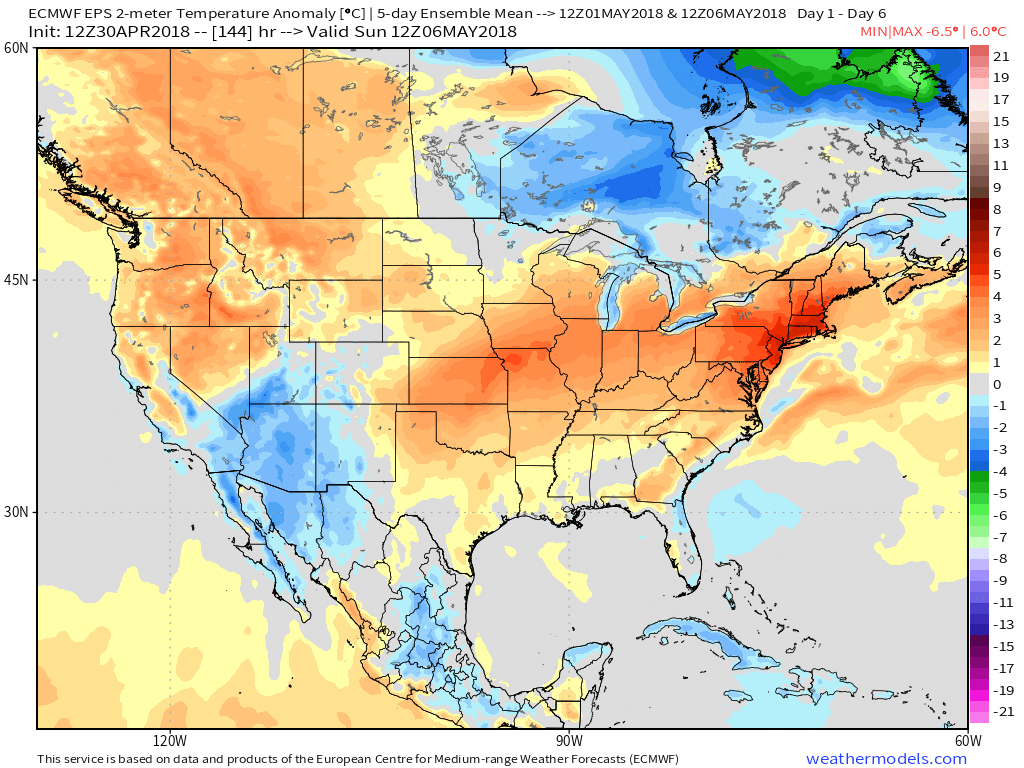
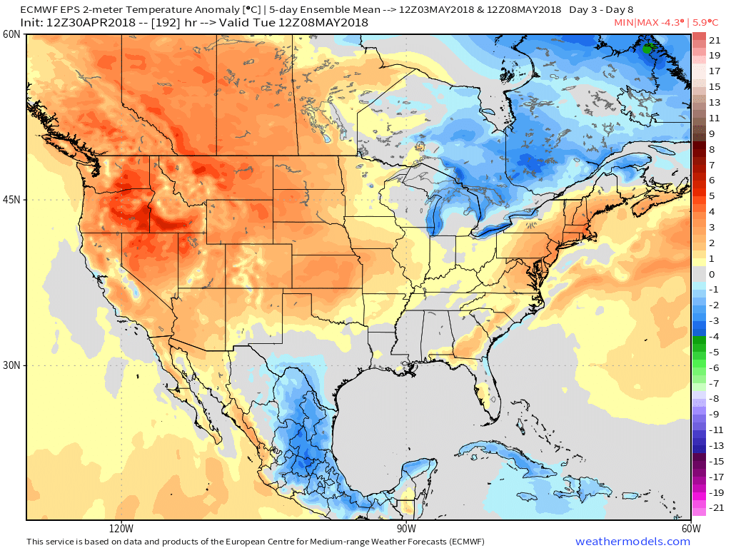 This will include multiple days with high temperatures rising into the 80s over the upcoming 10-day stretch (Tuesday and Wednesday and again next Monday through Wednesday).
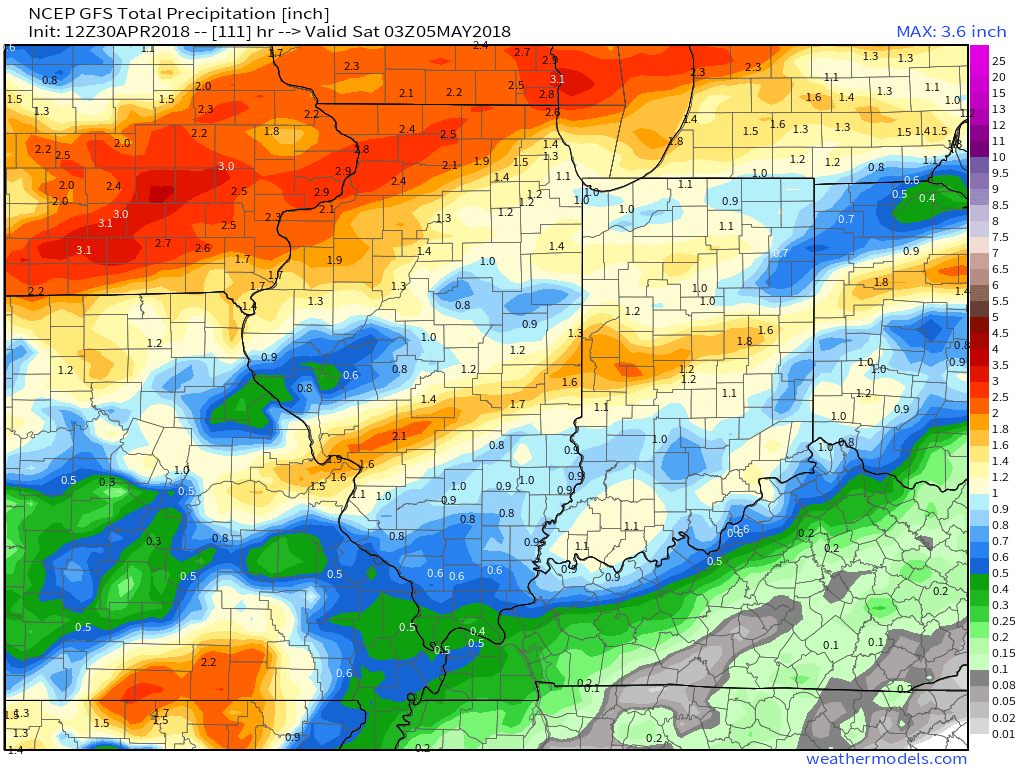
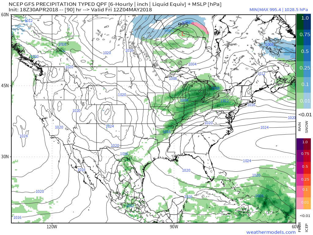 As for rainfall totals, it still appears widespread amounts will check-in in the half inch to one inch range, but a few locally heavier amounts can be expected.
 Models continue to dry us out in time for the weekend and all of those important Cinco de Mayo/ Derby plans. An increasingly sunny sky will be with us along with highs in the middle 70s Saturday afternoon! Can you say “perfection?”