Category: Tropics

Tuesday Morning Rambles: Tropics Turn More Active And More On The Cool 1st Half Of August…

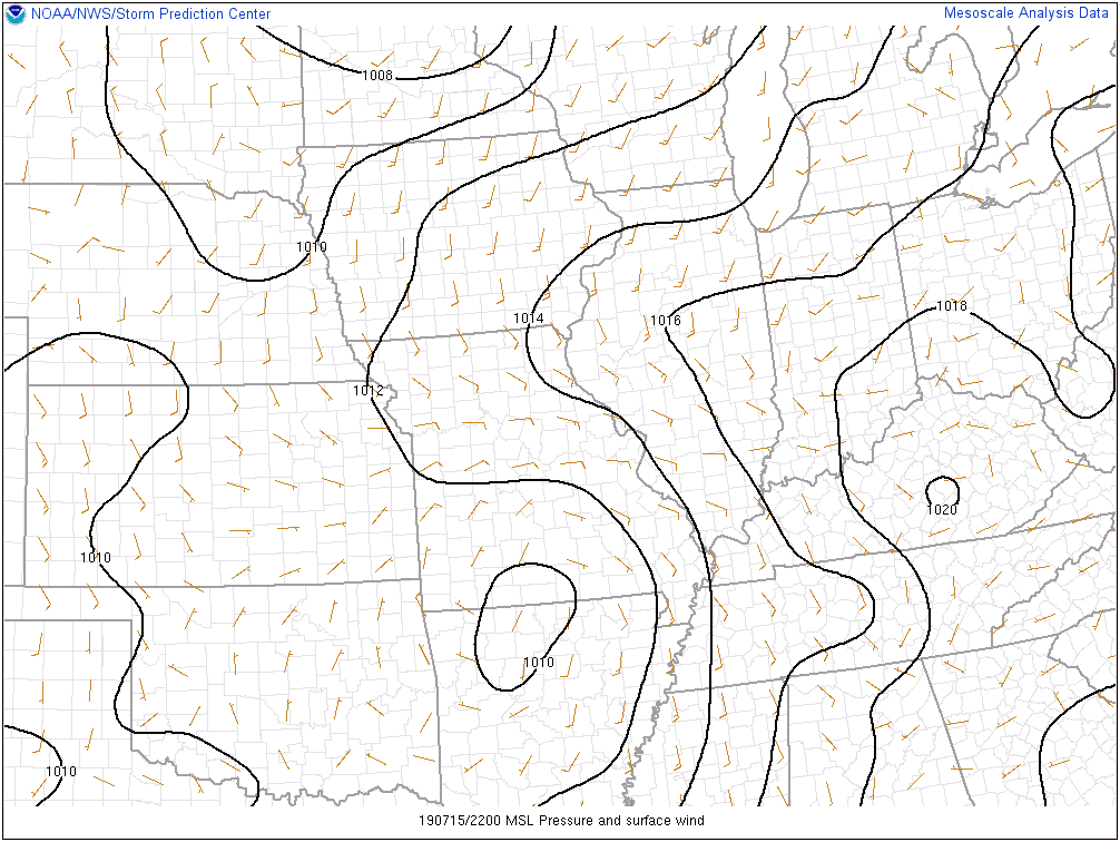
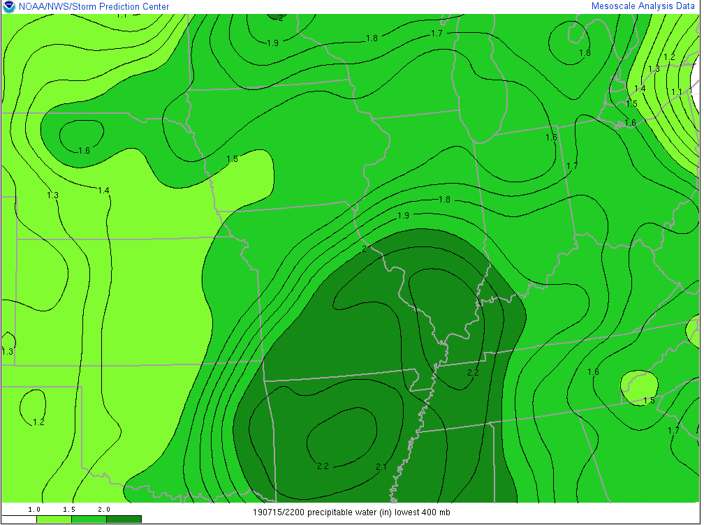
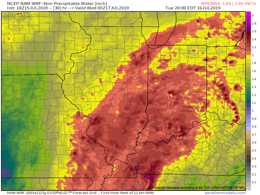
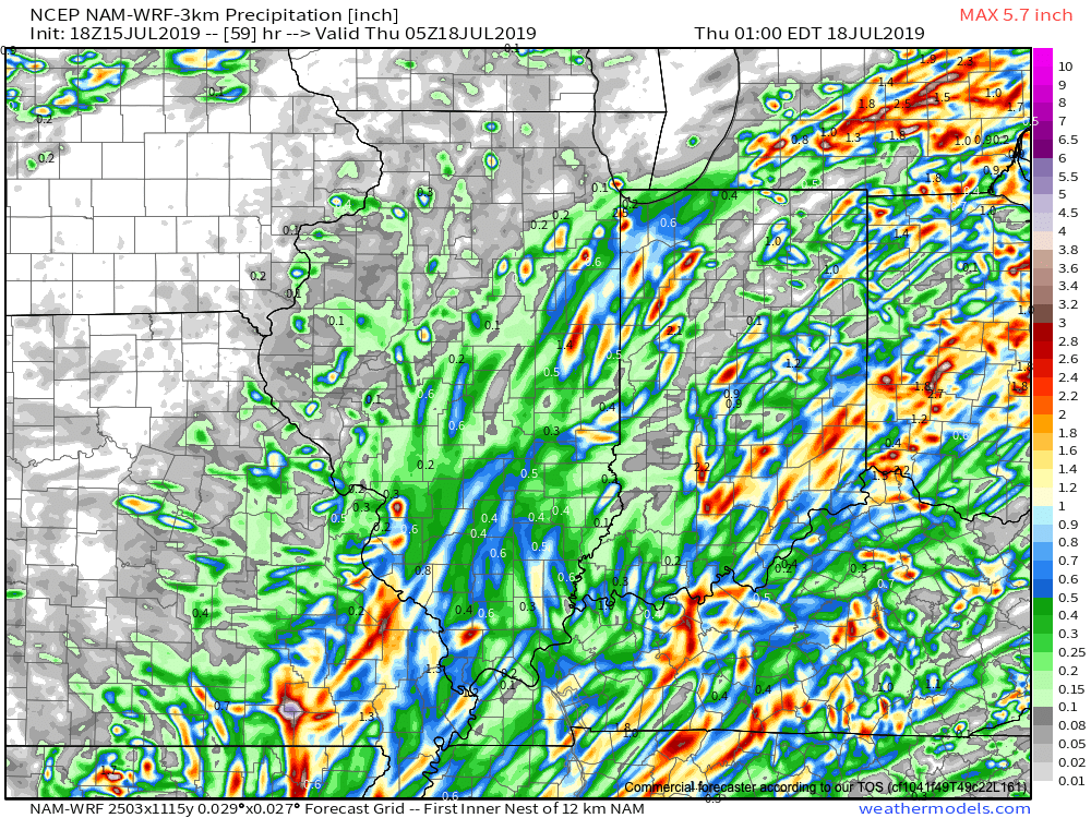
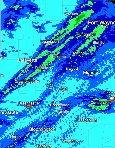
I. Indianapolis officially register 0.68″ in the rain gauge Monday, however, there were many neighborhoods that reported over 1″ of rain. A snapshot of radar estimates below show between 1″ and 1.5″ of rain from places such as Crawfordsville up through Frankfort and towards Fort Wayne, along with areas in and around Connersville and Richmond. After a dry stretch, this rain sure was welcome!

II. Isolated to widely scattered thunderstorms will remain in the forecast today- especially across southeast portions of the state. From Indianapolis and points north, we’ll begin to really notice the drier air that will take hold later this evening.

Dew points will fall into the 50s and lower 60s across the northern half of the state by evening.

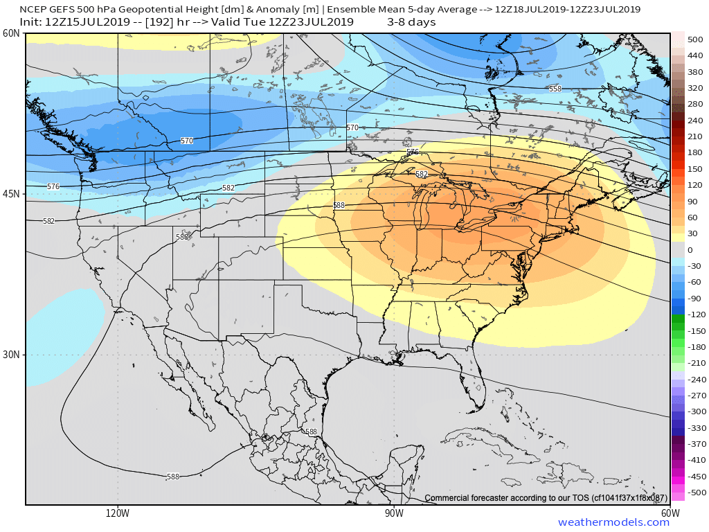
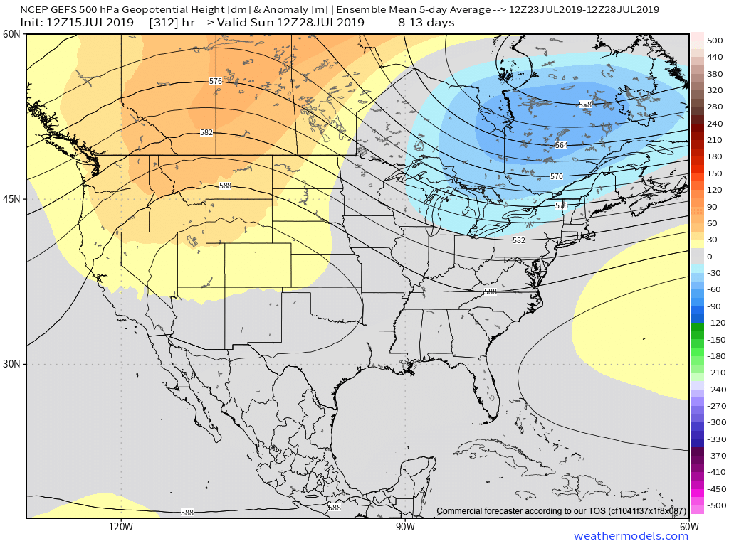
III. An extended stretch of dry, pleasant late summer weather is expected for the rest of the week and into the weekend, thanks to high pressure.

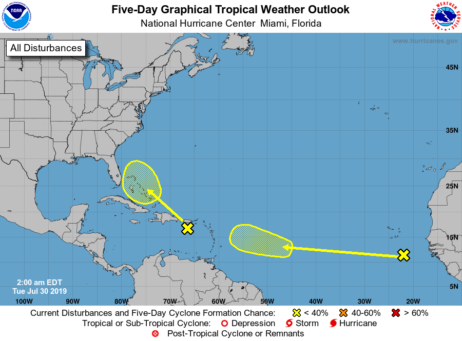
IV. The tropics will begin to turn more active over the upcoming 10 days. I think it’s the “follower” that we’ll need to pay close attention to as we get to the weekend and on into next week. Given the steering current, should this system develop, we’d likely be talking about a tropical storm sitting off the eastern FL or southeast coast early to middle next week.

V. Our August Outlook was posted last night and features an overall cooler than average month, locally. After a quiet week this week, a series of cold fronts will begin to impact our neck of the woods next week. Each front will deliver showers and embedded thunder along with unseasonably cool, pleasant air by early-August standards. More on the specifics here once we get closer!

Permanent link to this article: https://indywx.com/tuesday-morning-rambles-tropics-turn-more-active-and-more-on-the-cool-1st-half-of-august/

VIDEO: Dangerous Heat This Weekend; Significant Pattern Change Next Week…

You must be logged in to view this content. Click Here to become a member of IndyWX.com for full access.  Already a member of IndyWx.com All-Access?  Log-in here.

Permanent link to this article: https://indywx.com/video-dangerous-heat-this-weekend-significant-pattern-change-next-week/

VIDEO: Tropical Downpours Lead To Localized Flooding Later Today; Heat Gives Way To A Much Cooler Pattern…

You must be logged in to view this content. Click Here to become a member of IndyWX.com for full access.  Already a member of IndyWx.com All-Access?  Log-in here.

Permanent link to this article: https://indywx.com/video-tropical-downpours-lead-to-localized-flooding-later-today-heat-gives-way-to-a-much-cooler-pattern/

Barry’s Moisture Arrives; Dangerous Heat Builds And More On The Cool Pattern To Close The Month…

The remnant circulation of what at one time was Hurricane Barry is over north-central Arkansas and south-central Missouri as of Monday evening.

As you might imagine, this is helping pull juicy tropical air northbound. Note precipitable water values are exceeding 2″ now as far north as central Illinois and southwestern Indiana.

Rich, tropical air will continue to surge north and spread over central Indiana tonight and Tuesday. While we still don’t anticipate a widespread uniform soaking rain across central parts of the state, this will help lead to locally heavy downpours in scattered fashion over the upcoming 24-36 hours.

Precipitable water values will exceed 2″ Tuesday across most of the state.

In general, we still think most central Indiana rain gauges will accumulate between 0.50″ and 1″ of rain as Barry’s remnant moisture scoots across the state. That said, there will be locally heavier totals. Latest data continues to not only hint at these heavier totals being located across southeast portions of the state, but perhaps across northwest Indiana, as well.

Once we dry things out (through the day Wednesday) the big story will become the heat and humidity. A 5-day stretch of dangerously hot, humid conditions will claim headlines during the period Thursday through Monday, featuring overnight lows between 75-80 and daytime highs in the lower to middle 90s.

Thankfully, there are drivers that will result in a rather significant pattern change by early parts of next week. A “game changer” of a cold front is expected to sweep across the Ohio Valley Sunday into Monday with gusty storms followed by much cooler conditions as we head into Week 2. These cooler temperatures are expected to carry the day as we put a wrap on the month of July. We’ll replace highs in the lower to middle 90s with upper 70s to lower 80s and overnight lows in the upper 50s to lower 60s for the better part of the late month stretch.

Permanent link to this article: https://indywx.com/barrys-moisture-arrives-dangerous-heat-builds-and-more-on-the-cool-pattern-to-close-the-month/

VIDEO: Dealing With Barry’s Remnant Moisture; What’s Beyond The Heat Wave?

You must be logged in to view this content. Click Here to become a member of IndyWX.com for full access.  Already a member of IndyWx.com All-Access?  Log-in here.

Permanent link to this article: https://indywx.com/video-dealing-with-barrys-remnant-moisture-whats-beyond-the-heat-wave/