VIDEO: Humidity Increases This Weekend; Closely Watching The Gulf Into Next Week…
You must be logged in to view this content. Click Here to become a member of IndyWX.com for full access. Already a member of IndyWx.com All-Access? Log-in here.
You must be logged in to view this content. Click Here to become a member of IndyWX.com for full access. Already a member of IndyWx.com All-Access? Log-in here.
You must be logged in to view this content. Click Here to become a member of IndyWX.com for full access. Already a member of IndyWx.com All-Access? Log-in here.
Officially, IND picked up 0.85″ of rain today, but there were locally heavier totals. Communities in the green accumulated between 1″ and 1.5″ of rain, including around Frankfort southeast to Noblesville, Anderson, and New Castle and a second axis of heavy rain from Beech Grove, Shelbyville, and Greensburg (most of which fell between midnight and noon).
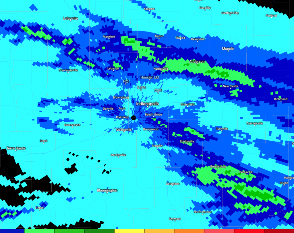
This was at a time when even high resolution, short-term, guidance yesterday afternoon suggested the front would have been south of the region with drier air building in. The error, of course, was the modeled progression of the front and failure of guidance (even as of this time yesterday) picking up on upper level energy that helped generate the more widespread, heavier rainfall. Given the pattern and “noise” (conflicting signals) ahead over the upcoming 2-4 weeks, rest assured, we’ll be on our toes from here on out.
Despite this morning’s set back, high pressure is still going to build in and control our weather through late week. Expect dry conditions (for real this time ;-)), unseasonably refreshing air, and cooler than normal temperatures tomorrow and Thursday thanks to this area of high pressure.
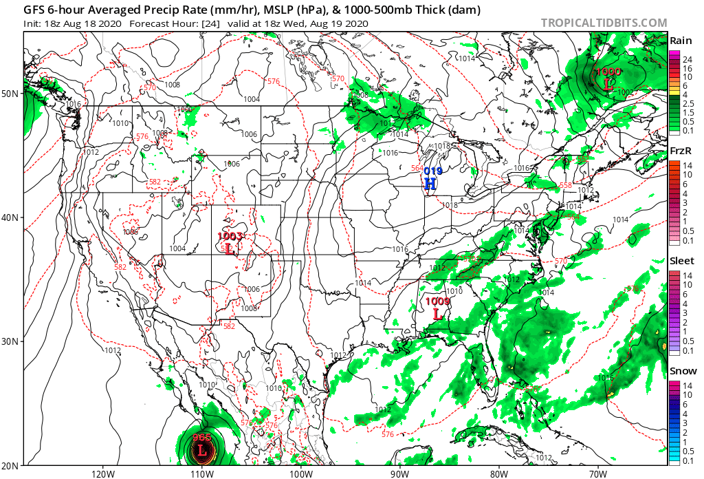
Lows in the lower to middle 50s will be commonplace throughout central Indiana the next few mornings with even some outlying areas across north-central parts of the state dipping into the upper 40s.
As we flip the page towards Friday afternoon, moisture levels will begin to rise and widely scattered thunderstorms will return. Coverage should be greatest across southeast Indiana Friday. Aerial coverage of showers and storms will increase each day through the weekend as another frontal boundary moves through the region. This should produce 0.50″ to 1″ of rainfall across central Indiana with locally heavier totals.
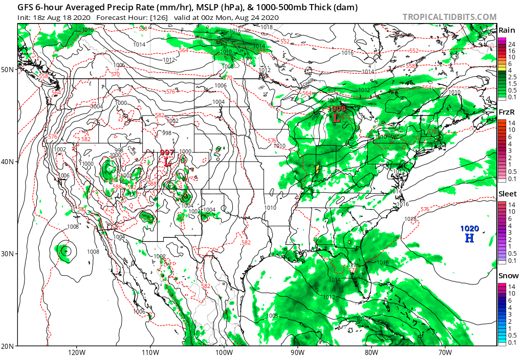
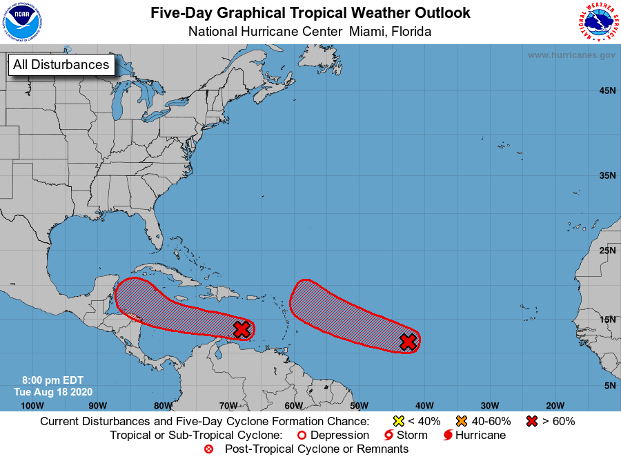
By the weekend, eyes will also begin to grow more focused on the front running tropical system that should be in the western Caribbean or Gulf of Mexico (more on this in the coming days, along with what’s behind).
From a temperature perspective, after the refreshing feel this week, more typical late-August temperatures will build in over the weekend and the majority of next week before late-month cooling takes place yet again.
More in the AM with our next client video update. Have a relaxing evening.
You must be logged in to view this content. Click Here to become a member of IndyWX.com for full access. Already a member of IndyWx.com All-Access? Log-in here.
You must be logged in to view this content. Click Here to become a member of IndyWX.com for full access. Already a member of IndyWx.com All-Access? Log-in here.