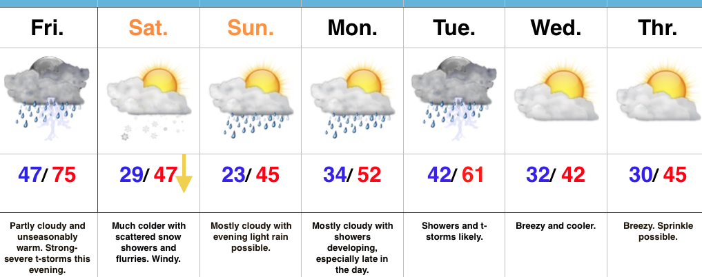
Severe T-storms This Evening Give Way To Much Colder Air This Weekend…
 Highlights:
- Record warmth
- Severe t-storm potential this evening
- Scattered snow showers Saturday
- Active pattern next week
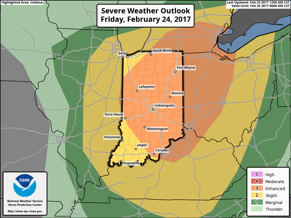
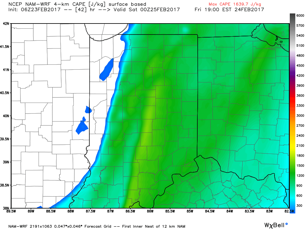
Focused On Severe Weather This Evening…Though the day is beginning on a quiet note, we’re concerned it might not end that way, as strong to severe thunderstorms impact central Indiana this afternoon and evening. The sunshine this morning is actually something that adds further concern for the potential of explosive thunderstorm development later today. More specifically, we’re bracketing the hours of 4p and 10p for the likelihood of storms impacting central parts of the state (west to east), and some of these may become severe. All modes of severe weather are in play today, including large hail, damaging winds, and a tornado or two. Please have a means of getting the latest warning information and ensure you know your family’s severe plan. Otherwise, we forecast to shatter the record high today as we zoom all the way into the middle 70s with a gusty southerly wind.
Winter will return with authority tonight and set-up a much colder weekend. That high in the upper 40s Saturday will actually come at midnight with falling temperatures (most of the daytime hours will feature low-mid 30s with ‘chills in the 20s), windy conditions, and scattered snow showers.
A weak weather system is looking less and less impressive for the second half of the weekend, but we’ll continue to keep a chance of light rain in our forecast by evening.
Better rain chances will begin to ramp up Monday evening and become widespread Tuesday, including the possibility of thunderstorms, as well. The second half of next week will trend colder…
Upcoming 7-Day Precipitation Forecast:
- Snowfall: Trace
- Rainfall: 0.50″ – 1.00″
 Summary:
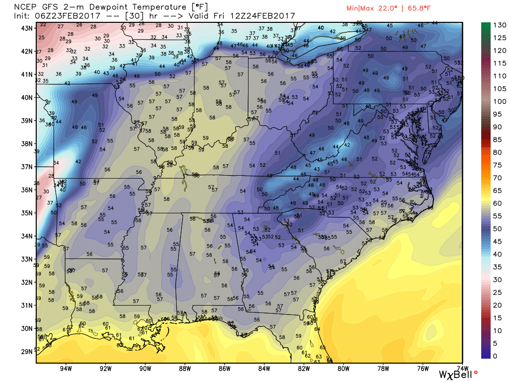
 Threats and Timing: