
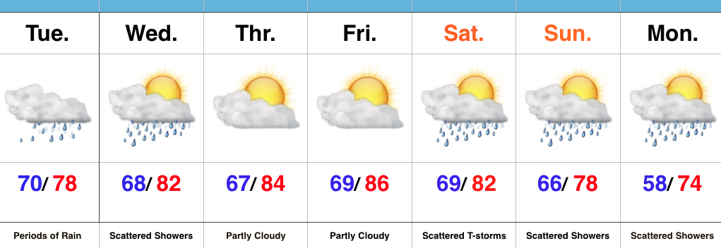
An updated 7-day forecast will hit later today. This morning we wanted to take the time to dig in a little deeper on Friday’s severe weather threat.
Severe Weather Outlook:
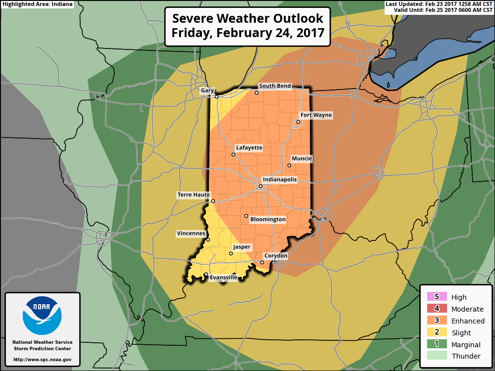
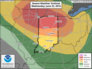
This morning the latest update from the National Weather Service Storm Prediction Center has expanded the ‘Enhanced Risk’ of severe weather Friday. This includes all of central Indiana.
 Summary:
A sub 1000 mb surface low pressure system will track northeast from northern MO (Friday morning) to central MI (Saturday morning). Ahead of this, a warm front will lift north through central IN and into lower MI Friday afternoon. A strong cold front will be located near the MS River Friday morning and barrel eastward, sweeping the state Friday night.
Unseasonably warm and moist air will be drawn northward and encompass the entire region Friday. Forecast highs should break records tomorrow and be in the lower-middle 70s for most of the region (thinking we see plentiful sunshine during the daytime hours). Dew points will near 60°. Considering this is late February, those are impressive ingredients coming into play. The added sunshine tomorrow is actually a bad thing as it will add “fuel to the fire,” so to speak, and help play a role in potentially explosive thunderstorm development Friday evening.
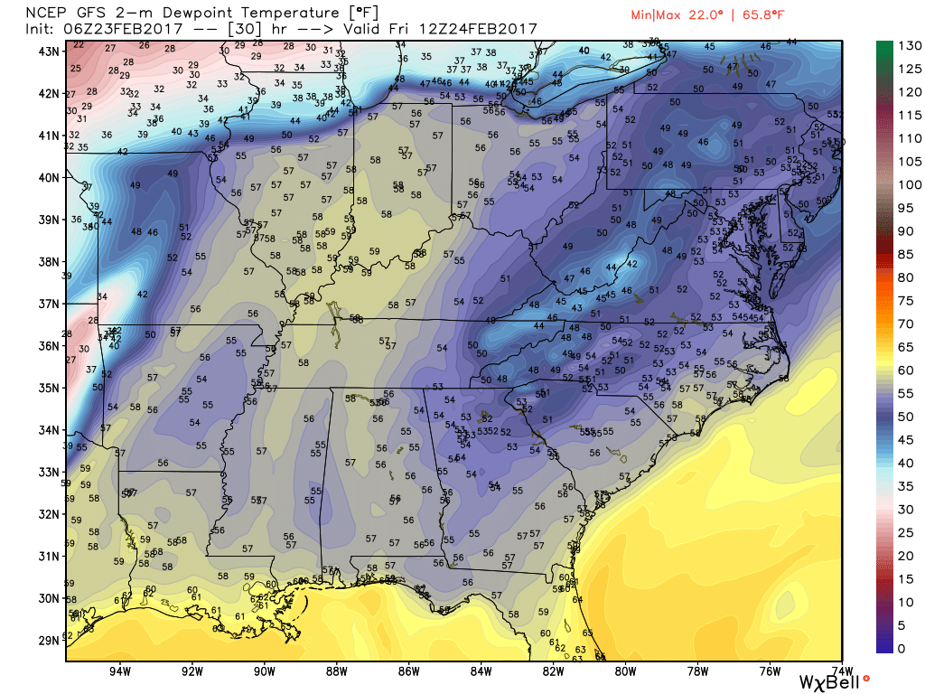
Forecast dew points will reach around 60 degrees across the region Friday afternoon.
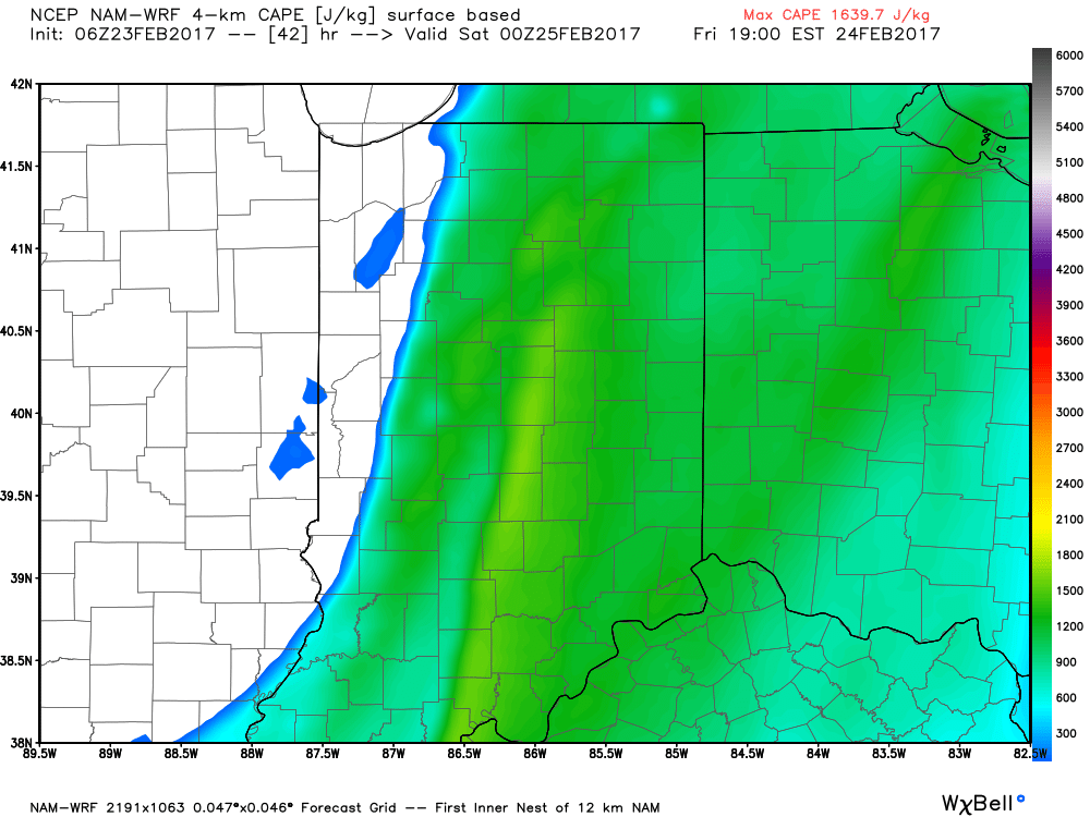
Surface-based CAPE (Convective Available Potential Energy) is modeled to reach between 1200-1600 J/kg Friday evening across the region.
 Threats and Timing:
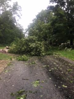
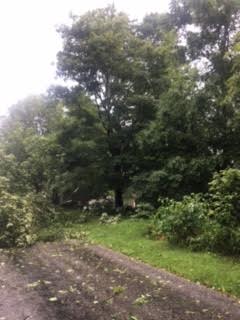
Most of Friday is going to be quiet, but it’s as we move into Friday afternoon and evening that we’ll need to keep close eyes to the sky and radar. The potential exists for individual super cells to develop out ahead of an eastward-advancing line of thunderstorms Friday evening. All modes of severe weather are possible Friday evening, including large hail, damaging winds, and tornadoes. As of now, we bracket the hours of 4p and 10p for the period where severe weather may be impacting portions of central IN.
As mentioned yesterday, we highly recommend reviewing your family’s severe weather safety plan and ensure weather radios are charged with warning modes “on” Friday.
 We won’t bore you with the meteorological ingredients/ lingo that are coming together to lead to an active Wednesday with this post, but please know that nearly all severe weather parameters point to the threat, and even likelihood, of an active day.
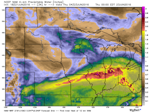
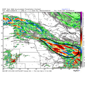 The first of multiple storm clusters will likely be moving into central IN Wednesday morning. Here’s an idea of what the radar may look like around 7a.
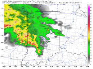 We think we undergo a “lull” in the action Wednesday afternoon before a potentially more serious complex of storms blows into town during the evening hours. We caution that we’re not as confident on specific timing with the evening round of storms.
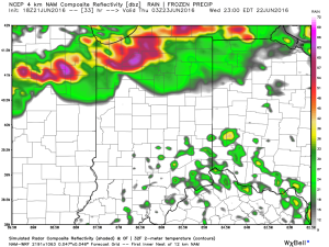
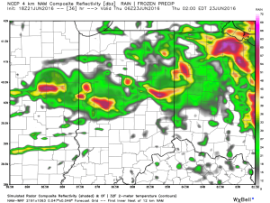 Current data would imply a tornado threat for areas from northern IL into northwestern IN with the afternoon/ evening convection before “morphing” into a more widespread damaging wind threat as the line propels southeast into the nighttime hours.