Saturday Evening Thoughts On The Pending Heavy Rain/ Severe Event…
Updated 03.30.24 @ 5:07p
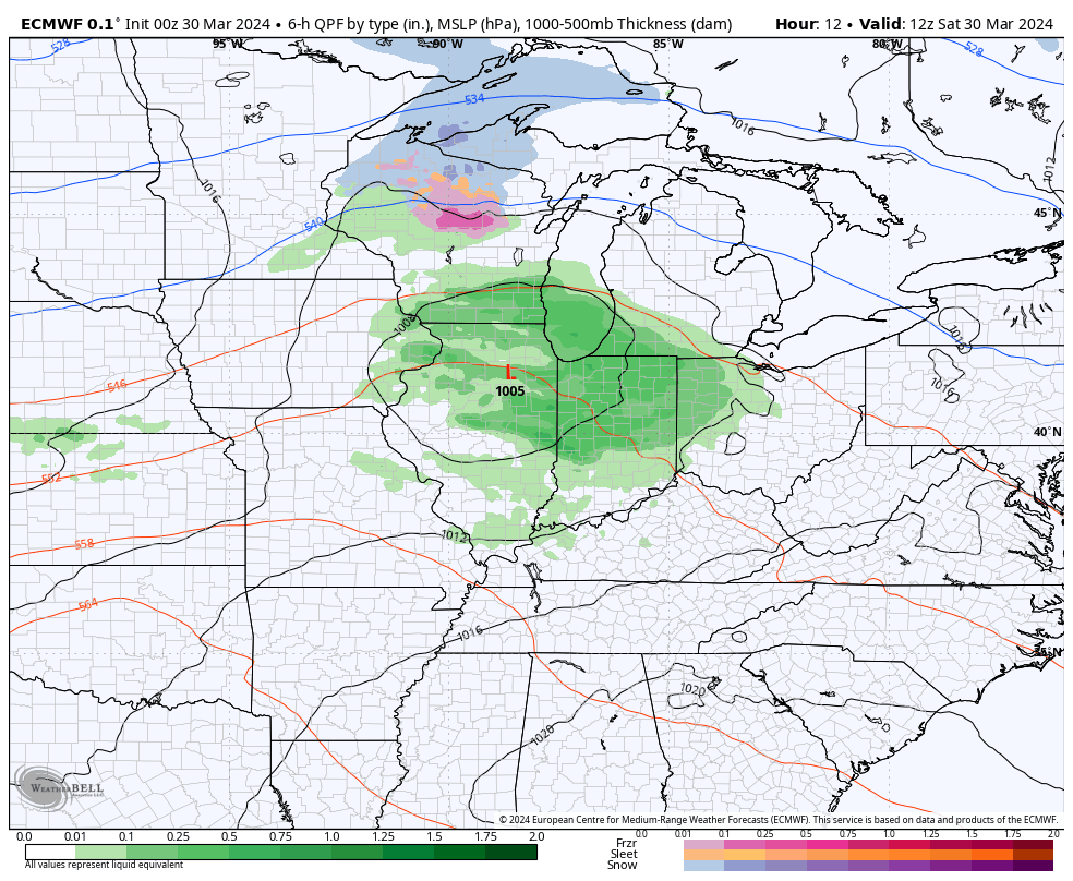
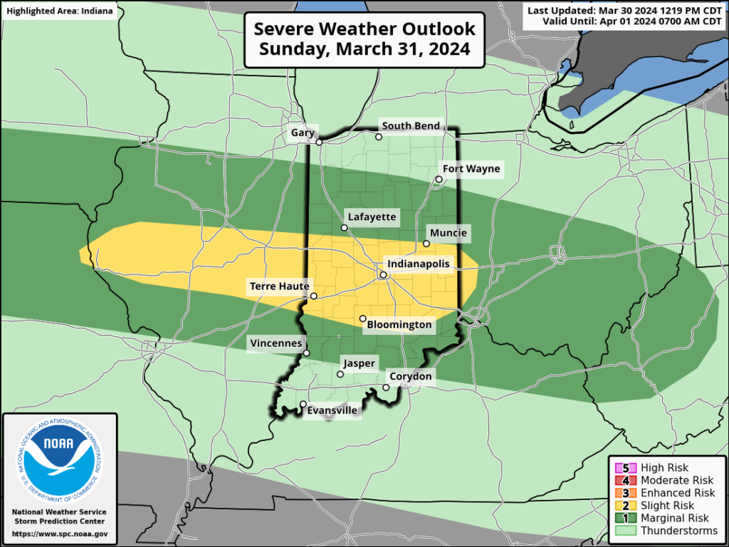
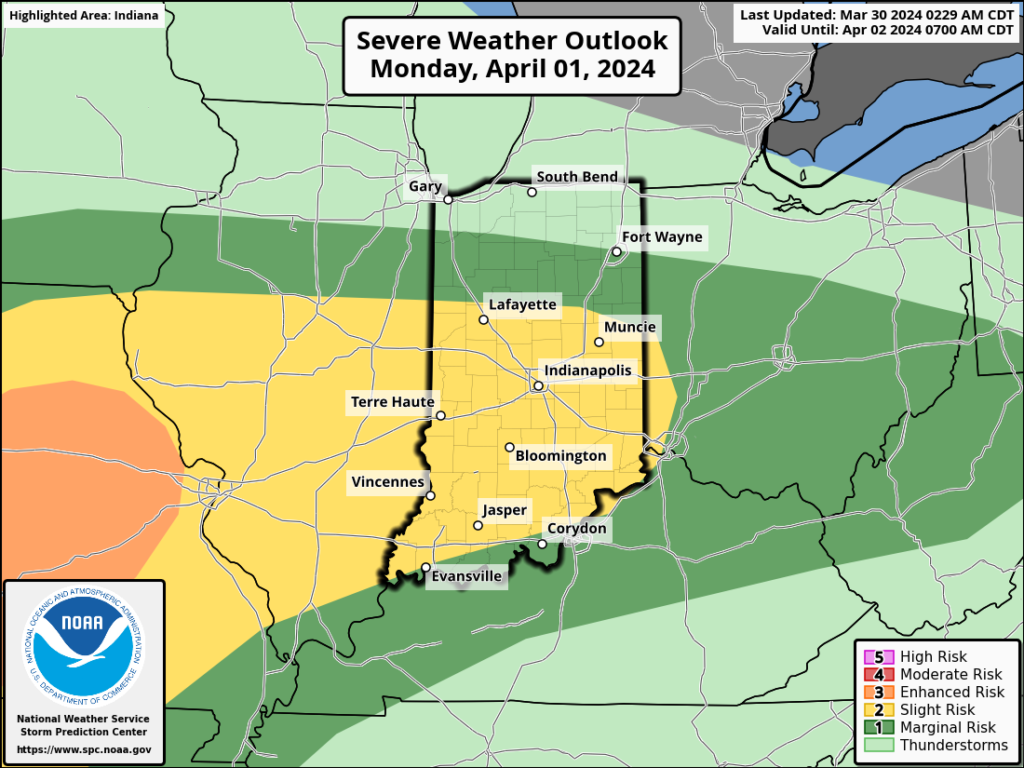
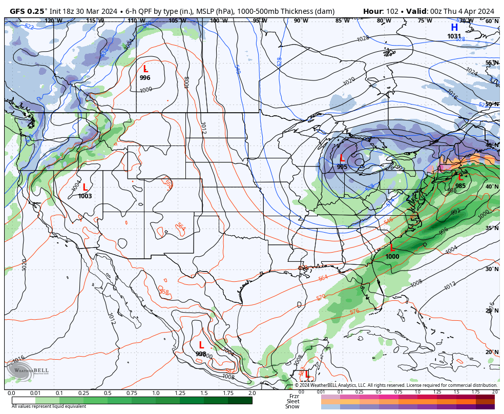
There’s not much, if anything, to change regarding the setup and anticipated outcome of the Easter Sunday through Tuesday timeframe. Periods of heavy rain will get going Sunday PM and we’ll also need to watch for the threat of severe storms not only tomorrow afternoon/ evening but again Monday.
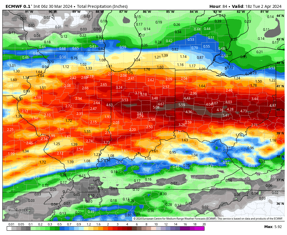
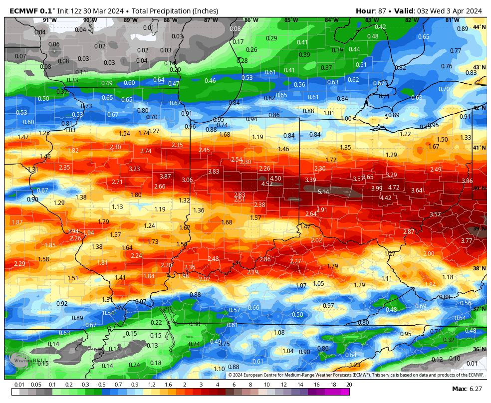
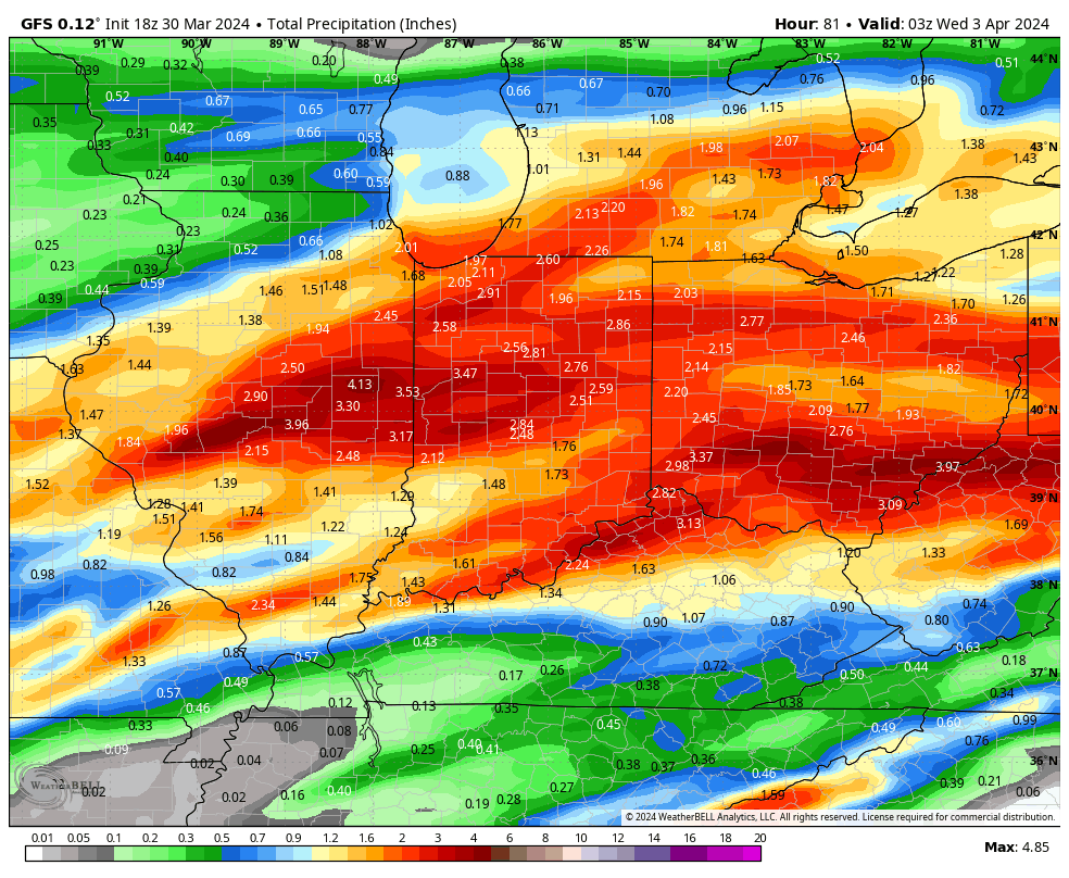
Midday models are latching onto a widespread 2”-4”+ event.
The Storm Prediction Center (SPC) has increased the threat area tomorrow afternoon. Large hail is greatest concern but an isolated tornado can’t be ruled out.
All modes of severe are on the table Monday, including tornado potential once again.
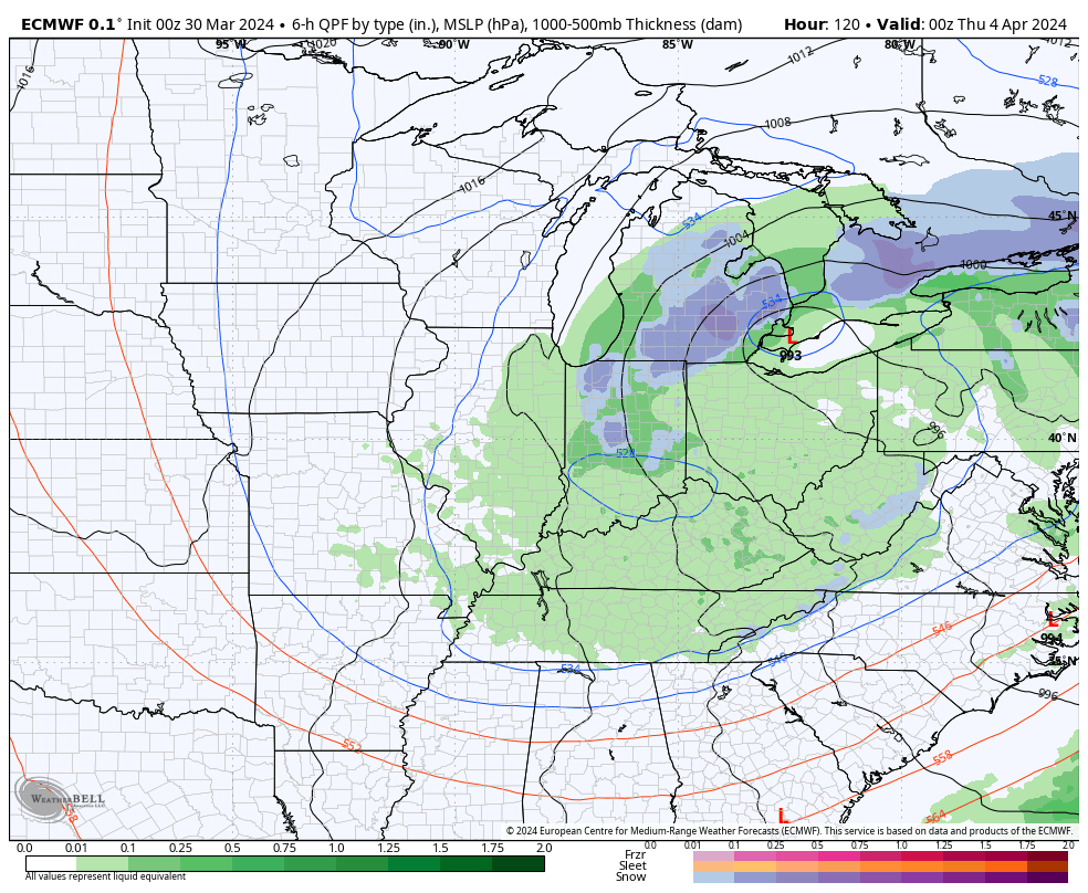
If all this wasn’t enough already, a much colder air mass will plunge into the region by midweek allowing rain to mix with and change to wet snow Wednesday evening into Thursday morning. The snow may even be heavy enough for slushy accumulations in spots.
Spring at its finest across the great Hoosier state…