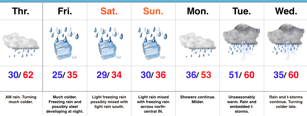
Weekend Ice And Heavy Rain Next Week…
Highlights:
- Turning colder
- Freezing rain develops Friday night
- Wet times continue
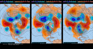
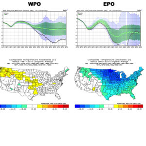
Active Times; Excessive Rainfall Risk Next Week…The overall weather pattern remains very active AND very wet. By the time all is said and done, an additional 3″ of rain is possible for a widespread portion of the region by the middle of next week, with locally heavier amounts. Lets time it out.
The focus in the shorter-term is for colder air to build in. Temperatures today will fall (after a spring-like feel during the wee morning hours). We’ll be in the 30s by mid to late afternoon and below freezing later this evening. Arctic high pressure will continue to force cold, dry air south across central IN as we wrap up the work week. At the same time, warm, moist air aloft will ride over the cold air trapped at the surface and trouble looms by Friday night. We expect light freezing rain to develop after dark and continue into Saturday morning. As disturbances move along the arctic boundary, additional precipitation (mostly light) will overspread central Indiana from time to time over the weekend. We want to continue to reiterate that a 1-2 degree temperature difference will mean a tremendous difference between additional ice accumulation and plain ole cold rain. Thinking is that the freeze line will shift north of the I-70 corridor Saturday afternoon before settling south towards I-70 again Saturday night and Sunday morning. We still have time to fine tune things, but as of now it seems likely that anywhere from 0.10″ to 0.20″ of glaze (freezing rain) will be possible across most central IN communities Friday night into Saturday.
We’ll get rid of the freezing rain early next week and bust back into a warm southwesterly air flow. Models are struggling with the precise details of how things evolve in the early-mid week period, but confidence remains very high on continued wet times. In fact, the GFS pulls a slug of 1.5″ precipitable water values (PWATs) north into the state the middle of next week and suggest the heavy rain threat remains Tuesday and Wednesday. By the middle of next week, we have to start becoming concerned for flood potential across the region.
Hang in there, we’ll see the sunshine return…some day.
Upcoming 7-Day Precipitation Forecast:
- Snowfall: 0.00″
- Rainfall: 2.50″ – 3.00″
 This is, of course, is in stark contrast to December 2015.
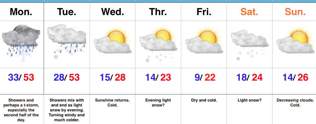
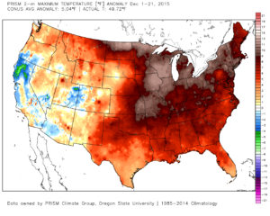 As we move forward, an active pattern awaits between now and the end of the year. This comes after a few days to catch our breath, including moderating temperatures leading up to Christmas.
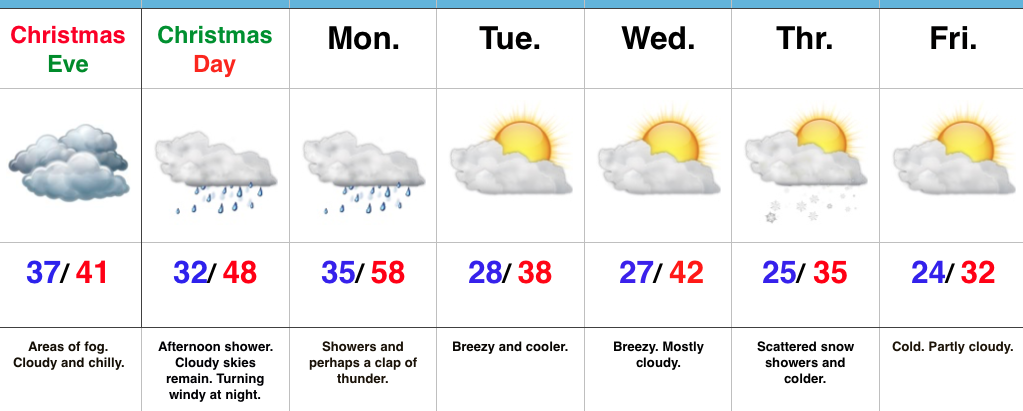
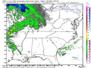 Christmas Eve will feature overcast skies with areas of fog and drizzle, but the majority of the concentrated rain should fall south of the region. Santa’s ride into central IN should be uneventful, weather-wise.
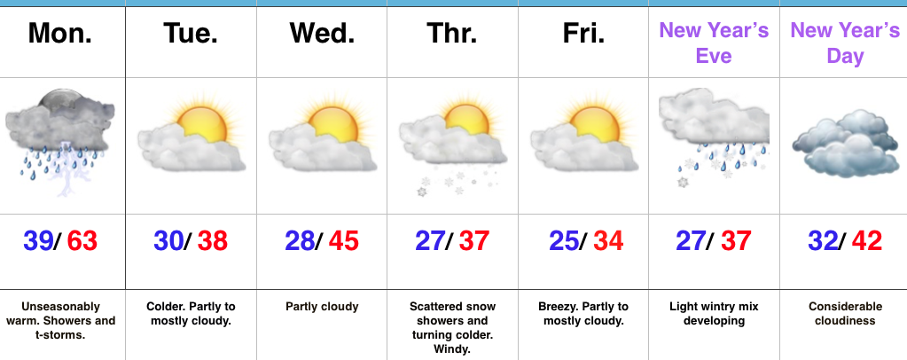
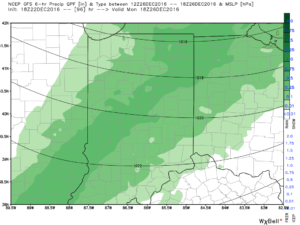 Temperatures will fall through the day Monday and we should run much closer to seasonable temperatures next week. A couple of additional storm systems will have to be monitored for rain and snow prospects the middle of next week and again around New Year’s Eve/ Day. Initially, we’ll be rather mild, but there may be more in the way of cold air readily available to make the storm system around New Years “more interesting” from a wintry perspective.