 Highlights:
- Nice open to the week
- Midweek storms
- Wet, chilly weekend ahead
Pleasant Open To The Week…High pressure will slowly build into the Ohio Valley through early portions of the work week. Periods of clouds will be with us today before we clear things out in earnest tonight, resulting in a mostly sunny and beautiful Tuesday.
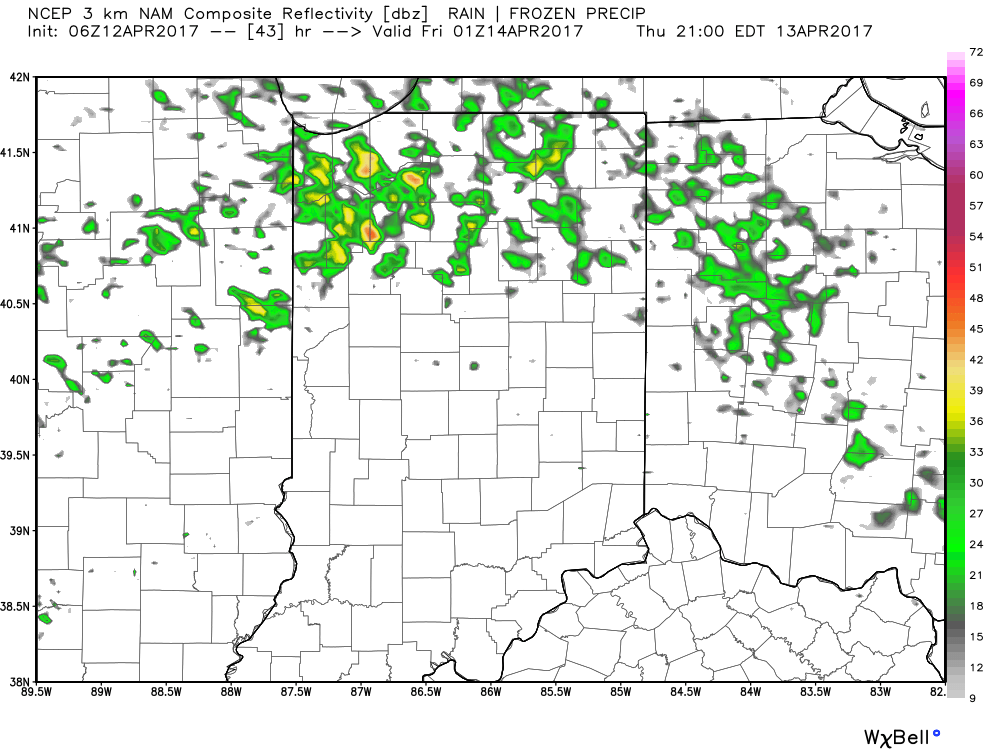
Our next storm system arrives Wednesday afternoon into Thursday morning with scattered thunderstorms. With a southerly wind flow in place, a touch of humidity can also be expected Wednesday afternoon. A cold front will pass early Thursday and result in a much cooler close to the work week.
Attention then shifts to our next storm system that will, unfortunately, arrive on the scene this weekend. Clouds will overspread the region Saturday and rain will develop. Early indications suggest we’ll also need to hit the wind and unseasonably cool air, as well for the weekend.
Upcoming 7-Day Precipitation Forecast:
- Snowfall: 0.00″
- Rainfall: 0.75″ – 1.25″
 Highlights:
 Temperatures will rise from the upper 30s and lower 40s into the middle 60s by evening.
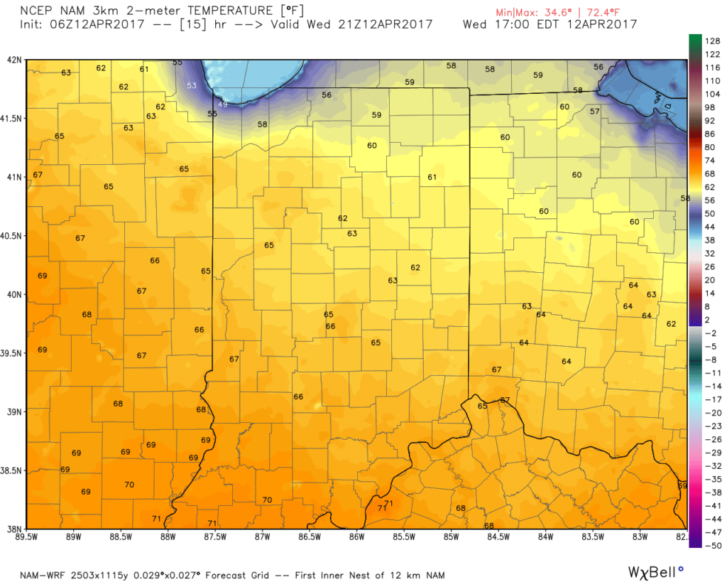 As we push into Thursday, moisture will return and will lead to an increase in cloud cover, along with scattered showers, especially across northern regions. It won’t rain the entire day by any means, and some neighborhoods likely won’t see a drop of rain Thursday, but we need to be prepared for a passing shower, especially from mid-morning into the evening.
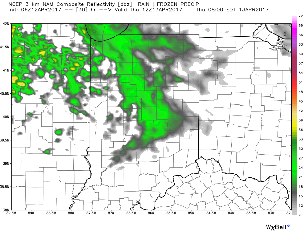
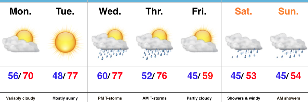
 Looking ahead to Easter weekend, unsettled weather is still expected with scattered showers and thunderstorms associated with a warm front lifting north through the region Friday into Saturday before a cold front sweeps through Easter Sunday with additional thunderstorm chances. That said, there will be plenty of rain-free hours this Easter weekend and warmth will dominate. In fact, highs will flirt with 80° Friday and Saturday. More on the Easter weekend forecast and our full 7-day later today!
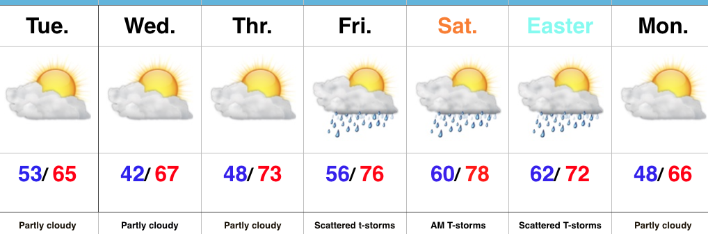 Highlights:
 Highs will run close to 15° above average this afternoon.
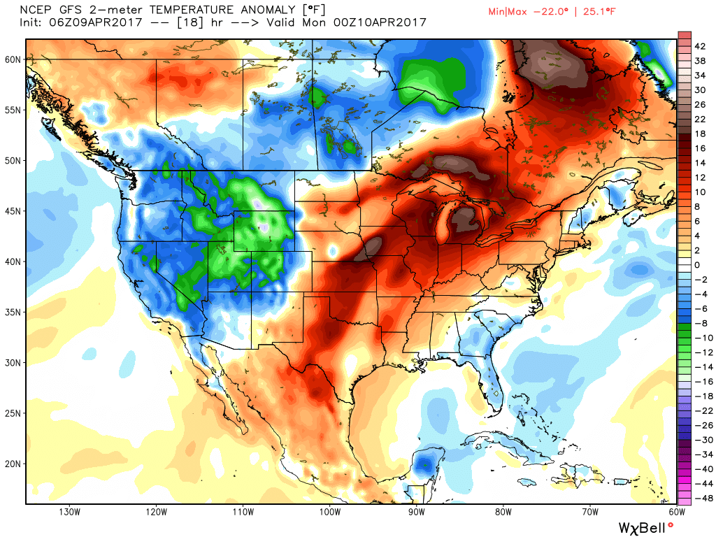 Stormy weather returns Monday as a frontal boundary slips into the state. A couple storms may become strong or severe Monday afternoon and the Storm Prediction Center highlights northwestern portions of the state for a Slight Risk. Damaging straight line winds are of greatest concern with any severe storm that may develop.
 High pressure returns for midweek and supplies a dry regime, along with increasing sunshine and temperatures that will run slightly above average (mid-40s at night and 65°-70° during the day).
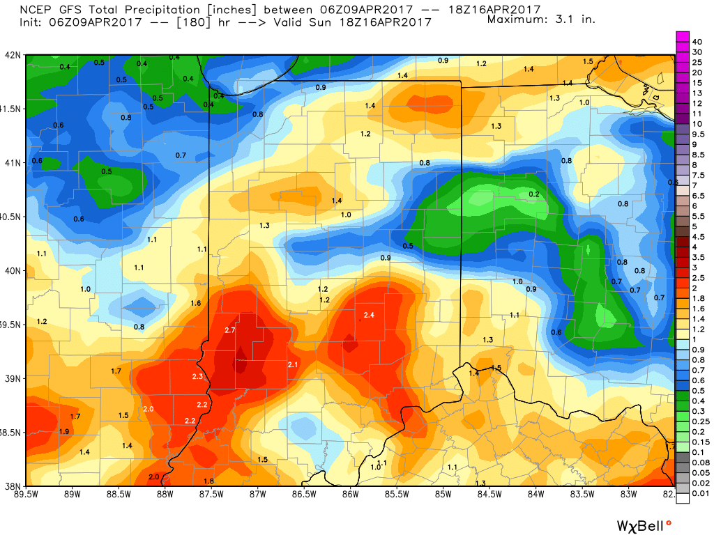
 There are questions once to the end of the period as the GFS and European handle the evolution of our late-week storm differently. The GFS brings energy out into the Ohio Valley and results in unsettled weather returning Friday, continuing into Easter weekend, while the European is slower. We’ll keep an eye on things over the next few days and update accordingly. The GFS suggests some localized heavier downpours would be possible in the Friday-Sunday period as the majority of the 7-day precipitation snapshot below falls within the timeframe.