Today’s 12z model suite is in and it remains consistent on a more active weather pattern returning to the delight of many Hoosiers! A blend of the GFS and European 10-day rainfall numbers print out 2″ for Indianapolis. The GFS ensemble ‘mean’ (a blend of 21 individual members) agrees.
 Best overall coverage of showers and thunderstorms should come in (3) waves over the upcoming 10-day period:
- Wednesday into Thursday
- Saturday into Sunday
- Middle parts of the following week
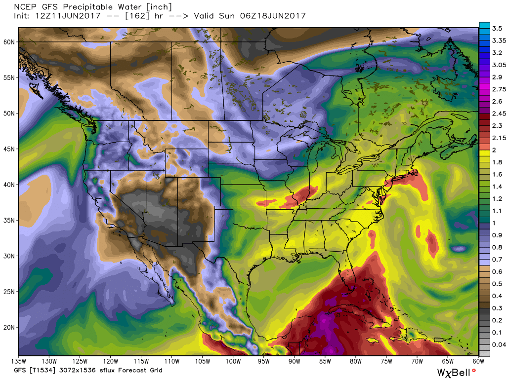
While we don’t see any sort of uniform type rains in the upcoming period, the “smattering” of storms should help most neighborhoods get in on the rainy “goods” at one time or another over the upcoming week and a half. Keep in mind, we’re in mid-June now and it’s mighty difficult to ask for anything much more than scattered storms this time of year on through late-summer…unless a tropical entity gets involved. That’s just the way this time of year is. With that said, localized torrential downpours are a very good bet from time to time, beginning as early as mid-week, as precipitable water values approach, or exceed, 2″ (about as moisture-rich as you can ask the air mass to get around these parts) into the upcoming weekend.
 As I type this outside on the back porch this evening, I hear the sounds of sprinklers in full-force through the ‘hood. Thankfully, Mother Nature will help save on the water bill later this week. Longer-term, you’ll hear us use the word “transient” many times this summer when discussing the overall weather pattern. Thankfully that tends to result in a fairly busy time of things. Before you know it, college football season will be back (83 days until my beloved Auburn Tigers kick-off), those wetter autumn storms will return, and thoughts will begin to shift to winter (they may have already started here :-))- not that we’re trying to rush summer away or anything…

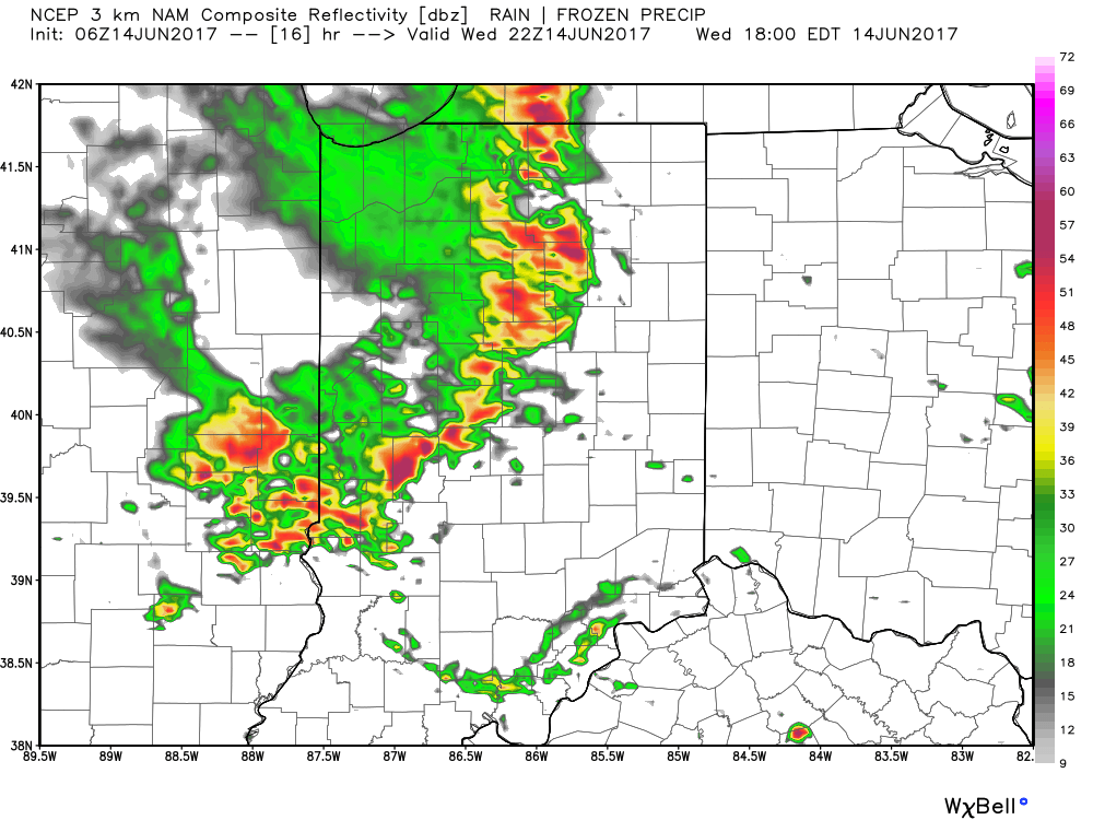
 Similar to Tuesday, any storms that develop will be capable of locally heavy rain and flash flooding. While storms should move in a quicker fashion today, precipitable water values (PWATs) remain downright tropical and will exceed 2″ later this afternoon.
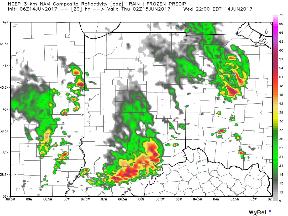
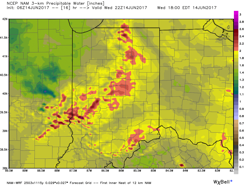 Overall storm coverage should become more widespread as we push into the afternoon and evening hours. Here’s what the radar may look like during the 4p, 6p, and 10p time frames:
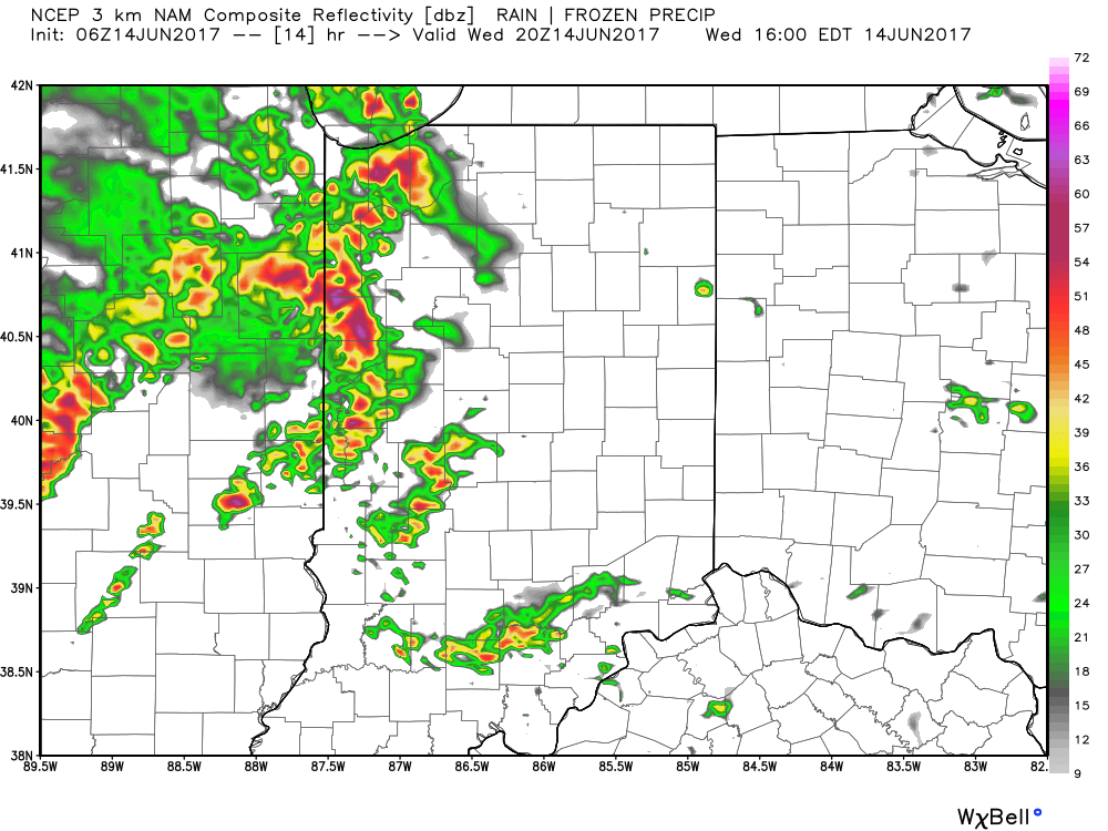
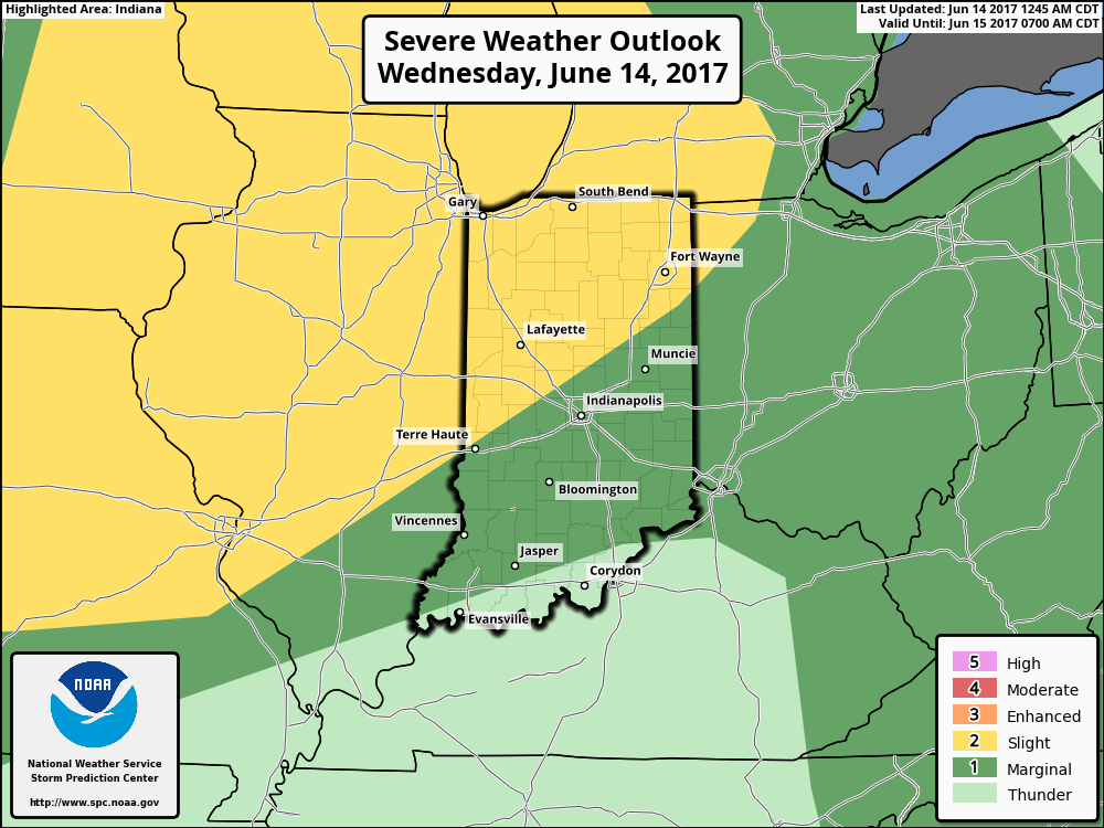
 From a severe perspective, the biggest concern is damaging straight line winds with stronger storms. Remain weather-aware later today, friends!
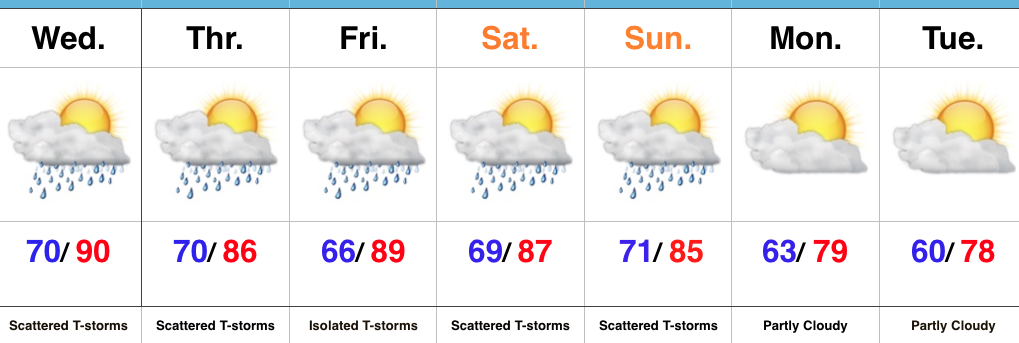 Highlights:
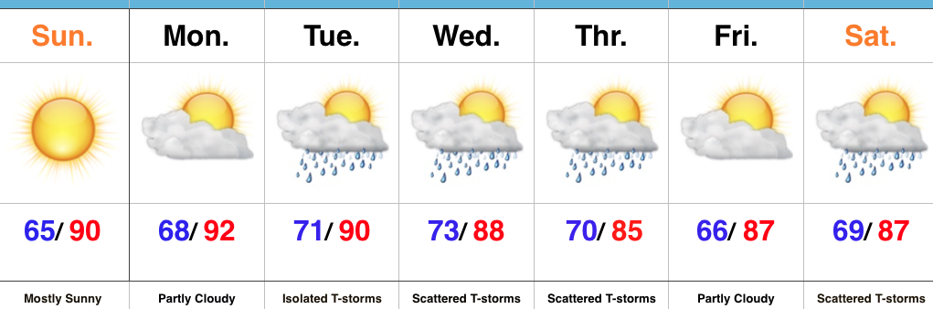 Highlights: